Gößeck
Conquer the highest peak in the Eisenerz Alps for breathtaking panoramic views. A challenging hike rewarding seasoned trekkers.

Highlights
Must-see attractions

Social
From TikTok & Reddit
Best Time
Best light for photos
Gößeck
Best Time
Best light for photos
Highlights
Must-see attractions
Conquer the highest peak in the Eisenerz Alps for breathtaking panoramic views. A challenging hike rewarding seasoned trekkers.
"The climb is well rewarded! It's the highest mountain in the Eisenerz Alps, with a summit cross at 2,187 m."
Pack Ample Provisions 💧
There are no huts on the trail. Bring plenty of water and snacks to stay energized for the long hike.
Sturdy Hiking Boots Needed 🥾
The trail involves steep sections and scree fields. Good grip and ankle support are crucial for safety.
Quick Facts
Rating
4.9 · 10 reviews
Type
Natural Feature
Address
Highlights
Discover the most iconic attractions and experiences
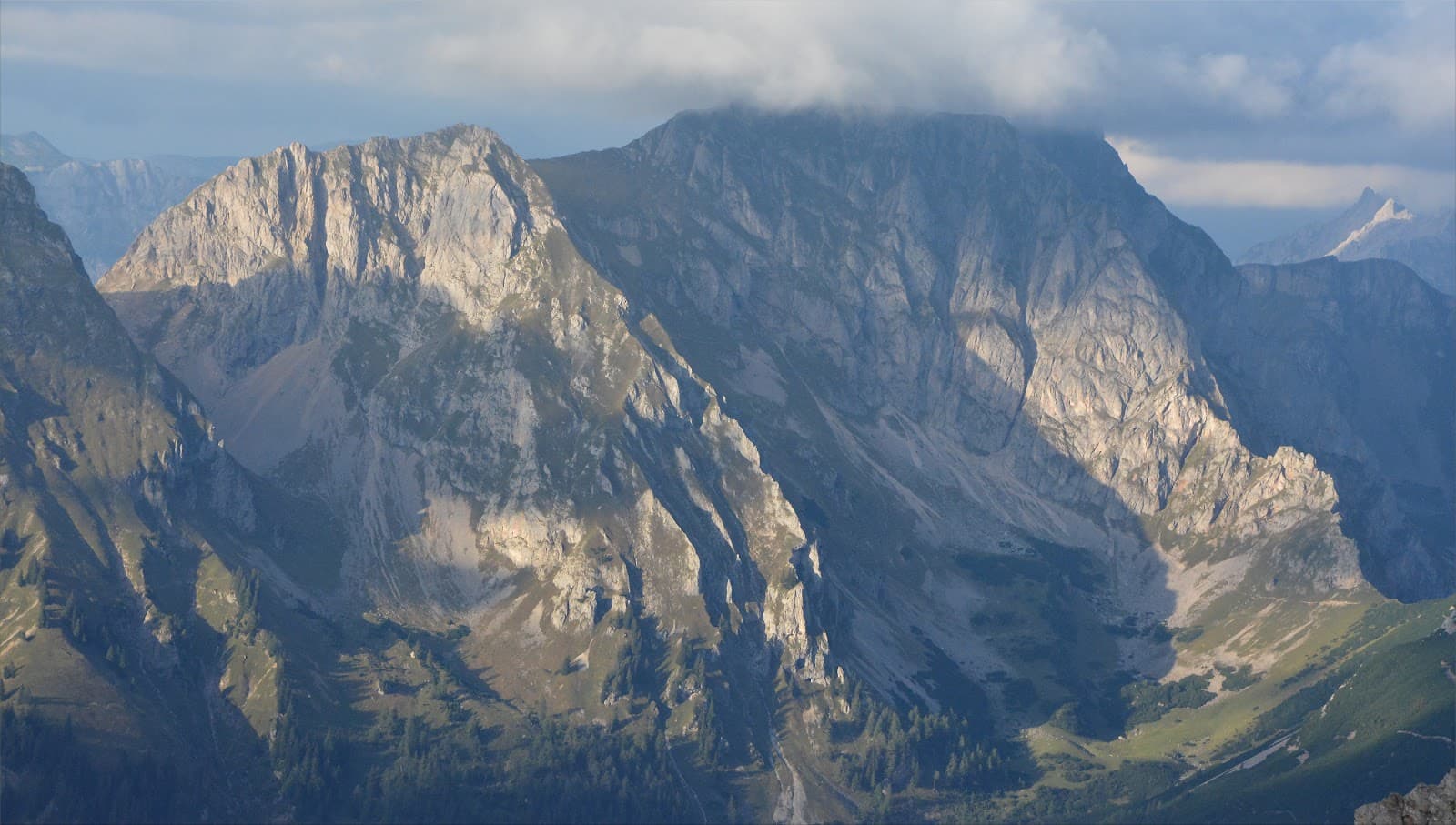
Gösseck Summit Panorama
Summit of Gösseck (2214 m)
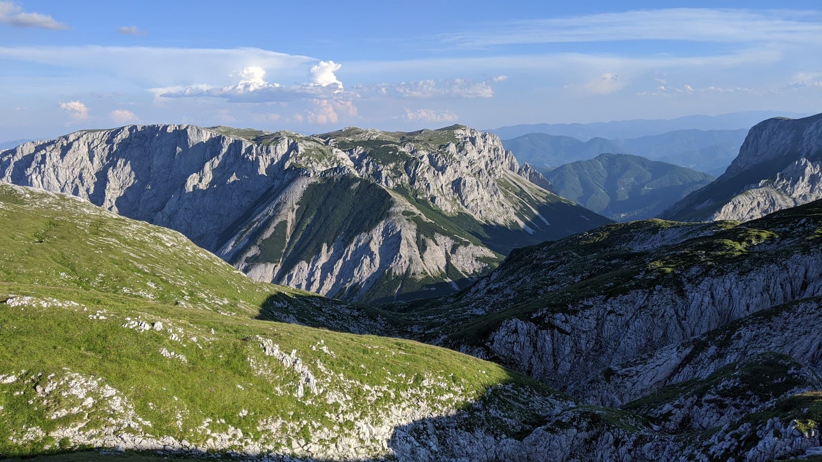
Breathtaking 360-degree views of the Eisenerz Alps, Gesäuse Mountains, and beyond. A truly rewarding sight!
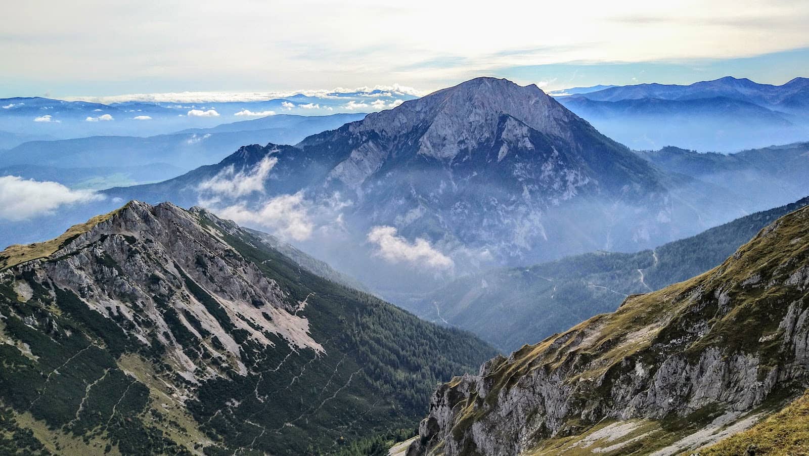
Wildfeld High Alpine Pasture
Below Grieskogel and Gösseck peaks
A beautiful plateau dotted with flowers, offering a serene resting spot before the final push to the summit.

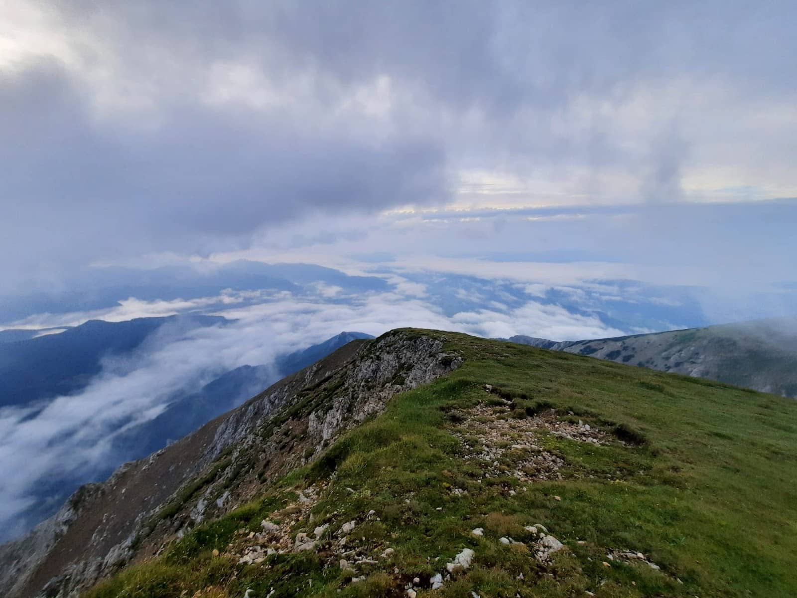
Bechlgraben Ravine
Ascent path
A scenic ravine with abundant flowers, offering chances to spot wildlife like ibexes or marmots.
Plans like a pro.
Thinks like you
Planning Your Visit
Prepare for a Challenging Ascent
Summit Views & Varied Routes
Best Times
Insider Tips
from TikTok, Instagram & Reddit
Pack Ample Provisions 💧
There are no huts on the trail. Bring plenty of water and snacks to stay energized for the long hike.
Sturdy Hiking Boots Needed 🥾
The trail involves steep sections and scree fields. Good grip and ankle support are crucial for safety.
Check Weather Forecast ☁️
Alpine weather can change rapidly. Be prepared for varying conditions, including sun, wind, and potential rain.
Vary Your Route ↔️
Consider the Jagasteig or Bechlgraben for a more interesting ascent/descent.
Tips
from all over the internet
Pack Ample Provisions 💧
There are no huts on the trail. Bring plenty of water and snacks to stay energized for the long hike.
Sturdy Hiking Boots Needed 🥾
The trail involves steep sections and scree fields. Good grip and ankle support are crucial for safety.
Check Weather Forecast ☁️
Alpine weather can change rapidly. Be prepared for varying conditions, including sun, wind, and potential rain.
Vary Your Route ↔️
Consider the Jagasteig or Bechlgraben for a more interesting ascent/descent.
Start Early for Views ☀️
An early start allows for better light for photography and a more relaxed pace.
What Travellers Say
Reviews Summary
Gösseck is praised for its stunning summit views and challenging, rewarding hike. Visitors appreciate the panoramic vistas and the beauty of the alpine scenery, particularly the wildflowers. However, the demanding nature of the trail, with significant elevation gain and lack of facilities, requires thorough preparation.
"Nice hike :)"
Tomas Michna - Wedding Photo & Video Worldwide
"The tour starts at the Zeller farm (893 m). At the parking lot, the farmer has set up a cash register for the parking fee, but you're happy to pay it 👍 You start hiking along a forest road and after a few minutes you pass a fenced-in water conservation area. Follow the markings (trail no. 693 m) and bypass the water reservoir on a small forest path. The forest road climbs steeply once again before it turns into a hiking trail. You climb through wooded areas until you reach the edge of the Bechlgraben ravine (tree line). Many flowers adorn the ravine, and with a bit of luck you might spot ibexes or marmots. The route leads along an increasingly steep path and over scree fields. Finally, you reach a beautiful high alpine pasture (Wildfeld), whose plateau lies below the peaks of the Grieskogel and Gößeck. Here you keep right and soon reach the summit of the Gößeck (2214 m). As the highest peak in the Eisenerz Alps, the Gößeck offers stunning views: from the Gesäuse Mountains to renowned peaks of the Eisenerz Alps, to the Hochschwab and Seckau Alps. After a rest at the summit, you can return to the starting point via the ascent path or via the Jagasteig trail past the Grieskogel down to the Rumpeleck and back to the Zeller farm."
Florian Graf
"A hike for experienced hikers with stamina, as it has over 1,200 meters of elevation gain over approximately 6.5 km!
The climb is well rewarded! It's the highest mountain in the Eisenerz Alps, with a summit cross at 2,187 m 🤩
A breathtaking panoramic view 😍💪😁
Bring plenty of provisions and water!!!
No huts along the entire trail! The weather can change quickly! Good gear is essential 🌧️🌬️🌥️🌞"
Gabriele Tynnauer
What People Like
What People Dislike
Frequently Asked Questions
🚇 🗺️ Getting There
The hike typically starts at the Zeller farm, which has a parking lot with a cash register for a parking fee. Follow trail markings (trail no. 693 m) from there.
Information on public transport options is limited. Driving to the Zeller farm is the most common access point. It's advisable to check local transport schedules if relying on public transit.
The Zeller farm has a designated parking lot where a fee is collected. It's a convenient starting point for the hike.
Roads leading to the trailhead are generally well-maintained, but it's always wise to check for any local advisories, especially during adverse weather conditions.
Travel times will vary depending on your starting point. It's recommended to use a navigation app for accurate estimates from your accommodation.
🎫 🎫 Tickets & Entry
There are no specific entry tickets for Gösseck itself. However, there is a parking fee collected at the Zeller farm trailhead.
Gösseck is an outdoor natural attraction, so it's accessible at any time. However, hiking during daylight hours is strongly recommended for safety and enjoyment.
The primary cost is the parking fee at the Zeller farm. The hike itself is free to access.
While not explicitly mentioned, local tourist information centers might offer guided tours. It's worth inquiring if you prefer a guided experience.
No specific hiking permits are generally required for Gösseck, but always check for any local regulations or temporary restrictions.
🎫 🧭 Onsite Experience
Gösseck is considered a challenging hike with over 1,200 meters of elevation gain and steep sections. It's best suited for experienced hikers with good stamina.
The ascent typically takes around 3 hours, with the total round trip time varying based on your pace and chosen route. Allow a full day for the excursion.
The trail includes forest roads, steep paths, and scree fields. Proper hiking footwear is essential.
There are no huts or facilities along the trail, so you must carry all your own water and supplies.
With luck, you might spot ibexes or marmots, especially in the Bechlgraben ravine and on the alpine pastures.
📸 📸 Photography
The summit offers unparalleled panoramic views. The Bechlgraben ravine with its flowers and the Wildfeld alpine pasture are also very picturesque.
Early morning or late afternoon often provide the best light for landscape photography, minimizing harsh shadows and creating a softer glow.
A wide-angle lens is great for capturing the expansive panoramas. A telephoto lens can be useful for wildlife spotting. Consider a sturdy tripod for stable shots.
Keep an eye out for wildflowers in the ravine and on the pasture, and the dramatic mountain vistas. The summit cross is also a popular photo subject.
Drone regulations can vary. It's essential to check local aviation laws and park rules before flying a drone in the area to ensure compliance.


Social
from TikTok, Instagram & Reddit