
Étang de Montady Montady France
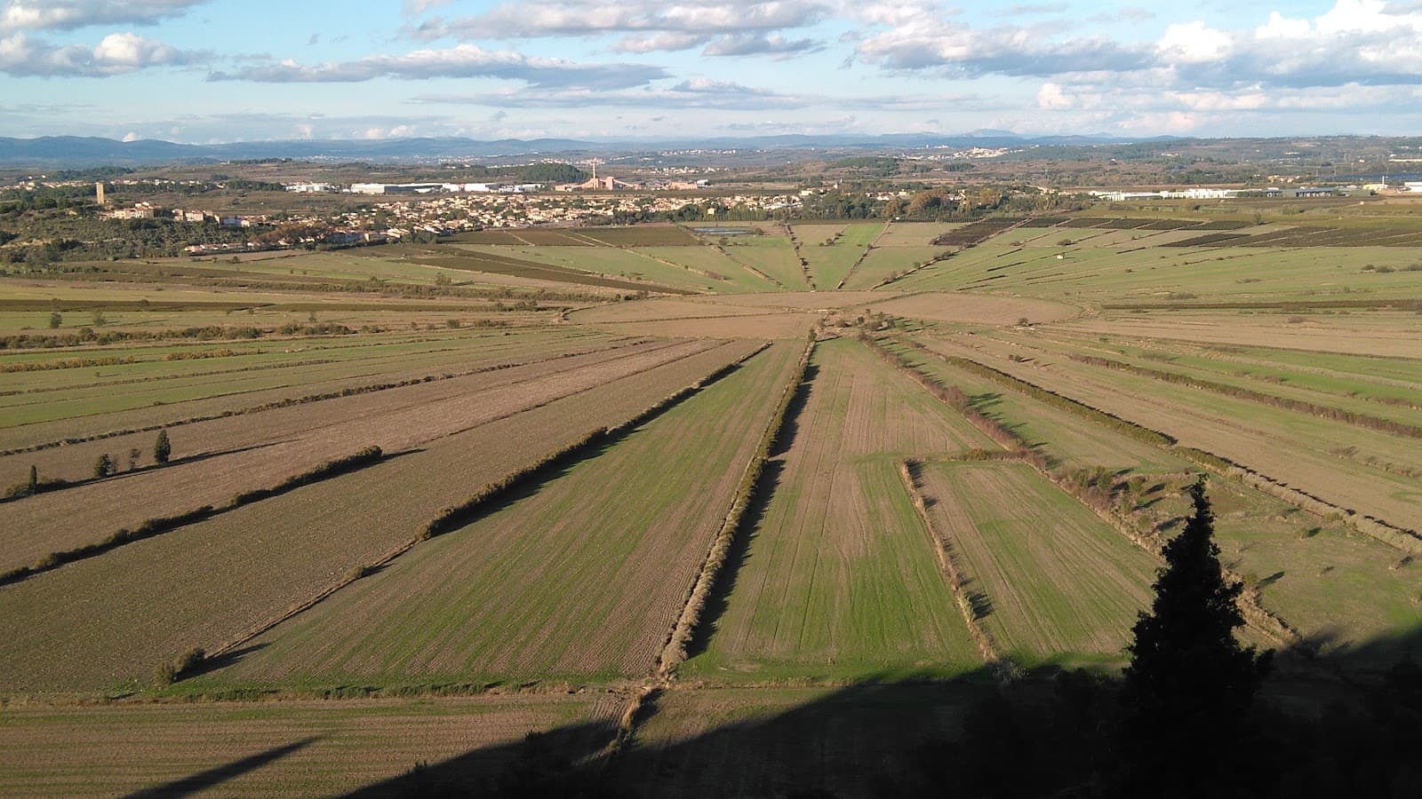
A 13th-century drained wetland, Étang de Montady showcases unique concentric agricultural patterns, best viewed from the historic Oppidum d'Ensérune.

Highlights
Must-see attractions

Social
From TikTok & Reddit
Best Time
Crops are vibrant and beautiful
Étang de Montady Montady France
Best Time
Crops are vibrant and beautiful
Highlights
Must-see attractions
A 13th-century drained wetland, Étang de Montady showcases unique concentric agricultural patterns, best viewed from the historic Oppidum d'Ensérune.
"It looks like a gigantic antenna pointing towards the cosmos!"

🎯 View from Above is Key
Don't expect water! The real magic is seeing the drained basin's design from a high vantage point.
🚗 Parking & Amenities
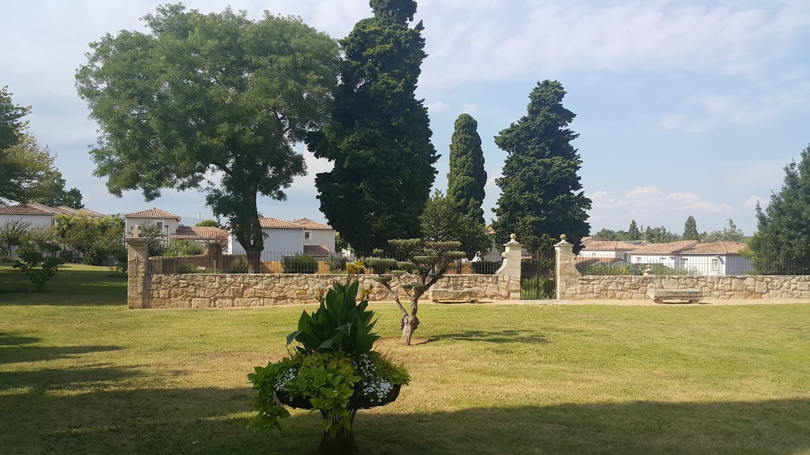
Parking is available near the Malpas tunnel, with picnic tables and a tourist office.

Quick Facts
Rating
3.9 · 16 reviews
Type
Natural Feature
Highlights
Discover the most iconic attractions and experiences
The Concentric Drainage System
Center of the Étang
A vast, dry basin with radiating channels, a testament to medieval engineering. Looks like a giant antenna!

Oppidum d'Ensérune Viewpoint
Hilltop overlooking the Étang
Panoramic views revealing the full, impressive scale of the drained wetland and its irrigation network.

Ancient Human History
Oppidum d'Ensérune
Explore a site settled by Celts 2,500 years ago, layered with history beneath your feet.
Plans like a pro.
Thinks like you
Planning Your Visit
Understand the Drainage Project
Best Views from Above
Best Times
Insider Tips
from TikTok, Instagram & Reddit
🎯 View from Above is Key
Don't expect water! The real magic is seeing the drained basin's design from a high vantage point.
🚗 Parking & Amenities
Parking is available near the Malpas tunnel, with picnic tables and a tourist office.
👟 Wear Comfortable Shoes
Exploring the Oppidum d'Ensérune involves walking on uneven terrain.
📸 Drone Photography
Capture stunning aerial views of the unique landscape.
Tips
from all over the internet
🎯 View from Above is Key
Don't expect water! The real magic is seeing the drained basin's design from a high vantage point.
🚗 Parking & Amenities
Parking is available near the Malpas tunnel, with picnic tables and a tourist office.
👟 Wear Comfortable Shoes
Exploring the Oppidum d'Ensérune involves walking on uneven terrain.
📸 Drone Photography
Capture stunning aerial views of the unique landscape.
What Travellers Say
Reviews Summary
Visitors are impressed by the unique historical engineering of the Étang de Montady, particularly its drained concentric design, best viewed from the Oppidum d'Ensérune. While some find it lacks water-based attractions, others appreciate the ingenuity and agricultural beauty, especially in spring. It's a site that rewards those who seek to understand its historical context.
"Built by wealthy Beziers’ & monks in 13th cc,
The Étang de Montady (English: "pond of Montady") is a drained freshwater wetland, located near Montady and Colombiers, midway between Béziers and Narbonne.
The Étang de Montady was drained to provide much-needed farmland for the Kingdom of France, which was then experiencing a population boom.. This agricultural landscape exists today and can be seen from the Oppidum d'Ensérune, a nearby hill and historic settlement."
Deniz Kural Vagabond
"Certainly some people will tell you that there is nothing to see, but if you really want to appreciate the particularity of the place, it is worth taking a step up to the Oppidum d'Enserune, there may be no more water but I think that the local farmers have managed to keep the originality of this place. It is true that there are no developments concerning this place but, for those who know how to admire the work of man, you will find several parking lots nearby to visit the Malpas tunnel and the Oppidum. In the first parking lot, you will find picnic tables as well as a tourist office."
Frédéric Carre
"A geological curiosity, an ancient lake that has been dry since the Middle Ages! It looks like a gigantic antenna pointing towards the cosmos! You can go to the very center of the circle, where about twenty concentric rays arrive, bringing runoff water. A must-see. In spring, it's even more beautiful with the crops."
Michel Pelvoux
What People Like
What People Dislike
Frequently Asked Questions
🚇 🗺️ Getting There
The Étang de Montady is located near Montady and Colombiers, between Béziers and Narbonne in southern France. Access is typically via car, with parking available near the Malpas tunnel and Oppidum d'Ensérune.
Public transport options are limited. It's best to travel by car to easily access the viewpoints and surrounding areas.
The most impressive views are from the Oppidum d'Ensérune, offering a panoramic perspective of the drained wetland.
No, the basin itself is an agricultural landscape. Access is for viewing from the surrounding hills.
While there aren't specific tours for the Étang itself, the nearby Oppidum d'Ensérune may offer historical context.
🎫 🎫 Tickets & Entry
No, the Étang de Montady is an open agricultural landscape and is free to view from surrounding areas like the Oppidum d'Ensérune.
As an outdoor landscape, there are no set opening hours. You can visit at any time, though daylight hours are best for viewing.
Entry to the viewpoint at the Oppidum d'Ensérune is generally free, allowing you to appreciate the historical site and the Étang.
Respect the agricultural land and do not enter private fields. Stick to designated paths and viewpoints.
Yes, the landscape changes with the seasons. Spring offers vibrant crops, while other times provide clear views of the drainage patterns.
🎫 🧭 Onsite Experience
The main activity is appreciating the unique, drained wetland landscape from viewpoints like the Oppidum d'Ensérune. It's a place for contemplation and understanding historical land management.
Comfortable walking shoes are recommended, especially if you plan to explore the Oppidum d'Ensérune. Dress for the weather.
Yes, there are picnic tables available near the parking area by the Malpas tunnel, and a tourist office is also located there.
Children can appreciate the vastness of the landscape and the historical aspect, especially with an explanation of the drainage project.
Drone usage is possible, offering spectacular aerial perspectives of the concentric design. Ensure you follow all local drone regulations.
📸 📸 Photography
The Oppidum d'Ensérune offers the most iconic panoramic shots. For unique perspectives, consider drone photography.
Early morning or late afternoon light can create dramatic shadows and highlight the landscape's contours. Clear skies are essential for wide views.
A wide-angle lens is great for capturing the expansive landscape. A drone provides unparalleled aerial views.
Focus on the concentric patterns of the drained wetland, the radiating irrigation channels, and the surrounding agricultural fields.
Yes, the ruins themselves are photogenic and add a historical layer to your images.


Social
from TikTok, Instagram & Reddit