
Mont Chenaillet Geology Trail
Explore a rare geological wonderland with petrified lava mountains and exposed oceanic crust, offering a unique glimpse into Earth's deep history.
Highlights
Must-see attractions

Social
From TikTok & Reddit
Best Time
Clear skies, best views
Mont Chenaillet Geology Trail
Best Time
Clear skies, best views
Highlights
Must-see attractions
Explore a rare geological wonderland with petrified lava mountains and exposed oceanic crust, offering a unique glimpse into Earth's deep history.
"A geologically marvelous place, it's our geological Eiffel Tower, a splendor!"
🥾 Wear Sturdy Hiking Boots
The terrain can be uneven, so good footwear is essential for navigating the rocky paths and enjoying the geology.
💧 Bring Plenty of Water
Stay hydrated on your hike, especially during warmer months. There are limited facilities on the trail.
Quick Facts
Rating
4.5 · 28 reviews
Type
Natural Feature
Highlights
Discover the most iconic attractions and experiences
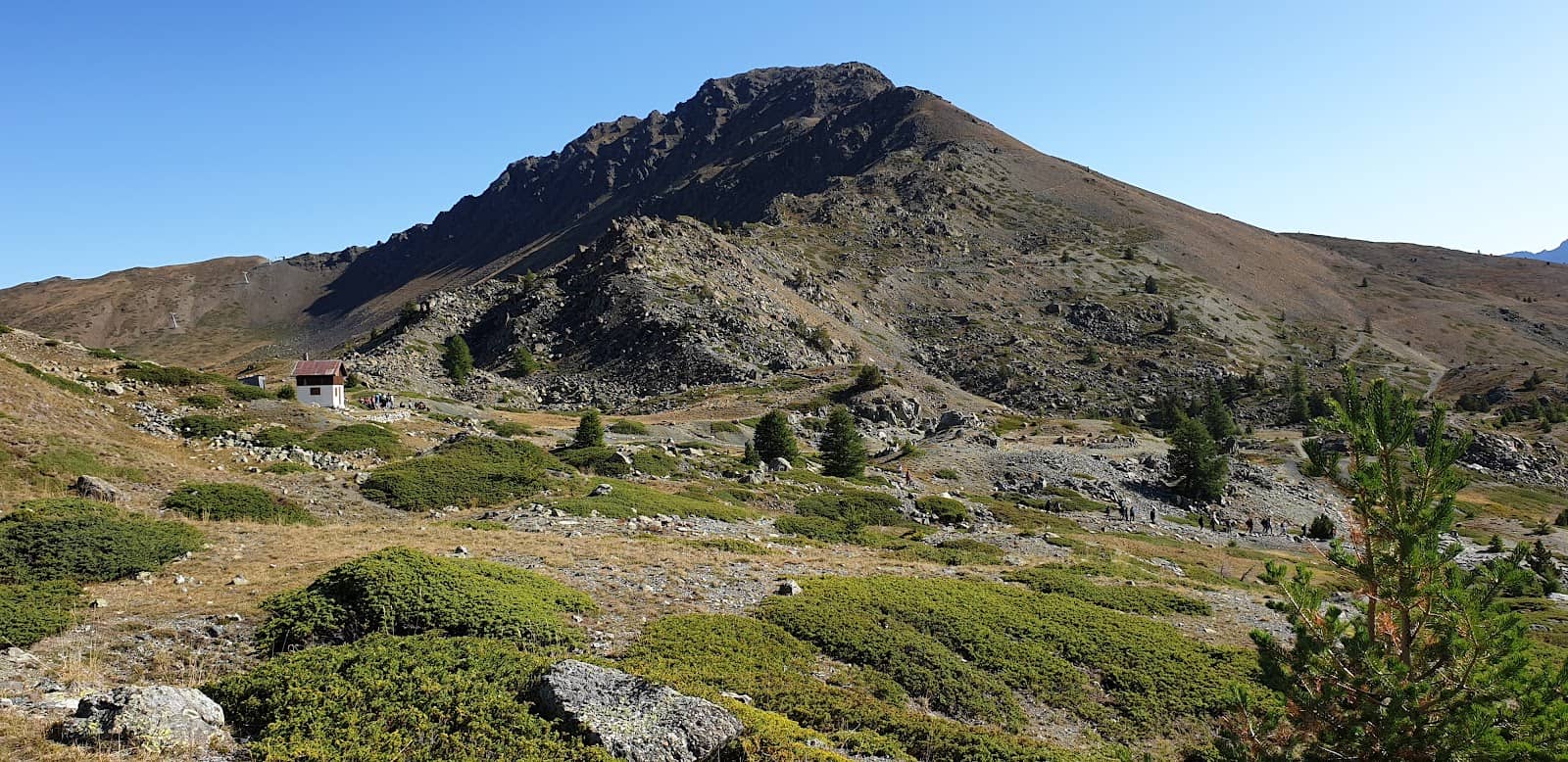
Petrified Lava Mountains
Mont Chenaillet Summit
Witness the awe-inspiring remnants of ancient volcanoes, showcasing petrified lava formations that tell a story of fiery origins.
Exposed Oceanic Crust (Moho)
Mont Chenaillet Trail
Discover the rare opportunity to see a deep layer of Earth's crust, the Moho, a geological marvel rarely accessible elsewhere.
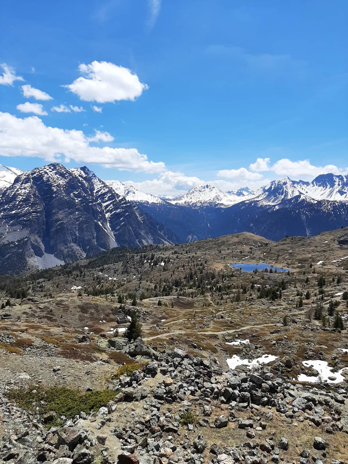
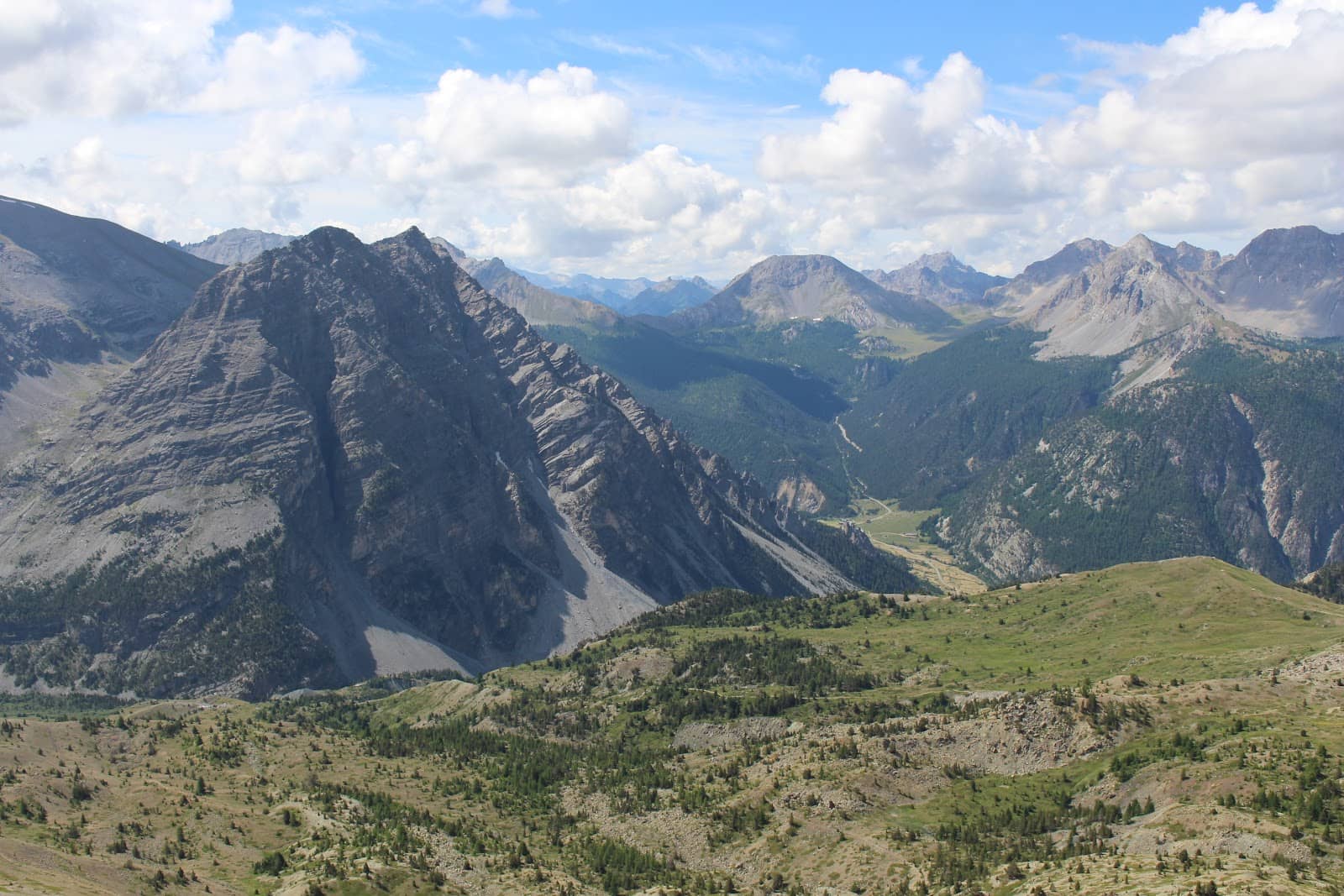
Panoramic Summit Views
Mont Chenaillet Summit
Be rewarded with sweeping vistas of the Ecrins to the west and Rochebrune peak to the south from this ancient volcano's peak.
Plans like a pro.
Thinks like you
Planning Your Visit
Geology Enthusiast's Dream
Prepare for an Epic View
Best Times
Insider Tips
from TikTok, Instagram & Reddit
🥾 Wear Sturdy Hiking Boots
The terrain can be uneven, so good footwear is essential for navigating the rocky paths and enjoying the geology.
💧 Bring Plenty of Water
Stay hydrated on your hike, especially during warmer months. There are limited facilities on the trail.
📚 Consult Local Guides
For deeper insights into the fascinating geology, consider hiring a local guide or seeking information beforehand.
📸 Capture the Layers
The distinct geological layers are incredibly photogenic. Take your time to frame shots of these natural wonders.
Tips
from all over the internet
🥾 Wear Sturdy Hiking Boots
The terrain can be uneven, so good footwear is essential for navigating the rocky paths and enjoying the geology.
💧 Bring Plenty of Water
Stay hydrated on your hike, especially during warmer months. There are limited facilities on the trail.
📚 Consult Local Guides
For deeper insights into the fascinating geology, consider hiring a local guide or seeking information beforehand.
📸 Capture the Layers
The distinct geological layers are incredibly photogenic. Take your time to frame shots of these natural wonders.
What Travellers Say
Reviews Summary
Visitors rave about Mont Chenaillet's unique geological formations, calling it a 'geological Eiffel Tower' and a 'sublime place.' The rare opportunity to see deep Earth crust layers like the Moho and impressive petrified lava mountains is a major draw. While the hike is moderate, the stunning panoramic views from the summit are universally praised, making it an underrated and highly recommended destination for nature and science lovers.
"Great hike, one of the only ones in France that allows you to see so many rocks that are normally unreachable! The petrified lava mountains are impressive even for those who are not familiar with them."
Quentin DUBOIS
"At the summit of this ancient volcano located under the ocean, a wide panorama opens onto the Ecrins to the west, or the Rochebrune peak to the south."
Cyril Durand
"sublime place, incredible geology...."
bodha jac
What People Like
What People Dislike
Frequently Asked Questions
🚇 🗺️ Getting There
The trail is typically accessed from the village of Val Cenis in the Savoie region of France. You'll likely need a car to reach the trailhead, which is often marked. Check local tourism websites for the most up-to-date access information and parking details.
Public transport options directly to the trailhead can be limited. Buses may run to nearby villages like Val Cenis, from where you might need to arrange a taxi or a local shuttle service. It's best to research seasonal bus routes in advance.
The most common starting point is near the village of Val Cenis. Look for signs indicating the 'Sentier Géologique du Mont Chenaillet' or similar. Parking is usually available near the trailhead.
Roads leading to the trailhead can be winding mountain roads. During peak season, they are generally well-maintained, but it's always wise to check local road conditions, especially if traveling outside of summer.
Winter access can be challenging due to snow. The trail may be impassable or require specialized winter hiking gear and experience. It's generally recommended for spring, summer, and fall.
🎫 🎫 Tickets & Entry
No, the Mont Chenaillet Geology Trail is generally a free, open-access natural site. There are no admission fees to hike the trails and explore the geological formations.
As an outdoor natural attraction, Mont Chenaillet does not have set opening or closing hours. You can visit at any time, though daylight hours are recommended for safety and visibility.
There is no entrance fee. The trail is a natural geological site, and access is free for all visitors.
No booking is required. You can visit Mont Chenaillet spontaneously. However, if you plan to hire a guide, booking in advance is highly recommended.
The primary restriction is to respect the natural environment. Stick to marked trails, do not disturb the geological formations, and pack out everything you pack in. Check for any local fire bans or specific park regulations.
🎫 🧭 Onsite Experience
It's a moderate hike with some rocky and uneven terrain. The elevation gain is significant as you ascend the ancient volcano, offering rewarding views and geological discoveries.
The time required can vary greatly depending on your pace and how much time you spend observing the geology and views. A typical hike might take 3-5 hours round trip, including stops.
You'll see petrified lava mountains, distinct geological layers, and the rare Moho (a deep layer of Earth's crust). It's like looking at the planet's history laid bare.
The main trails are generally marked, but it's always a good idea to have a map or GPS device, especially if you plan to explore off the most beaten paths. Look for trail markers indicating the geology trail.
Facilities are very limited or non-existent on the trail itself. It's crucial to bring all your own water and snacks, and be prepared to carry out all trash.
📸 📸 Photography
The summit offers incredible panoramic shots of the surrounding mountains. The exposed geological layers themselves are also highly photogenic, showcasing unique textures and colors.
Early morning or late afternoon light can create dramatic shadows and highlight the textures of the rock formations. Midday sun can be harsh but still offers clear views.
A standard camera or smartphone is sufficient. However, a wide-angle lens can be useful for capturing the expansive landscapes, while a macro lens might help detail the rock textures.
Drone regulations can vary by region and park. It's essential to check current local drone laws and obtain any necessary permits before flying. Respecting wildlife and other visitors is paramount.
Focus on the scale of the petrified lava, the distinct banding of the geological layers, and the sweeping mountain vistas from the summit. Close-ups of interesting rock textures are also great.

Social
from TikTok, Instagram & Reddit