
Prédikálószék
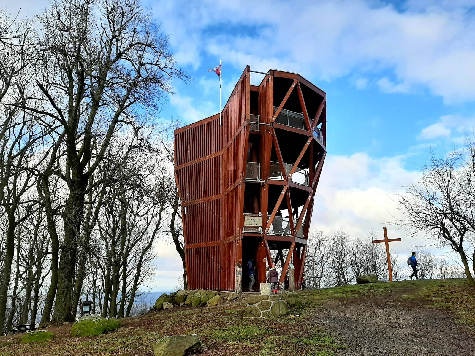
Hike to a 639m peak for breathtaking Danube curve views from a 12m lookout tower.
Highlights
Must-see attractions

Social
From TikTok & Reddit
Best Time
Crisp air, clear views
Prédikálószék
Best Time
Crisp air, clear views
Highlights
Must-see attractions
Hike to a 639m peak for breathtaking Danube curve views from a 12m lookout tower.
"The most amazing views after a few hours of climbing and walking but it was worth it!"
Pack Plenty of Water & Snacks
No facilities at the top! Bring enough for your entire hike. :water_wave: :apple:
Download Offline Maps
Hungarian maps can be hard to find. Ensure you have offline navigation. :iphone: :world_map:
Quick Facts
Rating
4.9 · 508 reviews
Type
Natural Feature
Highlights
Discover the most iconic attractions and experiences
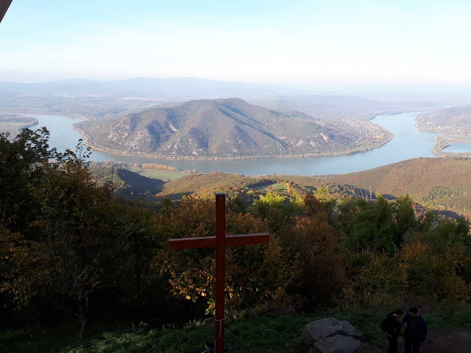
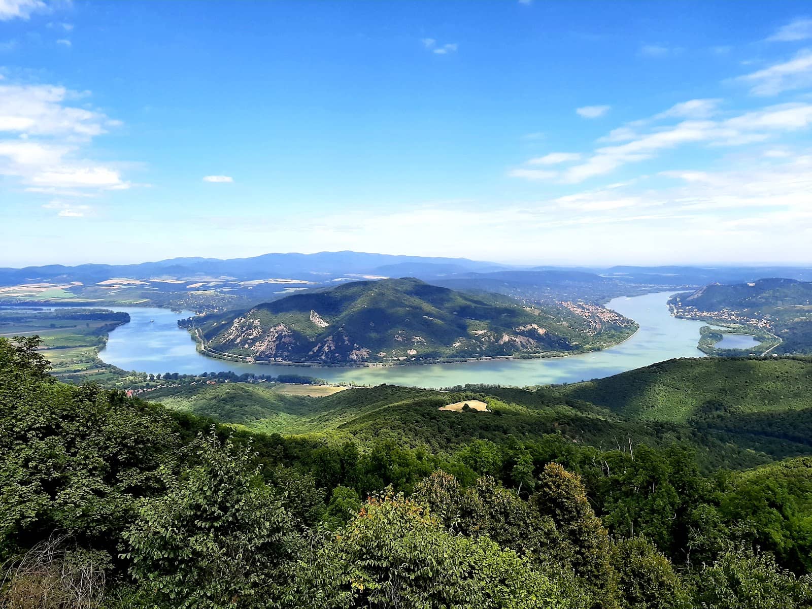
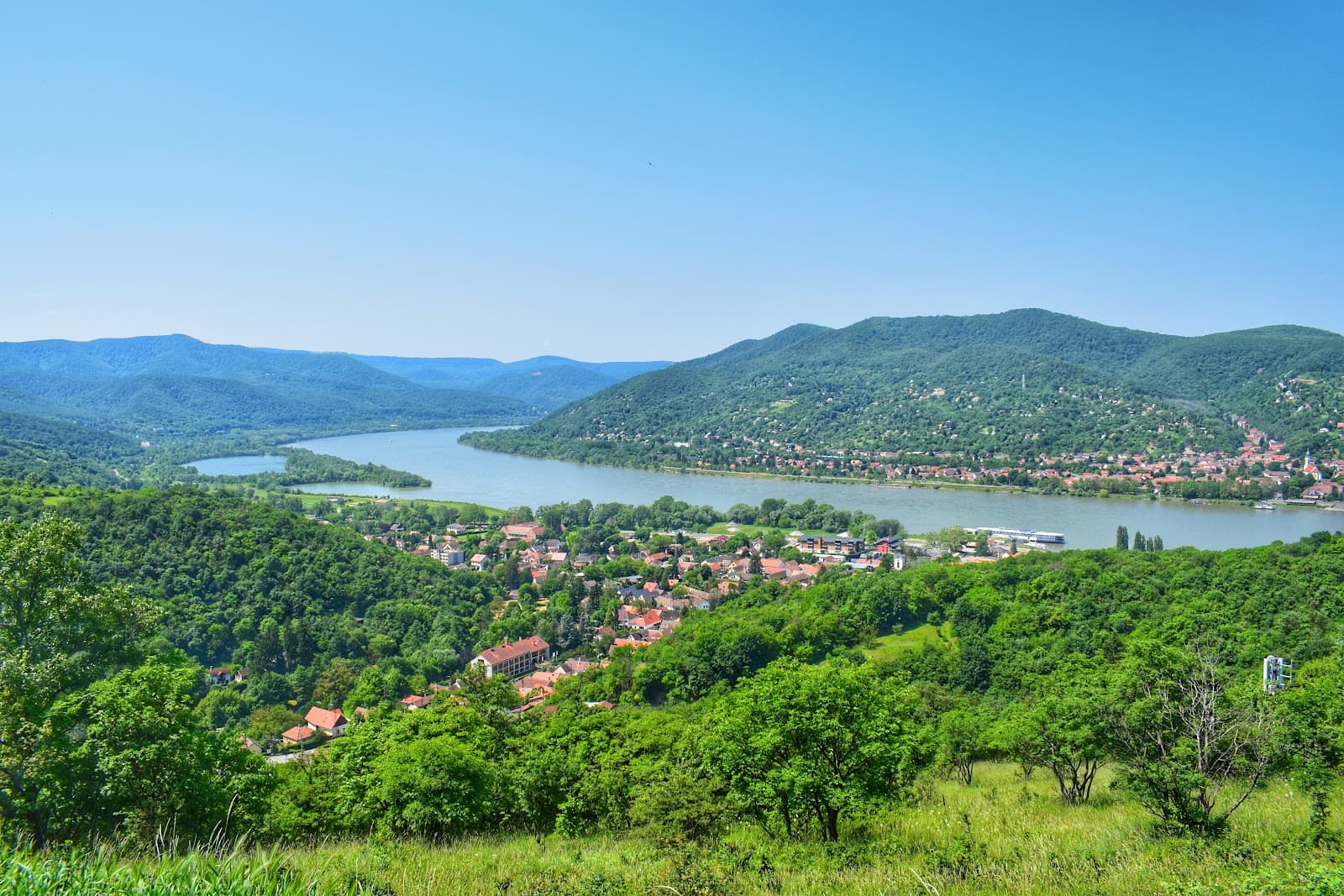
Panoramic Danube Views
Summit
Witness the majestic Danube curve, reminiscent of Horseshoe Bend, framed by mountains.
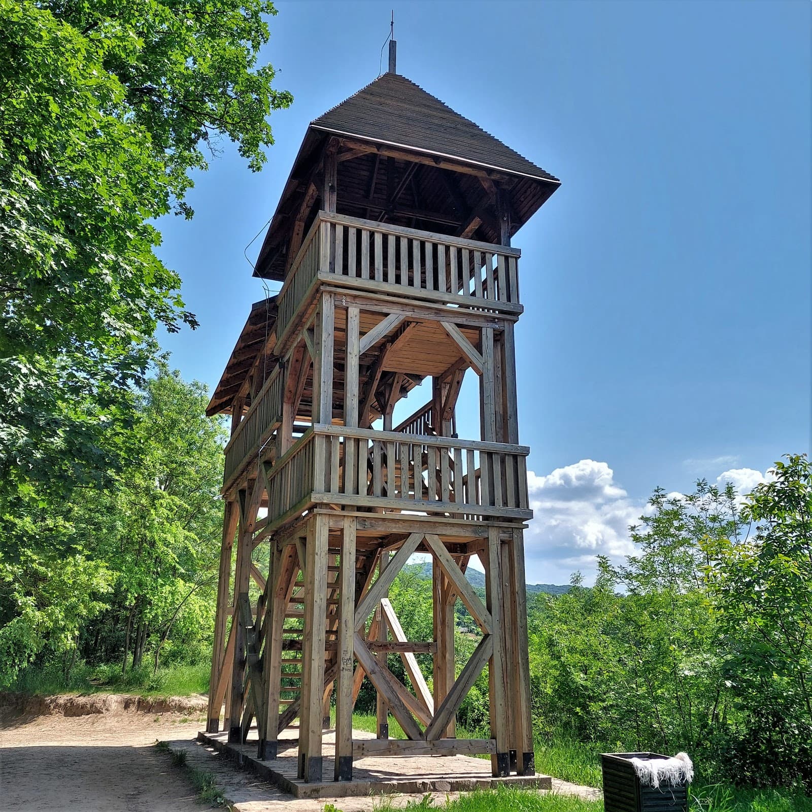
12-Meter Lookout Tower
Summit
Ascend the tower for breathtaking 360-degree vistas of the Visegrád Mountains and the river.
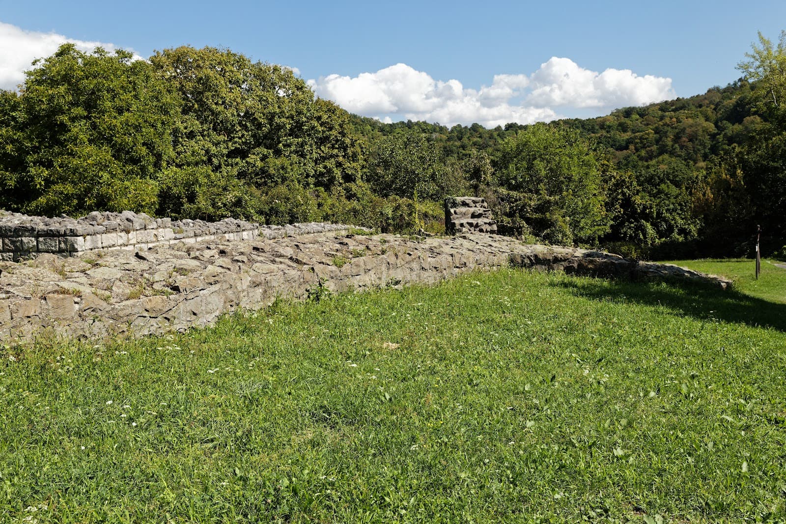
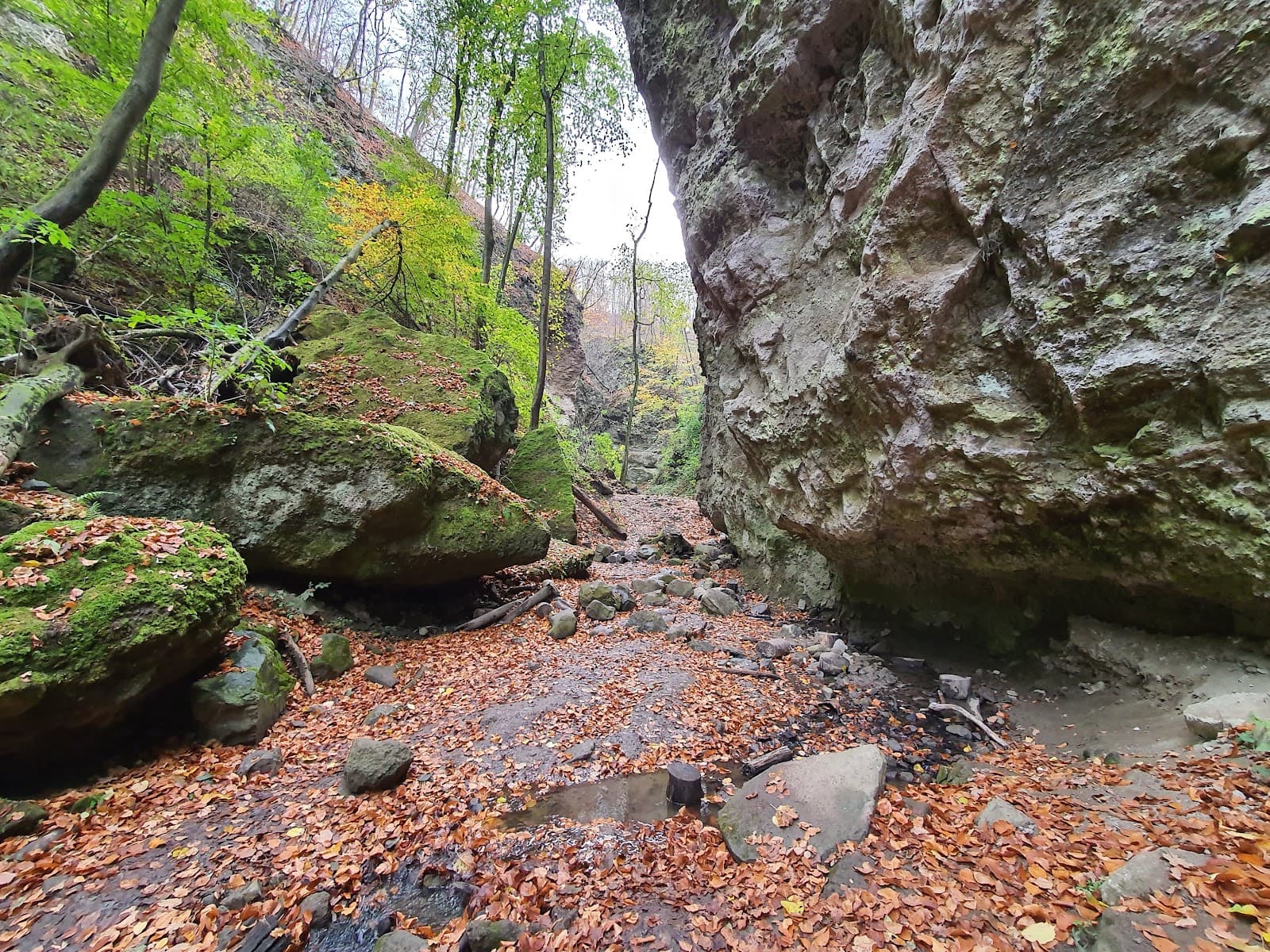
Vadállókövek Rock Formations
Trail from Dömös
Explore unique stone formations along a challenging but scenic hiking path.
Plans like a pro.
Thinks like you
Planning Your Visit
Trail Maps & Supplies
Best Hiking Routes
Best Times
Insider Tips
from TikTok, Instagram & Reddit
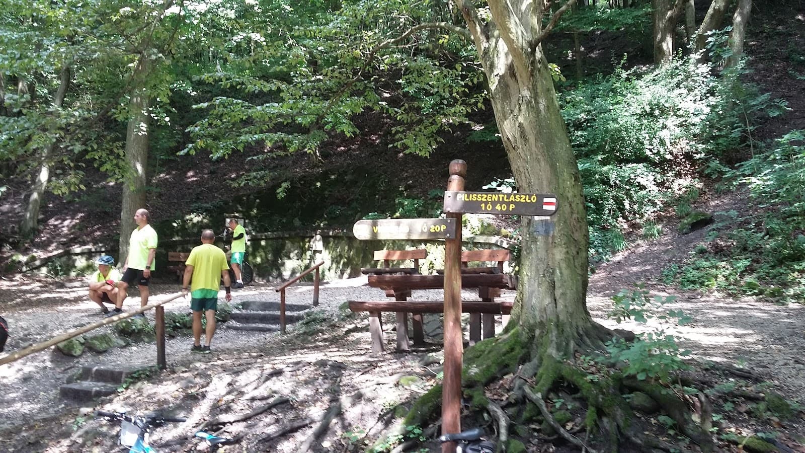
Dömös to Pilisszentlászló (over Prédikálószék)
Hiya, I want to do a hike in this area of the Duna bend but cannot find any reliable map. I went to Decathlon but couldn't find any maps of that particular area, and all the other ones that I found are only in Hungarian. ​ Has anyone done a similar route? I don't…
Pack Plenty of Water & Snacks
No facilities at the top! Bring enough for your entire hike. :water_wave: :apple:
Download Offline Maps
Hungarian maps can be hard to find. Ensure you have offline navigation. :iphone: :world_map:
Lake balaton or Danube Bend for daytrip in August?
Which would you recommend? We're 2 women in our 20s, we like pretty outdoor stuff, historic sites, and art. Food tourism isn't a huge thing for us and neither are party sites. We'll be in Budapest for about a week
Wear Sturdy Hiking Shoes
Trails can be steep and rocky, especially the Dömös route. :athleticshoe: :mountainclimbing:
Consider the Dömös Trail
Challenging but offers incredible scenery and unique rock formations. :hiking_boot: ⭐
Tips
from all over the internet
Pack Plenty of Water & Snacks
No facilities at the top! Bring enough for your entire hike. :water_wave: :apple:
Download Offline Maps
Hungarian maps can be hard to find. Ensure you have offline navigation. :iphone: :world_map:
Wear Sturdy Hiking Shoes
Trails can be steep and rocky, especially the Dömös route. :athleticshoe: :mountainclimbing:
Consider the Dömös Trail
Challenging but offers incredible scenery and unique rock formations. :hiking_boot: ⭐
What Travellers Say
Reviews Summary
Visitors consistently praise Prédikálószék for its absolutely stunning, majestic views of the Danube curve, often compared to Horseshoe Bend. The challenging hikes, particularly the route from Dömös with its unique rock formations, are considered well worth the effort for the panoramic vistas from the lookout tower. However, the lack of any facilities at the summit means visitors must be fully prepared with their own food and water.
"This is place where you can see the beautiful view of the Danube winding between the Börzsöny and Pilis mountains. Amazing beauty."
Borza G Judit
"The most amazing views after a few hours of climbing and walking but it was worth it! Make sure you take plenty of food and drinks with you because there are no bars or any type of facility with food and drink on the top!"
Anita Vizi
"Really nice lookout point with the beautiful view of the Duna curve. There are multiple hiking trail on which you can approach it, usually with an elevation about 600 m from multiple locations around it."
Balint Balint
What People Like
What People Dislike
Frequently Asked Questions
🚇 🗺️ Getting There
The most popular starting point is Dömös, offering a challenging hike. Other trails are available from surrounding villages. Public transport options to trailheads can be limited, so check schedules in advance. 🚌 🚂
While the Dömös route is strenuous, other trails might be less demanding. Research specific routes based on your fitness level. 🚶
Limited parking may be available at some trailheads, but the final ascent is typically on foot. 🚗
Hungarian trail maps can be difficult to find. Downloading offline maps on your phone or using a GPS device is highly recommended. :iphone: 🧭
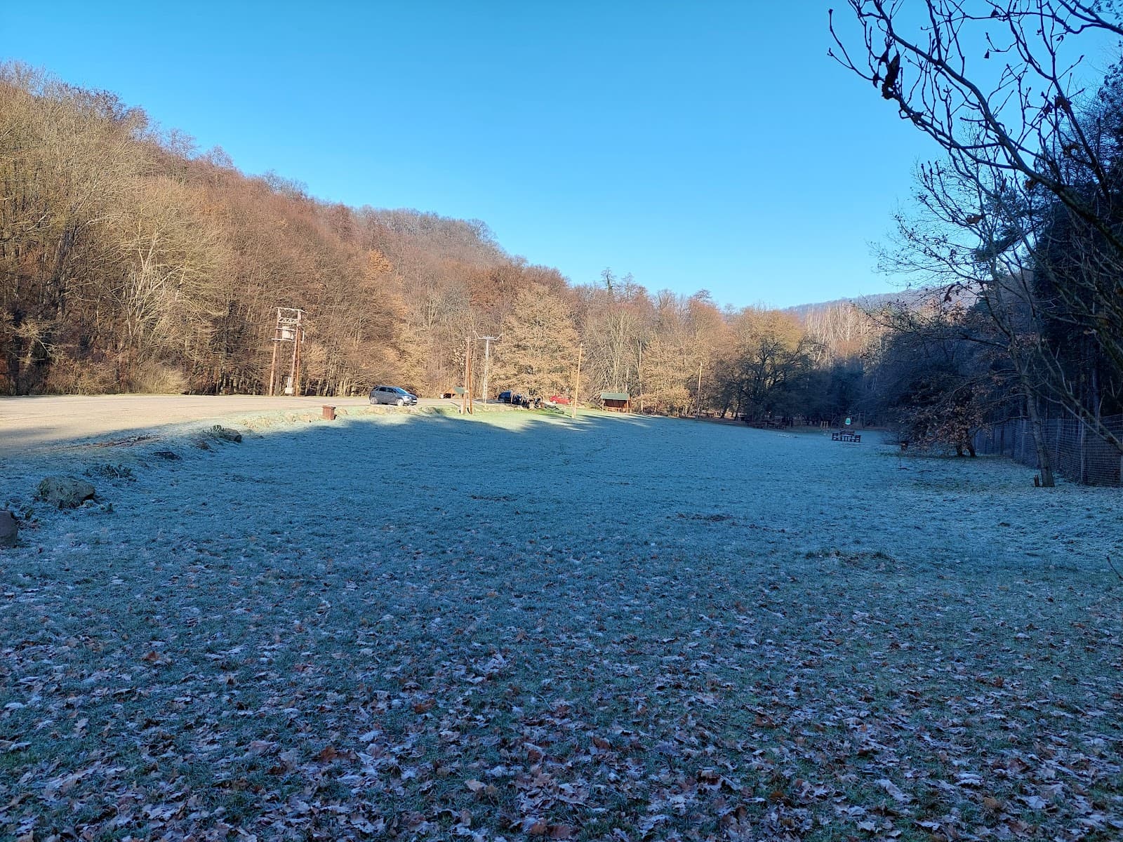
Yes, winter hikes are possible on sunny days, offering clear views. Be prepared for cold temperatures and potentially icy conditions. :snowflake: ☀️
🎫 🎫 Tickets & Entry
There is no entrance fee to access Prédikálószék or its lookout tower. The cost is associated with your transportation to the trailhead. :moneywithwings:
The lookout tower is generally accessible during daylight hours. It's advisable to check for any seasonal or maintenance closures. :clock1:
No advance booking is required as there are no tickets or fees for entry. 🎟️
While generally open, it's best to avoid visiting very early or late to ensure safety and visibility. 🔦
The hiking trails are generally accessible year-round, but conditions can vary significantly with weather. 📅
🎫 🏞️ Onsite Experience
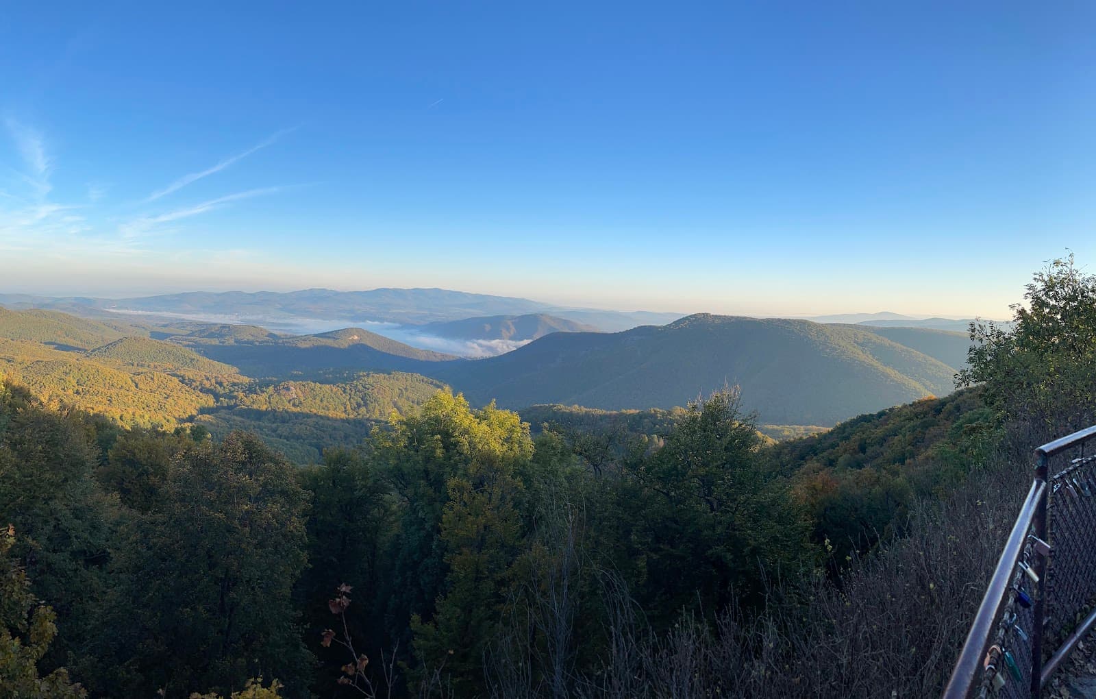
Expect stunning panoramic views of the Danube River's curve, the surrounding Visegrád Mountains, and the Bükk and Pilis ranges. It's often compared to Arizona's Horseshoe Bend. :camerawithflash: :mountain_snow:
Hiking times vary greatly depending on the chosen route and your fitness level. The Dömös trail can take several hours round trip. :stopwatch:
No, there are no facilities at the summit. It's crucial to bring all your own food and drinks. :noentrysign: :forkandknifewithplate:
The 12-meter tower offers incredible views but requires caution. Ensure you are comfortable with heights and climb carefully. ⚠️ :ladder:
Trails can be steep, rocky, and uneven, especially the route passing Vadállókövek. Sturdy footwear is essential. :rock: 👢
📸 📸 Photography
The summit and the lookout tower offer the most iconic panoramic shots. Don't miss the unique rock formations on the Dömös trail. 📷
Golden hour (early morning or late afternoon) provides beautiful light for landscape photography. Midday can be harsh but still offers clear views. 🌅 🌇
A wide-angle lens is great for capturing the expansive landscapes. A telephoto lens can be useful for details in the distance. :camerawithflash:
Drone regulations can be complex. It's best to check current local drone laws before flying. :drone:
Include a person or a recognizable landmark in your shot to convey the vastness of the scenery. :person_standing:


Social
from TikTok, Instagram & Reddit