
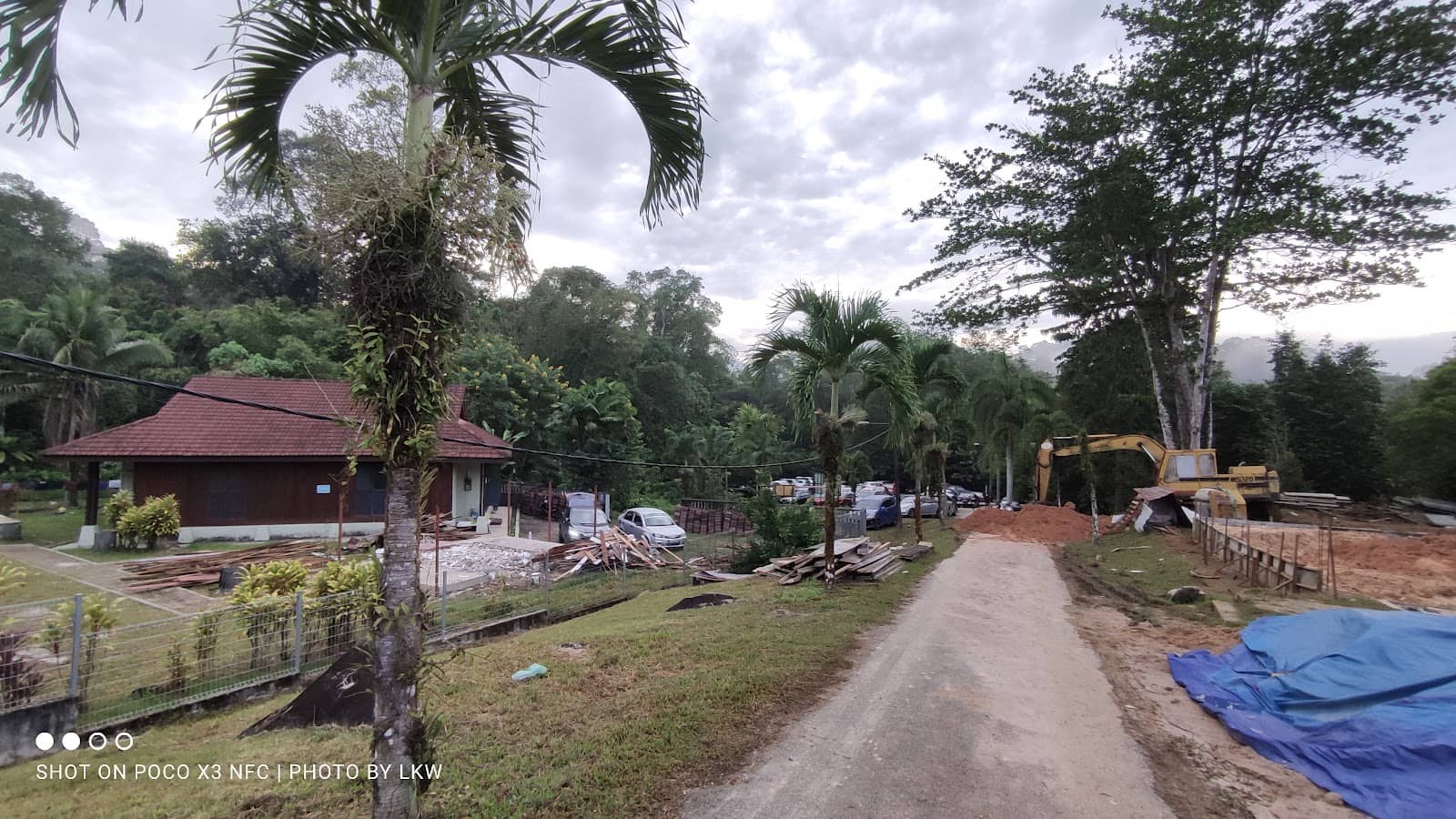
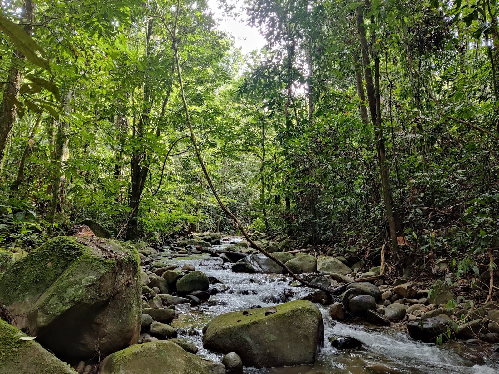
Gunung Nuang Trailhead
A challenging 20km trek with steep, muddy trails leading to a rewarding summit. Requires permits and often guides.
Highlights
Must-see attractions

Social
From TikTok & Reddit
Best Time
Beat the heat and crowds
Gunung Nuang Trailhead
Best Time
Beat the heat and crowds
Highlights
Must-see attractions
A challenging 20km trek with steep, muddy trails leading to a rewarding summit. Requires permits and often guides.
"This is not for the weak ones. Very muddy from middle part to peak area. Mental power must be kuat!"
🥾 Gear Up Wisely
Bring gloves, a hiking pole, and wear sturdy shoes. A raincoat is essential due to frequent mud.
💧 Hydration is Key
Carry at least 3-4 liters of water, plus energy drinks and snacks. Refill at Kem Lolo if needed.

Quick Facts
Rating
4.8 · 34 reviews
Type
Hiking Area
Highlights
Discover the most iconic attractions and experiences
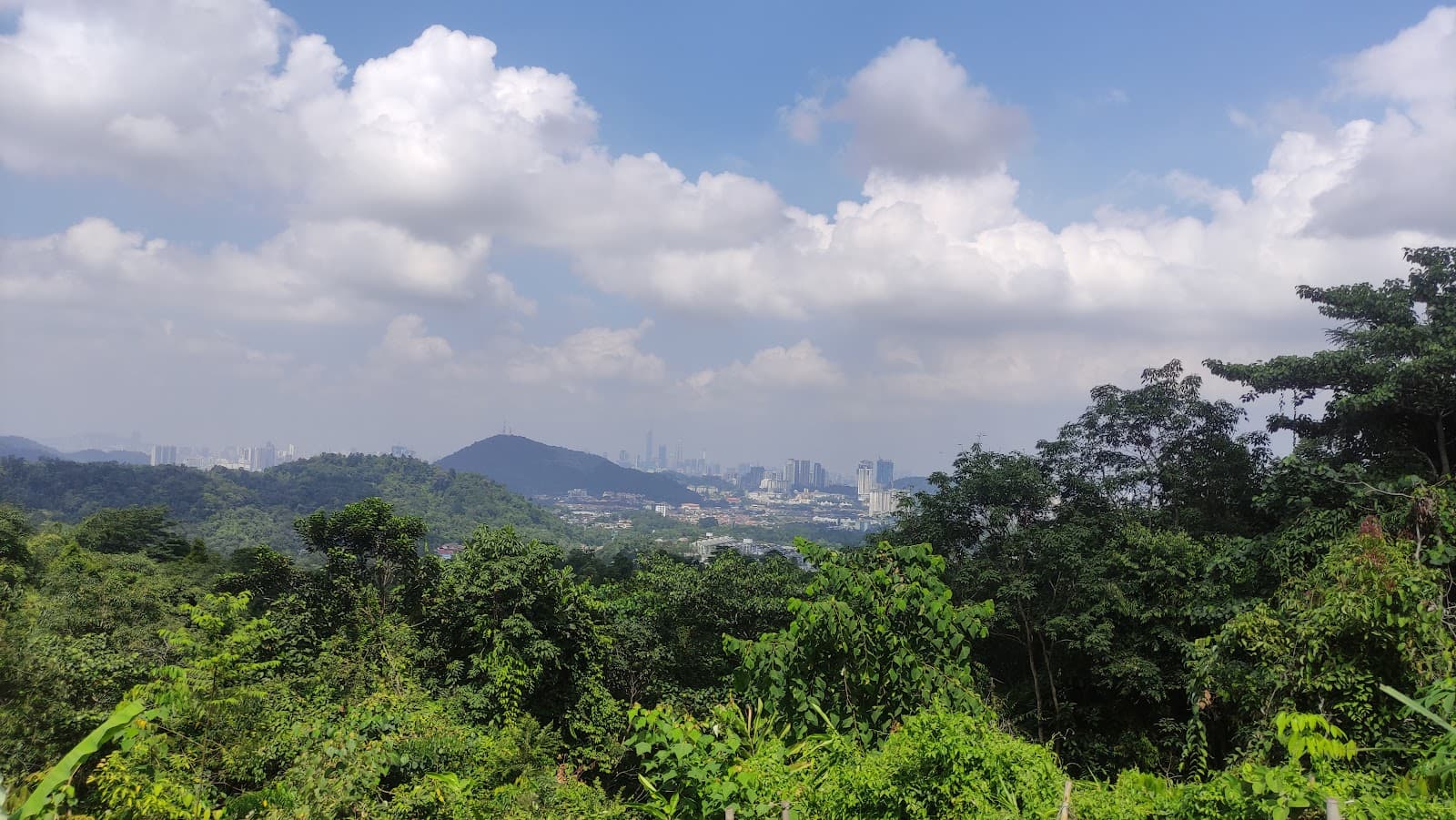
Puncak Nuang Summit
Peak
The ultimate reward! Reach the highest point for breathtaking panoramic views after a demanding trek.
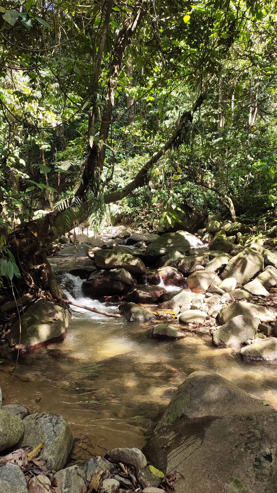
Kem Lolo Water Source
Mid-trail
A crucial stop for refilling water supplies and taking a well-deserved rest before continuing the ascent.
Steep Ascent to Kem Pengasih
Between Kem Pacat and Kem Pengasih
A notoriously steep and challenging section that tests your endurance and requires careful footing.
Plans like a pro.
Thinks like you
Planning Your Visit
Permit & Guide Requirements
Trail Conditions & Difficulty
Best Times
Insider Tips
from TikTok, Instagram & Reddit
17 Hikers Detained For Entering Gunung Nuang Without A Permit | TRP
The problem is to get a permit to climb mountains, they now force you to take a guide. So you either have to fork out 200 bucks to hire your own guide which is also a logistical nightmare or you have to follow set hiking trips with like 30 other people which generally costs…
🥾 Gear Up Wisely
Bring gloves, a hiking pole, and wear sturdy shoes. A raincoat is essential due to frequent mud.
💧 Hydration is Key
Carry at least 3-4 liters of water, plus energy drinks and snacks. Refill at Kem Lolo if needed.
🍎 Pack Smart Snacks
Focus on energy bars, fruits, and sandwiches. Avoid overpacking snacks you won't eat.
🧥 Peak Cold Gear
It gets very cold at the summit, so pack a jacket to stay warm.
Tips
from all over the internet
🥾 Gear Up Wisely
Bring gloves, a hiking pole, and wear sturdy shoes. A raincoat is essential due to frequent mud.
💧 Hydration is Key
Carry at least 3-4 liters of water, plus energy drinks and snacks. Refill at Kem Lolo if needed.
🍎 Pack Smart Snacks
Focus on energy bars, fruits, and sandwiches. Avoid overpacking snacks you won't eat.
🧥 Peak Cold Gear
It gets very cold at the summit, so pack a jacket to stay warm.
🗺️ Trail Markings
Pay attention to tree markings, especially after river crossings, to stay on the correct path.
What Travellers Say
Reviews Summary
Gunung Nuang is a challenging but rewarding hike, praised for its demanding terrain and the sense of accomplishment upon reaching the summit. However, hikers should be prepared for extremely muddy conditions, steep ascents, and the necessity of obtaining permits and potentially hiring guides, which can add to the cost and planning.
"Trail: Trail is easy to follow except for maybe after the first river crossing especially in the dark, it seems like there are a couple of trails to be followed. Be aware of the markings left on the trees and you should be fine. If it didn't rain the night before, the trail will be fairly dry except from Kem Pengasih to the peak. The muddiest trail I've ever hiked in.
Difficulty: Hard. If you’re a beginner and you’re wondering if you can hike Nuang, I’m a beginner myself and if I can do it, you can too. Try hike a couple of hills/mountains or climb the stairs every day a week or two before the hike and you should be okay. The most important thing is to prepare mentally. Know what to expect and prepare accordingly. I made a mistake of bringing too many snacks and in the end, I only ate a small amount of it. If I were to do it again, I’d bring about 2-2.5 litres of water, a couple of apples, energy bars and sandwiches. And a first-aid kit. That’s all. I started around 5am and ended the hike at around 5:50pm, so it’s an almost 13-hour hike so prepare accordingly.
Facilities: Toilet/dressing rooms only available at the trailhead/entrance. Last water source is at Kem Lolo. We did our Subuh and Zohor there. Sufficient parking spaces available at the trailhead.
Permit: Not available to purchase at the trailhead. I think you must apply a week before the hike. Most hikers came with a group, and I believe to hike Nuang, you are required to have a Malim Gunung with you, so they’re the one who prepares the application. A fee of RM5 per head for the permit.
Others: Hiking pole helped me tremendously and so does gloves. Kem Pacat to Kem Pengasih is very very steep and challenging so be careful of your surroundings so as not to fall. Take it easy, rest when you need to and good luck! Oh and it gets really really cold at the peak so bring a jacket.
Not proofread so grammar mistakes abound!"
I. Ibrahim
"12 Hours hike😅 don't play play, this is not for the weak ones. Very muddy from middle part to peak area. Mental power must be kuat 💪
Bring: gloves, Food, enough small bites, minimum 2 to 3 litre of water & softdrinks, painkiller cream/spray/medicine, hiking stick and lastly bring your smile when reach the peak 😄"
Ray Chong
"This trail is 20km return trip, elevation about 1600EG. Normal time 8 to 12 hours to complete.
Do your due diligence before conquering this mountain.
Easier trail to complete Gunung Nuang is via Janda Baik which you can complete it within 8 hours.
Before conquer Gunung Rajah, please complete this trail first.
Trailhead -> 6 huts -> start hike Camp Lolo -> Camp Pacat (make sure you're not damn tired here) rest and eat -> Puncak Pengasih -> Puncak Nuang 😀
Recommended 4L of water, 2 meals, 3 snacks, 2 powerbars, 2 powergels, hiking pole&raincoat(this trail most of the time is muddy), hiking gloves
Beware of rainy season, the trail will be muddy and it's slippery. Must be aware of the pouring water from the Hill top if it's raining.
Camp Lolo waterpoint if you're lack of water.
Camp Pacat does not have water point."
Mike Teh
What People Like
What People Dislike
Frequently Asked Questions
🚇 🗺️ Getting There
The Gunung Nuang Trailhead is accessible by car. There is sufficient parking available at the trailhead. For public transport options, research local bus routes to the nearest town and consider a taxi or ride-sharing service for the final leg to the trailhead.
Yes, there are sufficient parking spaces available at the trailhead, making it convenient for those driving to the location.
If you don't have a car, you'll likely need to combine public transport with a taxi or ride-sharing service. Research bus routes to nearby towns and then arrange for onward transport to the trailhead. It's advisable to coordinate this in advance.
While specific coordinates can vary slightly, searching for 'Gunung Nuang Trailhead' on navigation apps will generally lead you to the correct starting point. It's always good to cross-reference with recent traveler photos or descriptions.
The drive from Kuala Lumpur to the Gunung Nuang Trailhead typically takes around 1 to 1.5 hours, depending on traffic conditions.
🎫 🎫 Tickets & Entry
Yes, a permit is required to hike Gunung Nuang. It's recommended to apply at least a week in advance, as permits are not available for purchase at the trailhead.
The permit fee is typically RM5 per person. However, additional costs may apply if you are required to hire a guide.
No, permits are not available for purchase at the trailhead. You must apply in advance through the relevant authorities or your guide.
Many sources indicate that hikers are required to have a guide, especially for larger groups. Hiring a guide can also assist with the permit application process.
Permit application hours are typically during standard office working hours. It's best to confirm with the relevant forestry department or your guide for specific times.
🎫 🧭 Onsite Experience
Gunung Nuang is considered a hard hike. It's a 20km round trip with significant elevation gain, and the trail can be very muddy and slippery, especially from the middle to the peak.
The hike typically takes between 8 to 12 hours for experienced hikers, with some completing it in around 12-13 hours. Beginners should prepare for a full day.
Yes, toilet and dressing rooms are available at the trailhead/entrance.
The last reliable water source is at Kem Lolo. Camp Pacat does not have a water point, so ensure you have enough water before reaching Kem Lolo.
Wear sturdy hiking shoes with good grip. Bring gloves for climbing and a jacket for the cold summit. A raincoat is highly recommended due to the muddy conditions.
🍽️ 🍎 Food & Dining
Bring enough food for a full day, including 2 meals and 3 snacks. Energy bars, fruits like apples, and sandwiches are good options. Avoid overpacking snacks.
There are no food stalls or restaurants directly at the trailhead. It's best to pack all your food and drinks for the hike.
It's recommended to carry a minimum of 3-4 liters of water per person. Consider bringing energy drinks or soft drinks as well.
Yes, Kem Lolo is a water point where you can refill your water bottles. Ensure you have a reliable water filter or purification tablets if you plan to use natural water sources.
Energy bars, power gels, dried fruits, nuts, and small sandwiches are excellent choices for sustained energy during the hike.
📸 📸 Photography
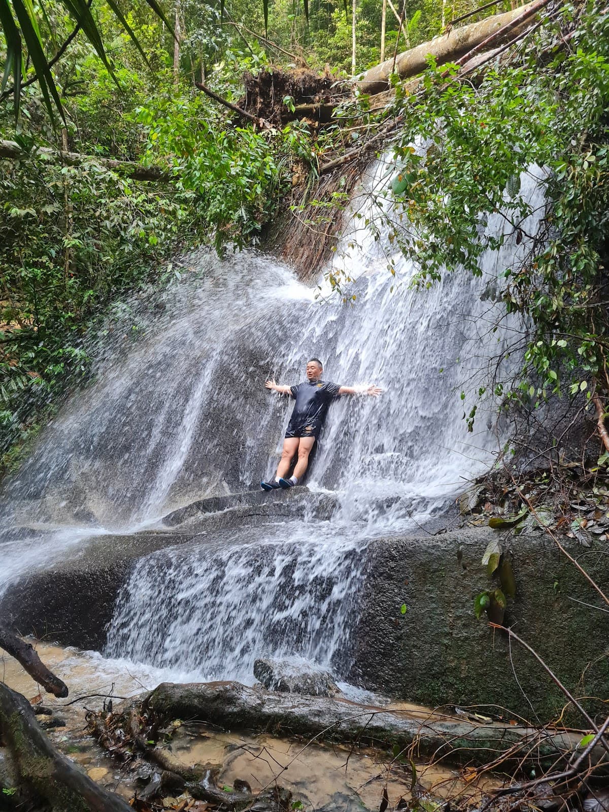
The summit offers panoramic views, especially during sunrise or sunset if you're camping or starting very early. The lush jungle scenery and challenging trail sections also make for dramatic photos.
Yes, but be cautious. The trail is often muddy and slippery, so ensure your camera is protected from moisture and impact. A waterproof camera or a good camera bag is recommended.
The dense jungle canopy creates dappled light for most of the trail. The summit offers open light, especially during the golden hours.
The summit of Gunung Nuang is the primary viewpoint. Other scenic spots might include clearings or viewpoints along the steeper sections, but the summit is the most rewarding.
Early morning for sunrise or late afternoon for sunset offers the best light and potentially fewer crowds. However, reaching the summit at these times requires an overnight stay or a very early start.


Social
from TikTok, Instagram & Reddit