
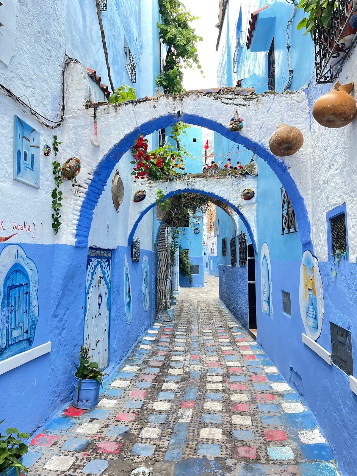
Jebel Tissouka Morocco
A challenging Moroccan peak offering ancient forests, unique karst landscapes, and rewarding panoramic summit views.
Highlights
Must-see attractions

Social
From TikTok & Reddit
Best Time
Pleasant temperatures, good shade
Jebel Tissouka Morocco
Best Time
Pleasant temperatures, good shade
Highlights
Must-see attractions
A challenging Moroccan peak offering ancient forests, unique karst landscapes, and rewarding panoramic summit views.
"Don't underestimate this hike; it's more demanding than many higher peaks but incredibly rewarding. "

💪 Physical Challenge Ahead
Rate your fitness 8/10; this hike demands stamina. Don't underestimate the 1500m ascent. :athletic_shoe:
💧 Hydration is Key
Bring plenty of water. Creeks are often dry; filter spring water if needed. :droplet:
Highlights
Discover the most iconic attractions and experiences
Summit Views
Jebel Tissouka Summit
Reach the 2122m peak for breathtaking panoramic views of the Ghomara region and beyond.
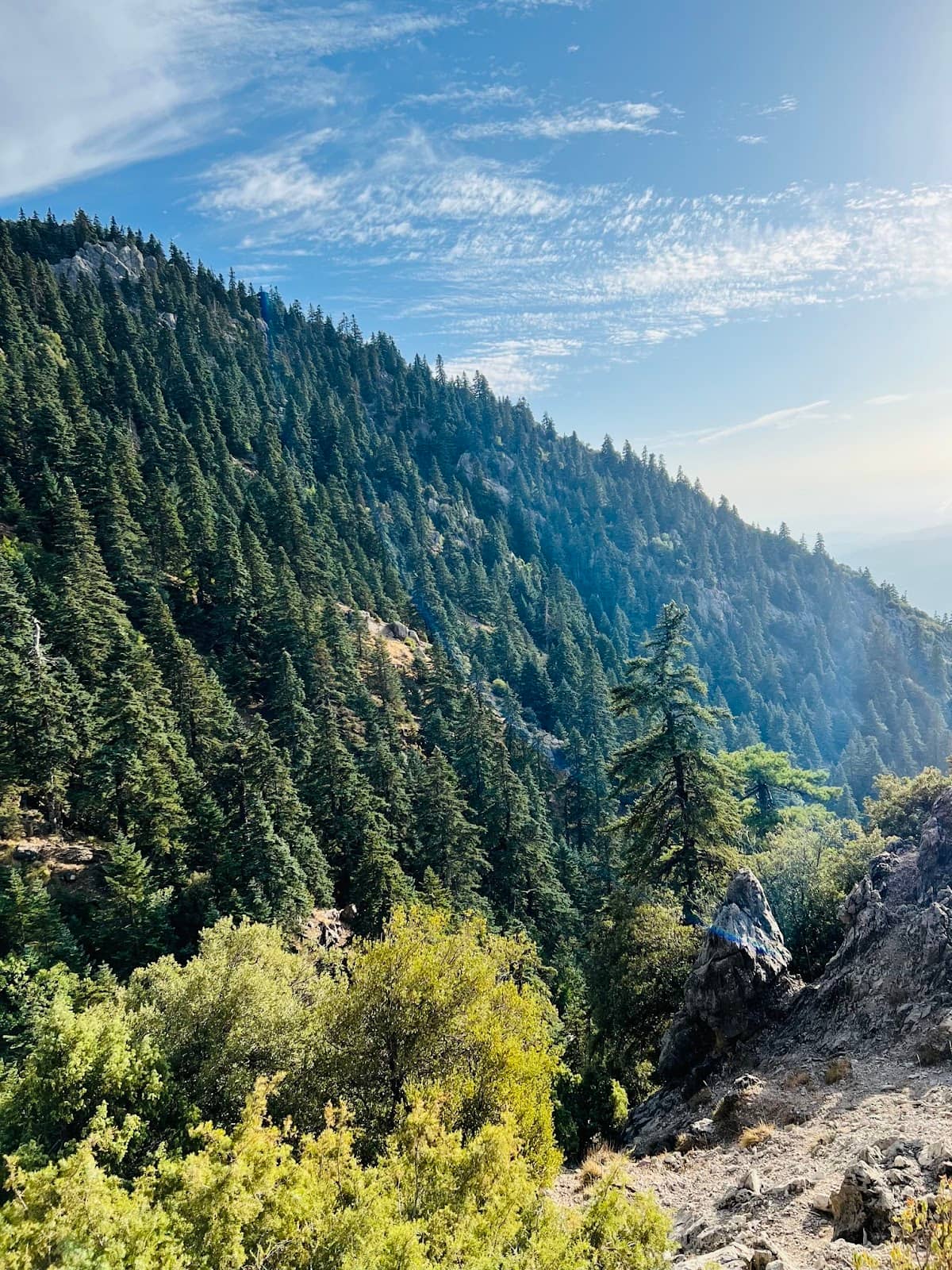
Ancient Cedar Forests
Upper Slopes
Trek through impressive forests of ancient cedar trees, a unique and beautiful landscape.

Karst Limestone Formations
Mountain Slopes
Marvel at the distinctive karst limestone formations characteristic of the region.
Plans like a pro.
Thinks like you
Planning Your Visit
Tackle the Ascent Wisely
Water and Trail Markers
Best Times
Insider Tips
from TikTok, Instagram & Reddit
💪 Physical Challenge Ahead
Rate your fitness 8/10; this hike demands stamina. Don't underestimate the 1500m ascent. :athletic_shoe:
💧 Hydration is Key
Bring plenty of water. Creeks are often dry; filter spring water if needed. :droplet:
🔵 Follow the Blue Markers
Blue blazes guide you from Chefchaouen. Yellow signs mark descent routes. :blue_heart:
🐒 Spot Barbary Macaques
Descend into Azilane for a chance to see these fascinating primates. :monkey:
Tips
from all over the internet
💪 Physical Challenge Ahead
Rate your fitness 8/10; this hike demands stamina. Don't underestimate the 1500m ascent. :athletic_shoe:
💧 Hydration is Key
Bring plenty of water. Creeks are often dry; filter spring water if needed. :droplet:
🔵 Follow the Blue Markers
Blue blazes guide you from Chefchaouen. Yellow signs mark descent routes. :blue_heart:
🐒 Spot Barbary Macaques
Descend into Azilane for a chance to see these fascinating primates. :monkey:
What Travellers Say
Reviews Summary
Hikers praise Jebel Tissouka for its stunning, unique landscapes, including ancient cedar forests and karst formations, culminating in breathtaking summit views. The challenging ascent is noted as demanding but rewarding. Some find the trail structure varied and water sources unreliable, emphasizing the need for thorough preparation.
"We took the trail from Chefchaouen through the gorge. It's definitely worth doing. 31st of December, nice shade in the valley while ascending and sunshine in the afternoon. Impressive forests above 1400 m with ages old cedar trees. Beautiful, unique landscape. Karst limestone with many of it's typical formations.
However, even though we go in the mountains regularly, we were quite surprised, how demanding it is. There is nothing technically too challenging on the trail, last 200 m easy scrambling the most. But the amount of ascent (ca. 1500 m) plus the constantly changing trail structure demand physical and mental capability. Don't underestimate! Its "only" above 2000 m, but more demanding than several 3000ers I've done. Took us from 10AM til 7 PM with 3 not too long breaks on the trail. Bring enough water - the creek very probably is dry, higher up is a spring - but filter needed! I am sure, in the hot season water is a real challenge here.
From my perspective, following classification of difficultiy seems reasonable:
Physical: 8/10 (10 being 4000er fit)
Technical: 6/10 on hiking scale (10 being medium scrambling)
Could be easier, if you start very early and take your time."
Martin Kretschmann
"Great mountain to climb from Chefchaouen, you can descend into Azilane in the valley on the other side via a junction 500m before the summet following the yellow signs, if you're lucky you can see the barbary macaques"
Arno Colin
"Really nice mountain to climb, even in winter. We hiked from Chefchaouen following the blue markers to the top. Then we went back down to a junction and hiked to the Gite in Azilane following yellow markers."
Bjarni Berkvens
What People Like
What People Dislike
Frequently Asked Questions
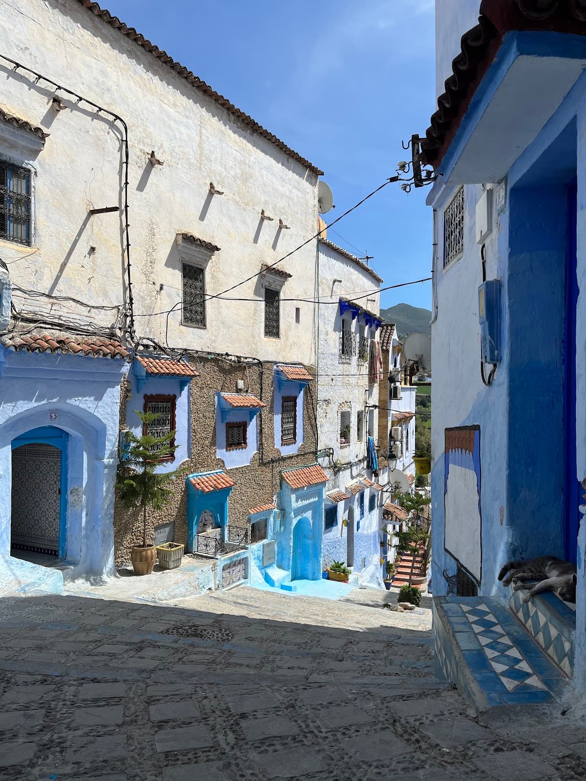
🚇 🗺️ Getting There
The most common approach is hiking from Chefchaouen through the gorge. The trail is marked with blue blazes for a significant portion. Some travelers also mention descending into Azilane via yellow markers.
While the base of the mountain is accessible, the challenging trails are best explored on foot. Driving directly to the summit is not possible.
Starting from Chefchaouen and following the gorge is a popular and scenic route. Ensure you have a good map or GPS if venturing off the main trail.
While not explicitly mentioned in the provided content, local guides are often available in Chefchaouen for mountain treks. It's advisable to inquire locally.
Chefchaouen is the primary gateway town for accessing Jebel Tissouka. Azilane is a village in the valley on the other side.
🎫 🎫 Tickets & Entry
There are no specific entrance fees mentioned for Jebel Tissouka itself, as it's a natural mountain area. However, any associated guesthouses or services might have charges.
As a natural mountain, Jebel Tissouka is accessible at all times. However, hiking during daylight hours is strongly recommended for safety.
No advance booking is required for hiking Jebel Tissouka. It's a natural attraction.
No specific permits are mentioned for hiking Jebel Tissouka. However, it's always wise to check local regulations before your trip.
Yes, Jebel Tissouka can be visited year-round, but winter hikes are recommended for cooler temperatures. Be aware of potential snow or ice at higher elevations.
🎫 🥾 Onsite Experience
The hike is considered demanding, with a significant ascent of approximately 1500m. It's rated 8/10 for physical difficulty and 6/10 for technicality on a hiking scale.
Wear sturdy hiking boots, comfortable clothing suitable for varied weather, and layers. Trekking poles can be beneficial for the steep ascents and descents.
A full round trip from Chefchaouen can take around 9-10 hours, including breaks. Starting early is crucial.
Restroom facilities are generally not available on the trail. Plan accordingly and use facilities in Chefchaouen before you start.
If you descend into Azilane, you might be lucky enough to spot Barbary macaques. The forests are also home to various bird species.
🍽️ 💧 Food & Dining
There are no dining facilities on the mountain itself. It's essential to pack all your food and drinks for the hike.
Pack high-energy snacks, sandwiches, and plenty of water. Consider items that are easy to eat on the go.
Chefchaouen offers a wide array of restaurants and cafes serving traditional Moroccan cuisine.
While Azilane is a village, dining options might be limited. It's best to confirm locally if you plan to rely on it for food.
Higher up, there might be springs, but water should be filtered. It's safer to carry all the water you'll need.
📸 📸 Photography
The summit offers incredible panoramic views. The ancient cedar forests and unique karst formations also make for stunning shots.
Sunrise and sunset can offer dramatic lighting, but the midday sun provides clear views from the summit. Consider the changing light on the forests.
A wide-angle lens is great for landscapes. A telephoto lens can be useful for capturing distant details. Ensure your gear is protected from dust and potential moisture.
The summit itself is the prime viewpoint. Keep an eye out for interesting rock formations and forest clearings along the trail.
Drone regulations can vary. It's advisable to check with local authorities in Chefchaouen regarding drone usage in natural parks.
For Different Travelers
Tailored advice for your travel style
👨👩👧 Families with Kids
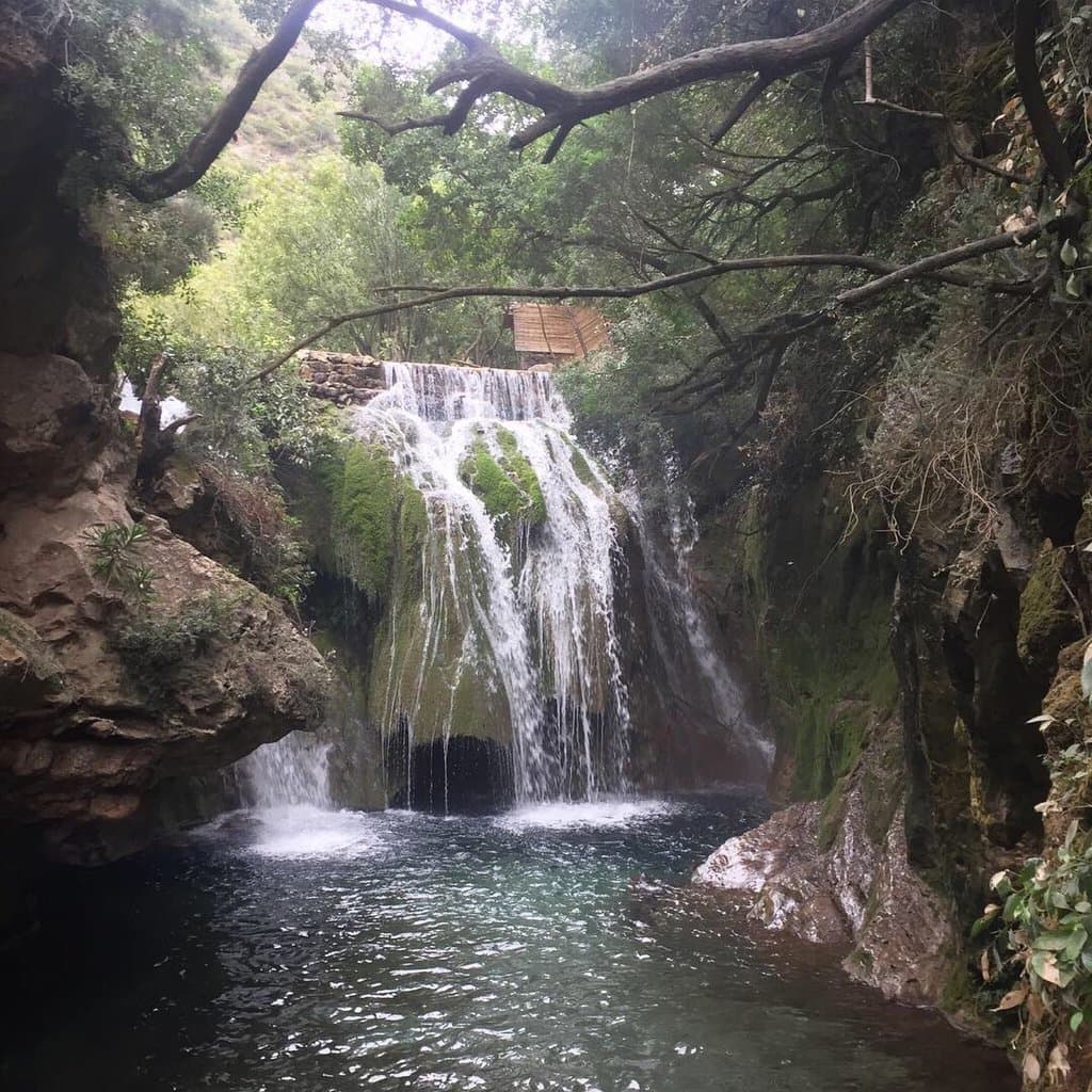
If you are considering a family outing in the Chefchaouen region, focusing on shorter, less strenuous hikes in the surrounding valleys or exploring the town itself might be more suitable. The Akchour waterfalls area, for instance, offers more accessible trails and natural beauty for a wider range of ages.
🚶 Solo Adventurers
Starting early is key for solo hikers to ensure you have enough daylight. The physical demands mean you should be confident in your fitness. The sense of accomplishment upon reaching the summit alone can be immense, with unparalleled views as your reward.
📸 Photography Enthusiasts
Don't forget to capture the unique karst limestone formations that dot the landscape. The contrast between the rugged terrain and the distant blue hues of the Ghomara region can be striking. Remember to pack appropriate gear, including wide-angle lenses for landscapes and a sturdy tripod if you plan for low-light photography.
Deep Dives
In-depth insights and expert knowledge
The Challenging Ascent: What to Expect
Hikers typically rate the physical demand as an 8 out of 10. The technical difficulty on a hiking scale is around a 6 out of 10, with the final 200 meters involving some easy scrambling. To manage the exertion, starting your hike very early in the morning is highly recommended, allowing ample time to complete the trek without rushing.
Consider the time of year. While winter offers pleasant temperatures and shade in the valley, the upper reaches can be sunny. In hotter seasons, water becomes a critical concern, making hydration and water sources paramount.
Navigating the Trails and Water Sources
Water is a crucial consideration. The creek along the lower parts of the trail is frequently dry. Higher up, you might find springs, but it's essential to carry a water filter or purification tablets as a precaution. Relying solely on natural water sources is not advisable, especially during drier months.
When planning your descent, the junction about 500 meters before the summit offers a route into the Azilane valley. This path is known for the potential to spot Barbary macaques, adding an element of wildlife viewing to your adventure.
The Unique Landscape of Jebel Tissouka
The mountain is characterized by its karst limestone geology. This results in distinctive formations, adding to the visual appeal of the area. The interplay of rock, vegetation, and the vast sky creates a dramatic backdrop for your hike.
From the summit, the views are expansive. Hikers report being able to see widely and clearly across the Ghomara region, making the challenging climb incredibly rewarding. The feeling of accomplishment combined with the breathtaking scenery is a memorable experience.


Social
from TikTok, Instagram & Reddit