Øksfjordjøkulen Glacier
Norway's 9th largest mainland glacier, offering a challenging hike to a stunning viewpoint atop Finnmark's highest peak.
Highlights
Must-see attractions

Social
From TikTok & Reddit
Best Time
Best light for photos
Øksfjordjøkulen Glacier
Best Time
Best light for photos
Highlights
Must-see attractions
Norway's 9th largest mainland glacier, offering a challenging hike to a stunning viewpoint atop Finnmark's highest peak.
"A great hike to a beautiful viewpoint overlooking the very impressive glacier!"
🥾 Sturdy Hiking Boots Needed
The trail is rocky, uneven, and often flooded. Waterproof boots are essential for comfort and safety.
⏰ Allow Extra Time
Don't rush the hike; the terrain demands a slower pace. Factor in time for photos and enjoying the views.
Quick Facts
Rating
4.5 · 10 reviews
Type
Natural Feature
Address
Highlights
Discover the most iconic attractions and experiences
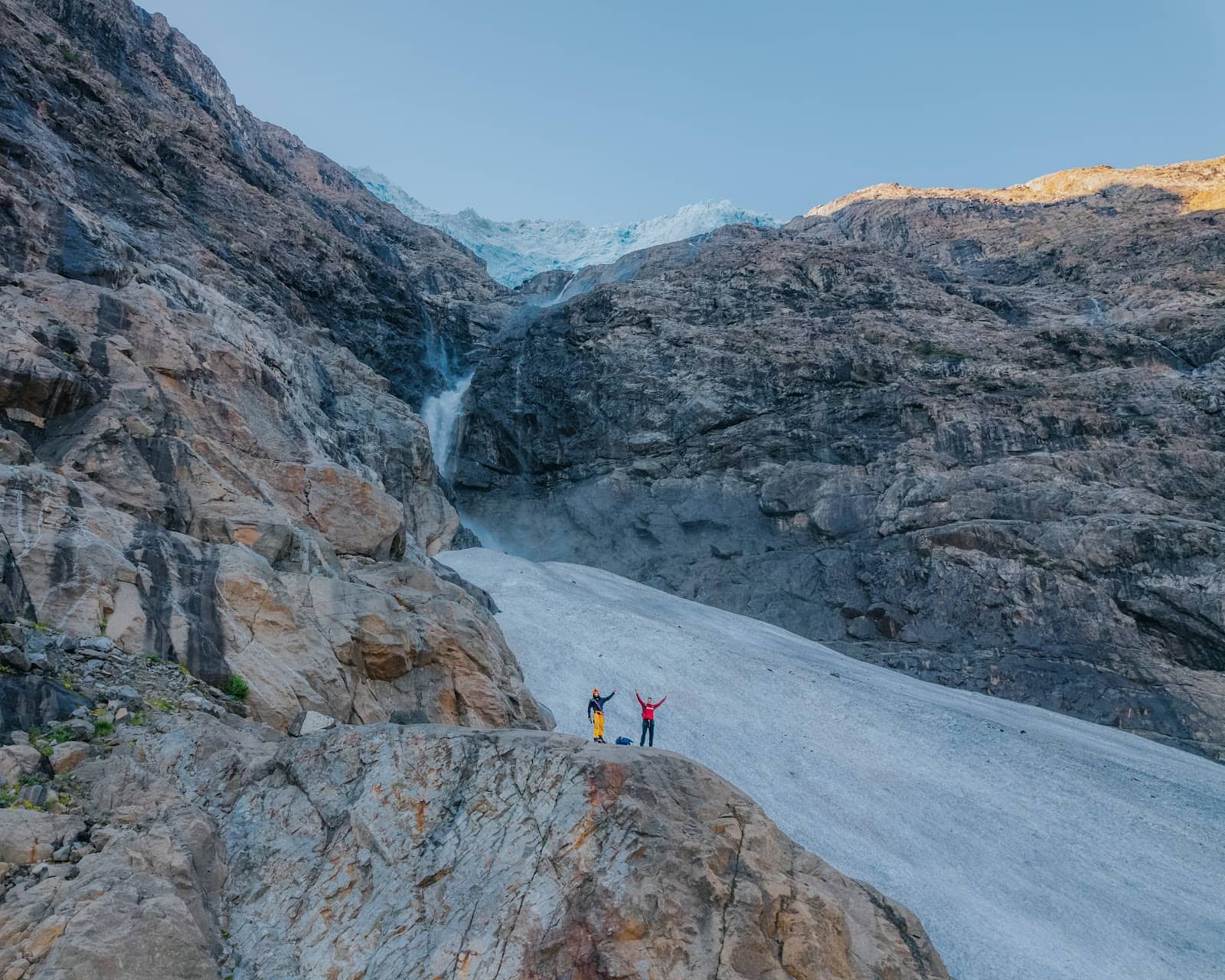
Glacier Viewpoint Hike
Trailhead near Øksfjorden
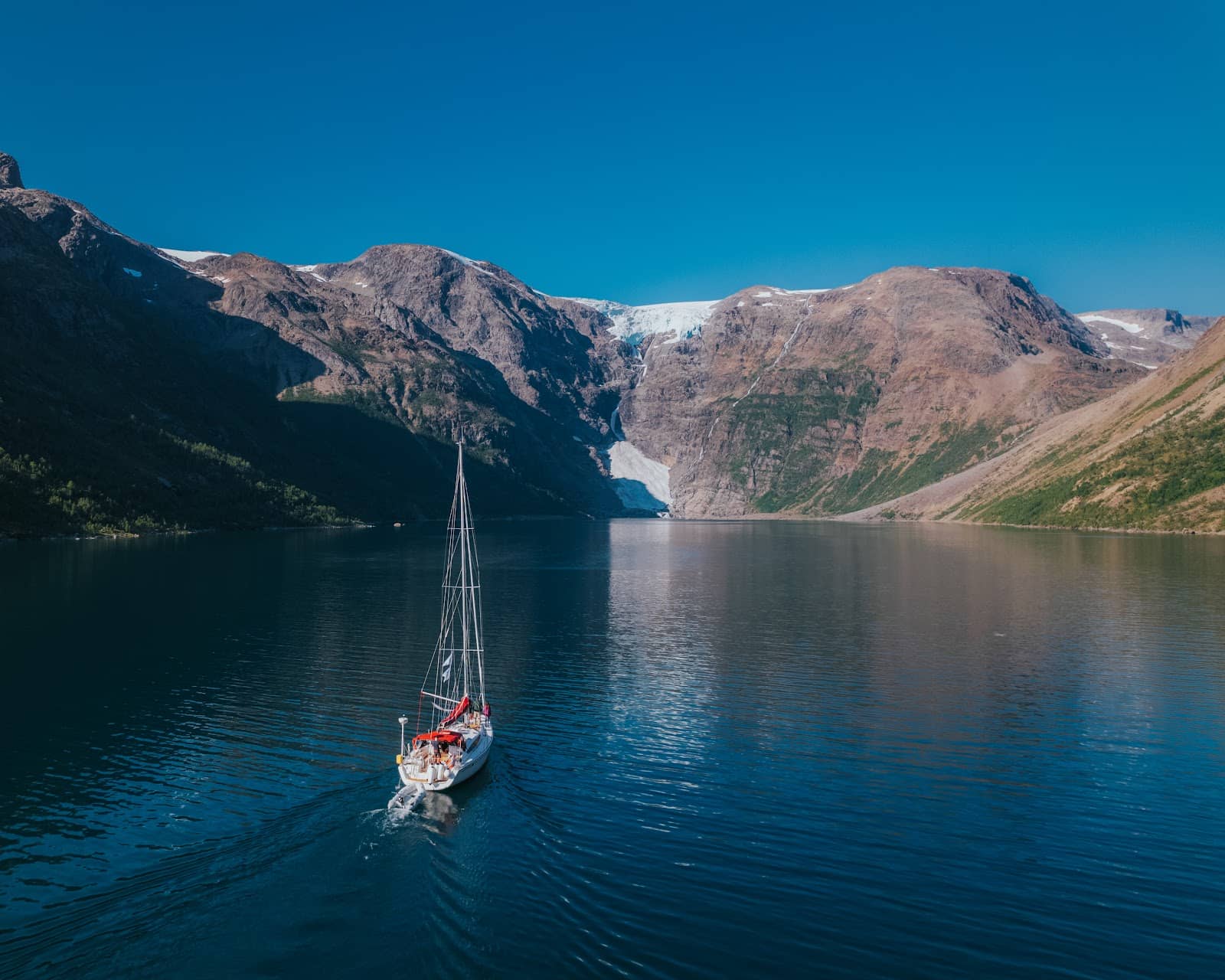
A challenging yet rewarding 5.6 km hike to a stunning vista of the expansive plateau glacier.
Øksfjordjøkulen Glacier
Norway's 9th largest mainland glacier, a vast ice cap offering breathtaking natural beauty.

Jiehčohkka Summit
Highest point of the glacier
The peak of Finnmark, offering panoramic views from 1191 meters above sea level.
Plans like a pro.
Thinks like you
Planning Your Visit
Trekking to the Glacier Viewpoint
Understanding Glacier Dynamics
Best Times
Insider Tips
from TikTok, Instagram & Reddit
🥾 Sturdy Hiking Boots Needed
The trail is rocky, uneven, and often flooded. Waterproof boots are essential for comfort and safety.
⏰ Allow Extra Time
Don't rush the hike; the terrain demands a slower pace. Factor in time for photos and enjoying the views.
💧 Be Prepared for Wet Conditions
The path can be very wet. Consider waterproof pants or gaiters to stay dry.
📸 Capture the Scale
The sheer size of the glacier is impressive. Wide-angle lenses are great for capturing the vastness.
Tips
from all over the internet
🥾 Sturdy Hiking Boots Needed
The trail is rocky, uneven, and often flooded. Waterproof boots are essential for comfort and safety.
⏰ Allow Extra Time
Don't rush the hike; the terrain demands a slower pace. Factor in time for photos and enjoying the views.
💧 Be Prepared for Wet Conditions
The path can be very wet. Consider waterproof pants or gaiters to stay dry.
📸 Capture the Scale
The sheer size of the glacier is impressive. Wide-angle lenses are great for capturing the vastness.
What Travellers Say
Reviews Summary
Visitors consistently praise the impressive scale and beauty of the Øksfjordjøkulen Glacier, describing the hike to the viewpoint as a fantastic and rewarding trip. However, the challenging, rocky, and often flooded trail requires significant preparation and can be more demanding than anticipated.
"Øksfjordjøkelen/ Ákšovuonjiehkkier
is of the plateau type, and lies like a cape over the mountains.
The plateau represents the remains of the old land surface that was just above sea level before the land uplift along the coast in the Tertiary period.
Located on the municipal border between Kvænangen in Troms and Loppa in Finnmark.
The glacier is named after Øksfjorden, which is located to the east. West of the glacier is Langfjorden. To the south are Jøkelfjorden and Isfjorden
It has an area of 41 km² and is the 9th largest glacier in Norway on the Norwegian mainland.
Previously, the highest point Jiehkečohkka on the glacier was 1204 meters above sea level but has recently been updated to 1191 meters above sea level. which is also the highest point in Finnmark.
The lowest point is 330 meters above sea level.
In 2007, the mountain Bergeberget thawed to 1177.5 meters above sea level.
And in 2013, the mountain Bergtattberget thawed to 1180 meters above sea level right at the highest point of the glacier."
Arnt Kaino
"A great hike (2.8 km) to a beautiful viewpoint overlooking the glacier. The path is very rocky, uneven, and frequently flooded. Therefore, allow a little more time than you would normally need for a total of 5.6 km. The glacier is very impressive."
Litola
"Nice glacier!"
Erlend Neergaard
What People Like
What People Dislike
Frequently Asked Questions
🚇 🗺️ Getting There
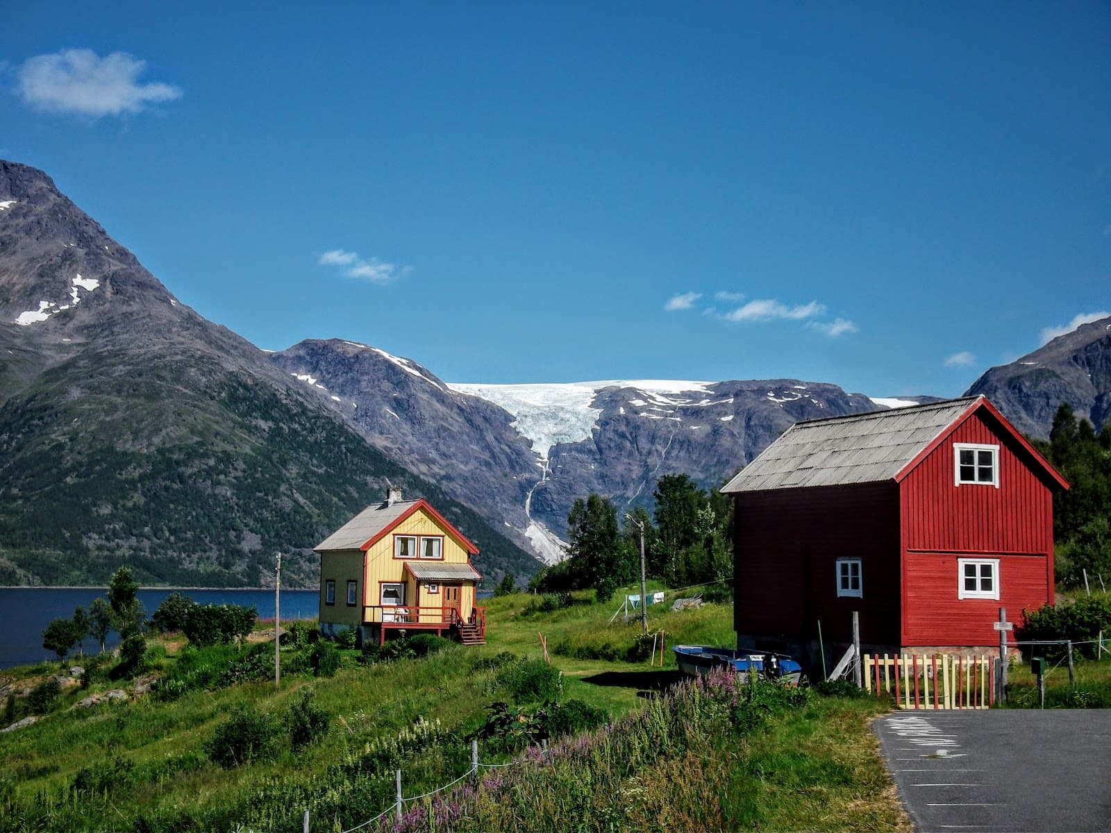
The glacier is located on the municipal border between Kvænangen and Loppa. Access is typically via road towards Øksfjorden, followed by a hike to the viewpoint. Check local road conditions, especially outside of summer months.
Public transport options directly to the trailhead are limited. It's recommended to have your own vehicle or arrange transport for the best flexibility.
The glacier straddles the border of Kvænangen and Loppa municipalities. Nearby towns might include Øksfjord or Alta, depending on your approach.
🎫 🎫 Tickets & Entry
There are typically no entrance fees for visiting the glacier viewpoint or hiking the trails. It's a natural attraction accessible to the public.
The glacier is accessible year-round, but the hiking trail is best attempted during the summer months when conditions are safer and more favorable.
🎫 🧭 Onsite Experience
The hike is approximately 2.8 km one way (5.6 km round trip) and is described as very rocky, uneven, and frequently flooded. It requires good physical condition and appropriate footwear.
Due to the challenging terrain (rocky, uneven, flooded), it's recommended for hikers with some experience. Beginners should proceed with caution and be well-prepared.
Wear sturdy, waterproof hiking boots, comfortable hiking pants, and layers of clothing. Waterproof outerwear is also advisable due to potential wet conditions.
Walking on the glacier without proper equipment and guidance is not recommended due to crevasses and unstable ice. The viewpoint hike offers safe observation.
Facilities at the trailhead are generally minimal. It's advisable to bring your own water, snacks, and any other necessities.
📸 📸 Photography
The primary photo opportunity is the panoramic view of the glacier from the viewpoint. The scale and textures of the ice are impressive.
Early morning or late afternoon light can create dramatic shadows and highlight the glacier's contours. Golden hour can be particularly stunning.
A wide-angle lens is useful for capturing the vastness of the glacier. A sturdy tripod can help with low-light conditions or long exposures.


Social
from TikTok, Instagram & Reddit