
Icmeler Turunc Coastal Trail
A rugged coastal trail offering stunning mountain and sea views, but demanding significant preparation due to overgrown paths and challenging terrain.

Highlights
Must-see attractions

Social
From TikTok & Reddit
Best Time
Still warm, less intense heat
Icmeler Turunc Coastal Trail
Best Time
Still warm, less intense heat
Highlights
Must-see attractions
A rugged coastal trail offering stunning mountain and sea views, but demanding significant preparation due to overgrown paths and challenging terrain.
"Extremely difficult, overgrown, and poorly marked - not for amateurs!"

🥾 Sturdy Footwear is Key
Trail sneakers or hiking boots are a must due to rough terrain and overgrown paths.
💧 Hydration is Crucial
Carry ample water, as the hike can be strenuous and take 3-4 hours.

Quick Facts
Rating
4.4 · 88 reviews
Type
Hiking Area
Highlights
Discover the most iconic attractions and experiences
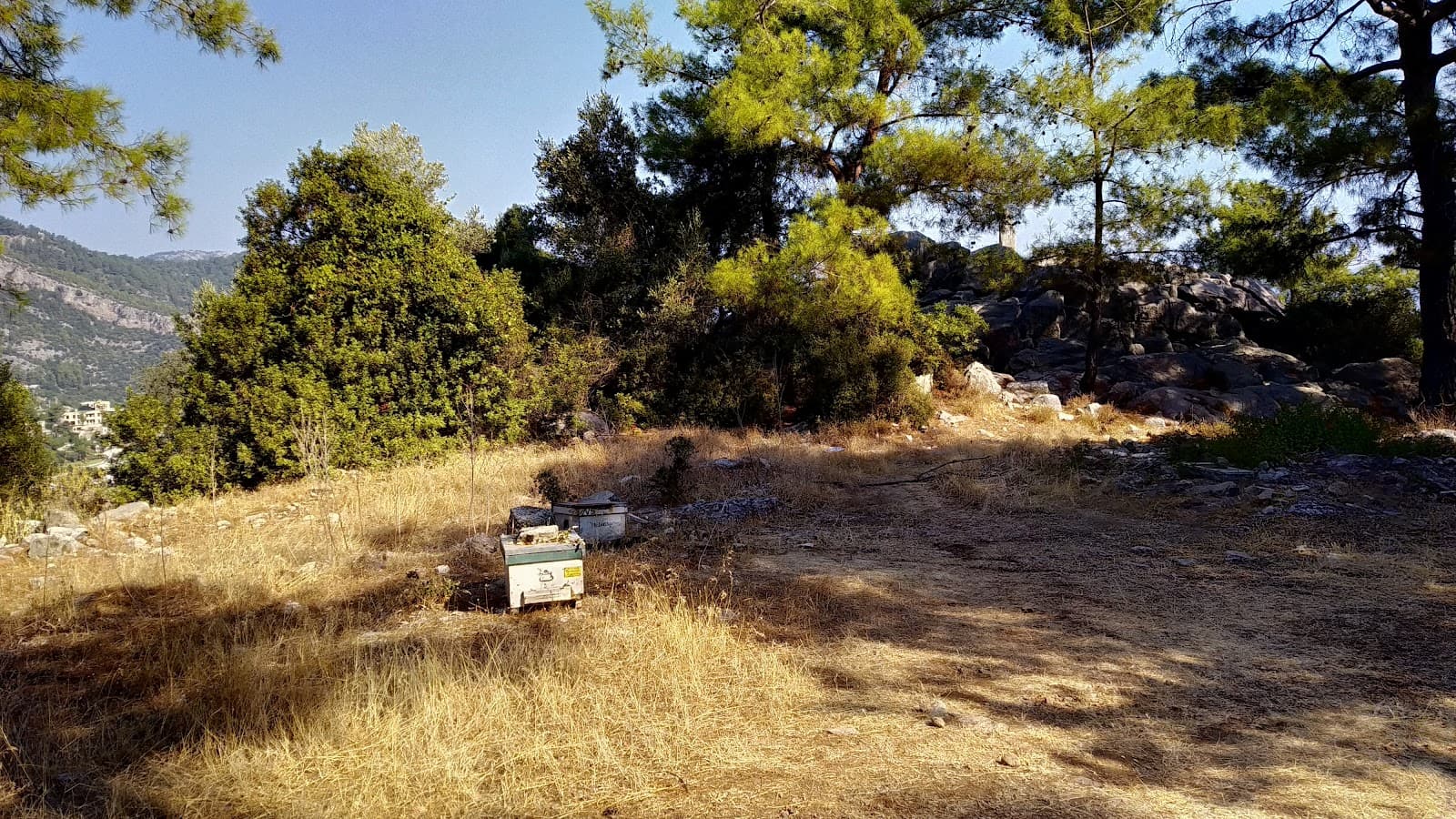
Ancient Ruins
Near the flag outcrop
Discover remnants of ancient structures, hinting at the area's historical significance.

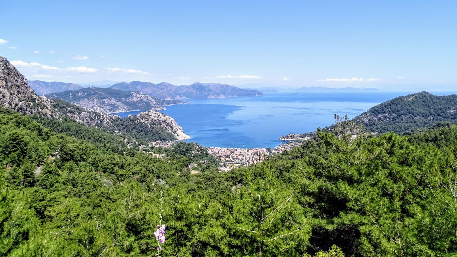
Panoramic Summit Views
At the highest points
Breathtaking vistas of the coastline and surrounding Turkish mountains await.

Diverse Wildlife Spotting
Along the trail
Encounter various local flora and fauna as you traverse the natural landscape.
Plans like a pro.
Thinks like you
Planning Your Visit
Tackle the Trail Prepared
Consider a Local Guide
Best Times
Insider Tips
from TikTok, Instagram & Reddit
🥾 Sturdy Footwear is Key
Trail sneakers or hiking boots are a must due to rough terrain and overgrown paths.
💧 Hydration is Crucial
Carry ample water, as the hike can be strenuous and take 3-4 hours.
🌿 Wear Long Clothing
Long sleeves and pants protect against thorny bushes and scratches.
🧭 Consider a Local Guide
Navigating overgrown sections is difficult; guides offer invaluable local knowledge.
Tips
from all over the internet
🥾 Sturdy Footwear is Key
Trail sneakers or hiking boots are a must due to rough terrain and overgrown paths.
💧 Hydration is Crucial
Carry ample water, as the hike can be strenuous and take 3-4 hours.
🌿 Wear Long Clothing
Long sleeves and pants protect against thorny bushes and scratches.
🧭 Consider a Local Guide
Navigating overgrown sections is difficult; guides offer invaluable local knowledge.
⚠️ Not for Amateurs
Requires good physical condition and comfort with heights and scrambling.
🏖️ Turunc Beach Flip-flops
The beach in Turunc is rocky, so pack flip-flops for comfort.
What Travellers Say
Reviews Summary
The Icmeler Turunc Coastal Trail is a challenging and often overgrown hike, with reviewers frequently citing difficulties in navigation due to dense vegetation and fallen trees. While the views are appreciated, many found the trail's condition to be poor and not suitable for amateurs. Hiring a local guide is often recommended for a safer and more manageable experience.
"Done this trail few days ago, very difficult , you need trekking sticks, grass and bushes too big the authorities should do something about it as you can barely see the signs(white and red) , you need good physical condition , not for amateurs , take lots of water with you ... you will need it , proper shoes is a must , I had my Hooka trail on and they would not manage same trail again.
Worth the effort unable to finish it due to the poor condition."
Raul B
"Great hike into the Turkish Mountains. The path is extremely difficult in places, overgrown, and has fallen trees over it. However, if you go with a local walking guide ( check out Michael's Facebook page "Icmeler walks"), he will be able to take you up to the flag and back down in one piece. Without his help, I would not have been able to find the flag. You enter on the South Side of Icmeler, traverse up the near vertical gorge over boulders and through thickets to arrive at the ancient ruins ( these looked like someone had been digging them out) at the bottom of the small rocky outcrop that the flag sits on. After climbing down from the small rocky outcrop, you then venture down to the right and make your way down the ravine on the other side, and although this is slightly easier than the other side, it's still quite tricky. Great views to be had at the top and plenty of wildlife to see. If you are old, infirm, and have difficulty walking and have a fear of heights, then this is not for you. If you are fit, able to scramble through thickets of spiky bushes, put up with the bugs and seed pods attaching themselves to your shoes and socks, are good with heights, then give it a go. It is challenging so take plenty of water and a snack to last 3-4 hours. And maybe something for the scratches you will receive. But do not attempt this without local knowledge ( if you are a seasoned walker) or preferably a local guide. The end of the walk now finishes in the middle of a building site, which we were asked to leave immediately."
Berglas71
"Beautiful hike with beautiful views. I enjoy being in more quiet places and in nature so this was the perfect place! If you enjoy hiking you'll love it. The path can be a little vague at times, but many of the paths take you the same way."
serena whitman
What People Like
What People Dislike
Frequently Asked Questions
🚇 🗺️ Getting There
The trail can be accessed from the south side of Icmeler. Some suggest starting near the gorge. Be prepared for an immediate ascent.
While not directly at the trailhead, local buses connect Icmeler and Turunc. You may need to walk a short distance to the starting point.
Parking near the trailheads can be limited and challenging due to the terrain. It's often easier to start from Icmeler town.
A popular option is to take a water taxi from Turunc back to Marmaris or Icmeler, which can be a scenic and convenient way to end your hike.
Many begin in Icmeler, tackling the steeper ascent first. The end of the trail in Turunc can sometimes lead into construction sites.
🎫 🎫 Tickets & Entry
No, the trail is generally accessible without an entrance fee. It's a natural path through the landscape.
The trail is open year-round, but it's best to hike during daylight hours for safety and visibility.
Hiking at night is strongly discouraged due to poor visibility, overgrown paths, and potential hazards.
No specific permits are typically required for this coastal trail.
While accessible year-round, avoid hiking immediately after heavy rain as certain sections can become very dangerous.
🎫 🧭 Onsite Experience
The hike typically takes 3-4 hours, depending on your pace and how often you stop to enjoy the views or navigate difficult sections.
It's considered a difficult trail, not suitable for amateurs. Expect steep ascents, overgrown paths, thorny bushes, and fallen trees.
Trail markers can be infrequent and difficult to spot due to overgrowth, making navigation challenging.
The terrain is varied and challenging, including rocky gorges, thickets of spiky bushes, ravines, and areas with tall grass.
No, this trail is not recommended for individuals with a fear of heights due to steep sections and exposed areas.
📸 📸 Photography
The summit offers stunning panoramic views of the coastline and mountains. Look for ancient ruins and interesting flora/fauna along the way.
The overgrowth can make it tricky to frame shots, but the natural beauty and expansive views provide ample photographic subjects.
Early morning or late afternoon light can enhance the landscape photography, but be mindful of the time needed to complete the hike safely.
While drone footage could be spectacular, be aware of local regulations and the challenging terrain for takeoff and landing.
The highest points offer the most dramatic vistas. Keep an eye out for any clearings that provide unobstructed views.


Social
from TikTok, Instagram & Reddit