
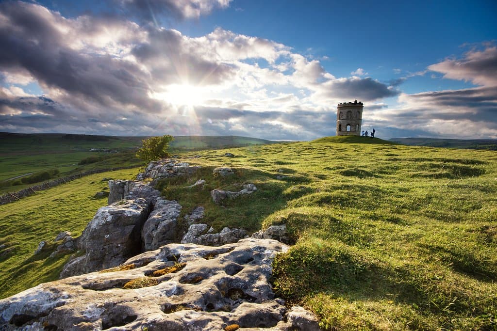
Axe Edge Moor
Vast moorland with panoramic views, home to the second-highest trig point in the Peak District. Features the unique Three Shires Head.
Highlights
Must-see attractions

Social
From TikTok & Reddit
Best Time
Minimizes boggy conditions
Axe Edge Moor
Best Time
Minimizes boggy conditions
Highlights
Must-see attractions
Vast moorland with panoramic views, home to the second-highest trig point in the Peak District. Features the unique Three Shires Head.
"A great view on the surrounding areas, no steep climb, only gentle slope up hill."

Waterproof Boots Essential
Moorland can be very boggy. Waterproof hiking boots are a must to keep your feet dry! :athletic_shoe:
Check the Weather
Conditions change fast. Be prepared for wind, rain, and sun, sometimes all in one day. :cloudwithrain:

Highlights
Discover the most iconic attractions and experiences
Axe Edge Trig Point
Summit of Axe Edge Moor
Reach the highest point at 551m for panoramic views across the Peak District. A classic trig point for hikers.
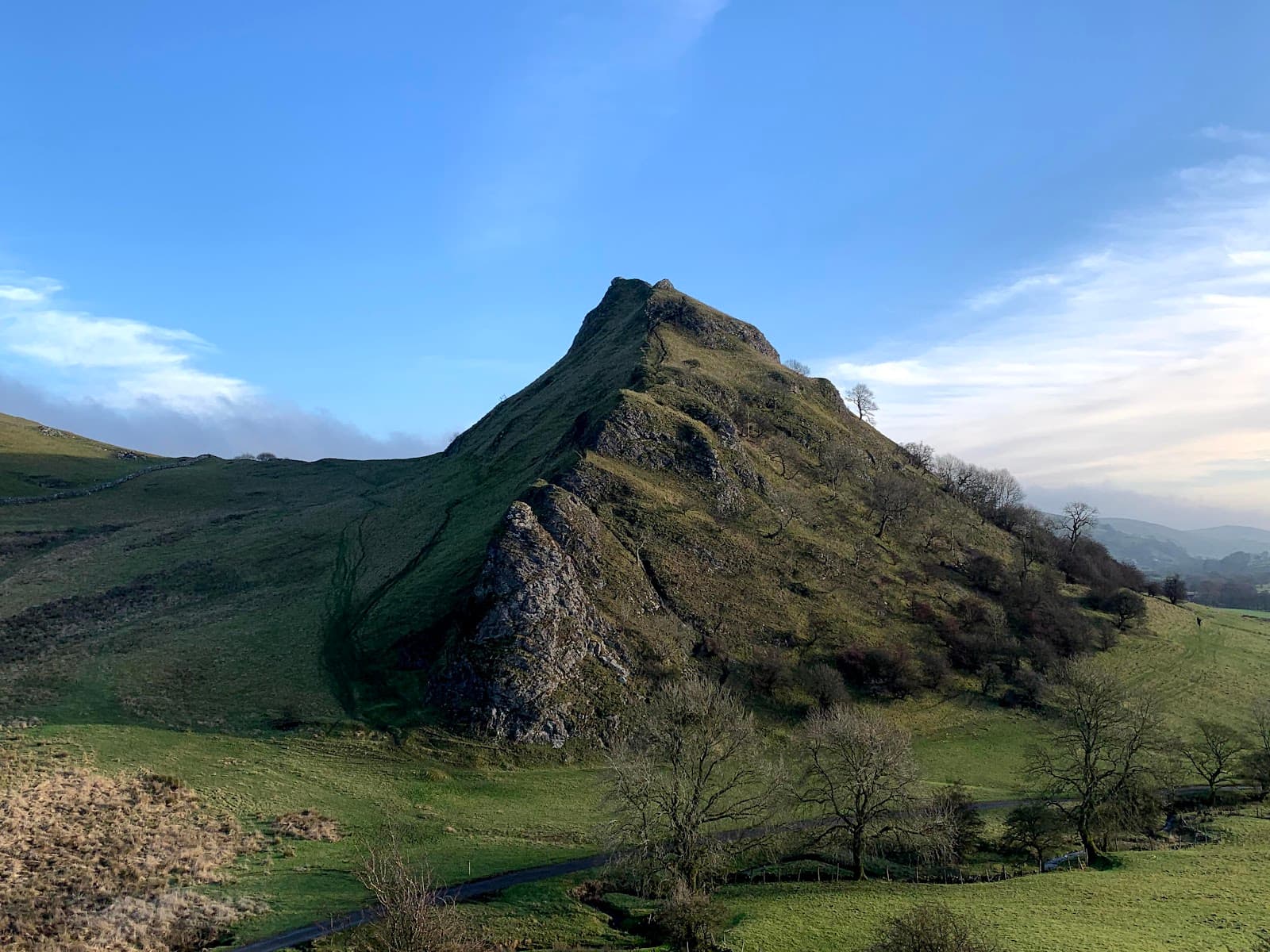
Three Shires Head
River Dane
Where Cheshire, Derbyshire, and Staffordshire meet. A picturesque spot with a lovely waterfall.

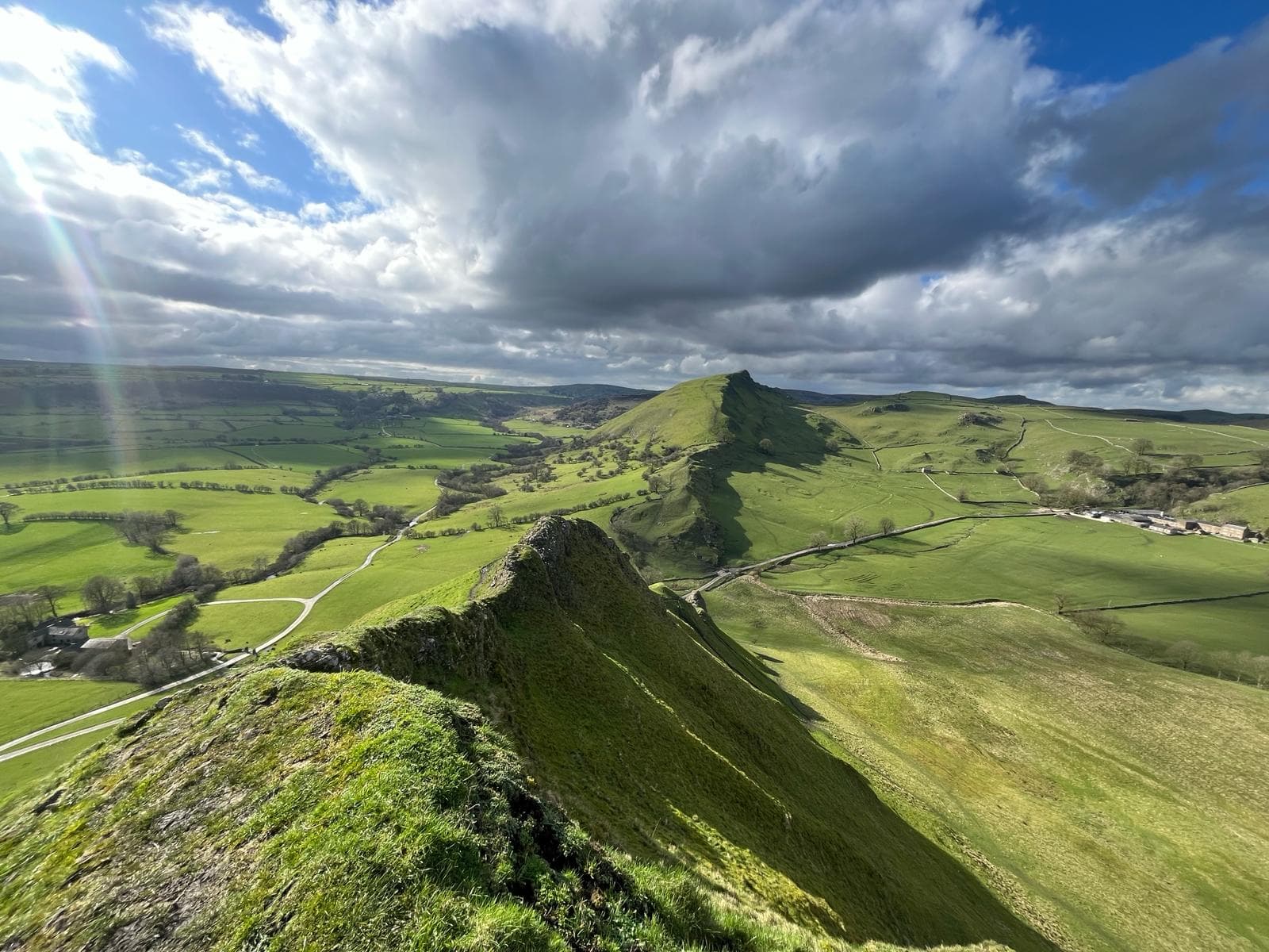
Panoramic Views
Various viewpoints on the moor
Enjoy vast, sweeping vistas of the surrounding Peak District landscape. Perfect for photography and quiet contemplation.
Plans like a pro.
Thinks like you
Planning Your Visit
Weather & Footwear are Key
Navigating the Moorland
Best Times
Insider Tips
from TikTok, Instagram & Reddit
Waterproof Boots Essential
Moorland can be very boggy. Waterproof hiking boots are a must to keep your feet dry! :athletic_shoe:
Check the Weather
Conditions change fast. Be prepared for wind, rain, and sun, sometimes all in one day. :cloudwithrain:
Navigate with Care
Paths can be indistinct. Carry a map and compass or use a GPS device. :compass:
Beware of Mosquitoes
Summer can bring swarms of mosquitoes. Pack insect repellent if visiting during warmer months. :bug:
Tips
from all over the internet
Waterproof Boots Essential
Moorland can be very boggy. Waterproof hiking boots are a must to keep your feet dry! :athletic_shoe:
Check the Weather
Conditions change fast. Be prepared for wind, rain, and sun, sometimes all in one day. :cloudwithrain:
Navigate with Care
Paths can be indistinct. Carry a map and compass or use a GPS device. :compass:
Beware of Mosquitoes
Summer can bring swarms of mosquitoes. Pack insect repellent if visiting during warmer months. :bug:
Combine with Burbage Edge
A popular circular route includes both Axe Edge and Burbage Edge trig points. :hiking_boot:
What Travellers Say
Reviews Summary
Visitors praise Axe Edge Moor for its stunning panoramic views and the sense of solitude it offers. The gentle slopes make it accessible, though the boggy terrain requires careful navigation and appropriate footwear. Some mention the potential for mosquitoes in summer and the presence of cyclists on nearby roads.
"Watch out for the mosquitoes in summer, they will eat you alive.
Other than great location for height
Oh watch out for the cyclists, they own the roads."
Pat “Pat” Pat
"551meters height, A great view on the surrounding areas, no steep climb, only gentle slope up hill from derbyshire bridge car park. some path may be wet and boggy."
WaiTak Chao
"Good walking workout taking both Burbage edge and Axe Edge moor trigs in the same circular route starting at Derbyshire Bridge.
Footfall virtually zero all day around this area with other walkers counted on one hand plus a dog.
Neither trig requires more than minimum effort to reach as the hillsides are gently sloped but I would recommend doing both during a dry spell of weather, especially Axe Edge as the ascent does go through some boggy peat areas."
Graham Hiley
What People Like
What People Dislike
Frequently Asked Questions
🚇 🗺️ Getting There
Axe Edge Moor is accessible by car. There are laybys and small parking areas along the nearby roads, such as off the A53. The Derbyshire Bridge car park is a popular starting point for walks. Public transport options are limited in this remote area.
Many walkers start from the Derbyshire Bridge car park, which offers access to trails leading onto the moor. Laybys on the A53 also provide convenient access points for shorter walks.
While cyclists use the roads around Axe Edge Moor, the moorland itself is best suited for walking. Some paths can be boggy and uneven, making cycling challenging.
No, you cannot drive directly to the summit. The moorland is a natural landscape, and access to the trig point is on foot. Cars can be parked in nearby laybys or designated parking areas.
Yes, Axe Edge Moor is located near Buxton in Derbyshire. It's a popular destination for those looking for outdoor activities and scenic views in the Peak District National Park.
🎫 🎫 Tickets & Entry
No, Axe Edge Moor is a natural landscape and part of the Peak District National Park. There are no entrance fees or tickets required to access the moorland itself.
Axe Edge Moor is open to the public at all times. As it's an outdoor natural area, there are no specific opening or closing hours. However, it's advisable to visit during daylight hours for safety and visibility.
Yes, there are parking options. You can find laybys along the A53 and a car park at Derbyshire Bridge. Be aware that parking can be limited, especially on busy days.
Axe Edge Moor is a wild moorland and does not have facilities like visitor centers, toilets, or cafes. It's recommended to bring all necessary supplies with you, including water and snacks.
Axe Edge Moor is part of the Peak District National Park, which is a protected landscape. While it's open for public access, visitors are expected to follow the Countryside Code and respect the natural environment.
🎫 🚶 Onsite Experience
The terrain is primarily moorland, characterized by heather, peat, and grass. Some paths can be wet and boggy, especially after rain. The ascent to the trig point is generally a gentle slope.
You can expect expansive, panoramic views across the Peak District. On a clear day, you can see for miles, offering a great vantage point for appreciating the landscape.
Yes, it can be suitable for families, especially if sticking to clearer paths and during dry weather. The gentle slopes make it less strenuous. However, the boggy sections and potential for rapid weather changes require supervision.
The highest point on Axe Edge Moor is marked by a trig point at 551 meters (1808 feet) above sea level. This is the second-highest point in the Peak District. +1
While there are some established paths, they can be indistinct and merge with the natural terrain. It's advisable to use a map and compass or GPS for navigation, especially if venturing off the main routes.
📸 📸 Photography
The panoramic views from the summit are spectacular, especially during sunrise or sunset. The Three Shires Head waterfall offers a picturesque scene, and the vast moorland itself provides dramatic landscapes. +1
Early mornings can offer beautiful mist and soft light, while late afternoons provide golden hour hues. The open nature of the moor means it's exposed to light throughout the day, but these times often yield the most dramatic results.
A wide-angle lens is great for capturing the expansive landscapes. A polarizing filter can help manage the bright sky and enhance colors. Don't forget a sturdy tripod for low-light conditions or long exposures of the waterfall. :camerawithflash:
The Axe Edge trig point is a must-have shot for hikers. The Three Shires Head waterfall and the meeting point of the three counties are also popular photographic subjects. +1
The weather can change rapidly, so protect your gear from rain and wind. The terrain can be uneven, so ensure you have stable footing when setting up shots.
For Different Travelers
Tailored advice for your travel style
👨👩👧 Families with Kids
Consider sticking to the more established paths and perhaps focusing on reaching the trig point or visiting the Three Shires Head. Bring plenty of snacks and drinks, as there are no facilities on the moor. Keep a close eye on children, especially near any water features or in areas with less defined paths. The open nature of the moor means it can be exposed and windy, so dress in layers.
🚶 Solo Hikers & Peace Seekers
Navigation skills are key for solo hikers, as paths can be indistinct and the terrain challenging. Ensure you have a reliable map and compass or GPS device, and inform someone of your route and expected return time. The exposed nature of the moor means you should be prepared for all weather conditions, even on a seemingly clear day.
📸 Photographers
Be prepared for changeable weather, which can add to the dramatic feel of the photos but also requires protecting your gear. A wide-angle lens is highly recommended to capture the expansive views. For the Three Shires Head, a tripod can be useful for longer exposures to smooth out the water.
Deep Dives
In-depth insights and expert knowledge
Exploring the Three Shires Head
Visitors often describe it as a 'lovely and pleasant walk' leading to a 'gorgeous waterfall.' The River Dane itself flows through the moorland, creating a picturesque scene that contrasts with the ruggedness of the surrounding landscape. It's a perfect place to pause, enjoy the natural beauty, and perhaps even take a refreshing dip in the water during warmer months.
While the walk to Three Shires Head is generally straightforward, the surrounding moorland can be boggy, so appropriate footwear is recommended. The area offers a sense of tranquility and a chance to connect with the wilder side of the Peak District, away from the more crowded tourist spots.
Navigating Axe Edge Moor's Terrain
Many visitors note that while there are paths, they can be indistinct and easily lost in the heather and peat. This is why carrying a map and compass or utilizing a GPS device is highly advised, particularly if you plan to explore beyond the most obvious routes. Mobile signal can also be unreliable in this remote area, making self-reliance crucial.
Despite the potential for boggy conditions, the reward is often a sense of solitude. Some walkers report encountering 'virtually zero' other people throughout the day, making it an ideal spot for those seeking peace and quiet in nature.
The Significance of the Trig Point
These concrete structures, known as triangulation pillars, were originally built by the Ordnance Survey for surveying purposes. Today, they serve as popular waypoints for walkers and a symbol of reaching a high point. The trig point on Axe Edge Moor is no exception, providing a focal point amidst the vast, undulating landscape.
Reaching the trig point typically involves a gentle uphill walk, making it accessible for most fitness levels. However, as with the rest of the moor, the approach can be boggy, so appropriate footwear is key. The summit offers a fantastic opportunity for photos and a moment to take in the breathtaking 360-degree views.

Social
from TikTok, Instagram & Reddit