Bleaklow Peak District
Vast, remote moorland plateau in the Peak District, famous for its stark beauty and the poignant B-29 bomber crash site.

Highlights
Must-see attractions

Social
From TikTok & Reddit
Best Time
Vibrant colours, crisp air
Bleaklow Peak District
Best Time
Vibrant colours, crisp air
Highlights
Must-see attractions
Vast, remote moorland plateau in the Peak District, famous for its stark beauty and the poignant B-29 bomber crash site.
"A hauntingly beautiful and remote landscape, perfect for those seeking solitude and a unique historical encounter."

🗺️ Essential Navigation
Always carry a map and compass. Bleaklow is featureless and bogs can be treacherous. Don't rely solely on GPS .
🥾 Waterproof Footwear is Key
The moorland is often boggy and marshy. Waterproof boots are a must to keep your feet dry and comfortable .

Quick Facts
Rating
4.7 · 84 reviews
Type
Natural Feature
Highlights
Discover the most iconic attractions and experiences
B-29 Superfortress Crash Site
Near Higher Shelf Stones
A haunting and historic site with exposed wreckage of a 1948 aircraft crash. A solemn memorial on the moors.
Higher Shelf Stones
Bleaklow Plateau
The second-highest point in the Peak District, offering expansive views and a sense of remote wilderness.

Bleaklow Head
Bleaklow Plateau
The subtle summit of Bleaklow, a vast plateau with a brooding atmosphere and challenging terrain.
Plans like a pro.
Thinks like you
Planning Your Visit
Prepare for the Elements
Respect the Crash Site
Best Times
Insider Tips
from TikTok, Instagram & Reddit
🗺️ Essential Navigation
Always carry a map and compass. Bleaklow is featureless and bogs can be treacherous. Don't rely solely on GPS.
🥾 Waterproof Footwear is Key
The moorland is often boggy and marshy. Waterproof boots are a must to keep your feet dry and comfortable.
🧥 Layer Up for Weather
Conditions change rapidly. Pack layers, including waterproofs, even if the forecast is good.
Respect the Memorial
The B-29 crash site is a solemn memorial. Please treat it with respect and do not disturb the wreckage.
Tips
from all over the internet
🗺️ Essential Navigation
Always carry a map and compass. Bleaklow is featureless and bogs can be treacherous. Don't rely solely on GPS.
🥾 Waterproof Footwear is Key
The moorland is often boggy and marshy. Waterproof boots are a must to keep your feet dry and comfortable.
🧥 Layer Up for Weather
Conditions change rapidly. Pack layers, including waterproofs, even if the forecast is good.
Respect the Memorial
The B-29 crash site is a solemn memorial. Please treat it with respect and do not disturb the wreckage.
🚗 Parking on Snake Pass
Park in the lay-by on Snake Pass (A57) for easier access to the plateau and the crash site.
What Travellers Say
Reviews Summary
Visitors praise Bleaklow for its wild, remote beauty and the poignant B-29 crash site. The challenging moorland terrain and unpredictable weather are noted, requiring careful preparation and navigation. It's a destination for those seeking solitude and a unique historical experience.
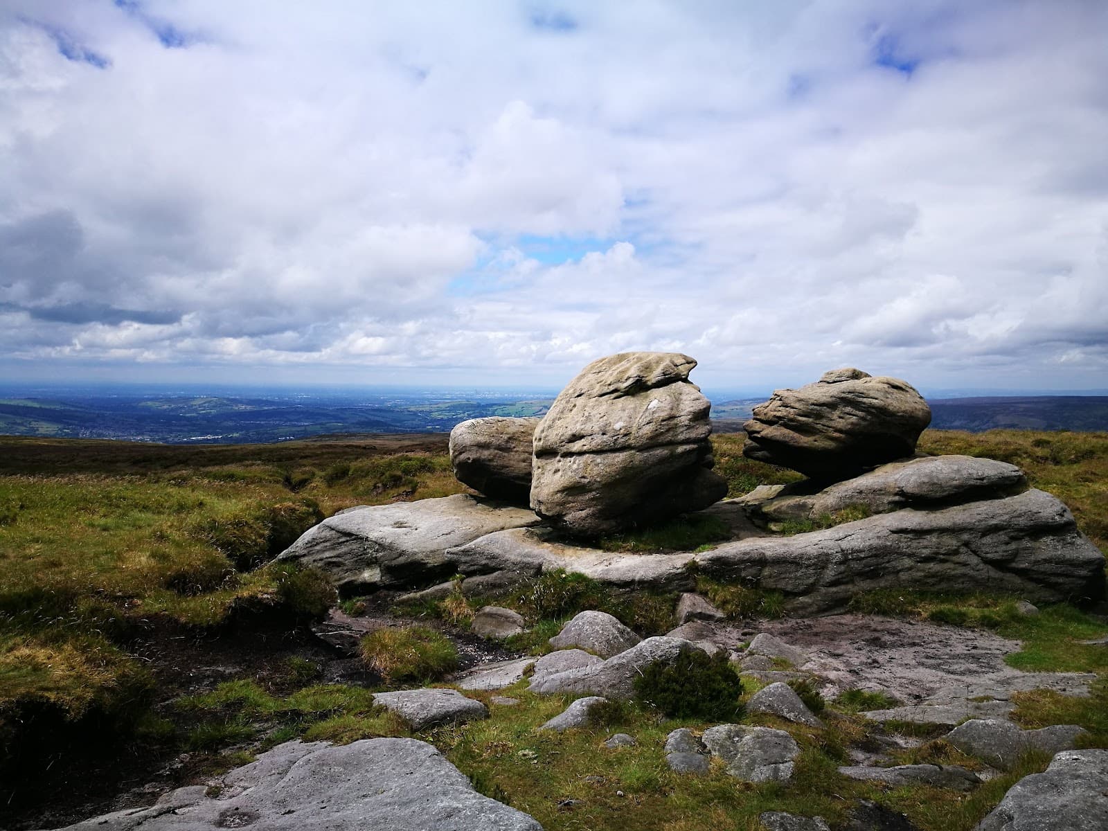
"This is a very easy walk to the top of the 2nd highest peak in the Peak district. Park on the side of the road (snake pass) near the bus stop - this is where the walk starts. You are exposed to the elements (rain, wind, sun) as you cross the open landscape, so be prepared with suitable clothing, footwear, etc. Depending on the amount of rain fallen in the preceeding days will make a difference on how boggy the walk will be. As you make your way to the 'peak' (which is not much of a peak) you will pass several stone outcrops that offer a point of interest. Also listen out for red grouse, golden plover or skylark, which can be heard regularly. Another point of interest is an aircraft crash site near the 'Shelf stones'."
Angus Carpenter
"Bleaklow Plateau is my favourite part of the "Dark Peak", the northern half of the Peak District characterised by gritstone geology, heather and peat moorlands. Bleaklow is less visited and busy than the more popular Kinder Plateau (which contains the high point of the Peak District) Bleaklow has a brooding, foreboding atmosphere; remote and challenging often draped in fog and mist.
There are multiple routes on to the plateau, with several excellent walking routes and some of the best scrambling the peak district has to offer. It can be accessed from the North from Torside reservoir (there are several parking options there - one of which is pay and display). This allows you to try one of the up the north face of the plateau, including the excellent Grade 3 scramble up Wildboar Clough (a serious undertaking, with several challenging pitches), Torside Clough (a lovely Grade 1 scramble) and several others. There is an easier route (along part of the Pennine Way) up the western side of Torside Clough that meanders up the hill and on to the plateau, where you can then head towards the high point at Bleaklow Head. During a cold snap, these north-facing approaches really catch the cold, and you can find massive icicles and frost in the frozen cloughs.
Snake Pass (A57) has a long layby to park up on, and as this road reaches a height of 500m, you can park there and access Bleaklow with less ascent and effort required. The Pennine way runs North from Snake Pass and is well paved for the most part, making it more accessible than the hikes from the North and giving easier access to the summit. This also gives you access via an hours walk to the B29 Bomber Crash site around Higher Shelf Stones. This is the remains and wreckage of a B29 which crashed into the moors at Snake Summit in 1948. The remains include an engine turbine and a portion of the body of the plane. Snake Pass also gives access to “Doctors Gate Path” which is a rugged downhill valley path that goes all the way to Glossop, but it also provides access to a few other scrambles up Yellowslacks Brook and Ashton Clough.
It is worth noting that "summit" is a strong word in this case, as Bleaklow is a plateau, the summit is more of a very subtle mound. That said, it is worth visiting for the remote feel. Whilst there are pathways marked across Google Maps this is serious ground with bogs and peat hags. Without wishing to sound dramatic, straying from the path in any weather would be a bad idea and a map and compass is essential just in case. the weather down in the valley could well be sunshine and warmth, but up on the Bleaklow Plateau the weather can be very different, and one can quickly find oneself in difficulty – cold, wet, windy, misty weather with zero landmarks to navigate by. For the well-equipped hiker, and confident navigator there is lots to see and explore. Pick up an OS map of the area and seek out the bizarrely named spots across the moor; Featherbed Moss, Grinah Stones, The Swamp, Jame’s Thorn, Devil’s Dike, Ferny Hole and Cock Hill!
I have been here more than 20 times in every type of weather and more than once has it been “touch and go”. But every visit has been exhilarating and inspiring and I still feel like there is so much to see.
My favourite spot on Bleaklow is at Dog Rock (it has an entry on Google Maps) which is a remote, photogenic valley with a lovely place to stop for lunch. Difficult to access and in the middle of nowhere, it has a special place in my heart."
Charlie Kinloch
"I loved this walk as it is asy but strenuous at the same time.
You can find certain places to park along the way.
Just sheep and zero people when I was there so not a lot of traffic and I like that.
I fully recommend this walk-in natural nature."
john el-jeizawi
What People Like
What People Dislike
Frequently Asked Questions
🚇 🗺️ Getting There
Bleaklow is accessible from various points. A popular starting point is the lay-by on Snake Pass (A57), offering direct access to the plateau and the B-29 crash site. You can also access it from Torside Reservoir, which has parking options, including pay-and-display.
Public transport is limited, but bus services like the 170 and Trans-Peak (TP) can get you to nearby areas if you're not travelling by car.
Yes, parking is available. The lay-by on Snake Pass (A57) is a common spot for hikers heading to Bleaklow and the crash site. Torside Reservoir also offers parking, with some pay-and-display options.
It's challenging but possible. You can utilize bus services like the 170 and Trans-Peak (TP) to reach nearby towns and villages, then undertake longer walks to Bleaklow. This requires careful planning and may involve significant walking distances.
From the Snake Pass lay-by, the Pennine Way runs north and is generally well-paved, offering a more accessible route onto the plateau. This route also provides access to the B-29 Bomber Crash site within about an hour's walk.
While not as common as for more popular Peak District sites, some local outdoor activity providers may offer guided walks to Bleaklow, especially for specific features like the crash site or challenging scrambles. It's worth checking with local walking groups or adventure companies.
🎫 🎫 Tickets & Entry
No, Bleaklow is part of the Peak District National Park and is open access land. There are no entry fees or tickets required to visit the moorland itself.
Bleaklow is an open natural landscape and is accessible at all times. However, visiting during daylight hours is highly recommended for safety and navigation.
No permits are required for general hiking and walking on Bleaklow. It is designated as open access land, allowing responsible public access.
There is no entrance fee for the B-29 crash site. It is located on open access land and is freely accessible to visitors who reach it via the surrounding moorland.
Wild camping is generally discouraged in the Peak District National Park due to its popularity and environmental impact. However, responsible wild camping may be permitted in certain remote areas away from popular routes and with landowner permission. It's best to check local guidelines or opt for designated campsites like Crowden Campsite if available.
🎫 🧭 Onsite Experience
Bleaklow is characterized by vast, peat-covered moorland with gritstone outcrops. It can be very boggy and marshy, especially after rain. There are also areas with peat hags and heather. Some routes involve scrambling, particularly from the north.
While some routes are relatively easy, like the walk from Snake Pass to Higher Shelf Stones, Bleaklow as a whole can be challenging due to its remoteness and unpredictable weather. Beginners should stick to well-defined paths and be prepared for the elements.
You might spot birds like red grouse, golden plover, and skylarks. Sheep are also common on the moorland. Keep an eye out for insects and other moorland flora and fauna.
From the Snake Pass lay-by, it typically takes about an hour to reach the B-29 crash site near Higher Shelf Stones. The exact time will depend on your pace and the conditions.
Absolutely! Bleaklow offers dramatic, windswept landscapes, especially in moody weather. The B-29 crash site is a unique photographic subject, and the vast moorland provides opportunities for capturing atmospheric shots.
📸 📸 Photography
The B-29 Superfortress crash site is a must-photograph for its historical significance and unique visual appeal.+1 Higher Shelf Stones and Bleaklow Head offer panoramic views of the vast moorland, especially under dramatic skies.
Dog Rock is also a remote and photogenic spot for those willing to venture further.
Sunrise and sunset can offer stunning light for landscape photography, but be prepared for challenging conditions and navigation in the dark. Overcast or misty days can create a moody, atmospheric feel that enhances the bleak beauty of the moorland.
A wide-angle lens is great for capturing the expansive landscapes. A telephoto lens can be useful for wildlife. A sturdy tripod is recommended for low-light conditions. Most importantly, ensure your camera is protected from the elements, as rain and wind are common.
The biggest challenge is the weather. Poor visibility due to fog and mist can make navigation difficult and impact photo opportunities. The boggy terrain can also make it challenging to set up tripods. Be prepared for wet conditions.
Yes, you can photograph the B-29 wreckage. However, it's crucial to do so respectfully, as it is a memorial site. Avoid touching or disturbing any parts of the wreckage.+1


Social
from TikTok, Instagram & Reddit