
Tameside Trail
A network of scenic walking and cycling routes through Tameside's green spaces and along the River Tame.

Highlights
Must-see attractions

Social
From TikTok & Reddit
Best Time
Nature awakens beautifully
Tameside Trail
Best Time
Nature awakens beautifully
Highlights
Must-see attractions
A network of scenic walking and cycling routes through Tameside's green spaces and along the River Tame.

🗺️ Grab a Trail Map
Essential for navigation! Download or find a physical Tameside Trail map to make the most of your walk.
👟 Wear Comfortable Shoes
The trail has varied terrain, so sturdy walking shoes are a must for comfort and safety.

Quick Facts
Highlights
Discover the most iconic attractions and experiences
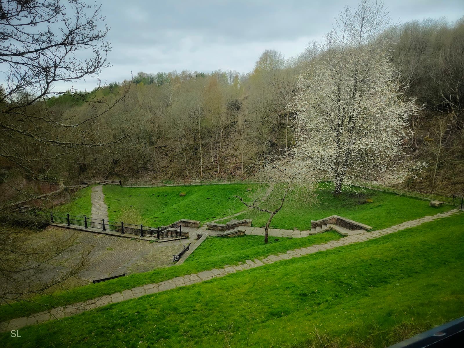
Scenic River Views
Along the River Tame
Enjoy picturesque stretches of the River Tame, offering tranquil moments and beautiful natural scenery.

Green Spaces and Parks
Various points along the trail
Discover charming parks and green oases perfect for a relaxing break or a family picnic.

Local Wildlife Spotting
Woodland and riverside sections
Keep an eye out for diverse birdlife and other small creatures that inhabit the trail's natural environment.
Plans like a pro.
Thinks like you
Planning Your Visit
Navigating the Tameside Trail
Best Footwear for the Trail
Best Times
Insider Tips
from TikTok, Instagram & Reddit
Ashton under lyne
So in July next year I'm moving up from Bristol to AuL because of dad's work. I'll be starting a college course but don't know anyone so I'm mega nervous! What's AuL like?
🗺️ Grab a Trail Map
Essential for navigation! Download or find a physical Tameside Trail map to make the most of your walk.
👟 Wear Comfortable Shoes
The trail has varied terrain, so sturdy walking shoes are a must for comfort and safety.
First time buyer considering Brinnington or alternative is Tameside (Ashton, Droylsden, Audenshaw)
Hi, I have just put an offer in for a house in brinnington. It is on the side if the new builds, 60 seconds walk from the train station. I know it is rough but seems to be less rough than wythenshawe and moston according to crime stats and the news headlines. I am also looking…
Which areas of Manchester have improved and which areas have declined?
I saw a similar question in r/Liverpool, so I thought I'd ask it here too. I think Levenshulme has gotten a bit better, at least from my experience, but I might be completely wrong. I do worry a lot of Manchester has declined in other ways over the past 15 years or so though.…
💧 Pack Water & Snacks
Stay hydrated and energized, especially on longer walks. Limited facilities along some sections.
📸 Capture the Scenery
Plenty of photo opportunities! Don't forget your camera or phone to capture the natural beauty.
Is Droylsden a good area to live?
How is it for walks, schools crime, distance to shops?
Tips
from all over the internet
🗺️ Grab a Trail Map
Essential for navigation! Download or find a physical Tameside Trail map to make the most of your walk.
👟 Wear Comfortable Shoes
The trail has varied terrain, so sturdy walking shoes are a must for comfort and safety.
💧 Pack Water & Snacks
Stay hydrated and energized, especially on longer walks. Limited facilities along some sections.
📸 Capture the Scenery
Plenty of photo opportunities! Don't forget your camera or phone to capture the natural beauty.
What Travellers Say
Reviews Summary
Visitors appreciate the Tameside Trail for its accessible natural beauty and opportunities for walking and cycling. It's seen as a valuable green space for local recreation, offering a peaceful escape. However, some find signage inconsistent and facilities limited on certain stretches.
What People Like
What People Dislike
Frequently Asked Questions
🚇 🗺️ Getting There
The Tameside Trail can be accessed from various points across Tameside. Popular starting points include areas near Ashton-under-Lyne and Stalybridge. Public transport options like local bus routes serve many access points, and some sections are accessible by train.
Parking availability varies depending on the access point. Some sections have dedicated parking areas, while others may rely on street parking. It's advisable to check local council information or use a Tameside Trail map to identify parking spots near your intended starting point.
Yes, the Tameside Trail is suitable for cycling, offering a great way to explore the route. Many sections are well-maintained for cyclists.
Absolutely! Many parts of the Tameside Trail are well-connected by public transport, making it accessible for those without a car. Check local bus and train schedules for routes near your desired access point.
Popular starting points often include areas with good transport links and amenities. Consider areas around Ashton-under-Lyne or Stalybridge for convenient access and potential parking.
🎫 🎫 Tickets & Entry
No, the Tameside Trail is a public right of way and is free to access. You can enjoy the natural beauty and walking paths without any admission charges.
The Tameside Trail is open 24/7, as it is an outdoor public space. You can visit at any time of day or night, though daylight hours are recommended for safety and visibility.
There is no need to book tickets or make reservations for the Tameside Trail, as it is a free public amenity.
Generally, there are no specific restrictions, but always be mindful of local bylaws, respect the environment, and keep dogs under control.
Accessibility can vary along the Tameside Trail. Some sections are paved and relatively flat, making them more accessible, while others may be uneven or have steps. Checking specific section details or using a Tameside Trail map with accessibility information is recommended.
🎫 🧭 Onsite Experience
The terrain on the Tameside Trail is varied. You'll encounter paved paths, gravel tracks, and some natural, potentially muddy, sections, especially after rain.
Facilities are limited and can be sporadic. Some sections might have public restrooms or nearby cafes, particularly in town centers, but it's best to be prepared with your own supplies.
Signage can vary. While many main sections are marked, having a Tameside Trail map is highly recommended to ensure you stay on the correct path and explore effectively.
The trail offers opportunities to spot various bird species, small mammals, and insects, particularly in the more natural and woodland areas along the River Tame.
For the most part, yes, especially during daylight hours and on more populated sections. However, as with any outdoor activity, it's wise to be aware of your surroundings and inform someone of your plans.
📸 📸 Photography
Look for scenic river bends, bridges, woodland clearings, and any areas with interesting flora and fauna. The changing seasons also offer unique photographic opportunities.
Early morning or late afternoon often provide the best light for photography, creating softer shadows and warmer tones. Golden hour can be particularly beautiful.
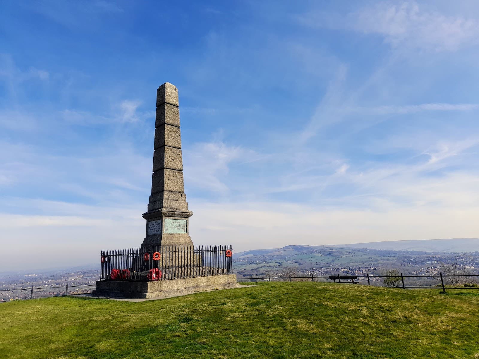
Keep an eye out for historical bridges, old industrial remnants, and natural features like mature trees or water features. The specific landmarks will depend on the section you are exploring.
A versatile camera, like a smartphone or a mirrorless camera with a good zoom lens, is ideal. Consider a wide-angle lens for landscapes and a macro lens for close-ups of nature.
Drone usage may be subject to local regulations and landowner permissions. It's essential to check these before flying to avoid any issues.


Social
from TikTok, Instagram & Reddit