
Mulberry Riverwalk
An accessible 5-6 mile trail with varied terrain, offering glimpses of wildlife and river scenery.
Highlights
Must-see attractions

Social
From TikTok & Reddit
Best Time
Fewer crowds, cooler temps
Mulberry Riverwalk
Best Time
Fewer crowds, cooler temps
Highlights
Must-see attractions
An accessible 5-6 mile trail with varied terrain, offering glimpses of wildlife and river scenery.
"Easy trail with varied terrain, great for spotting deer and enjoying the river."
👟 Trail Shoe Choice
Opt for shoes good for varied terrain: asphalt, mulch, sand, and gravel. Avoid open-toed sandals .
🦟 Bug Spray is Key
Especially in summer, mosquitoes can be abundant. Pack repellent to enjoy your walk .
Quick Facts
Hours
Rating
4.2 · 82 reviews
Type
Hiking Area
Highlights
Discover the most iconic attractions and experiences
Four Counties Monument
Mid-trail marker
A unique spot where Hall, Gwinnett, Barrow, and Jackson counties converge. A great photo op!
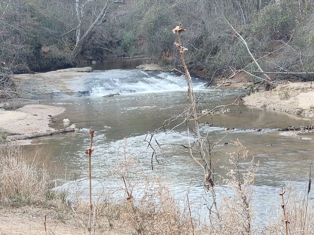
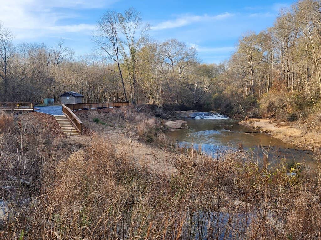
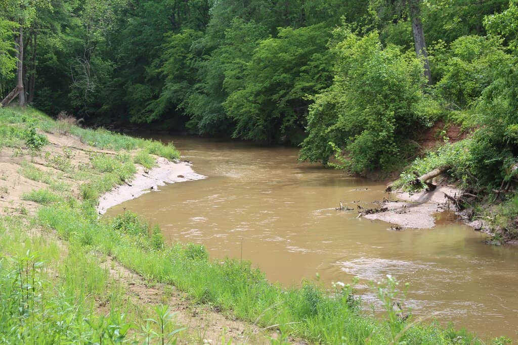
Mini Waterfall
Along the river
A surprisingly noisy and beautiful cascade, perfect for a moment of quiet reflection.
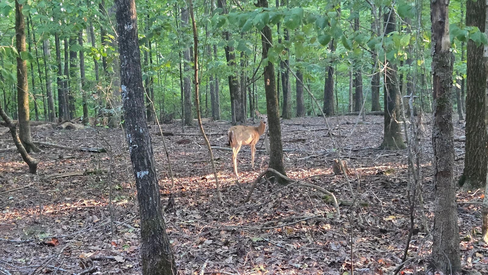
Wildlife Spotting
Marshy stretches and riverbanks
Keep an eye out for white-tailed deer, great blue herons, and other woodland creatures.
Plans like a pro.
Thinks like you
Planning Your Visit
Navigating the Trail's Terrain
Embrace Nature, But Be Aware
Best Times
Insider Tips
from TikTok, Instagram & Reddit
👟 Trail Shoe Choice
Opt for shoes good for varied terrain: asphalt, mulch, sand, and gravel. Avoid open-toed sandals.
🦟 Bug Spray is Key
Especially in summer, mosquitoes can be abundant. Pack repellent to enjoy your walk.
🗺️ Stay Aware of Trail End
The latter half is less maintained. Check signage to avoid getting lost.
💧 River Levels Vary
The river's water level can change, so don't expect a roaring river year-round.
Tips
from all over the internet
👟 Trail Shoe Choice
Opt for shoes good for varied terrain: asphalt, mulch, sand, and gravel. Avoid open-toed sandals.
🦟 Bug Spray is Key
Especially in summer, mosquitoes can be abundant. Pack repellent to enjoy your walk.
🗺️ Stay Aware of Trail End
The latter half is less maintained. Check signage to avoid getting lost.
💧 River Levels Vary
The river's water level can change, so don't expect a roaring river year-round.
📸 Capture the Scenery
Despite some drawbacks, the river views and wildlife offer great photo opportunities.
What Travellers Say
Reviews Summary
Visitors find the Mulberry Riverwalk to be an easy and accessible trail with opportunities for wildlife viewing and enjoying the river. While some appreciate the varied terrain and natural beauty, others note issues with potential sewage odors near the start and less maintained sections further along the path. The trail's proximity to residential areas and road noise are also mentioned as drawbacks by some.
"As of 11/19/2024 from a RUNNER'S PERSPECTIVE.
➡️ CONDITIONS: 61° / overcast / slight rain / foggy / leaf litter / not busy (3:30 - 4:30 PM).
The beginning of the trail starts out as asphalt and immediately leads to a sewer hub or some sort of minor treatment facility for waste. Needless to say, the beginning of the trail stinks!
(Unfortunately, I could smell sewage for approximately 1 to 1.5 miles into the trail. With this said, it's important to note that the entire trail runs parallel to sewage shelters, pipes, man holes, and covers. These constructs dot the trail from start to finish.)
The RiverWalk is about 5 to 6 miles in total length. With terrain that varies from asphalt to mulch, to sand, to large gravel, to typical soil, and only a few shallow mud holes. There's not very many roots or rock gardens to deal with - your ankles will thank you!
The immersion level is about a zero. Most of the trail you're behind people's homes ranging from high-class to middle-class neighborhoods. A very busy road is heard throughout the majority of the trail. I also noticed air traffic was pretty regular.
However, some redeeming points are that the river is a fun experience for those choosing to run or trek beside it. There's a mini waterfall that you will stumble upon (elevation drop). It's surprisingly teeming with life! I saw many herds of white-tailed deer near the marshy stretches, multiple great blue heron sightings, and lots of other woodland creatures. At about the halfway marker, you'll come to a monument that signifies four counties converging: HALL / GWINNETT / BARROW / JACKSON (pictured).
It's also important to bring up that the second half of the trail after crossing Silk Tree Pointe is not well-maintained. In fact, on the map/signage, you'll see that the trail towards the end is still a future project and not even under construction. Without having some trail knowledge, you could get lost.
⚠️ Overall, the trail receives a 3 out of 5 score for just being okay.
It's an easy trail without much elevation deviation. I think I only came across maybe two short sections where there was a slight incline/decline.
Great for beginners and intermediate runners & trekkers."
Vincent Roccagli
"Overall an easy little 5-6 mile walk not far from residences ( if you live near, it's a great spot to walk regularly). I used to come to this trail to walk my dog years ago before the renovation. Trees provided dappled shade at all points of the trail which left it comfortable at all times of the year (even the middle of the day mid-summer). After the renovation they removed most of the trees along the most popular section of the trail to "improve the view of the river". As a result the sun absolutely BLAZES. There is a solid 3/4 to a mile of the trail that has been torched of vegetation and is no longer an enjoyable stroll but a rush to get to the next bit to get out of the sun. Also keep in mind it is an out and back so you have to walk the section x2. Used to be a great place to meander and let the dogs sniff..."
Rae Stryker
"Nice hike, tons of mosquitos tho (it’s also summer)! The river didn’t have much water, the trail wraps around a housing area so you could see other people’s backyard."
Jouhanna Austin
What People Like
What People Dislike
Frequently Asked Questions
🚇 🗺️ Getting There
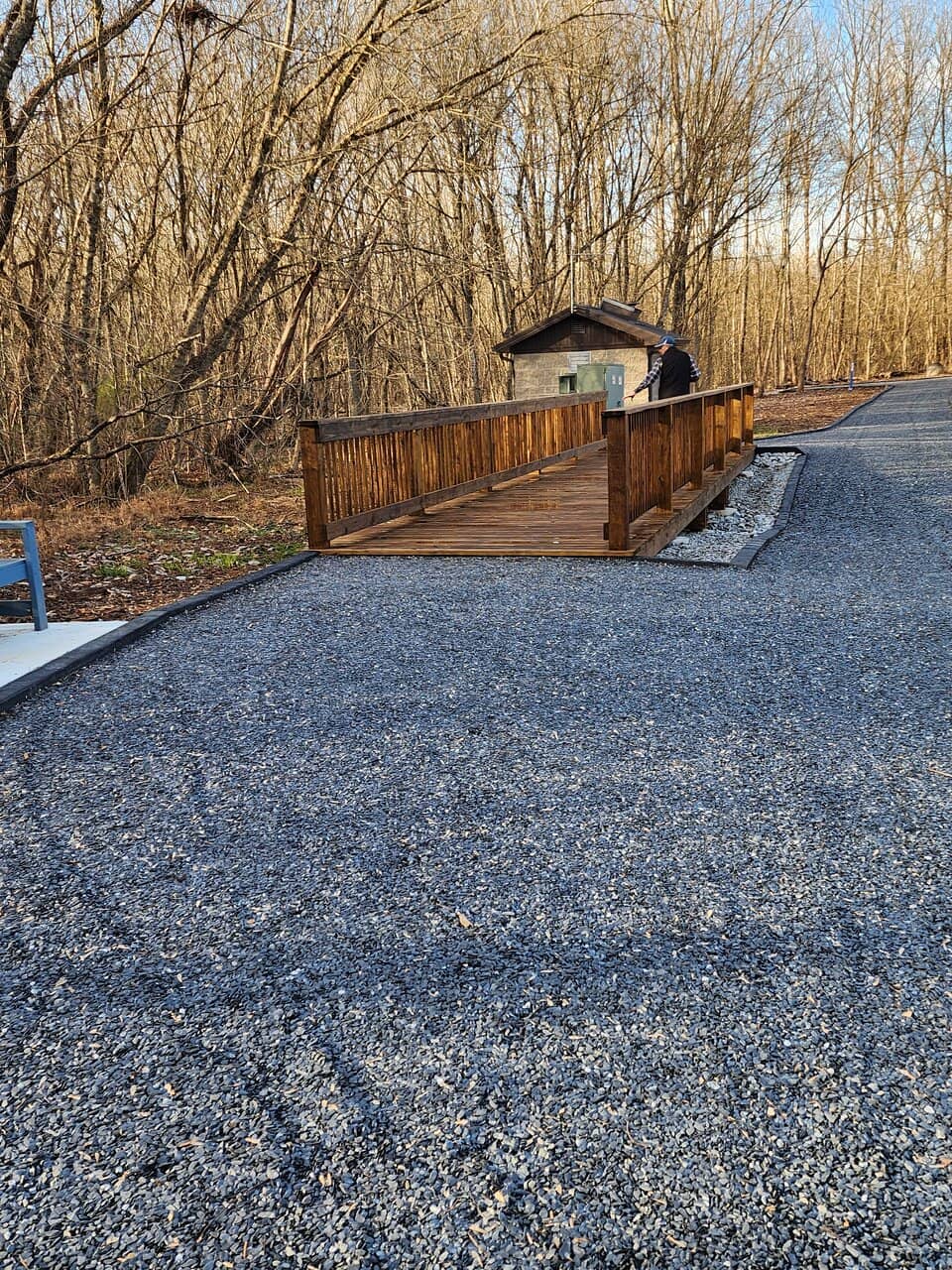
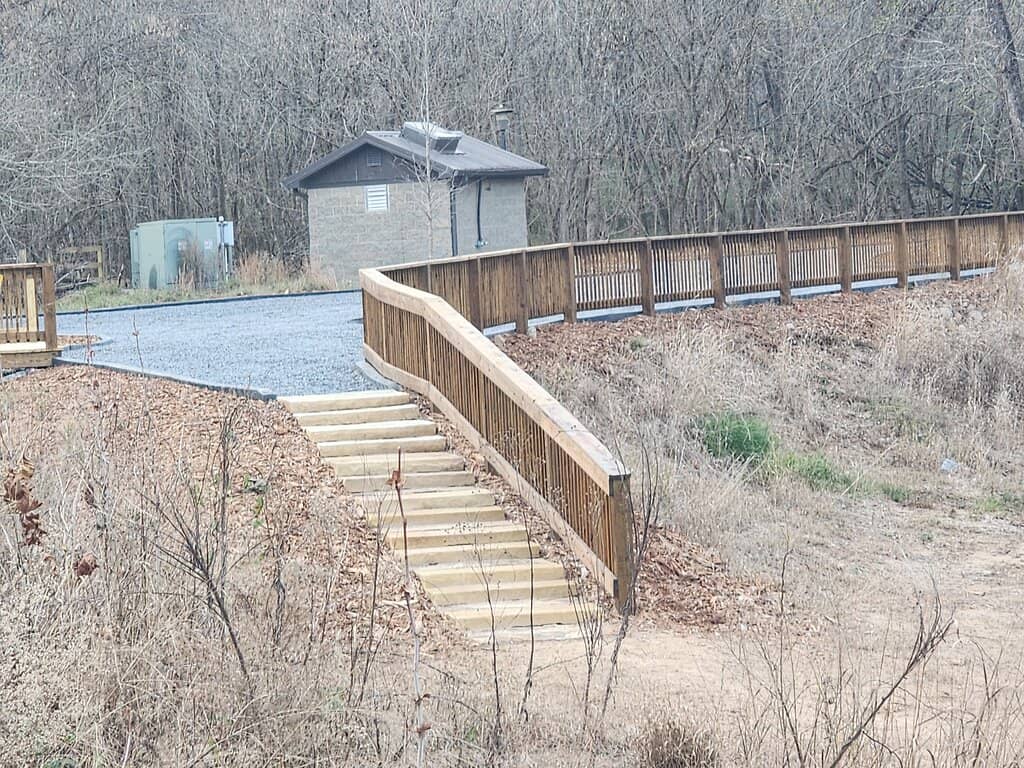
The Mulberry Riverwalk is accessible via multiple entry points. While specific public transport options are limited, driving is the most common method. Parking is available at designated trailheads. Check local maps for the closest access point to your starting location.
Yes, there are parking areas available at various access points along the Mulberry Riverwalk. These can fill up, especially on weekends, so arriving early is recommended.
Biking is permitted on most sections of the Mulberry Riverwalk. However, be mindful of the varied terrain and pedestrian traffic, especially on narrower or more crowded paths.
Yes, dogs are generally allowed on the Mulberry Riverwalk, but they must be kept on a leash. Be sure to clean up after your pet to maintain the trail's cleanliness.
Mulberry Riverwalk is situated near several towns, including Braselton, GA. This makes it a convenient destination for locals and visitors in the surrounding areas.+1
🎫 🎫 Tickets & Entry
Mulberry Riverwalk is a public park and generally does not have an entrance fee. Enjoying the natural beauty and trails is free for all visitors.
As a public park, Mulberry Riverwalk is typically open from dawn to dusk. It's always a good idea to check local park authority websites for any specific seasonal hours or closures.
No, tickets are not required for Mulberry Riverwalk as it is a public access area. You can visit anytime during park hours without prior booking.
While not a primary focus, local events or community gatherings might occasionally take place. It's best to check local event listings or park announcements for any scheduled activities.+1
The best access point depends on where you're coming from. Many visitors use trailheads with parking facilities. The trail runs parallel to residential areas, offering various potential entry points.
🎫 🏞️ Onsite Experience
The Mulberry Riverwalk is approximately 5 to 6 miles in total length, offering a decent stretch for walking, running, or hiking.
Expect a mix of surfaces including asphalt, mulch, sand, gravel, and typical soil. Some sections can be muddy or have shallow water, especially after rain.
Yes, the Mulberry Riverwalk is considered an easy trail with minimal elevation changes, making it great for beginners and intermediate runners or walkers.
You might spot white-tailed deer, great blue herons, and various other woodland creatures, particularly near marshy areas and along the riverbanks.
Restroom availability can vary depending on the access point. It's advisable to check park information or plan accordingly before your visit.
📸 📸 Photography
Look for the mini waterfall, the Four Counties Monument, and scenic river views. Wildlife sightings also offer great photographic opportunities.
Yes, especially during the golden hours of sunrise and sunset. The river, surrounding trees, and occasional wildlife provide diverse landscape subjects.
While the trail runs alongside residential areas, it's best to focus your photography on the natural scenery and public landmarks to respect privacy.
Early mornings and late afternoons offer softer light and fewer crowds, ideal for capturing the beauty of the riverwalk. Wildlife is also often more active during these times.
Drone usage is typically subject to park regulations. It's recommended to check with local authorities or park management regarding any restrictions on drone operation.


Social
from TikTok, Instagram & Reddit