
Skyline Trail Beavers Bend
An 8.6-mile loop trail in Beavers Bend State Park, known for its strenuous climbs and rewarding mountain vistas.
Highlights
Must-see attractions

Social
From TikTok & Reddit
Best Time
Pleasant temps, fewer crowds
Skyline Trail Beavers Bend
Best Time
Pleasant temps, fewer crowds
Highlights
Must-see attractions
An 8.6-mile loop trail in Beavers Bend State Park, known for its strenuous climbs and rewarding mountain vistas.
"This trail is no joke, a challenging hike with beautiful views but be prepared for difficulty. "
👟 Wear sturdy hiking boots
Tennis shoes are okay, but boots offer better support on this challenging trail.
💧 Carry ample water
You'll need it for the significant elevation changes and length of the hike.
Quick Facts
Rating
4.8 · 43 reviews
Type
Hiking Area
Highlights
Discover the most iconic attractions and experiences
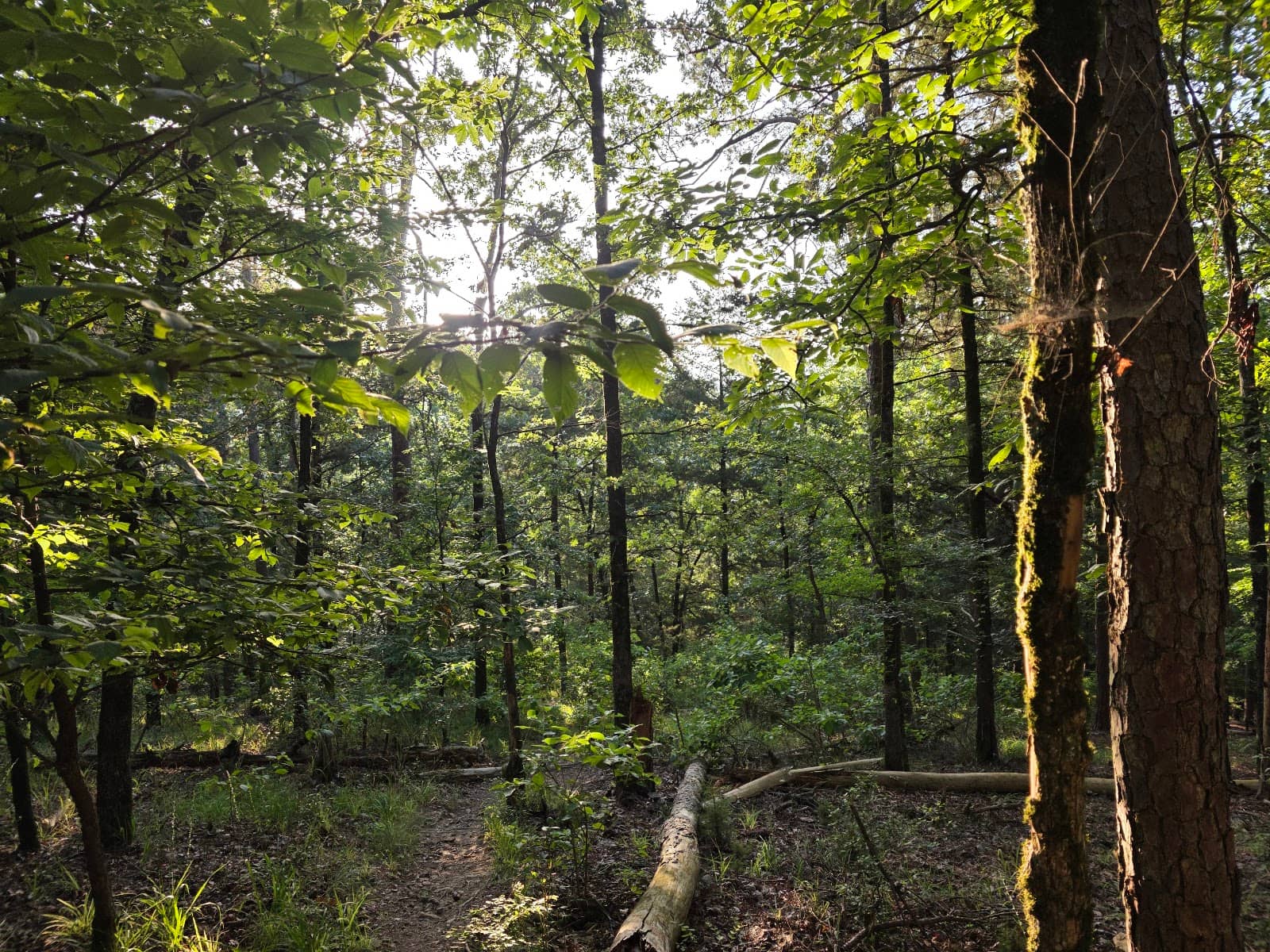
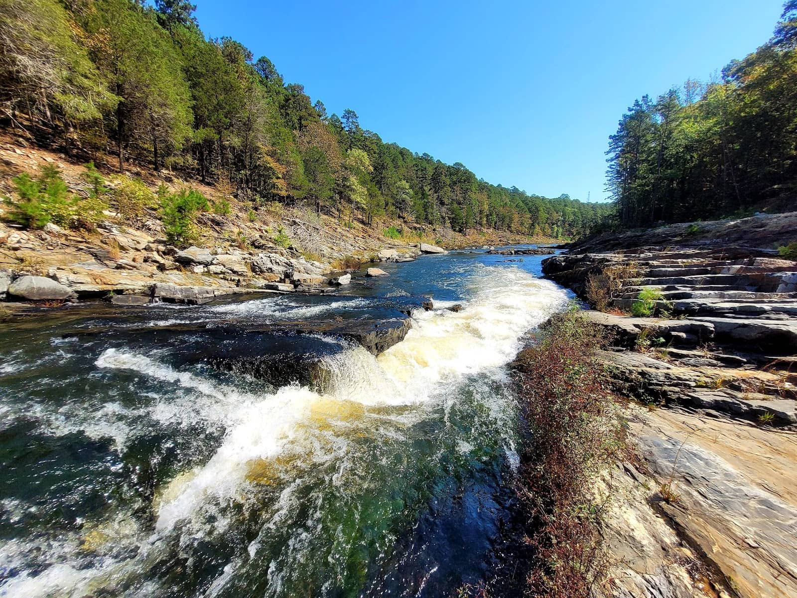
Panoramic Mountain Vistas
Along the trail
Experience breathtaking views of the Ouachita Mountains and the Mountain Fork River.
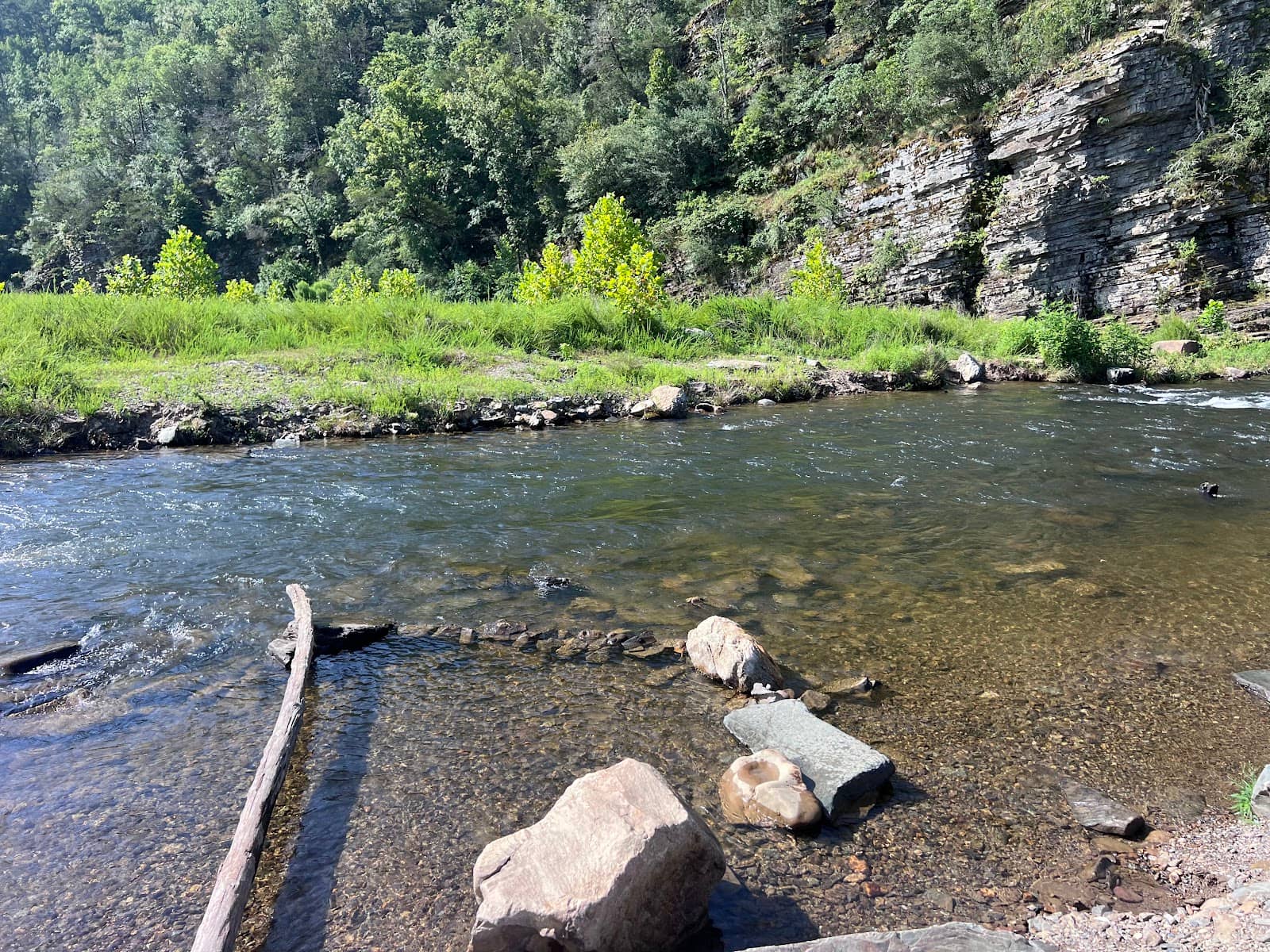
Thunderbird Falls
Accessible via Skyline Trail or Boy Scout Road
A picturesque waterfall, though it can sometimes be dry depending on the season.
Challenging Loop Hike
8.6-mile loop
Test your endurance on this demanding trail with significant elevation changes.
Plans like a pro.
Thinks like you
Planning Your Visit
Tackle the Skyline Trail's Challenge
Water & Navigation are Key
Best Times
Insider Tips
from TikTok, Instagram & Reddit
👟 Wear sturdy hiking boots
Tennis shoes are okay, but boots offer better support on this challenging trail.
💧 Carry ample water
You'll need it for the significant elevation changes and length of the hike. +1
🗺️ Use a GPS app
Trail markings can be hard to spot; a navigation app is highly recommended.
⏰ Allow ample time
The 8.6-mile trail can take 5+ hours, longer than some apps suggest.
Broken bow camping and hiking
Going for my birthday in November 17-19th Looking for good hiking trails but also CAMPING spots along the way( preferably free, if not it’s okay) group of 4. Want something somewhat challenging. Any recommendations for my trip please ASAP. Disclosure- was really interested in…
Tips
from all over the internet
👟 Wear sturdy hiking boots
Tennis shoes are okay, but boots offer better support on this challenging trail.
💧 Carry ample water
You'll need it for the significant elevation changes and length of the hike. +1
🗺️ Use a GPS app
Trail markings can be hard to spot; a navigation app is highly recommended.
⏰ Allow ample time
The 8.6-mile trail can take 5+ hours, longer than some apps suggest.
⚠️ Be prepared for difficulty
This trail is strenuous; assess your fitness level before starting.
What Travellers Say
Reviews Summary
The Skyline Trail is a challenging and rewarding hike for those prepared for its strenuous nature, offering beautiful mountain vistas. However, hikers should be aware of potential navigation difficulties and the possibility of a dry waterfall. It's best suited for experienced hikers rather than casual walkers or families with young children. +1
"As an occasional hiker, the Skyline trail was no joke. Our group of 6 went in with high expectations and ended up realizing we were a bit over our heads with the trails difficulty. I would not recommend this trail to people who are not prepared for it physically. The trees provided ample shade most of the way which was a nice. However, there were many spots were the trail was not marked and the path was unclear. There were also narrow cliff edges that had to be crossed that could have ended badly if a wrong step was made. We also made it to the first waterfall for the entire thing to be dried up so it was a bit of a let down. After 8 hours of hiking and 7 miles completed with two miles left we made the decision to abandon the trail and walk down a road we found to call for a ride. We did so because the kids were exhausted and we were getting very low on water. We had anticipated the hike only lasting a little over 4 hours as that's what the All Trails app suggested the hike would take. Overall, I am glad we did it but would not attempt it again. The hikes I've done in Sedona, other parts of Arizona, the Grand Canyon, and Tennessee were significantly more rewarding and less difficult."
Gage Desormeaux
"The starting point is not where the maps says, the trail starts at Cedar Bluff Nature Trail. You will go 2.52 miles before you come to the starting point but it will test you if you are not fit or use to the elevation changes just to get here. You will see a warning signed mostly about water. From this point you still have another 5 miles Togo. Be prepared to rest and drink water, like I said if you are not fit return to the start at this point of the signed. I walk at work about 15k steps and this was hard for me. My wife and I did this trail in about 3.5 hours 5.11 miles. One way 2.5 sh and then in the way back.
FYI the trail does not loop around. Keep an eye out for the trail markings some are hard to see."
Eddie Santi
"We did the trail this last weekend with our Boy Scout group. Was one of the harder trails we’ve done with the elevation changes. On the start of the trail we missed the marker and did an extra mile but got to see some extra scenery. Overall hike was 11 miles at 9 hours. The last leg of the trail to make a loop back to the parking lot is about 1.2 miles along the roadside."
David Kubala
What People Like
What People Dislike
Frequently Asked Questions
🚇 🗺️ Getting There
The official trailhead for the Skyline Trail is often cited as starting at Cedar Bluff Nature Trail, which is about 2.5 miles before the main trail begins. Some maps may show a different starting point, so using a GPS app is advised.
Parking is available at the trailhead, but it can fill up, especially on weekends. Arriving early is recommended.
Yes, you can access certain points like Thunderbird Falls via Boy Scout Road, which offers a shorter route to specific features.
While not explicitly stated in all sources, dogs are generally allowed on trails in Beavers Bend State Park on a leash. Always check park regulations before your visit.
Due to potentially unclear markings, using a reliable hiking app with offline maps or a dedicated GPS device is highly recommended to stay on track.
🎫 🎫 Tickets & Entry
Generally, no specific permit is required for day hiking the Skyline Trail. However, Beavers Bend State Park may have entrance fees or require park passes depending on the season and specific areas.
Beavers Bend State Park is typically open year-round from dawn to dusk. However, specific facilities or visitor centers may have limited hours.
There might be a day-use fee for Beavers Bend State Park. It's best to check the official park website or inquire locally for the most current fee information.
Camping is generally not permitted directly on the Skyline Trail itself. Designated campgrounds are available within Beavers Bend State Park.
There are no age restrictions, but the trail's difficulty means it's best suited for older children and adults who are physically prepared.
🎫 🥾 Onsite Experience
While some apps suggest around 4 hours, many hikers report taking 5-9 hours to complete the 8.6-mile loop due to the challenging terrain and elevation. +1
The Skyline Trail has a significant elevation gain of approximately 1,600 feet, making it a strenuous hike.
Restroom facilities are limited on the trail itself. It's advisable to use facilities at the trailhead or visitor center before starting your hike.
You might encounter diverse wildlife, including deer, and various bird species. Always maintain a safe distance and do not feed the animals. +1
Trail markings can be inconsistent and difficult to spot in some areas, making navigation challenging. A GPS device or app is highly recommended.
📸 📸 Photography
Look for scenic overlooks offering panoramic views of the Ouachita Mountains and the Mountain Fork River. Thunderbird Falls is also a popular photo spot.
If you're seeking challenging hikes with rewarding vistas, yes. However, there are easier trails in Beavers Bend that offer great views with less effort.
Early morning or late afternoon light can provide beautiful golden hour shots, especially for the mountain vistas.
Drone usage is typically restricted in state parks to protect wildlife and visitor experience. Check Beavers Bend State Park's specific drone policy.
A wide-angle lens is great for capturing the expansive mountain views, and a sturdy tripod can help with low-light photography.


Social
from TikTok, Instagram & Reddit