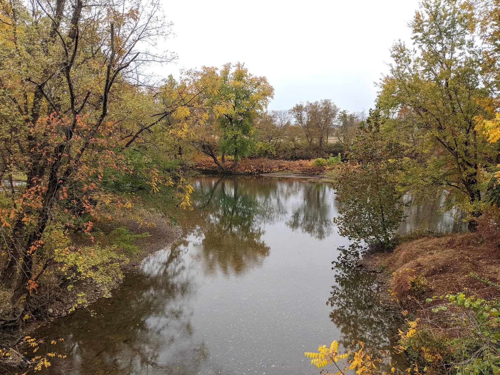
Evitts Creek Aqueduct C&O Canal
A picturesque historic aqueduct on the C&O Canal towpath, offering a scenic and accessible walk or bike ride.
Highlights
Must-see attractions

Social
From TikTok & Reddit
Best Time
Pleasant weather, fewer crowds
Evitts Creek Aqueduct C&O Canal
Best Time
Pleasant weather, fewer crowds
Highlights
Must-see attractions
A picturesque historic aqueduct on the C&O Canal towpath, offering a scenic and accessible walk or bike ride.
"Very scenic area of the C&O canal towpath, perfect for pictures and a nice walk."
🎯 Verify Directions Carefully
Many find directions misleading. Avoid farm signs; they indicate you're off course. Use reliable GPS and confirm your route before departing.
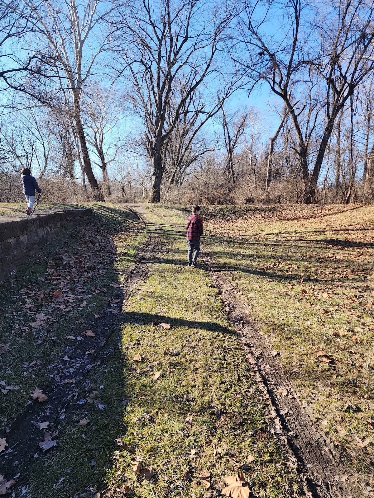
🚶♀️ Enjoy the Towpath
The C&O Canal towpath here is flat and wide, perfect for a relaxing walk or bike ride. Appreciate the natural beauty.
Quick Facts
Hours
Rating
4.1 · 19 reviews
Highlights
Discover the most iconic attractions and experiences
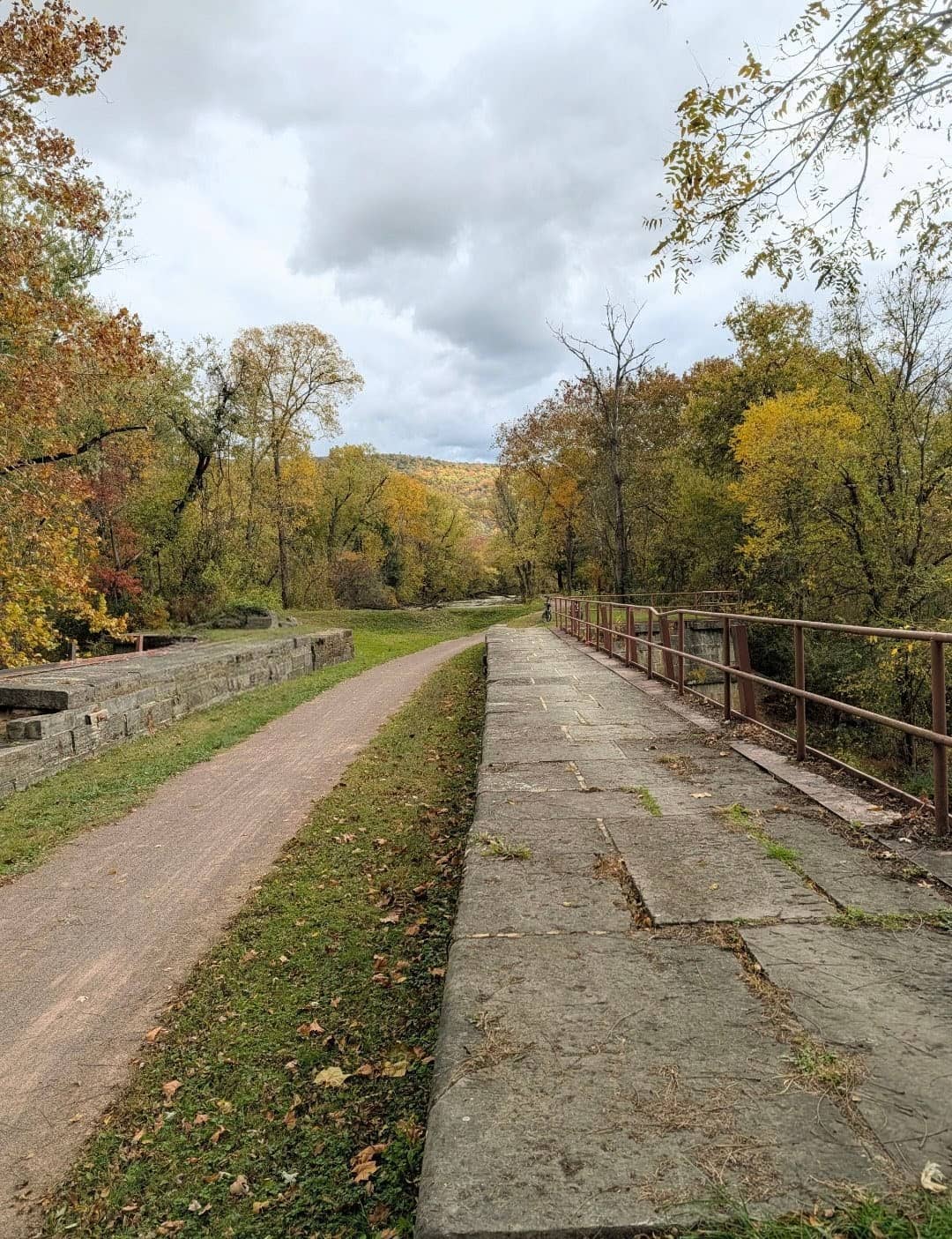
Evitts Creek Aqueduct
C&O Canal Towpath (Mile Markers 180-181)
A scenic and historic stone structure on the C&O Canal, offering picturesque views and a glimpse into industrial history.
C&O Canal Towpath
Between Mile Markers 180 and 181
Enjoy a peaceful, flat, and wide trail perfect for leisurely walks or bike rides with scenic surroundings.
Plans like a pro.
Thinks like you
Planning Your Visit
Navigating to the Aqueduct
Understanding the History
Best Times
Insider Tips
from TikTok, Instagram & Reddit
🎯 Verify Directions Carefully
Many find directions misleading. Avoid farm signs; they indicate you're off course. Use reliable GPS and confirm your route before departing.
🚶♀️ Enjoy the Towpath
The C&O Canal towpath here is flat and wide, perfect for a relaxing walk or bike ride. Appreciate the natural beauty.
📚 Seek Historical Context
No on-site markers. Visit mile marker 184.5 for historical info. Appreciating the history enhances the visit.
📸 Great Photo Opportunities
The aqueduct offers beautiful scenery for photography. Capture the stonework and the surrounding landscape.
Tips
from all over the internet
🎯 Verify Directions Carefully
Many find directions misleading. Avoid farm signs; they indicate you're off course. Use reliable GPS and confirm your route before departing.
🚶♀️ Enjoy the Towpath
The C&O Canal towpath here is flat and wide, perfect for a relaxing walk or bike ride. Appreciate the natural beauty.
📚 Seek Historical Context
No on-site markers. Visit mile marker 184.5 for historical info. Appreciating the history enhances the visit.
📸 Great Photo Opportunities
The aqueduct offers beautiful scenery for photography. Capture the stonework and the surrounding landscape.
What Travellers Say
Reviews Summary
Visitors find the Evitts Creek Aqueduct a scenic spot on the C&O Canal towpath, appreciating its historical presence and the pleasant, flat trail. However, many struggle with inaccurate directions, leading to frustration, and note the lack of on-site historical information.
"Very scenic area of the C&O canal towpath. It is located in-between mile markers 180 and 181, approximately 4 miles south of the Cumberland train station along a very nice, flat, and wide section of trail. The river is not immediately visible at this location, but it is at other locations on the C&O towpath.
There are no info placards or other historic markers. You need to go up to mile marker 184.5 to obtain this type of information."
Thomas Hornik
"Take time to appreciate the history."
James Keefer
"Directions ARE WRONG. We never made it. I even saw a review that said the directions were wrong, and we went anyway. If you see signs for a farm, you're not gonna make it."
Mark Rhoderick
What People Like
What People Dislike
Frequently Asked Questions
🚇 🗺️ Getting There
Navigating to the Evitts Creek Aqueduct can be challenging as many GPS directions are inaccurate and can lead to private property. Travelers have reported that seeing farm signs means you are going the wrong way. It's recommended to use a reliable GPS and cross-reference with local maps if possible. The aqueduct is located on the C&O Canal towpath between mile markers 180 and 181, about 4 miles south of the Cumberland train station.
Yes, the C&O Canal towpath in this section is generally described as very nice, flat, and wide, making it accessible for walking and biking.
The flat and wide nature of the towpath makes it ideal for a leisurely walk or a bike ride. Many visitors enjoy the ease of travel along this section.
While the aqueduct itself is a landmark, there are no specific informational signs directly at the site. For historical context, you'll need to go further up the towpath.
Direct driving access to the aqueduct is not typically available. Access is primarily via the C&O Canal towpath, which is a trail for non-motorized use.
🎫 🎫 Tickets & Entry
No, there are no tickets or entry fees required to visit the Evitts Creek Aqueduct or the C&O Canal towpath. It is a public access area.
The C&O Canal National Historical Park, including the towpath, is generally open from dawn to dusk. There are no specific closing times for the trail itself.
The C&O Canal National Historical Park is free to enter and explore. There are no admission fees for accessing the towpath or its historical structures.
The primary restriction is that the towpath is for non-motorized use. Visitors should respect private property boundaries and adhere to park guidelines.
For detailed historical information, including about structures like the Evitts Creek Aqueduct, it's recommended to visit the interpretive signs located at mile marker 184.5 on the C&O Canal towpath.
📸 📸 Photography
The aqueduct itself provides a beautiful backdrop. Capture the stonework against the natural surroundings. The wide, flat towpath also offers scenic vistas for photography.
Yes, the wide and flat towpath makes it easy to stop and take pictures without obstructing other users. The scenery is generally quite photogenic.
Morning and late afternoon light often provide the most flattering illumination for the aqueduct and the surrounding landscape, creating softer shadows and warmer tones.
Drone usage is subject to National Park Service regulations. It's essential to check the specific rules for the C&O Canal National Historical Park regarding drone operation before flying.
Many visitors capture the aqueduct from the towpath level, showcasing its scale. Shots that include the canal channel or surrounding trees can also be very appealing.


Social
from TikTok, Instagram & Reddit