
Green Bay Trail
A 24-mile paved path connecting Chicago's North Shore suburbs, perfect for biking, walking, and exploring nature and charming towns.
Highlights
Must-see attractions

Social
From TikTok & Reddit
Best Time
Pleasant weather, fewer crowds
Green Bay Trail
Best Time
Pleasant weather, fewer crowds
Highlights
Must-see attractions
A 24-mile paved path connecting Chicago's North Shore suburbs, perfect for biking, walking, and exploring nature and charming towns.
"A beautiful, accessible trail perfect for a leisurely bike ride or a peaceful walk through nature and charming towns."

🚲 Rent a Bike
Make the most of the trail by renting a bike. Many local shops offer rentals for a few hours or the whole day.
🗺️ Grab a Trail Map
Plan your route and discover points of interest with a Green Bay Trail map. Essential for longer rides!
Quick Facts
Rating
4.3 · 4 reviews
Highlights
Discover the most iconic attractions and experiences
Historic Plaque
Fort Dearborn area
Discover the plaque marking the start of this ancient Indigenous route, once a vital connection from Chicago to Green Bay.
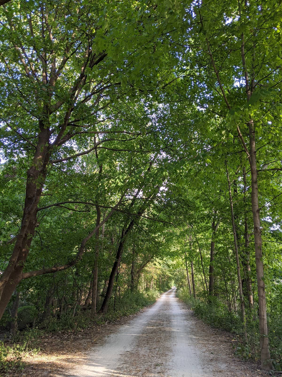
Skokie Lagoons
Along the trail
A serene natural area perfect for a peaceful break, offering beautiful water views and a chance to connect with nature.
Charming North Shore Towns
Evanston, Glencoe, Wilmette, Winnetka
Explore picturesque towns with unique shops and eateries accessible directly from the trail.
Plans like a pro.
Thinks like you
Planning Your Visit
Embrace the Path
Beyond the Bike
Best Times
Insider Tips
from TikTok, Instagram & Reddit
🚲 Rent a Bike
Make the most of the trail by renting a bike. Many local shops offer rentals for a few hours or the whole day.
🗺️ Grab a Trail Map
Plan your route and discover points of interest with a Green Bay Trail map. Essential for longer rides!
💧 Stay Hydrated
Carry water, especially on warmer days. There are limited spots to refill along the path. :droplet:
👟 Comfortable Footwear
Whether walking or biking, wear comfortable shoes. The path is paved and well-maintained. :athletic_shoe:
Advice on getting from the skokie lagoons east to the lakefront trail?
Hey yall. I’m trying to ride the north branch trail and then go southeast to the lakefront trail. I tried making a route on strava but really want to avoid Sheridan. Thanks everybody :-)
Tips
from all over the internet
🚲 Rent a Bike
Make the most of the trail by renting a bike. Many local shops offer rentals for a few hours or the whole day.
🗺️ Grab a Trail Map
Plan your route and discover points of interest with a Green Bay Trail map. Essential for longer rides!
💧 Stay Hydrated
Carry water, especially on warmer days. There are limited spots to refill along the path. :droplet:
👟 Comfortable Footwear
Whether walking or biking, wear comfortable shoes. The path is paved and well-maintained. :athletic_shoe:
What Travellers Say
Reviews Summary
Visitors rave about the Green Bay Trail's scenic beauty and accessibility, praising it as a perfect spot for biking, walking, and enjoying nature. The trail's connection to charming towns and historical significance are frequently highlighted as major draws. Some users note that parking can be limited at popular access points, and during peak times, the trail can get crowded.
""
A H
""
Alexander Hill
""
E R
What People Like
What People Dislike
Frequently Asked Questions
🚇 🗺️ Getting There
The Green Bay Trail has multiple access points. Popular starting points include areas near Fort Dearborn in Chicago and various parks and street access points in North Shore suburbs like Evanston and Wilmette. You can find specific access points on a Green Bay Trail map.
Yes, the Green Bay Trail is generally considered safe for cycling. It's a dedicated bike path for much of its length, separated from car traffic, making it a good option for those seeking less dangerous routes.
Many sections of the Green Bay Trail are accessible via public transport, particularly the Metra train lines that run through the North Shore suburbs. You can often get off at a station and find trail access nearby.
The most popular and efficient way to experience the Green Bay Trail is by bicycle. You can also walk or run the trail.
Parking availability varies by access point. Many parks and public areas along the trail offer parking, but it can be limited, especially on weekends. It's advisable to check specific access points on a Green Bay Trail map for parking information.
🎫 🎫 Tickets & Entry
No, the Green Bay Trail is a public park and trail system, so there are no tickets or entry fees required to use it. It's free for everyone to enjoy!
The Green Bay Trail is generally open from dawn to dusk. However, it's always a good idea to check local park district regulations for specific hours at different access points.
Most sections of the Green Bay Trail allow dogs, but they must be kept on a leash. Always check local signage for specific rules regarding pets. 🐕
The Green Bay Trail is largely paved and relatively flat, making it accessible for wheelchairs and strollers in most areas.
Restroom facilities are available at various parks and access points along the Green Bay Trail, particularly in more developed areas. It's wise to check a Green Bay Trail map for their locations. 🚽
🎫 🚴 Onsite Experience
The Green Bay Trail is approximately 24 miles long, stretching from Chicago's north side through several North Shore suburbs.
The Green Bay Trail is primarily a paved multi-use path, making it suitable for biking, walking, and running. You'll encounter some gentle inclines and declines.
Yes, the trail passes through several charming towns like Evanston and Wilmette, which offer numerous cafes, restaurants, and pizza spots. +1
Many enjoy the sections that pass through the Skokie Lagoons for its natural beauty and the parts that go through the picturesque North Shore towns.
The Green Bay Trail itself is a segment of a larger network. While it historically connected to Green Bay, the current trail is about 24 miles long and primarily serves the North Shore area.
📸 📸 Photography
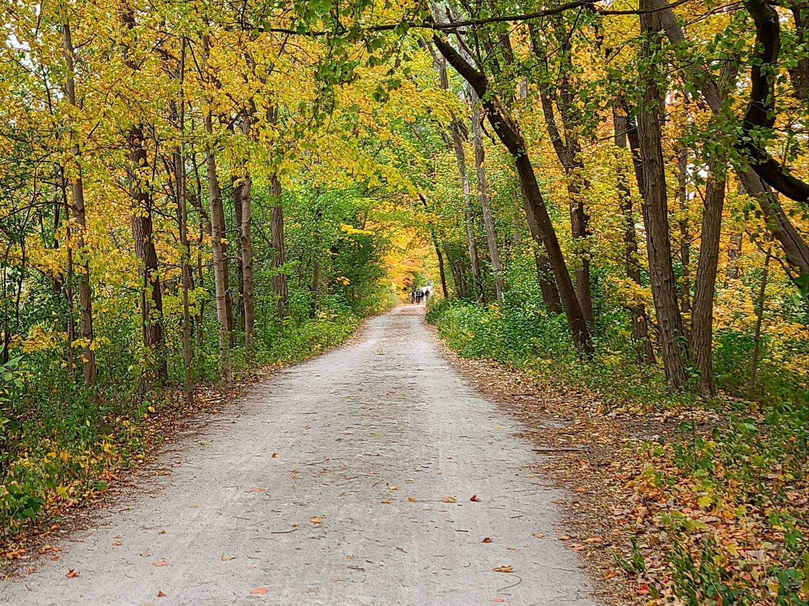
Look for scenic views along the Skokie Lagoons, charming architecture in the North Shore towns, and historical markers like the plaque at Fort Dearborn. The changing seasons also offer beautiful backdrops.
It's best to pull over to a safe spot before taking photos to avoid disrupting other trail users. Many scenic overlooks provide good opportunities.
Early morning or late afternoon often provide the best light for photography, with softer shadows and a golden glow.


Social
from TikTok, Instagram & Reddit