
Des Plaines River Trail
A sprawling 60+ mile multi-use trail system offering scenic rides and runs through diverse landscapes, from urban paths to natural preserves.
Highlights
Must-see attractions

Social
From TikTok & Reddit
Best Time
Pleasant temps, fewer crowds
Des Plaines River Trail
Best Time
Pleasant temps, fewer crowds
Highlights
Must-see attractions
A sprawling 60+ mile multi-use trail system offering scenic rides and runs through diverse landscapes, from urban paths to natural preserves.
🗺️ Check Trail Conditions
Muddy or icy spots can occur. Always check recent reports before heading out!
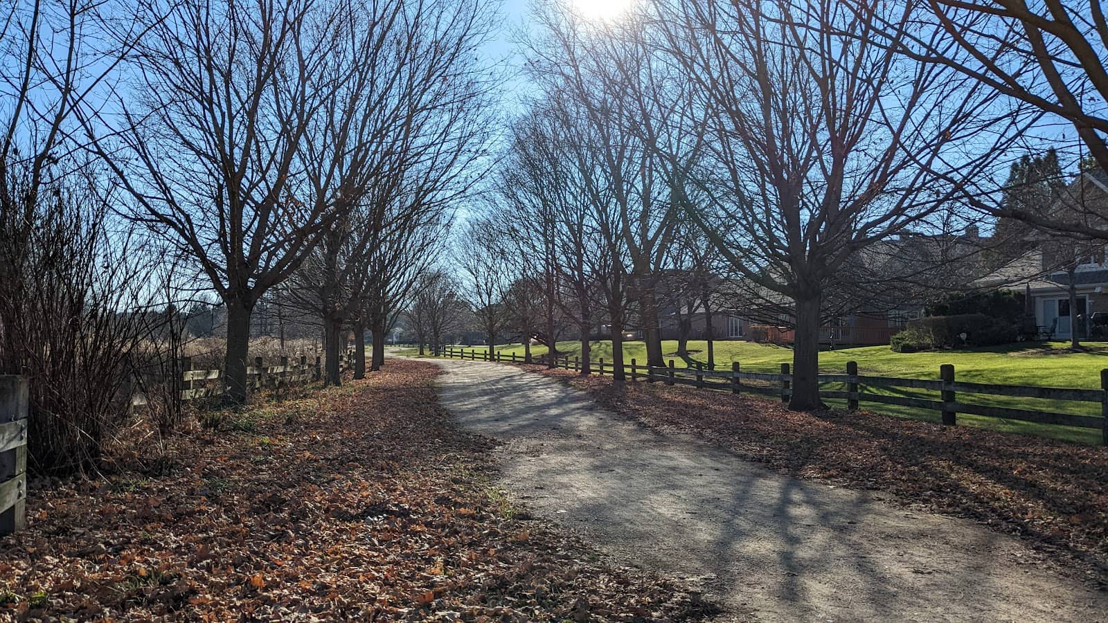
🚴♀️ Bike Type Matters
Paved and gravel sections exist. A hybrid or gravel bike is ideal for exploring more of the trail.
Quick Facts
Highlights
Discover the most iconic attractions and experiences
Northern Illinois Stretch
Cook and Lake Counties
Ride or run for miles through scenic landscapes, all the way to the Wisconsin border. Perfect for long-distance enthusiasts.
New Boardwalk Section
Rosemont, IL
Enjoy a modern, elevated pathway offering unique views and a smooth riding experience near O'Hare Airport.
Confusion Corner
Various points along the trail
A helpful landmark for runners, especially during events like the Des Plaines River Trail Marathon.
Plans like a pro.
Thinks like you
Planning Your Visit
Trail Conditions & Access
Best for Biking & Running
Best Times
Insider Tips
from TikTok, Instagram & Reddit
🗺️ Check Trail Conditions
Muddy or icy spots can occur. Always check recent reports before heading out!
🚴♀️ Bike Type Matters
Paved and gravel sections exist. A hybrid or gravel bike is ideal for exploring more of the trail.
🅿️ Numerous Access Points
Easily join the trail from many suburban locations. Plan your start and end points!
💧 Stay Hydrated
Especially on longer rides or runs, carry plenty of water.
Tips
from all over the internet
🗺️ Check Trail Conditions
Muddy or icy spots can occur. Always check recent reports before heading out!
🚴♀️ Bike Type Matters
Paved and gravel sections exist. A hybrid or gravel bike is ideal for exploring more of the trail.
🅿️ Numerous Access Points
Easily join the trail from many suburban locations. Plan your start and end points!
💧 Stay Hydrated
Especially on longer rides or runs, carry plenty of water.
🏃♀️ Event Awareness
Marathons and races use the trail. Be aware of event dates to avoid crowds or participate!
What Travellers Say
Reviews Summary
Visitors rave about the Des Plaines River Trail's extensive length and accessibility, making it a go-to for cycling and running. The varied terrain and scenic northern sections are frequently praised, though some note that trail conditions can vary, especially after rain. It's a beloved resource for outdoor recreation in the Chicago suburbs.
What People Like
What People Dislike
Frequently Asked Questions
🚇 🗺️ Getting There
The 'best' start depends on your desired length and scenery. Many users recommend the northern sections in Lake County for longer, more scenic rides. There are numerous parking areas and access points throughout Cook and Lake counties, so you can easily find a convenient spot.
Parking is available at many forest preserves and designated trailheads along the Des Plaines River Trail. Popular access points include those in Rosemont, Glenview, and further north towards the Wisconsin border. Searching for 'Des Plaines River Trail parking' on your preferred map app will reveal many options.
While direct public transport to every trailhead might be limited, some Metra train lines run near sections of the trail. You may need to combine a train ride with a short bike ride or walk to reach the trail itself. Check local transit maps for routes near your desired access point.
For navigation, using a GPS device or a reliable mapping app on your phone is highly recommended. Many users find 'Des Plaines River Trail map' or 'Des Plaines River Trail bike map' helpful for planning routes and identifying access points.
Yes, you can find various maps online by searching for 'map of Des Plaines River Trail' or 'Des Plaines River Trail south map' and 'Des Plaines River Trail north map'. These maps often detail the trail's length, surface type, and access points.
🎫 🎫 Tickets & Entry
No, the Des Plaines River Trail is a public multi-use path and generally does not have an entrance fee. Access to the trail and most parking areas within forest preserves is free.
The trail is typically open from dawn to dusk. However, specific forest preserve hours may vary, so it's always a good idea to check the operating hours for the particular forest preserve you plan to access.
Generally, no permit is required for recreational activities like biking, running, or walking on the Des Plaines River Trail. However, if you plan on organizing a large event, specific permits might be necessary.
Yes, the Des Plaines River Trail hosts various events, including marathons and organized runs.+1 It's worth checking local event calendars if you're interested in participating or want to be aware of potential crowds.
While the trail itself may be accessible, most forest preserves and parking areas close at dusk. It's advisable to plan your activities to conclude before closing time to avoid any issues.
🎫 🧭 Onsite Experience
Trail conditions vary. Some sections are paved, while others are crushed gravel, making them suitable for different types of bikes. After rain or snow, expect muddy or icy patches, especially in lower-lying areas.
Checking recent 'Des Plaines River Trail conditions' online is recommended.
Absolutely! It's a popular spot for runners, offering long stretches away from traffic. Runners often mention 'Confusion Corner' as a helpful landmark during races.
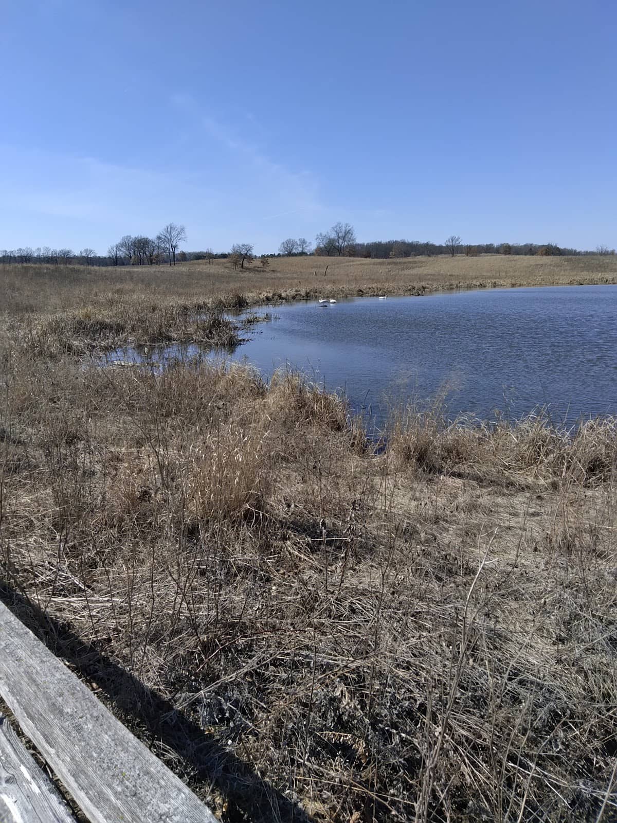
Many users find the northern sections, extending towards the Wisconsin border, to be the most scenic and less developed, offering a more immersive nature experience. The new boardwalk in Rosemont is also a unique feature.
Restroom facilities are available at various forest preserve access points and trailheads along the Des Plaines River Trail. It's a good idea to check the specific amenities for the forest preserve you plan to visit.
The trail is generally considered safe, especially during daylight hours and in more populated sections. However, like any long trail, it's always wise to be aware of your surroundings, let someone know your route, and carry a phone.
🍽️ 🍽️ Food & Dining
Yes, numerous restaurants and cafes are located in the suburban towns that the trail passes through, such as Rosemont, Glenview, and others. You'll find a variety of dining options depending on your location along the trail.
Picnicking is a great way to enjoy the trail! Many forest preserves along the route have designated picnic areas with tables. Remember to pack out everything you pack in.
Water fountains are available at some of the larger forest preserve access points and restrooms. However, it's always best to carry your own water, especially for longer excursions, as they may not be available at every point.
The Rosemont area, being close to O'Hare Airport and entertainment venues, offers a wide array of dining choices, from casual eateries to more upscale restaurants. You can easily find something to suit your taste before or after your trail activity.
Directly on the trail, dedicated cafes or snack bars are uncommon. Your best bet is to access the trail from a town or forest preserve that has nearby amenities for food and drinks.
📸 📸 Photography
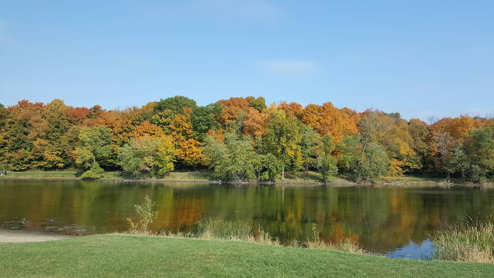
The northern sections offer beautiful natural scenery, especially during fall foliage. The new boardwalk in Rosemont provides a modern, urban-meets-nature backdrop.
Look for scenic overlooks, bridges, and areas with interesting water reflections.
The trail is ideal for landscape photography, nature shots, and action photography if you're capturing cyclists or runners.+1 The changing seasons offer diverse photographic opportunities throughout the year.
Drone usage is typically regulated by the specific forest preserve district managing the land. Many forest preserves have restrictions on drone operation to protect wildlife and ensure visitor safety. Always check the rules for the specific preserve you are visiting.
Golden hour, shortly after sunrise and before sunset, offers the most flattering light for photography. Early mornings can also be great for capturing mist over the river or dew on the foliage.
While candid shots are common, it's always respectful to ask for permission before taking close-up photos of individuals or groups, especially if they are the main subject of your image.


Social
from TikTok, Instagram & Reddit