
Dry Creek Trail Lehi
A vast network of trails offering varied terrain and stunning Utah Valley views, perfect for runners and hikers seeking adventure.

Highlights
Must-see attractions

Social
From TikTok & Reddit
Best Time
Pleasant temps, fewer crowds
Dry Creek Trail Lehi
Best Time
Pleasant temps, fewer crowds
Highlights
Must-see attractions
A vast network of trails offering varied terrain and stunning Utah Valley views, perfect for runners and hikers seeking adventure.

👟 Sturdy Footwear is Key
The trail has varied terrain, from smooth dirt to rocky patches. Good hiking shoes are a must!
💧 Hydration is Crucial
Bring plenty of water, especially for longer hikes or runs. There are no water sources on the trail.

Quick Facts
Highlights
Discover the most iconic attractions and experiences
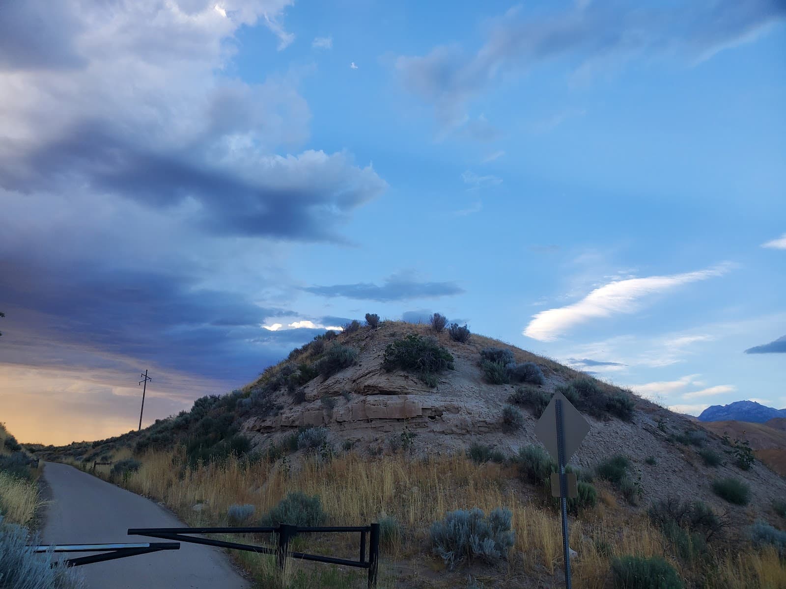
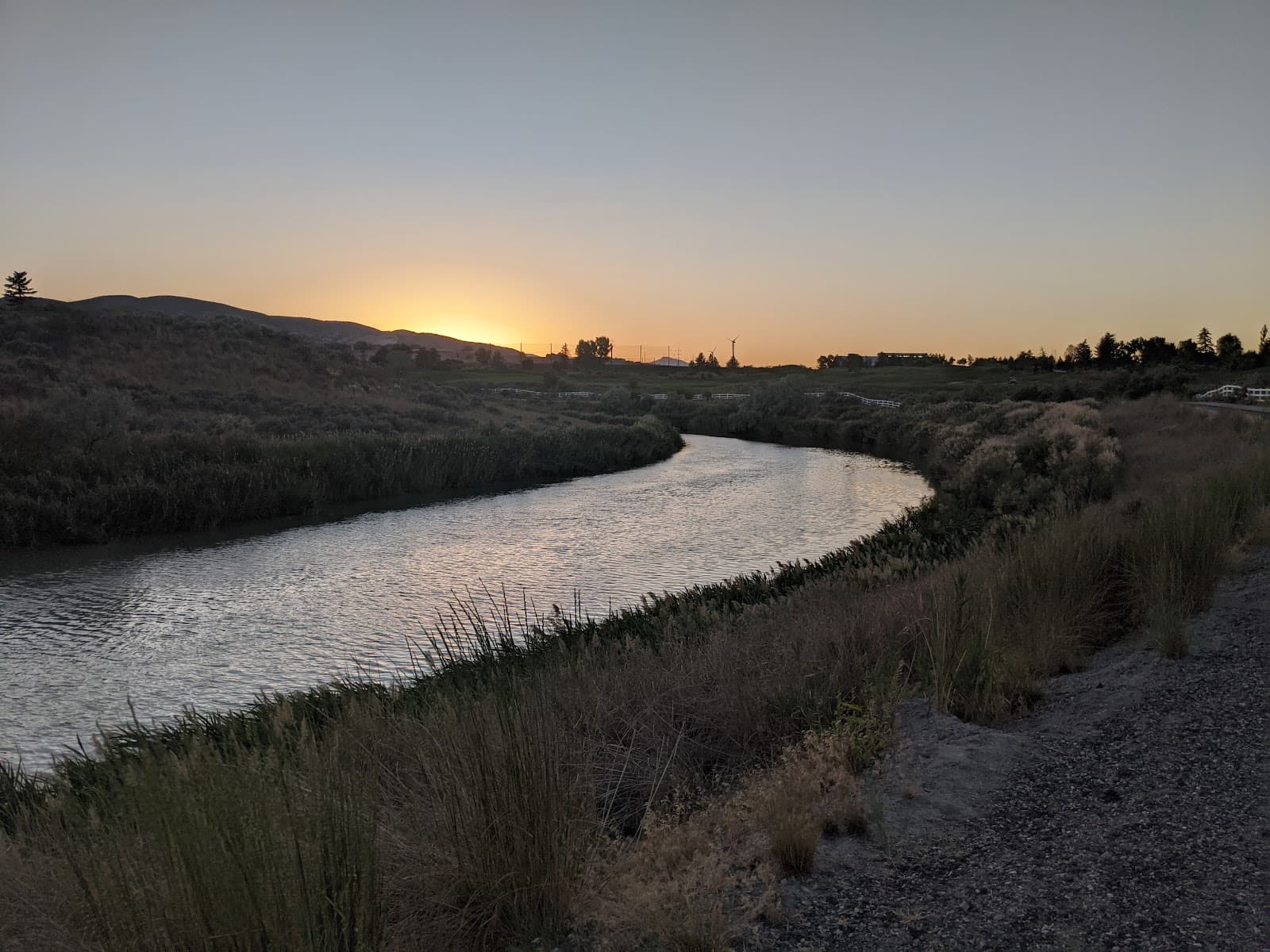
Scenic Vistas
Enjoy panoramic views of Utah Valley and the surrounding mountains. Perfect for a refreshing escape.

Varied Terrain
From smooth dirt paths to rocky sections, this trail offers a dynamic experience for hikers and runners.

Connection to Longer Routes
Links to other trails, allowing for extended runs and exploration of the Wasatch Front.
Plans like a pro.
Thinks like you
Planning Your Visit
Trail Conditions & Gear
Trail Etiquette & Safety
Best Times
Insider Tips
from TikTok, Instagram & Reddit
LONG trail runs between Ogden and Provo.
Training for a trail marathon and looking for LONG trail runs (10-20 miles) that are: - Well-maintained - Varied and undulating in elevation - BONUS: dirt paths with some rocks > rocky paths consisting of entirely ankle-rollers Thanks in advance!
👟 Sturdy Footwear is Key
The trail has varied terrain, from smooth dirt to rocky patches. Good hiking shoes are a must!
💧 Hydration is Crucial
Bring plenty of water, especially for longer hikes or runs. There are no water sources on the trail.
☀️ Sun Protection
Much of the trail is exposed. Wear sunscreen, a hat, and sunglasses to protect yourself from the sun.
🗺️ Explore Extended Routes
Connect to longer trail systems for marathon training or extended adventures.
Tips
from all over the internet
👟 Sturdy Footwear is Key
The trail has varied terrain, from smooth dirt to rocky patches. Good hiking shoes are a must!
💧 Hydration is Crucial
Bring plenty of water, especially for longer hikes or runs. There are no water sources on the trail.
☀️ Sun Protection
Much of the trail is exposed. Wear sunscreen, a hat, and sunglasses to protect yourself from the sun.
🗺️ Explore Extended Routes
Connect to longer trail systems for marathon training or extended adventures.
What Travellers Say
Reviews Summary
Dry Creek Trail is praised for its extensive network, offering challenging terrain and scenic vistas ideal for trail running and longer hikes. While many appreciate the varied paths and connectivity, some users note that parking can be limited and certain sections can be quite rocky, requiring sturdy footwear.
What People Like
What People Dislike
Frequently Asked Questions
🚇 🗺️ Getting There
Access points are typically found off residential streets in Lehi, often near trailheads marked for the Traverse Mountain area. Parking can be limited, so arriving early is recommended.
Public transport options to the immediate trailhead are limited. It's best to drive or use a ride-sharing service to reach the trail access points. Consider parking further away and walking to the trailhead if needed.
Key access points are often found in neighborhoods bordering Traverse Mountain. Look for trail markers indicating access from residential areas.
Yes, the trail is popular with mountain bikers. You can bike directly to many access points from surrounding Lehi neighborhoods.
Parking is available at some trailheads, but it can be scarce, especially on weekends. Be prepared to find street parking or consider alternative access points.
🎫 🎫 Tickets & Entry
No, Dry Creek Trail is a public trail and does not require any tickets or admission fees. Access is free for all users.
Generally, no permits are required for day hiking or recreational use of Dry Creek Trail. However, always check local regulations for any specific event or group activity requirements.
Dry Creek Trail is open year-round from dawn to dusk. There are no official operating hours, but it's advisable to finish your hike before dark for safety reasons.
Dogs are generally allowed on Dry Creek Trail but must be kept on a leash at all times. Please be respectful of other trail users and clean up after your pet.
Camping is not permitted directly on Dry Creek Trail. This is a day-use trail. For camping, you would need to look for designated campgrounds in nearby national forests or state parks.
🎫 🧭 Onsite Experience
The difficulty varies. Some sections are relatively flat and smooth, while others can be steep and rocky, making it moderate overall. It's great for training runs.
The main Dry Creek Trail itself is a few miles, but it connects to a much larger network of trails, allowing for runs of 10-20 miles or more.
Expect beautiful views of Utah Valley, Traverse Mountain, and the surrounding Wasatch Front. The landscape is arid with scrub oak and native plants.
It can get busy on weekends and holidays, especially during peak hiking and biking seasons. Weekday mornings or afternoons are generally less crowded.
Restroom facilities are typically not available directly on the trail. You may find some at larger trailhead parking areas, but it's best to plan accordingly.
📸 📸 Photography
Look for elevated points offering panoramic views of the valley and mountains. Sunrise and sunset can provide beautiful lighting.
The 'golden hours' around sunrise and sunset offer the most dramatic and flattering light. Midday can be harsh due to direct sunlight.
A wide-angle lens is great for capturing the expansive vistas. A telephoto lens can be useful for details in the mountains. Consider a lightweight setup for hiking.
Keep an eye out for native flora and fauna, interesting rock formations, and the interplay of light and shadow on the mountain slopes.
Drone usage may be restricted in certain areas, especially near residential zones or sensitive wildlife habitats. Always check local FAA regulations and Lehi city ordinances before flying.


Social
from TikTok, Instagram & Reddit