
Hawes Trail System
Explore a vast network of desert trails for thrilling mountain biking and scenic hikes in Mesa, Arizona.
Highlights
Must-see attractions

Social
From TikTok & Reddit
Best Time
Cooler temps for outdoor fun
Hawes Trail System
Best Time
Cooler temps for outdoor fun
Highlights
Must-see attractions
Explore a vast network of desert trails for thrilling mountain biking and scenic hikes in Mesa, Arizona.
"Hawes has been one of my favorite travel systems in the Phoenix valley. All the trails are well kept and marks easy enough to know you’re way around."
📱 Download Trail Maps
Essential for navigating the extensive Hawes Trail System. Apps like MTB Project or Trailforks are highly recommended.
☀️ Beat the Heat
Visit during cooler months (Oct-Apr). Summer is extremely hot; plan early morning or late evening rides.
Quick Facts
Highlights
Discover the most iconic attractions and experiences
Big Sister Trail
Hawes Trail System
An intermediate trail offering a thrilling mix of climbs and descents with rewarding scenic views.
Mine Trail
Hawes Trail System
A popular choice for mountain bikers, known for its engaging terrain and scenic desert landscape.
Riverview Trail
Hawes Trail System
Enjoy picturesque river views on this scenic trail, where short climbs lead to breathtaking vistas.
Plans like a pro.
Thinks like you
Planning Your Visit
Best Time for Trail Adventures
Navigating the Trails
Best Times
Insider Tips
from TikTok, Instagram & Reddit
📱 Download Trail Maps
Essential for navigating the extensive Hawes Trail System. Apps like MTB Project or Trailforks are highly recommended.
☀️ Beat the Heat
Visit during cooler months (Oct-Apr). Summer is extremely hot; plan early morning or late evening rides.
🥾 Wear Proper Footwear
Sturdy hiking boots or biking shoes are a must for the varied terrain, including gravel paths and desert trails.
🐎 Wild Horse Sightings
Keep an eye out for wildlife, including wild horses, for a unique desert encounter.
Tips
from all over the internet
📱 Download Trail Maps
Essential for navigating the extensive Hawes Trail System. Apps like MTB Project or Trailforks are highly recommended.
☀️ Beat the Heat
Visit during cooler months (Oct-Apr). Summer is extremely hot; plan early morning or late evening rides.
🥾 Wear Proper Footwear
Sturdy hiking boots or biking shoes are a must for the varied terrain, including gravel paths and desert trails.
🐎 Wild Horse Sightings
Keep an eye out for wildlife, including wild horses, for a unique desert encounter.
🚗 Parking Access
Various parking areas exist, including unassuming gravel lots. Check maps for specific trailheads.
What Travellers Say
Reviews Summary
Visitors praise the Hawes Trail System for its extensive network of well-maintained trails, offering fantastic opportunities for mountain biking, hiking, and enjoying desert scenery. The chance to see wild horses and the beautiful sunset views are frequently highlighted as memorable experiences. Some visitors note the presence of burnt trees and low-hanging branches, but generally find the paths manageable.
"I parked my car near wild horse trail, but I wanted to see the lake hoping to find something interesting along the way. It wasn’t bad at all, but I got upset seeing the burnt trees. Aside from the low-hanging branches that could easily scratch you and the twisted stems of the trees, the path was still pretty easy."
Pegah Kh
"Great riding both in the desert and on the canals ran into a group of wild horses what's an awesome experience"
James LeBlanc Sr.
"Hawes has been one of my favorite travel systems in the Phoenix valley. All the trails are well kept and marks easy enough to know you’re way around. It’s helpful to have an app like mtb project or Trailforks but, if you dont their are trail maps around the system."
Joe Sam
What People Like
What People Dislike
Frequently Asked Questions
🚇 🗺️ Getting There
The Hawes Trail System is located in Mesa, Arizona, within the Tonto National Forest. There isn't one single main entrance, but rather multiple access points and parking areas. Many visitors use unassuming gravel lots off the side of the road. Using a navigation app with trail data is recommended to find suitable parking for your desired trail.
Yes, the Hawes Trail System is conveniently located within the Phoenix valley. It's approximately 25 minutes from Scottsdale, making it an accessible destination for a day trip or a quick ride.
Driving is the most common and practical way to reach the Hawes Trail System. Public transportation options are limited for direct access to the trailheads. Ensure your vehicle can handle potentially unpaved access roads if you're heading to more remote parking areas.
While many trails are multi-use, popular mountain biking trails like Big Sister and Mine Trail have accessible parking areas nearby. It's best to consult a trail map or app to identify the most suitable trailhead for your biking adventure. +1
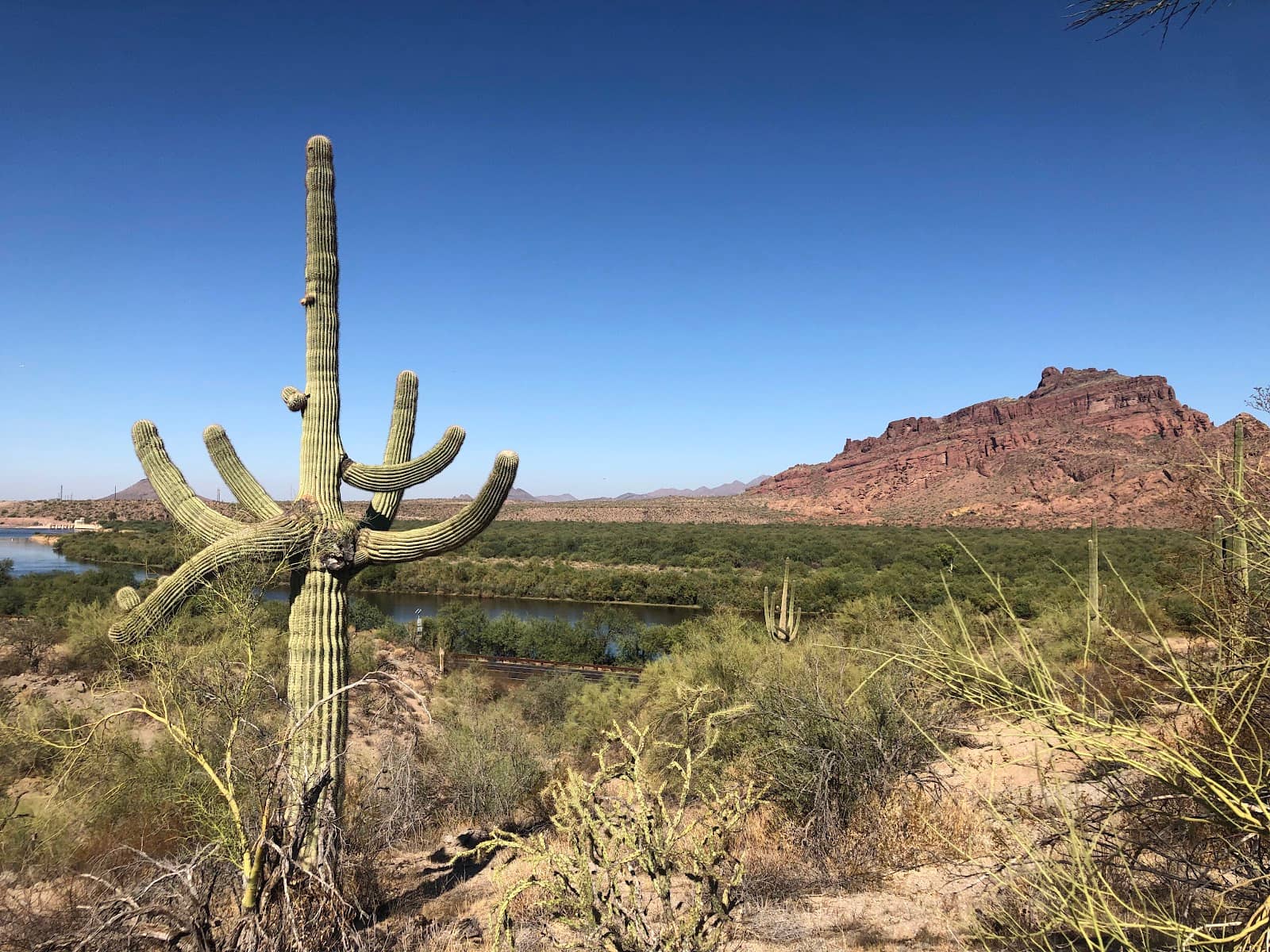
Yes, some access points to the Hawes Trail System are located along the Salt River, offering beautiful riparian views. These spots can be peaceful, especially during the winter months.
🎫 🎫 Tickets & Entry
The Hawes Trail System is located within the Tonto National Forest. While general access to the trails is free, a Tonto National Forest Recreation Pass may be required for parking at certain developed recreation sites. Check the Tonto National Forest website for the most current information on pass requirements.
Generally, there are no direct fees for using the hiking and biking trails themselves. However, if you park in designated recreation areas or trailheads that require a Tonto National Forest Recreation Pass, there will be a fee for parking.
The Hawes Trail System is generally open from sunrise to sunset, as it is an outdoor natural area. However, specific parking areas or access points might have their own posted hours. It's always a good idea to check local advisories before heading out.
While there aren't official guided tours directly managed by the park, local outfitters or biking shops in the Mesa and Phoenix area may offer guided mountain biking tours. It's worth checking with local businesses for such services.
No, there is no specific entrance fee for mountain biking at the Hawes Trail System. The primary cost would be related to parking if you use a designated recreation area requiring a Tonto National Forest Recreation Pass.
🎫 🧭 Onsite Experience
Popular choices for mountain bikers include the Big Sister Trail (intermediate), Mine Trail, and Riverview Trail. The system offers a variety of terrain suitable for different skill levels. +3
Absolutely! Hikers can enjoy the scenic desert landscape and riparian areas. Trails range from easy gravel paths to more challenging routes.
Expect a mix of desert terrain, including gravel paths, sandy sections, and some rocky areas. You'll also find areas with low-hanging branches and twisted stems, so be mindful of your surroundings.
Many trails are well-kept and marked, but the system is extensive. Having a trail app like MTB Project or Trailforks is highly recommended to avoid getting lost, as some areas may have branching paths with limited signage.
Visitors have reported seeing groups of wild horses, which can be an awesome and unique experience. Keep an eye out for other desert wildlife as well.
📸 📸 Photography
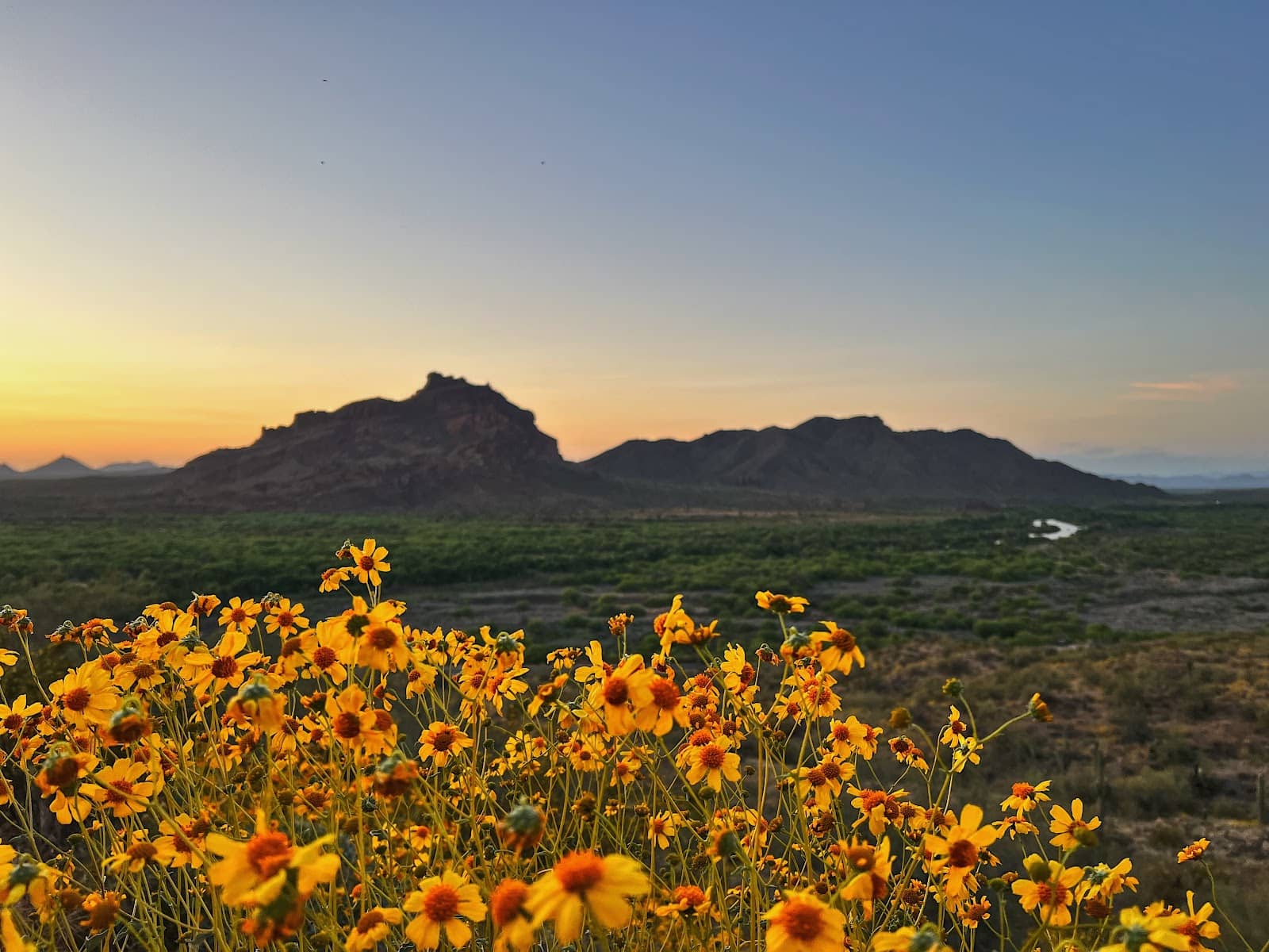
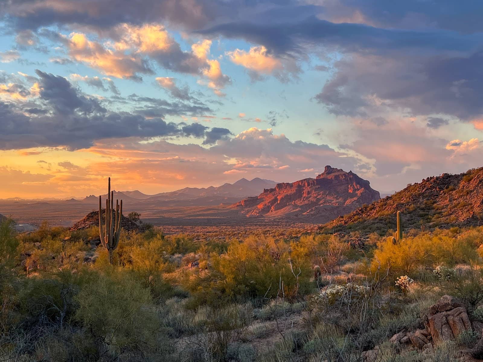
The riparian areas along the Salt River offer beautiful scenery, especially at sunset. The desert landscapes provide unique photographic opportunities, with opportunities to capture the vastness and unique flora.
Yes, sunset is often cited as the best time for photography at Hawes, offering stunning light over the desert and riparian areas. It's a peaceful time to capture the scenery.
Action shots of mountain biking are very popular, capturing the dynamic movement and jumps on the trails. Landscape photography of the desert and river views is also a common subject. +2
The Riverview Trail offers scenic overlooks that are great for photography. Many pull-off spots along the access roads also provide accessible views of the surrounding landscape.
Be mindful of low-hanging branches and twisted stems that could potentially scratch you or your equipment. Also, keep your eyes on the trail while riding or hiking if you're also trying to capture photos.


Social
from TikTok, Instagram & Reddit