Panoramic Highway
A breathtaking scenic drive through Marin County, offering sweeping Pacific Ocean views and access to Mount Tamalpais.
Highlights
Must-see attractions

Social
From TikTok & Reddit
Best Time
Fewer crowds, better parking
Panoramic Highway
Best Time
Fewer crowds, better parking
Highlights
Must-see attractions
A breathtaking scenic drive through Marin County, offering sweeping Pacific Ocean views and access to Mount Tamalpais.
Drive Safely on Winding Roads
Take your time on the curves and use pull-offs to let faster traffic pass. Enjoy the journey! :oncoming_automobile:
Fog Can Be Tricky
Summer fog can roll in quickly, obscuring views. Check forecasts and be prepared for cooler temperatures. ☁️
Quick Facts
Highlights
Discover the most iconic attractions and experiences
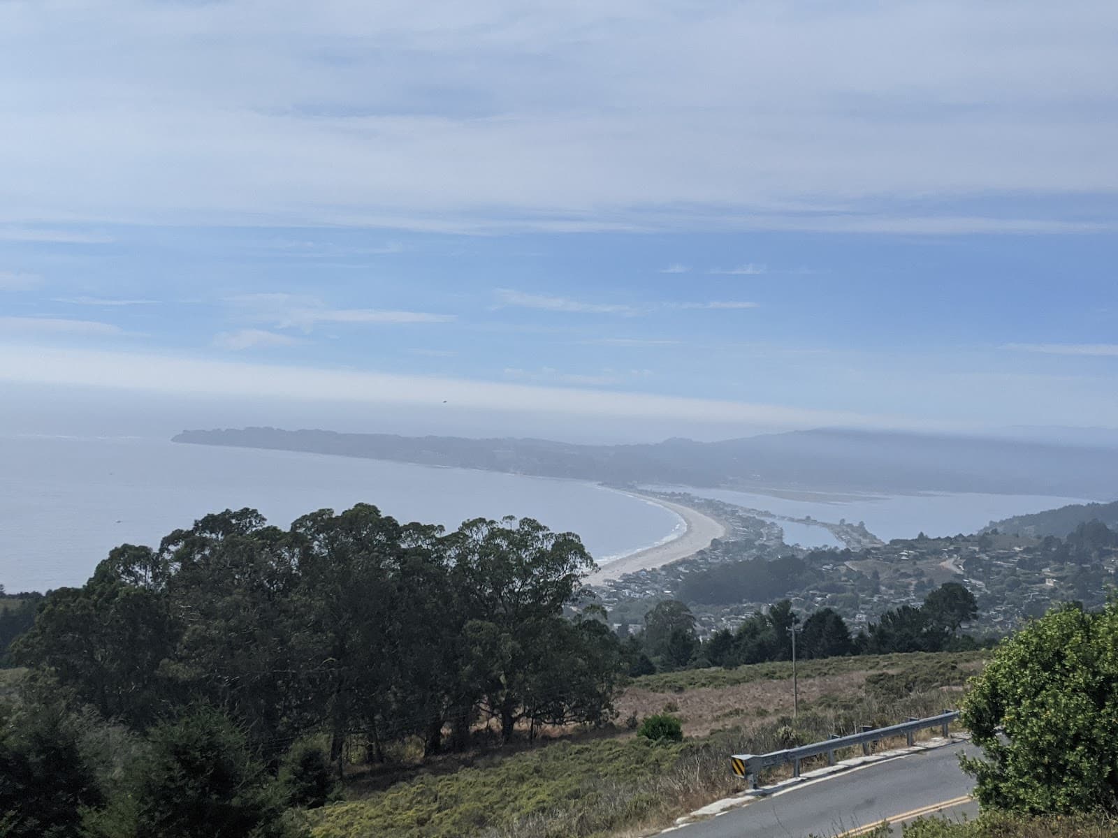
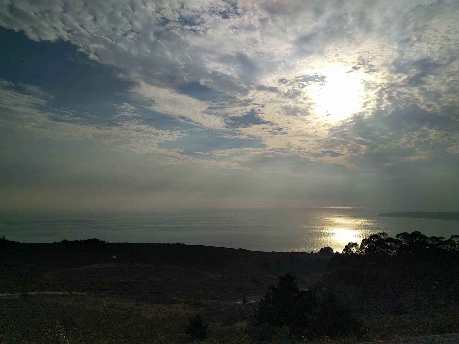
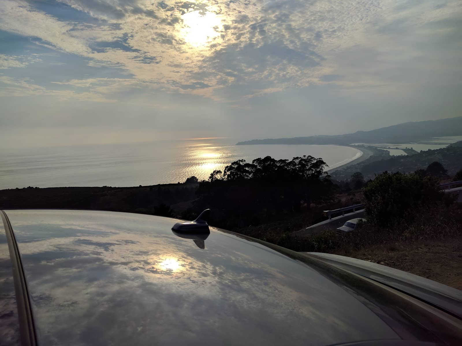
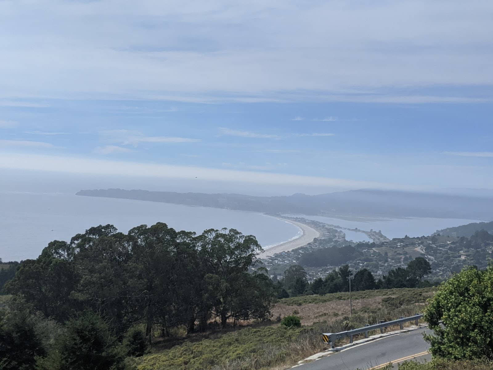
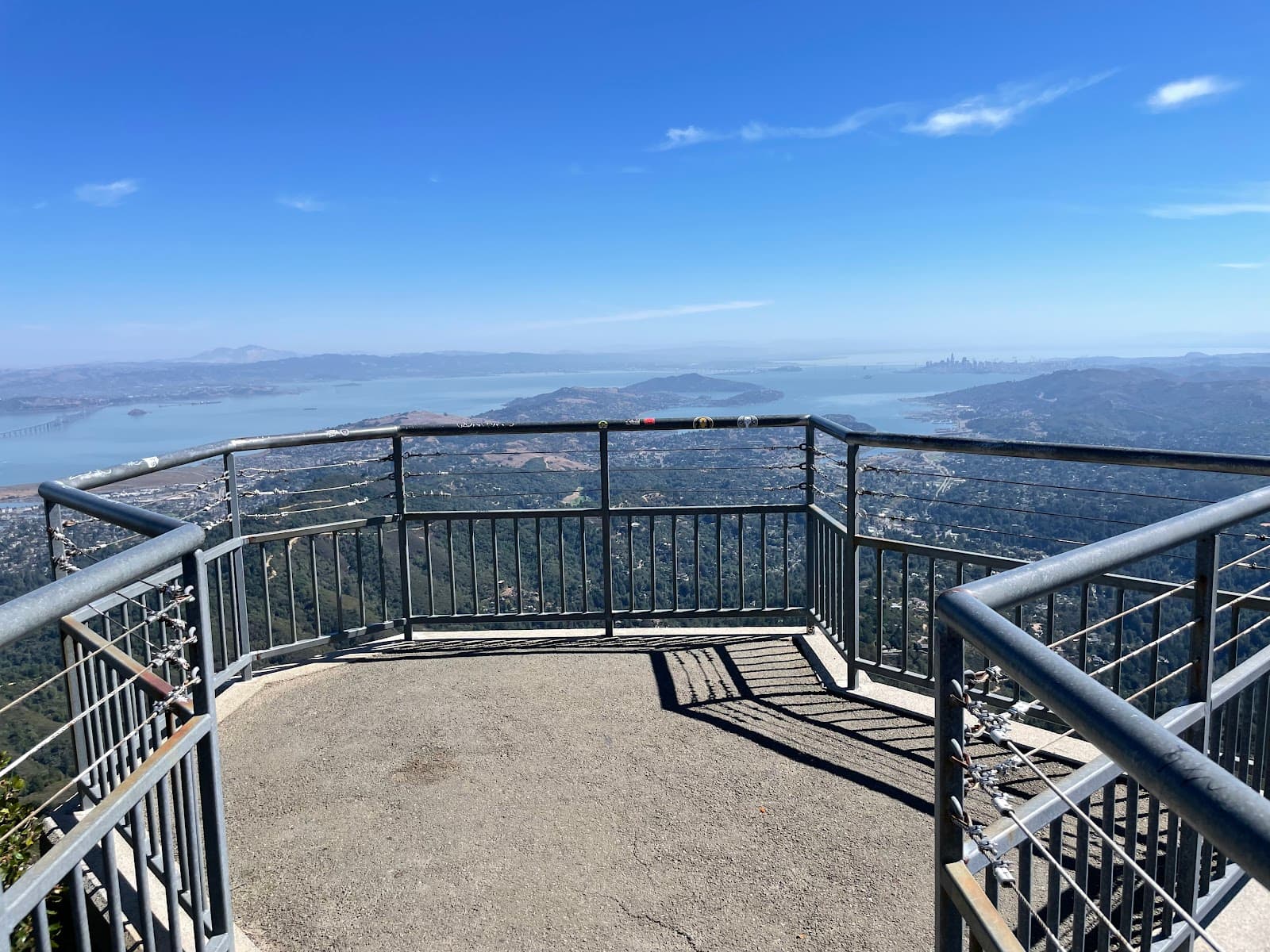
Ocean Vistas
Various pull-offs along the highway
Experience sweeping views of the Pacific Ocean, coastline, and distant San Francisco skyline. A true feast for the eyes!
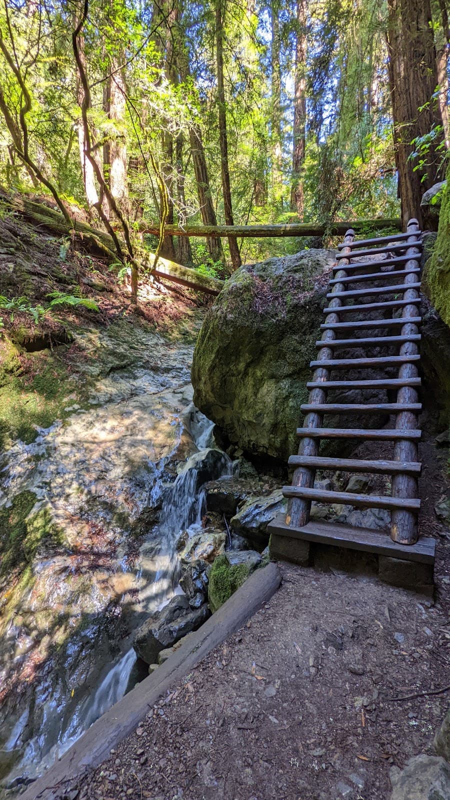
Mount Tamalpais State Park
Access points along the highway
Explore hiking trails, redwood forests, and summit viewpoints offering unparalleled natural beauty and vistas.
Secret Swing
Tucked away off the highway
Discover a hidden swing with an incredible ocean panorama – a unique photo opportunity and a moment of pure bliss.
Fire Lookout
East Peak of Mount Tamalpais
Visit the historic Gardner Fire Lookout for 360-degree views and a glimpse into the area's history.
Plans like a pro.
Thinks like you
Planning Your Visit
Embrace the Scenic Drive
Mount Tamalpais Access
Best Times
Insider Tips
from TikTok, Instagram & Reddit
Drive Safely on Winding Roads
Take your time on the curves and use pull-offs to let faster traffic pass. Enjoy the journey! :oncoming_automobile:
Fog Can Be Tricky
Summer fog can roll in quickly, obscuring views. Check forecasts and be prepared for cooler temperatures. ☁️
Pack Layers
Coastal weather changes rapidly. Bring layers to stay comfortable, even on a sunny day. :wind_chime:
Road Descent is Epic
The road descent down Mount Tamalpais via Pantoll and Panoramic Highway is a must-do for its amazing views. :mountain_railway:
Tips
from all over the internet
Drive Safely on Winding Roads
Take your time on the curves and use pull-offs to let faster traffic pass. Enjoy the journey! :oncoming_automobile:
Fog Can Be Tricky
Summer fog can roll in quickly, obscuring views. Check forecasts and be prepared for cooler temperatures. ☁️
Pack Layers
Coastal weather changes rapidly. Bring layers to stay comfortable, even on a sunny day. :wind_chime:
Road Descent is Epic
The road descent down Mount Tamalpais via Pantoll and Panoramic Highway is a must-do for its amazing views. :mountain_railway:
Find the Secret Swing
Adventure off the beaten path to find a swing with breathtaking Pacific Ocean views. :swing:
What Travellers Say
Reviews Summary
Visitors rave about the breathtaking, panoramic views of the Pacific Ocean and the stunning natural beauty of Mount Tamalpais. The scenic drive itself is a major highlight, with many appreciating the winding roads and opportunities for exploration. Some find the fog can obscure views, and parking can be challenging during peak times.
What People Like
What People Dislike
Frequently Asked Questions
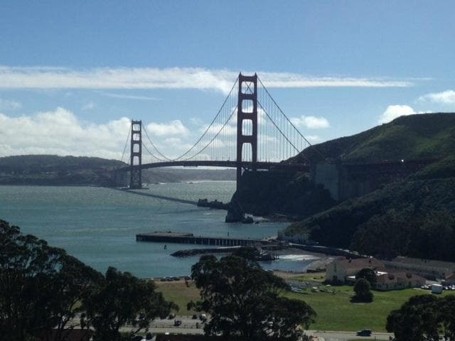
🚇 🗺️ Getting There
The Panoramic Highway is easily accessible from San Francisco by crossing the Golden Gate Bridge and heading north on Highway 1. It's a scenic drive that leads you towards Mount Tamalpais State Park. Many visitors start their journey from Mill Valley.
No, the Panoramic Highway is a two-way road. However, it is quite winding and can be narrow in places, so drive with caution and be mindful of other vehicles.
Public transport options are limited for directly accessing the Panoramic Highway and its viewpoints. It's best explored by car. Some bus routes may get you close to Mill Valley, from where you might consider ride-sharing or a taxi.
Many visitors begin their drive from Mill Valley, which offers access to Mount Tamalpais. Alternatively, you can approach it from Highway 1 along the Marin Headlands. +1
The road is winding and can be steep in sections, requiring attentive driving. However, it's generally manageable for most drivers. Take your time and enjoy the views.
🎫 🎫 Tickets & Entry
No, there is no specific ticket required to drive the Panoramic Highway itself. However, if you plan to enter Mount Tamalpais State Park or use its facilities, a day-use parking fee may apply.
Mount Tamalpais State Park is generally open from sunrise to sunset. Specific facilities like campgrounds or visitor centers may have different hours. It's always best to check the official park website for the most up-to-date information.
While the highway itself is free to drive, parking at popular viewpoints within Mount Tamalpais State Park may incur a fee. This fee typically covers access to the park's amenities and trails.
Access to the East Peak Fire Lookout is generally included with your park entry fee. There isn't a separate charge to visit the lookout itself, but you'll need to pay for parking if you drive into the park.
Parking cannot typically be booked in advance for Mount Tamalpais State Park. It operates on a first-come, first-served basis, so arriving early is recommended, especially on busy days.
📸 📸 Photography
Look for designated pull-offs that offer unobstructed views of the Pacific Ocean and the coastline. The 'secret swing' and the East Peak Fire Lookout are also prime photography locations. +2
Sunrise and sunset offer the most dramatic lighting for photos, casting a warm glow over the landscape. Midday can be bright, but often above the fog, offering clear views.
A wide-angle lens is great for capturing the expansive vistas. A telephoto lens can be useful for zooming in on distant landmarks or wildlife. Don't forget a sturdy tripod for low-light conditions. :camerawithflash:
Yes, travelers often highlight the 'secret swing' for its unique perspective and the Pan Toll road itself, which is incredibly photogenic from viewpoints like Trojan Point. +1
Drone usage is often restricted in state parks and national parks. Always check the specific regulations for Mount Tamalpais State Park before flying a drone to avoid fines. :drone:
🎫 🌲 Nature & Hiking
You'll encounter diverse landscapes, from coastal scrub and grasslands to majestic redwood forests. Keep an eye out for various bird species and marine life if you visit coastal overlooks.
Absolutely! Mount Tamalpais State Park offers numerous hiking trails for all skill levels, ranging from easy strolls through redwoods to more challenging summit climbs.
Popular trails include the Matt Davis Trail, Steep Ravine Trail, and various paths leading to the summit of Mount Tamalpais. The Dipsea Trail is also nearby and famous for its challenging terrain.
While many trails are well-trafficked, it's always wise to hike with a companion or let someone know your hiking plans. Be aware of your surroundings and trail conditions.
Bring plenty of water, snacks, a map, sunscreen, and wear sturdy hiking shoes. Layers are essential due to changing weather conditions. :hiking_boot:


Social
from TikTok, Instagram & Reddit