
Katahdin Loop Road
A scenic dirt road loop offering views of Katahdin mountain and Maine's natural beauty, best explored with a prepared vehicle.
Highlights
Must-see attractions

Social
From TikTok & Reddit
Best Time
Smoothest driving conditions
Katahdin Loop Road
Best Time
Smoothest driving conditions
Highlights
Must-see attractions
A scenic dirt road loop offering views of Katahdin mountain and Maine's natural beauty, best explored with a prepared vehicle.
"The Katahdin Loop Road offers beautiful views but requires a sturdy vehicle and offline maps due to rough terrain and no cell service."
🚗 Vehicle Preparedness
Bring a vehicle with good clearance; 4WD recommended. Avoid RVs due to narrow, overgrown sections. 🚗
🗺️ Download Offline Maps
Cell service is unreliable. Download maps and trail info beforehand. :iphone:

Quick Facts
Rating
2.9 · 22 reviews
Highlights
Discover the most iconic attractions and experiences
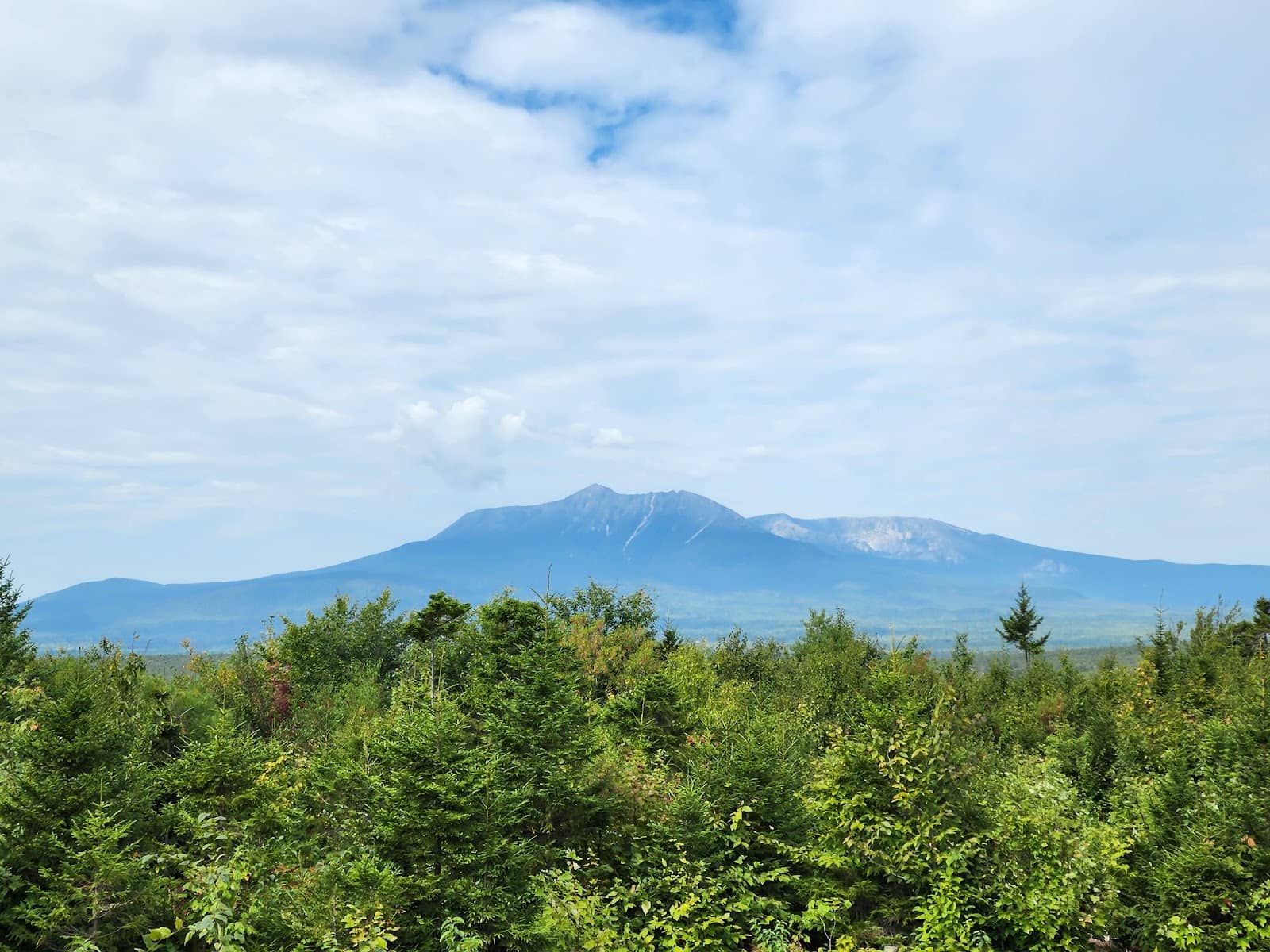
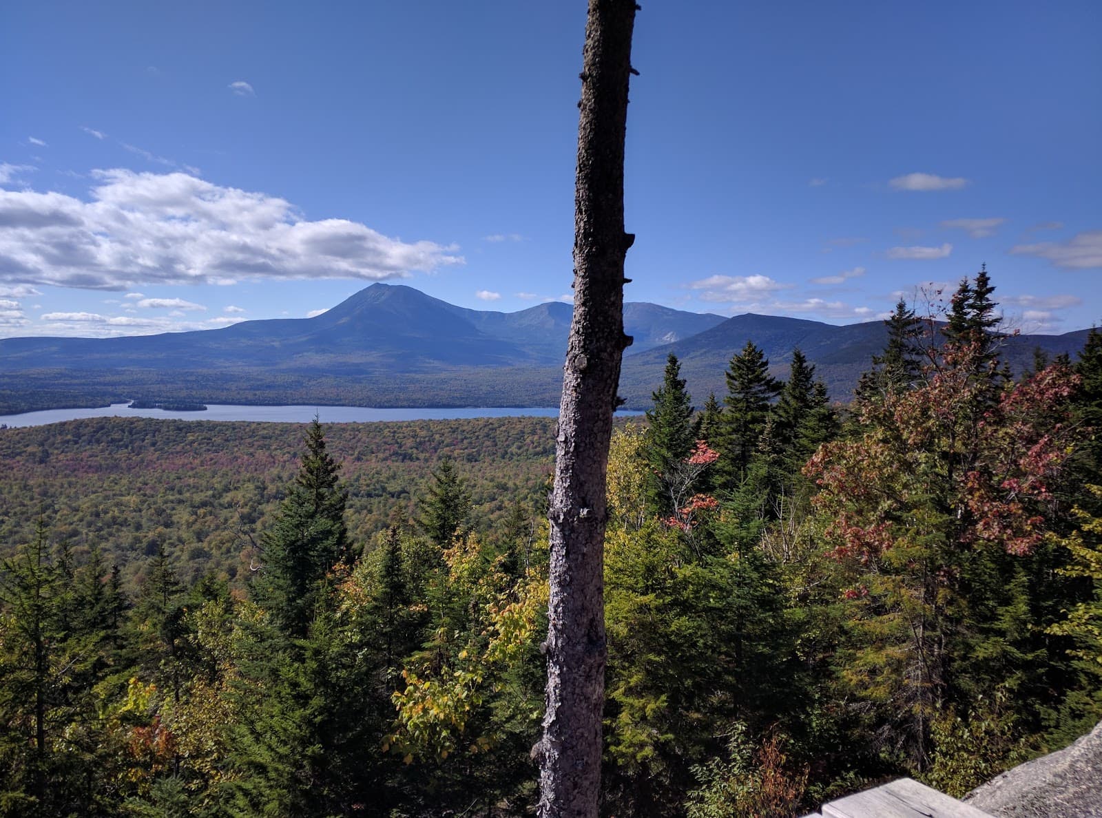
Katahdin Mountain Views
Various pull-offs along the loop
Catch breathtaking glimpses of Katahdin mountain from designated viewpoints. The best views are often found early in the loop when traveling clockwise.
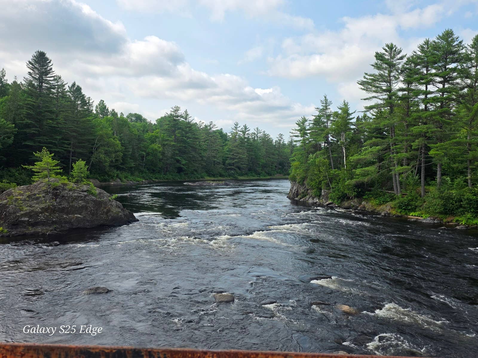
Maine Ponds & Rivers
Along the loop road
Discover serene Maine ponds and the beautiful river via a bridge, offering peaceful scenery and photo opportunities.
Wildlife Spotting
Trails and roadsides
Keep an eye out for moose poop and other signs of wildlife. While sightings aren't guaranteed, the natural environment is rich with possibilities.
Plans like a pro.
Thinks like you
Planning Your Visit
Road Conditions & Vehicle Choice
Navigation & Connectivity
Best Times
Insider Tips
from TikTok, Instagram & Reddit
🚗 Vehicle Preparedness
Bring a vehicle with good clearance; 4WD recommended. Avoid RVs due to narrow, overgrown sections. 🚗
🗺️ Download Offline Maps
Cell service is unreliable. Download maps and trail info beforehand. :iphone:
🥾 Trail Markers
Walking trails may lack mileage markers; be prepared for unknown hike lengths. :hiking_boot:
📸 Clockwise for Views
Travel clockwise for the best initial views of Katahdin. :camerawithflash:
How Accessible are the logging roads into the 100 Mile Wilderness?
Planning to do a section-hike from Katahdin to Monson with a potential resupply from my SO in the middle(ish) of the 100 Mile Wilderness. Was wondering how negotiable the roads were. Can your average sedan make it with minimal issues or would you recommend a more rugged…
Tips
from all over the internet
🚗 Vehicle Preparedness
Bring a vehicle with good clearance; 4WD recommended. Avoid RVs due to narrow, overgrown sections. 🚗
🗺️ Download Offline Maps
Cell service is unreliable. Download maps and trail info beforehand. :iphone:
🥾 Trail Markers
Walking trails may lack mileage markers; be prepared for unknown hike lengths. :hiking_boot:
📸 Clockwise for Views
Travel clockwise for the best initial views of Katahdin. :camerawithflash:
🚫 No Pets in Baxter
Unlike Baxter State Park, pets are allowed on the Katahdin Loop Road. 🐕
What Travellers Say
Reviews Summary
The Katahdin Loop Road offers beautiful mountain and pond views, especially when traveling clockwise. However, visitors frequently mention the rough road conditions, lack of cell service, and poorly marked trails as significant drawbacks. While free and pet-friendly, it requires a well-prepared vehicle and offline navigation.
"Drove off 11 to swamp bark rd . Got to contact station. Very nice structure. Asked ranger how to get to mt. Katadin loop rd. She told me. I asked how long. She said 30 min to loop. Then 1 hour around. We did exactly that. Seen the river via the bridge. That was beautiful. But kept going, unfortunately. Saw a 4 reservable campground. Cool. From the car, just lots of potholes, major rocks, washout. Ranger could have recommended something for us. Provided no map. Was extremely disappointed in this loop road.all pictures are before loop road."
Penny (Hello Kitty)
"Great views at the first 2 stops if you go clockwise. The reat of the loop not worth the time IMO. The road is rough in some spots. We had a Subaru which was fine. You don't need 4 wheel drive if it's dry but if you have a low clearance vehicle forget about it. Also don't recommend RV because it's very narrow and overgrown in spots."
Edward Rosenberg
"Lots to see and was super beautiful. Absolutely worth it! The walking trails from the loop road could use mileage markers because we wanted to continue hiking them but couldn’t determine how much longer they’d go! Internet service wasn’t that great so we couldn’t use the All Trails app 😓 but we did find moose poop on the trail! 🫎"
Breunisje Kass-McGrady
What People Like
What People Dislike
Frequently Asked Questions
🚇 🗺️ Getting There
The Katahdin Loop Road is accessed off Route 11. From Route 11, you'll turn onto Swamp Bark Road and proceed to the contact station. Rangers can provide directions to the loop itself.
No, the Katahdin Loop Road is a dirt and gravel logging road. Be prepared for rough terrain with potholes and rocks.
A vehicle with good ground clearance is essential. While a Subaru can manage when dry, a 4WD is recommended for better handling of rough patches. Low-clearance vehicles and RVs are not advised.
The Katahdin Loop Road is generally free to access, unlike nearby Baxter State Park which has an entrance fee.
Stacyville is a public road that can lead to Spring Brook, and from there, many dirt roads are accessible. However, be aware that most of these are private logging roads and are patrolled.
🎫 🎫 Tickets & Entry
No, there are no tickets required for entry to the Katahdin Loop Road. It is a free-access scenic drive.
The Katahdin Loop Road is an open scenic drive and does not have set operating hours. However, it's best to visit during daylight hours for safety and visibility.
Yes, there is a contact station located off Swamp Bark Road where you can speak with a ranger for information and directions.
Yes, pets are allowed on the Katahdin Loop Road, which is a difference from Baxter State Park.
Yes, motorcycles are permitted on the Katahdin Loop Road. Dual-sport bikes are particularly well-suited for the terrain.
🎫 🏞️ Onsite Experience
The loop offers views of Katahdin mountain, Maine ponds, and a river. There are also pull-offs and walking trails to explore.
Unfortunately, the walking trails along the loop can be poorly marked with scarce mileage markers, making it difficult to gauge hike lengths.
The loop road is a rough dirt road with significant potholes, rocks, and overgrown sections. It can be challenging for low-clearance vehicles.
No, cell service is very limited to non-existent along the Katahdin Loop Road, so be prepared to be offline.
Yes, there are reservable campgrounds located along the loop road for those wishing to stay overnight.
📸 📸 Photography
The initial stops when traveling clockwise offer the best views of Katahdin mountain. The ponds and river also provide scenic photo opportunities.
Early morning often provides the best light for landscape photography, minimizing harsh shadows and capturing the serene beauty of the area.
While wildlife sightings are not guaranteed, you might find signs of animals like moose. Always maintain a safe distance and respect their habitat.
Yes, there are several pull-offs that offer good vantage points for photographing Katahdin mountain, especially in the early part of the loop.
Given the rough roads, ensure your gear is protected. A wide-angle lens is great for landscapes, and a telephoto lens can be useful if you spot wildlife.



Social
from TikTok, Instagram & Reddit