Katy Trail State Park St. Charles
America's longest rail-trail, offering 247 miles of scenic beauty for biking, walking, and exploring Missouri's heartland.
Highlights
Must-see attractions

Social
From TikTok & Reddit
Best Time
Pleasant temps, fewer crowds
Katy Trail State Park St. Charles
Best Time
Pleasant temps, fewer crowds
Highlights
Must-see attractions
America's longest rail-trail, offering 247 miles of scenic beauty for biking, walking, and exploring Missouri's heartland.
Bike Rentals Available
Many towns along the trail offer bike rentals, making it easy to explore. 🚲
Pack Plenty of Water
Stay hydrated! Water stops can be sparse, so carry more than you think you'll need. :water_wave:
Quick Facts
Highlights
Discover the most iconic attractions and experiences
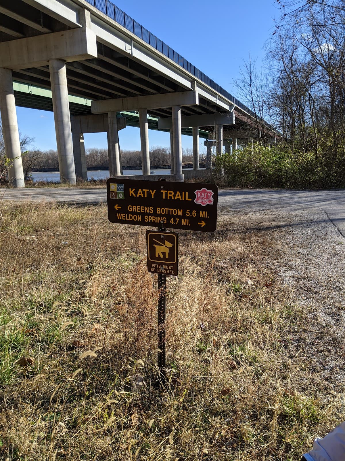
Historic Katy Trail
St. Charles to Clinton
America's longest rail-trail, offering 247 miles of scenic beauty for biking and hiking.
St. Charles Trailhead
St. Charles
A popular starting point with convenient access to the eastern end of the trail.

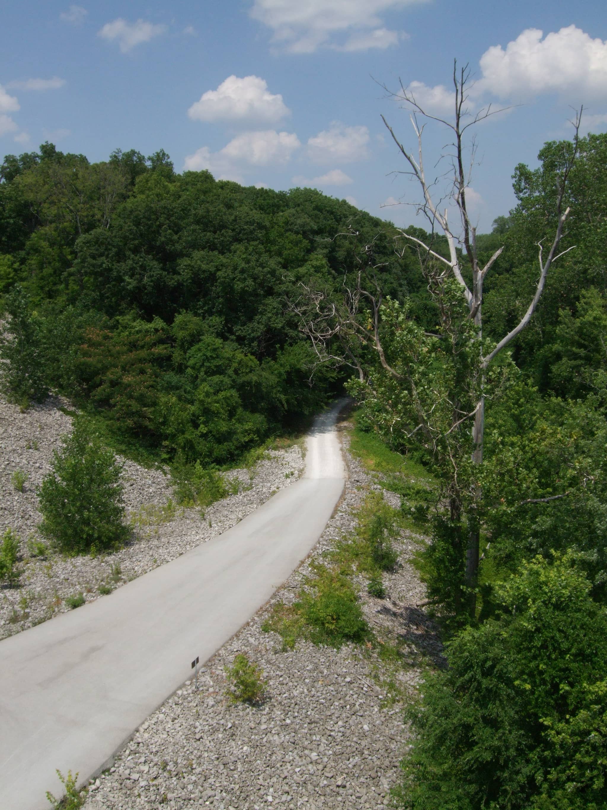
Fall Foliage Views
Throughout the trail
Experience breathtaking autumn colors as the trail winds through picturesque landscapes.
Plans like a pro.
Thinks like you
Planning Your Visit
Trail Etiquette & Safety
Parking Pointers
Best Times
Insider Tips
from TikTok, Instagram & Reddit
Bike Rentals Available
Many towns along the trail offer bike rentals, making it easy to explore. 🚲
Pack Plenty of Water
Stay hydrated! Water stops can be sparse, so carry more than you think you'll need. :water_wave:
Check Trail Conditions
Before you go, check for any closures or maintenance. :construction_worker:
Download Offline Maps
Cell service can be spotty. Have offline maps ready on your phone. :iphone:
Tips
from all over the internet
Bike Rentals Available
Many towns along the trail offer bike rentals, making it easy to explore. 🚲
Pack Plenty of Water
Stay hydrated! Water stops can be sparse, so carry more than you think you'll need. :water_wave:
Check Trail Conditions
Before you go, check for any closures or maintenance. :construction_worker:
Download Offline Maps
Cell service can be spotty. Have offline maps ready on your phone. :iphone:
What Travellers Say
Reviews Summary
Visitors rave about the Katy Trail's extensive length and scenic beauty, making it a top choice for biking and walking. The well-maintained limestone path and the charming towns along the route are frequently praised. However, some find parking at popular trailheads challenging, and occasional reports of trail hazards or safety concerns near urban areas warrant awareness.
What People Like
What People Dislike
Frequently Asked Questions
🚇 🗺️ Getting There
The Katy Trail State Park in St. Charles is accessible via major highways. The St. Charles North Trailhead is a popular entry point. If driving, research specific trailhead parking options as they can vary.
Public transportation options directly to trailheads can be limited. It's often best to drive or arrange a ride-share to your chosen starting point.
From St. Louis, you can drive west towards St. Charles. The Katy Trail State Park St. Charles North Trailhead is a convenient option for those coming from the city.
Yes, there are several access points. The St. Charles North Trailhead is a primary one, but exploring maps will reveal other smaller access points along the route.
Absolutely! Many people bike the entire 220-mile stretch. Planning for about 8 days is common for this multi-day adventure.
🎫 🎫 Tickets & Entry
No, entry to Katy Trail State Park is free. It's a public park, so no tickets or passes are required to access the trail itself.
The park is open year-round from sunrise to sunset. However, facilities like restrooms may have more limited hours.
There is no admission fee to use the Katy Trail. It's a state park designed for public enjoyment.
The Katy Trail is a public trail and does not require reservations for general use. You can access it anytime during park hours.
For organized events or large gatherings, you may need to contact the Missouri State Parks department to inquire about permits.
🎫 🚶 Onsite Experience
The Katy Trail is perfect for biking, running, walking, and horseback riding. It's a versatile trail for various outdoor activities.
The Katy Trail is primarily a crushed limestone surface, making it ideal for hybrid bikes, mountain bikes, and comfortable for walking.
Restrooms and water fountains are available at various trailheads and designated rest stops, but they are not continuous. Plan accordingly.
You might spot deer, various bird species, and other small mammals. It's a great place for nature observation.
While generally safe, it's always wise to be aware of your surroundings, especially in less populated areas or at dusk. Let someone know your plans.
🍽️ 🍽️ Food & Dining
Yes, the St. Charles area offers numerous dining options, from casual cafes to restaurants, many within easy reach of the trailheads.
Absolutely! Packing a picnic is a great way to enjoy the trail. Remember to pack out all your trash.
While not directly on the trail, many towns along its path have restaurants and cafes that are easily accessible from trail access points.
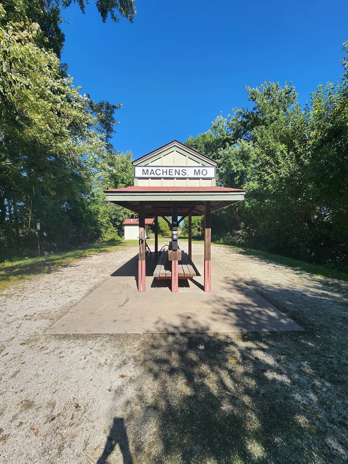
Many bikers stop in towns like Rocheport or Hermann for a meal. Research towns along your route for specific recommendations.
Alcohol consumption is permitted on the Katy Trail, but it's important to do so responsibly and in moderation.
📸 📸 Photography
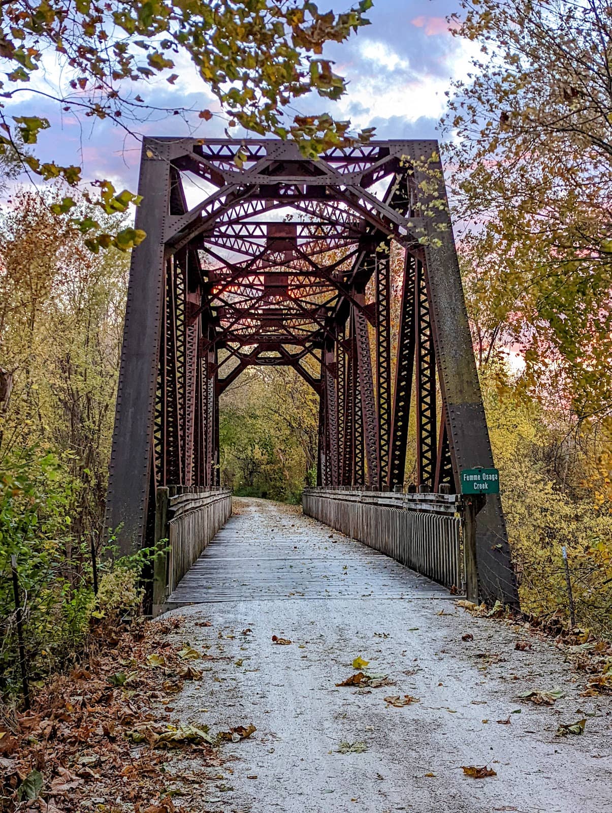
Look for scenic overlooks, bridges, and areas with vibrant foliage. The changing seasons offer unique photographic opportunities.
It can be challenging while actively biking. Consider stopping at scenic points or using a handlebar mount for your camera or phone.
Early morning and late afternoon offer the best light for photography, creating beautiful shadows and golden hues.
The historic bridges, the rolling Missouri landscape, and the charming small towns along the trail all make for memorable photos.
Drone usage is subject to Missouri State Parks regulations. It's best to check with the park authorities for current rules and restrictions.


Social
from TikTok, Instagram & Reddit