
Red Grade Trails
Red Grade Trails offer premier mountain biking and hiking with well-maintained, flowing singletrack and stunning Wyoming vistas.
Highlights
Must-see attractions

Social
From TikTok & Reddit
Best Time
Cooler temps, fewer crowds
Red Grade Trails
Best Time
Cooler temps, fewer crowds
Highlights
Must-see attractions
Red Grade Trails offer premier mountain biking and hiking with well-maintained, flowing singletrack and stunning Wyoming vistas.
"By far the best trail system in the area. Well maintained and many options from easy to advanced."

Pack for All Conditions
Weather can change quickly. Bring layers, rain gear, and sun protection. :sunbehindcloud:
Download Trail Maps
Cell service can be spotty. Download offline maps before you go. :iphone:
Quick Facts
Highlights
Discover the most iconic attractions and experiences
Flowing Singletrack
Various trails
Experience meticulously designed trails that offer a smooth, exhilarating ride with natural flow.
Scenic Overlooks
Higher elevation trails
Enjoy breathtaking panoramic views of the surrounding Wyoming landscape from well-placed vantage points.

Challenging Descents
Advanced trails
Test your skills on steep, technical downhill sections with exciting hairpin turns.
Plans like a pro.
Thinks like you
Planning Your Visit
Trail Etiquette & Safety
Best Trails for Your Level
Best Times
Insider Tips
from TikTok, Instagram & Reddit
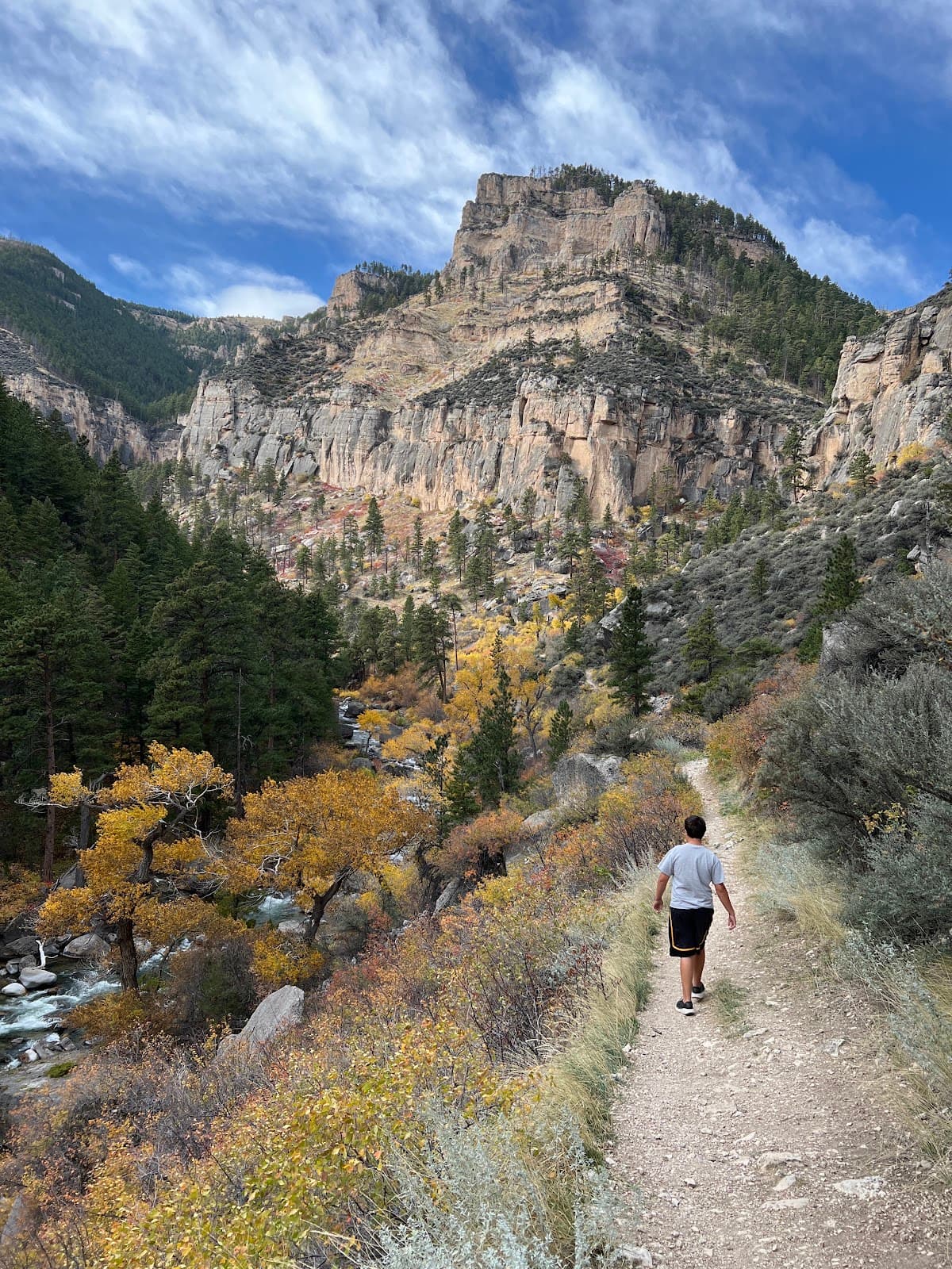
Bighorn National Forest advice
Hi guys! Soon I'll be in the US for my second time and at some point on the trip we'll be driving from the Yellowstone area to the Black Hills in South Dakota. We will probably spend the night in Cody after our last day in Yellowstone and then make our way east. I would like to…
Pack for All Conditions
Weather can change quickly. Bring layers, rain gear, and sun protection. :sunbehindcloud:
Download Trail Maps
Cell service can be spotty. Download offline maps before you go. :iphone:
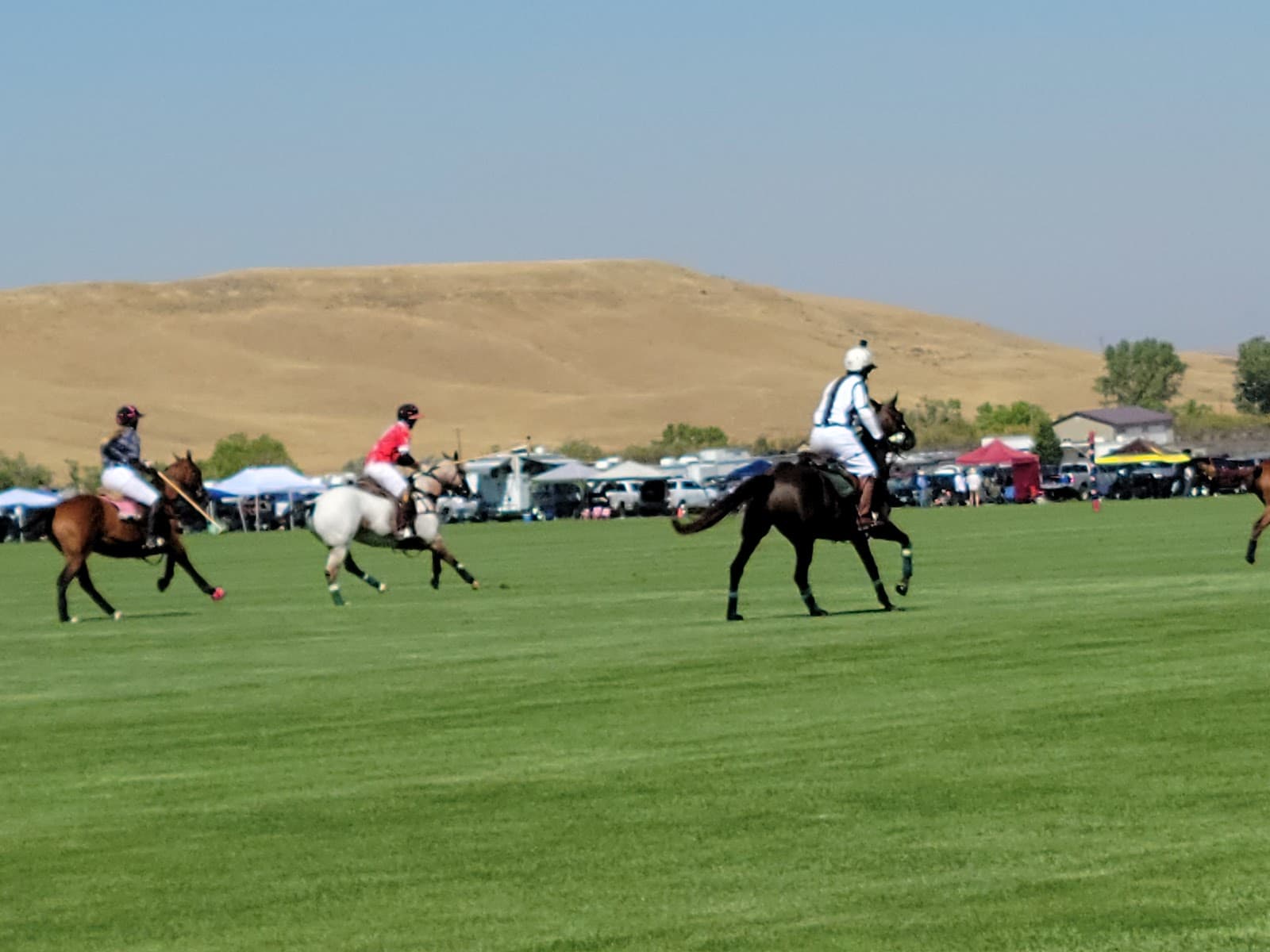
Recommendations Needed - Avoiding the crowds in Wyoming / Montana in late July
I'll be traveling to SLC for work the third week of July and then taking some much-needed vacation for the next ten days to explore. I've never been to Wyoming or Montana, so looking for suggestions. Here is my rough itinerary, all of which can be adjusted. * **Thursday -…
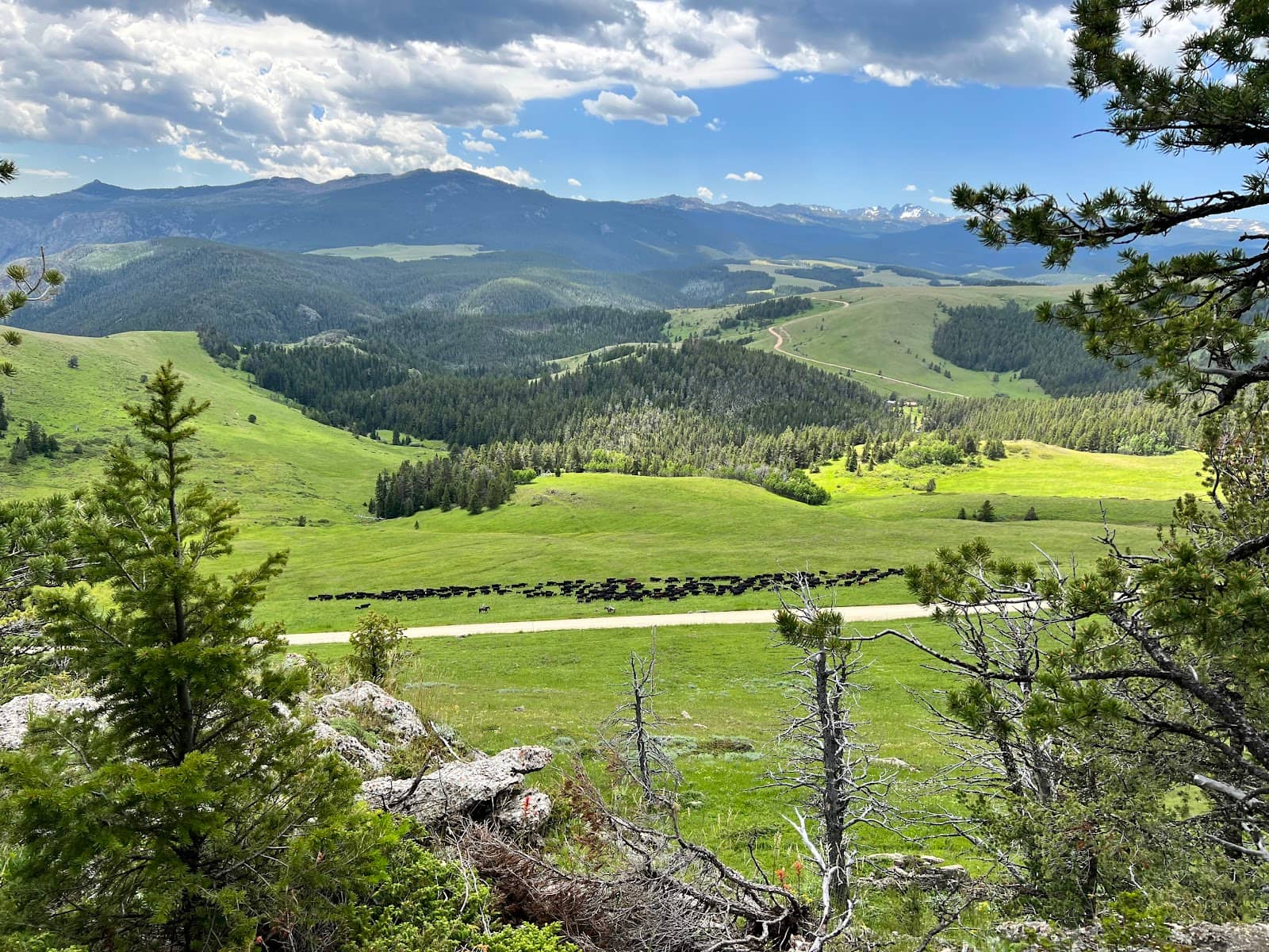
Sometimes the mountains seem to smile back (Big Horns 7/21)
Big Horn National Park next to Sheridan WY up “red grade” I had almost forgotten about this picture because it ended up being a crazy kind of week this was on the first day after we set up a home base and went to one of the reservoirs, I spotted it off in the distance, pointed…
Respect Trail Markings
Follow signs for trail difficulty and direction to ensure a safe and enjoyable experience. 🧭
Bring Plenty of Water
Stay hydrated, especially on longer hikes or rides. Water sources are limited. :droplet:
fly fishing near Wolf
Hi Wyomings, Anyone live near Wolf? Sheridan? Ranchester? Are there any good fly fishing spots near there? I see a Wolf Creek and Red Canyon creek on the map and saw the Tongue in your fishing regs. Might be operating out of Eaton Ranch as a base. What else is there to do in…
Tips
from all over the internet
Pack for All Conditions
Weather can change quickly. Bring layers, rain gear, and sun protection. :sunbehindcloud:
Download Trail Maps
Cell service can be spotty. Download offline maps before you go. :iphone:
Respect Trail Markings
Follow signs for trail difficulty and direction to ensure a safe and enjoyable experience. 🧭
Bring Plenty of Water
Stay hydrated, especially on longer hikes or rides. Water sources are limited. :droplet:
Check for Local Events
Sometimes organized rides or hikes happen, which can be fun but also increase crowds. 📅
What Travellers Say
Reviews Summary
Visitors consistently praise Red Grade Trails for their exceptional mountain biking and hiking opportunities, highlighting the well-maintained, flowing singletrack and scenic views. The variety of trails caters to all skill levels, making it a top destination for outdoor enthusiasts in the region. Some minor challenges include potential for rougher road access and the need for preparedness regarding weather and water.
"Love the trails in this area! Probably the best mtn bike trails in the state. They have parking lots and even porta potties. Trails are fun and are well thought through. love how they flow and love the views."
B Mad
"I love the red grade trails! We are so lucky to have such great hiking and walking paths around the Sheridan area."
Denelle Campbell
"Both easy and difficult hikes available. Very nicely maintained and well placed signs along the trails"
Matt King
What People Like
What People Dislike
Frequently Asked Questions
🚇 🗺️ Getting There
Red Grade Trails are located southwest of Sheridan. The most common access point is via the Forest Service Road 340, which is typically well-maintained but can be rough in places. Always check local road conditions before you go. Many visitors use GPS or navigation apps to find the trailhead parking areas.
Yes, there are designated parking lots available at the main trailheads, which often include porta-potties. These can fill up on busy weekends, so arriving early is recommended.
Most of the main access roads are suitable for regular passenger cars, especially during drier months. However, some sections can be gravel or dirt and may become challenging after rain or snow. An SUV or vehicle with higher clearance is beneficial but not always strictly necessary for the primary access points.
Public transportation options are very limited in this rural area. It is highly recommended to have your own vehicle for convenient access to Red Grade Trails.
While Red Grade Trails are popular, they are less crowded than some national park destinations. Arriving on weekdays or early on weekend mornings is the best strategy to avoid peak crowds. The main access routes are generally the same for most visitors.
🎫 🎫 Tickets & Entry
No, Red Grade Trails are part of the Bighorn National Forest and are generally free to access. There are no entrance fees or tickets required to use the trails.
Typically, no special permits are required for day use for hiking or mountain biking. However, if you plan on camping or engaging in activities that require a permit in the Bighorn National Forest, you should check with the Forest Service.
Red Grade Trails are open year-round, dawn to dusk. Access may be limited during winter months due to snow.
No, there is no reservation system for accessing the trails or parking areas at Red Grade Trails. It operates on a first-come, first-served basis.
While the trails themselves are free, some parking areas may have optional donation boxes to help with trail maintenance. Porta-potties are usually available and maintained by local efforts.
🎫 🏞️ Onsite Experience
For beginners, look for trails marked as 'easy' or 'moderate' on trail maps. Many of the lower-elevation trails offer gentler grades and less technical terrain, providing a pleasant hiking experience with beautiful views.
Red Grade is renowned for its flowing singletrack. Trails like 'Dynamite' and others in the system are frequently praised for their well-maintained condition and fun, undulating paths that are great for mountain biking.
Absolutely. Experienced riders and hikers will find challenging routes with steep climbs, technical descents, and hairpin turns. Some reviews mention 'hairpin that were fairly nasty' but also the thrill of 'SEND IT' downhill.
You can expect a mix of forested areas offering shade, open meadows, and scenic overlooks with panoramic views of the surrounding Wyoming landscape. The 'red' in the name hints at the unique geological features you might encounter.
Yes, there are easier, well-maintained paths suitable for families with young children. Stick to the less technical trails and be mindful of the terrain and any potential wildlife.
🍽️ 🍽️ Food & Dining
No, Red Grade Trails is a natural area and does not have any on-site restaurants or cafes. You'll need to bring your own food and drinks.
The nearest dining options are in the town of Sheridan, Wyoming. Sheridan offers a variety of restaurants, from casual diners to more upscale establishments. It's recommended to pack a picnic to enjoy amidst the trails.
Yes, picnicking is a popular activity at Red Grade Trails. Many visitors pack lunches and enjoy them at scenic spots along the trails or at designated parking areas. Remember to pack out all trash.
The closest grocery stores for picnic supplies will be in Sheridan, Wyoming. Plan your shopping trip before heading out to the trails.
Easy-to-carry, non-perishable items are best. Sandwiches, trail mix, fruit, and plenty of water are ideal for a day of hiking or biking.
📸 📸 Photography
Look for scenic overlooks that offer panoramic views of the landscape. The varied terrain, including forested areas and open meadows, also provides excellent opportunities for capturing the beauty of the trails.
The 'golden hours' – shortly after sunrise and before sunset – often provide the most dramatic and beautiful lighting for landscape photography. Midday can be harsh, but offers good light for capturing trail details.
Keep an eye out for unique rock formations, the vibrant colors of the foliage (especially in autumn), and the dynamic action shots if you're photographing mountain bikers or hikers. Wildlife sightings can also be a photographic bonus.
A versatile lens, like a wide-angle for landscapes and a mid-range zoom for general shots, is recommended. A polarizing filter can help manage glare and enhance colors. If you're serious about wildlife, a telephoto lens might be useful.
Drone usage is subject to Bighorn National Forest regulations. It's essential to check the latest rules and restrictions with the Forest Service before flying a drone in the area.


Social
from TikTok, Instagram & Reddit