
Tahoe Rim Trail
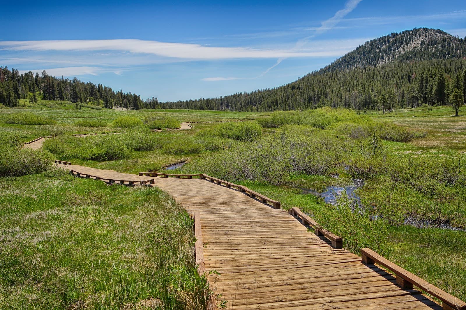
A 165-mile loop trail encircling Lake Tahoe, offering diverse landscapes and breathtaking views across California and Nevada.
Highlights
Must-see attractions

Social
From TikTok & Reddit
Best Time
Best weather, snow-free trails
Tahoe Rim Trail
Best Time
Best weather, snow-free trails
Highlights
Must-see attractions
A 165-mile loop trail encircling Lake Tahoe, offering diverse landscapes and breathtaking views across California and Nevada.

Pack for All Weather
Mountain weather changes rapidly. Pack layers, rain gear, and sun protection. ☁️
Water Sources & Filtration
Carry plenty of water and a reliable filter or purification method. Water sources can be scarce in some sections. :droplet:

Quick Facts
Highlights
Discover the most iconic attractions and experiences
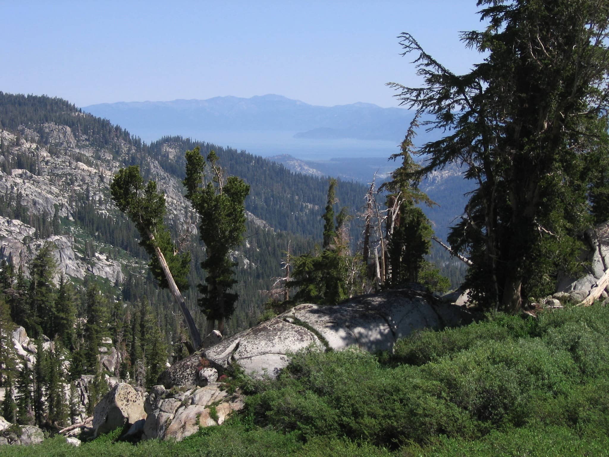
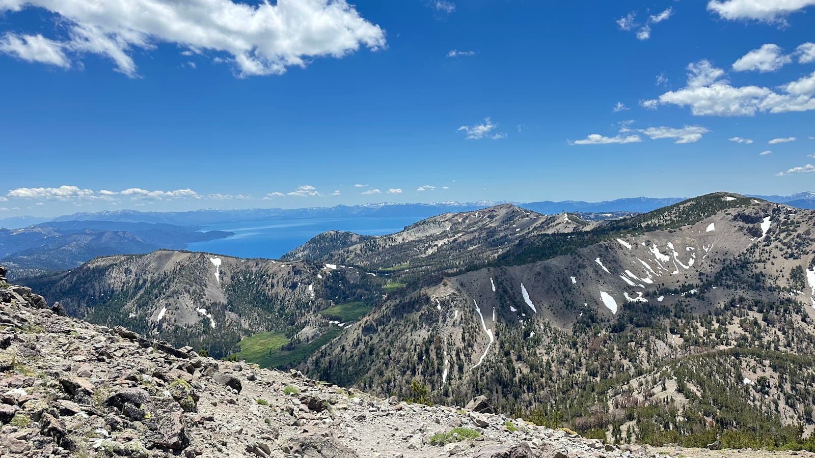
Lake Tahoe Views
Various points along the trail
Experience breathtaking, panoramic views of the crystal-clear Lake Tahoe from high mountain vantage points.

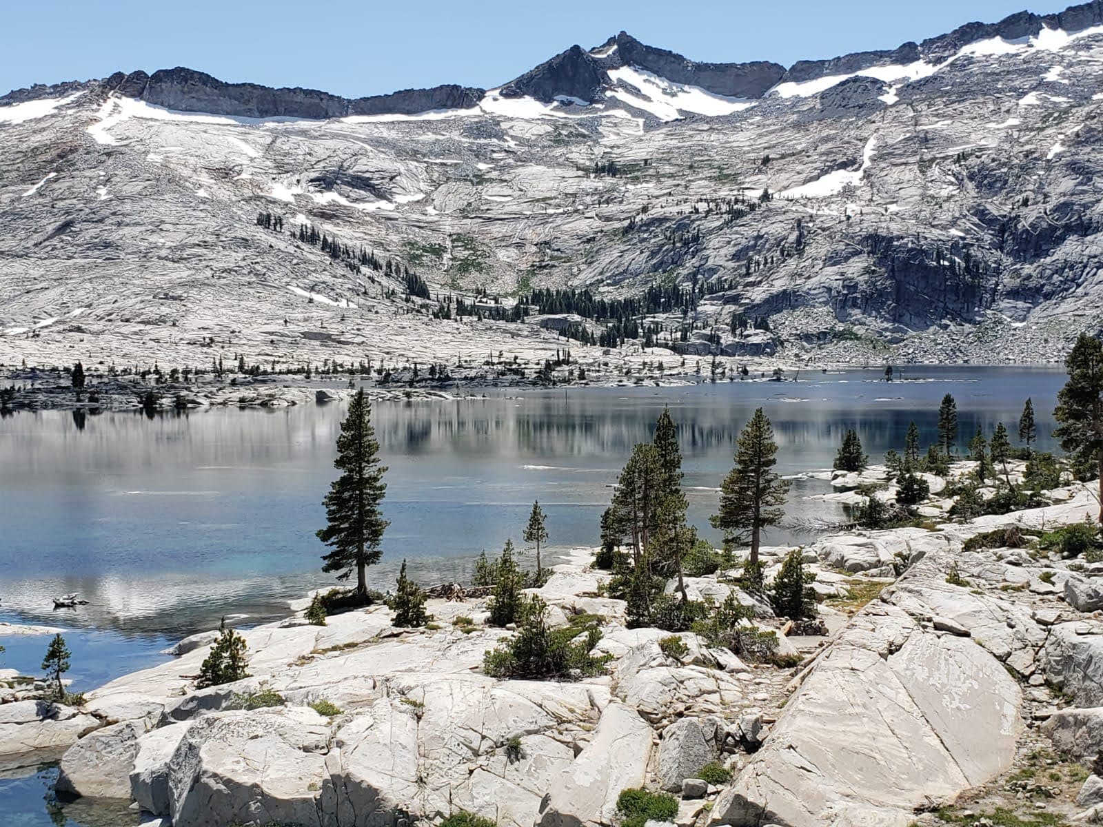
Desolation Wilderness
Western section of the trail
Hike through the stunning Desolation Wilderness, known for its granite peaks, alpine lakes, and rugged beauty.

California & Nevada Scenery
Entire loop
Traverse diverse landscapes, from pine forests to alpine meadows, as the trail winds through both California and Nevada.

PCT Overlap Section
Near Echo Lake
Hike a beautiful section where the Pacific Crest Trail (PCT) and TRT overlap, offering a taste of two iconic trails.
Plans like a pro.
Thinks like you
Planning Your Visit
Plan Your Thru-Hike or Section Hike
Best Time to Visit for Optimal Conditions
Best Times
Insider Tips
from TikTok, Instagram & Reddit
Pack for All Weather
Mountain weather changes rapidly. Pack layers, rain gear, and sun protection. ☁️
Water Sources & Filtration
Carry plenty of water and a reliable filter or purification method. Water sources can be scarce in some sections. :droplet:
Bear Safety is Crucial
Proper food storage is essential. Use bear canisters and know bear safety protocols. 🐻
Navigation is Key
While well-marked, carry a map, compass, and GPS device. Download offline maps. 🧭
Tips
from all over the internet
Pack for All Weather
Mountain weather changes rapidly. Pack layers, rain gear, and sun protection. ☁️
Water Sources & Filtration
Carry plenty of water and a reliable filter or purification method. Water sources can be scarce in some sections. :droplet:
Bear Safety is Crucial
Proper food storage is essential. Use bear canisters and know bear safety protocols. 🐻
Navigation is Key
While well-marked, carry a map, compass, and GPS device. Download offline maps. 🧭
Consider Section Hiking
Don't have time for the full loop? Many enjoy day hikes or multi-day section hikes. :hiking_boot:
Book Accommodation Early
If planning rest days in towns, book lodging and shuttles well in advance. 🛏️
What Travellers Say
Reviews Summary
The Tahoe Rim Trail is widely praised for its spectacular Lake Tahoe views and diverse mountain scenery, offering both challenging thru-hikes and accessible day trip options. While many appreciate the well-maintained trails and the opportunity to explore both California and Nevada, some find the continuous lake vistas can become monotonous on longer thru-hikes.
What People Like
What People Dislike
Frequently Asked Questions
🚇 🗺️ Getting There
Trailheads are accessible from various points around Lake Tahoe. Many hikers start at the Big Meadow Trailhead or Kingsbury Grade. Driving is the most common way to reach trailheads, and parking can be found at designated areas. Shuttles are available for thru-hikers needing to connect between trail sections or towns. +1
Public transportation options are limited directly to trailheads. However, some towns near the trail offer local bus services that might get you closer. For thru-hikers, arranging shuttle services in advance is highly recommended for logistics.
Yes, the Tahoe Rim Trail is a popular destination for bikepacking! Many sections are suitable for mountain biking, offering a different kind of adventure. +1
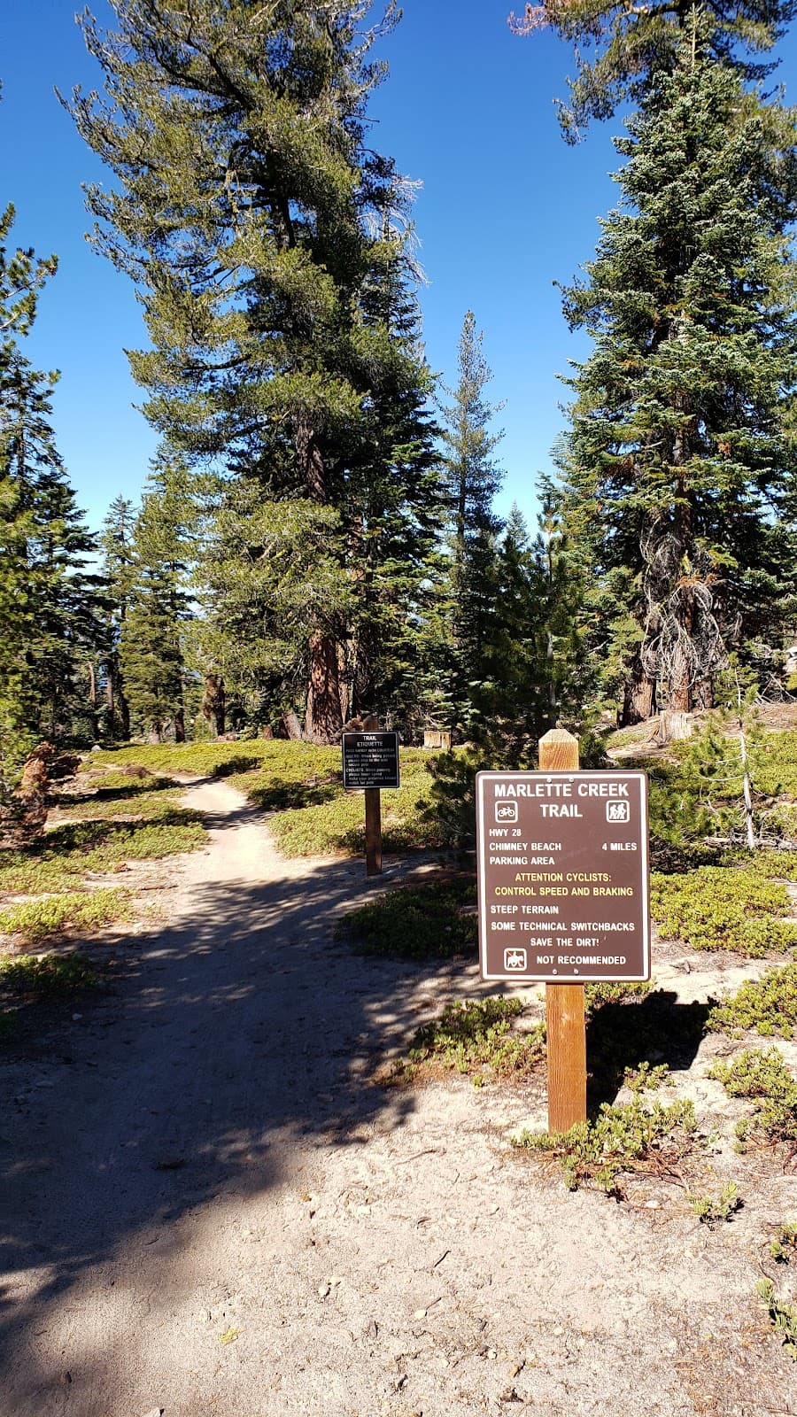
Popular access points for day hikes include Echo Lake, Spooner Lake State Park, and Brockway Summit. These offer stunning views and manageable distances for a shorter outing.
Thru-hikers often arrange for shuttle services to and from trailheads, especially for point-to-point sections or to reach resupply towns. Some also use ride-sharing services or coordinate with friends.
🎫 🎫 Tickets & Entry
For day hiking or short overnight trips, permits are generally not required for most sections. However, if you plan to camp in the Desolation Wilderness, a wilderness permit is mandatory and can be obtained in advance or at self-registration stations.
There are no general entrance fees for the Tahoe Rim Trail itself. However, some trailheads or nearby state parks may have parking fees or day-use fees.
The Tahoe Rim Trail is open year-round, but accessibility and conditions vary greatly with the seasons. The prime hiking season is summer and early fall.
Absolutely! You can find detailed Tahoe Rim Trail maps online, through the Tahoe Rim Trail Association, and in outdoor gear stores. Many hikers also use digital map apps.
Tahoe Rim Trail guidebooks are available from the Tahoe Rim Trail Association, online retailers, and local outdoor shops. These guides offer invaluable information for planning your hike.
🎫 🥾 Onsite Experience
The Tahoe Rim Trail has a total elevation gain of approximately 24,000 feet over its 165 miles. While not extremely steep in most sections, the cumulative gain is significant.
Expect a variety of terrain, including forested paths, rocky ascents, sandy sections, and some exposed ridgelines. The views of Lake Tahoe are a constant reward.
While the full thru-hike is challenging, many sections of the Tahoe Rim Trail are suitable for beginners as day hikes or short overnight trips. Choose flatter, well-maintained sections for your first experience.
Iconic viewpoints include Marlette Peak, Relay Peak, and sections overlooking Emerald Bay. The entire trail offers stunning vistas of Lake Tahoe.
The section through Desolation Wilderness is known for its rugged beauty and can be challenging. Some of the higher passes also present significant climbs.
🎫 🏕️ Camping & Lodging
Dispersed camping is allowed in many areas along the TRT, adhering to Leave No Trace principles. Designated campgrounds are also available near trailheads and in nearby towns. Wilderness permits are required for camping in Desolation Wilderness.
Yes, there are established campsites, particularly in areas like Spooner Lake and near trail towns. For thru-hikers, planning resupply points often involves staying in motels or campgrounds in towns like South Lake Tahoe.
Follow Leave No Trace principles: pack out all trash, minimize campfire impacts (check fire restrictions), and camp at least 100 feet from water sources. Bear canisters are mandatory in some areas.
Yes, but you must obtain a wilderness permit in advance. Camping is restricted to designated zones and requires adherence to strict regulations to protect the fragile environment.
Towns like South Lake Tahoe, Truckee, and Tahoe City offer a range of lodging, from budget-friendly motels to upscale resorts. These are great for rest days or as bases for section hikes.
🍽️ 🍎 Food & Dining
Resupply points are available in towns like South Lake Tahoe, Tahoe City, and Truckee. Many thru-hikers also arrange mail drops to post offices or outfitters along the route.
Towns near the trail offer a variety of dining, from casual cafes to fine dining restaurants. For a quick bite, look for delis and pizza places in South Lake Tahoe or Truckee.
Pack lightweight, high-calorie, non-perishable foods. Dehydrated meals, trail mix, energy bars, jerky, and nuts are popular choices for thru-hikers.
No, there are no restaurants directly on the trail. You'll need to plan for resupply in towns or carry all your food for the duration of your hike.
Popular trail snacks include dried fruit, nuts, jerky, peanut butter packets, and energy chews. These provide quick energy boosts during your hike.
📸 📸 Photography
Anywhere with a view of Lake Tahoe! Look for panoramic vistas from ridgelines, especially during sunrise and sunset. The Desolation Wilderness also offers dramatic landscapes.
A lightweight mirrorless or DSLR camera with a versatile zoom lens is ideal. Consider a wide-angle lens for landscapes and a telephoto for wildlife. Don't forget extra batteries and memory cards.
Yes, keep an eye out for deer, marmots, and various bird species. A telephoto lens will be helpful for capturing wildlife from a safe distance.
The 'golden hours' – shortly after sunrise and before sunset – offer the most dramatic and flattering light for landscape photography. Midday sun can be harsh.
Drone usage is restricted in wilderness areas like Desolation Wilderness. Always check local regulations and park rules before flying a drone.


Social
from TikTok, Instagram & Reddit