
Orinoquia Bridge
A monumental bridge spanning the Orinoco River, connecting Venezuela's diverse regions and offering breathtaking views.

Highlights
Must-see attractions

Social
From TikTok & Reddit
Best Time
Serene views, fewer cars
Orinoquia Bridge
Best Time
Serene views, fewer cars
Highlights
Must-see attractions
A monumental bridge spanning the Orinoco River, connecting Venezuela's diverse regions and offering breathtaking views.

🚗 Check Traffic Before
Traffic can be heavy. Use local apps or ask locals about the best times to cross.
📸 Capture the Scale
Wide-angle lenses are great for showing the bridge's immense size against the landscape.

Quick Facts
Highlights
Discover the most iconic attractions and experiences
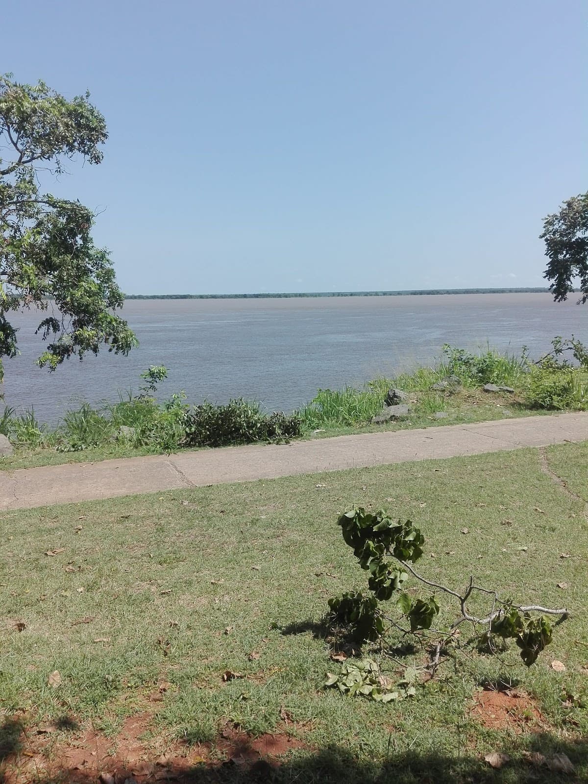
Panoramic River Views
Mid-span
Witness the vast Orinoco River stretching out, a breathtaking vista of nature's grandeur.

Engineering Marvel
Bridge structure
Appreciate the impressive scale and design of this significant infrastructure project.
Gateway to the Llanos
Southern approach
Experience the transition into the vast plains of the Orinoco, a unique ecological zone.
Plans like a pro.
Thinks like you
Planning Your Visit
Bridge Access & Timing
Navigating the Region
Best Times
Insider Tips
from TikTok, Instagram & Reddit
🚗 Check Traffic Before
Traffic can be heavy. Use local apps or ask locals about the best times to cross.
📸 Capture the Scale
Wide-angle lenses are great for showing the bridge's immense size against the landscape.
💧 Stay Hydrated
The region can be hot and humid. Carry plenty of water, especially if you plan to stop.
⛽ Fuel Up
Gas stations can be sparse on either side. Ensure your tank is full before crossing.
Tips
from all over the internet
🚗 Check Traffic Before
Traffic can be heavy. Use local apps or ask locals about the best times to cross.
📸 Capture the Scale
Wide-angle lenses are great for showing the bridge's immense size against the landscape.
💧 Stay Hydrated
The region can be hot and humid. Carry plenty of water, especially if you plan to stop.
⛽ Fuel Up
Gas stations can be sparse on either side. Ensure your tank is full before crossing.
What Travellers Say
Reviews Summary
Visitors often highlight the Orinoquia Bridge as a significant engineering feat and a crucial transportation link. The panoramic views of the Orinoco River are frequently praised, offering a sense of scale and natural beauty. However, some travelers note potential traffic congestion and the need for preparedness regarding services and road conditions in the surrounding areas.
What People Like
What People Dislike
Frequently Asked Questions
🚇 🗺️ Getting There
The Orinoquia Bridge is accessible via major highways connecting the states of Apure and Bolívar in Venezuela. It's a key transit point for road travel in the region.
The bridge is primarily served by national highways that connect to the surrounding cities and towns. Road conditions can vary, so check for recent updates.
While direct public transport to the bridge itself might be limited, buses and colectivos operate between major cities that cross the bridge.
Cycling across the bridge is possible but requires caution due to vehicle traffic. Ensure you have appropriate safety gear and visibility.
From Caracas, you would typically travel south via the main highways towards the Orinoco River. The bridge is a significant landmark on this route.
🎫 🎫 Tickets & Entry
Yes, there are tolls for vehicles crossing the Orinoquia Bridge. The exact amount can vary, so it's advisable to have local currency ready.
The Orinoquia Bridge is generally open 24 hours a day for vehicular traffic, but it's always wise to confirm with local authorities for any unexpected closures.
For standard passenger vehicles and commercial traffic, no special permits are usually required beyond standard vehicle registration and driver's licenses.
Pedestrian access might be restricted or unsafe due to the volume of vehicular traffic. It's best to confirm local regulations or use designated walkways if available.
Toll fees are charged per vehicle. Prices can differ for cars, trucks, and buses. It's recommended to have small denominations of Venezuelan Bolívar for the toll booths.
📸 📸 Photography
Good vantage points include the riverbanks on either side of the bridge and from nearby elevated areas. Capturing it during sunrise or sunset offers dramatic lighting.
Photography for personal use is generally permitted, but be mindful of traffic and avoid stopping in travel lanes. Professional or commercial photography might require permits.
A wide-angle lens is excellent for capturing the bridge's scale. A telephoto lens can be useful for details or distant shots of the surrounding landscape.
Drone usage is subject to national aviation regulations. Always check local laws and obtain necessary permissions before flying a drone in the vicinity of the bridge.
Early mornings offer soft light and fewer vehicles, while late afternoons provide warm, golden hour hues. Midday can be harsh but offers clear visibility.


Social
from TikTok, Instagram & Reddit