Dandenong Creek Trail
A scenic, accessible paved trail perfect for walking, cycling, and enjoying nature along Dandenong Creek.
Highlights
Must-see attractions

Social
From TikTok & Reddit
Best Time
Fewer crowds, peaceful atmosphere
Dandenong Creek Trail
Best Time
Fewer crowds, peaceful atmosphere
Highlights
Must-see attractions
A scenic, accessible paved trail perfect for walking, cycling, and enjoying nature along Dandenong Creek.
🗺️ Download a Trail Map
Mobile reception can be unreliable. Grab a Dandenong Creek Trail map PDF before you go!
🚴♀️ Share the Path
Be courteous to cyclists and walkers. The Dandenong Creek Bike Trail is shared, so stay aware of your surroundings.
Quick Facts
Highlights
Discover the most iconic attractions and experiences
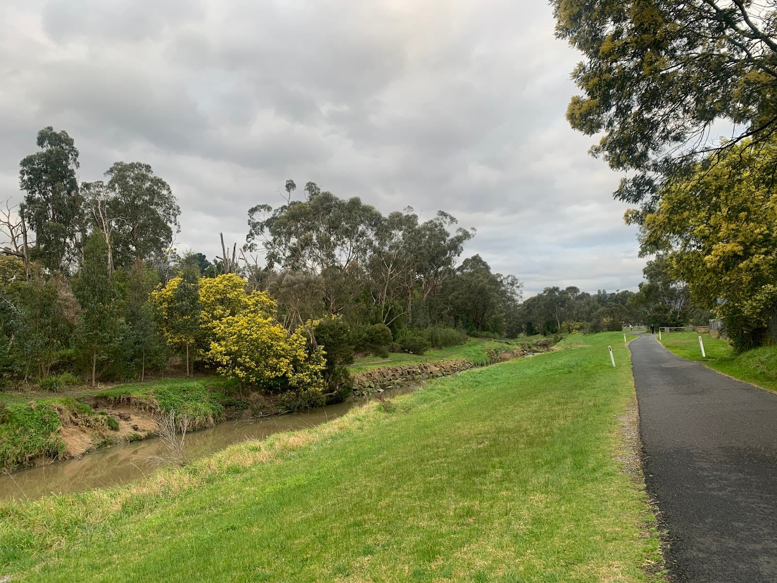
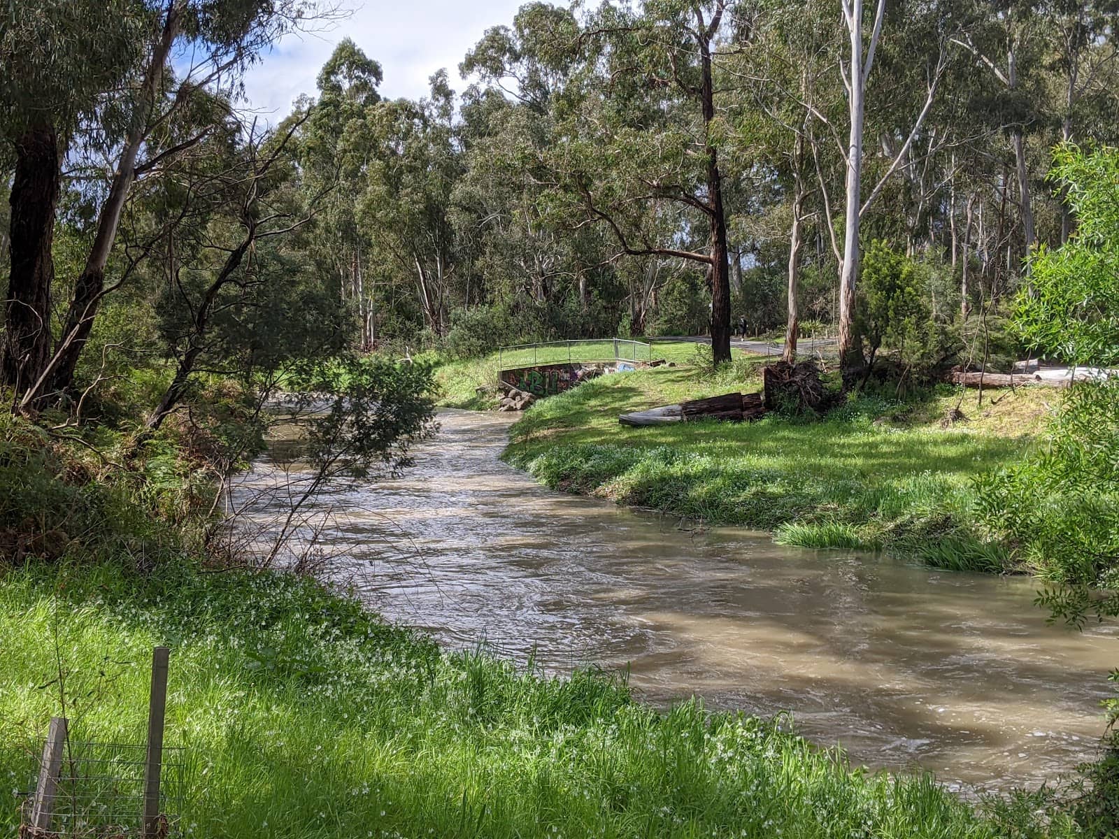
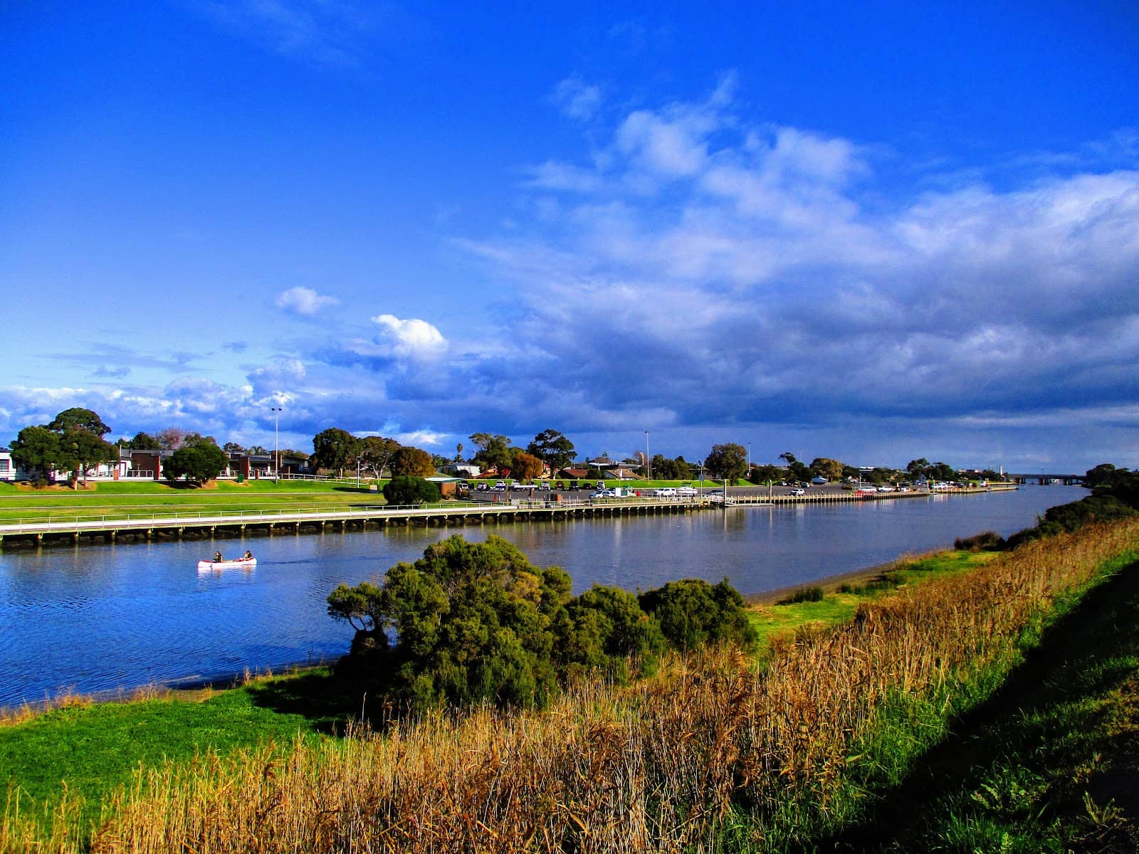
Scenic Waterways
Various points along the trail
Enjoy picturesque views of Dandenong Creek, wetlands, and diverse birdlife. A peaceful escape for nature lovers.
Diverse Flora & Fauna
Throughout the trail
Spot native Australian plants and a variety of bird species. Keep an eye out for kangaroos in quieter sections.

Paved Cycling Paths
Main trail sections
Smooth, paved surfaces make it perfect for a leisurely bike ride or a brisk walk. Great for all fitness levels.
Plans like a pro.
Thinks like you
Planning Your Visit
Trail Access & Parking
Trail Conditions & Navigation
Best Times
Insider Tips
from TikTok, Instagram & Reddit
Scenic hikes in the Dandenong Ranges
Hey everyone! I'm going to be coming to Melbourne in december and was trying to look up some info on the range i.e What are the most scenic hikes to take that last at max 5 hours? I'm having difficulty finding good info on them so I thought why not ask the locals!
🗺️ Download a Trail Map
Mobile reception can be unreliable. Grab a Dandenong Creek Trail map PDF before you go!
🚴♀️ Share the Path
Be courteous to cyclists and walkers. The Dandenong Creek Bike Trail is shared, so stay aware of your surroundings.
Cycling paths Melbourne
Hi, I am looking for any cycling paths ( non road) that are at a minimum of 50 km preferably 70 km - 80 km in the South East that is not congested and not stopping for red lights . Or otherwise, a really great cycling circuit that are 5 km - 10 km that is not congested.
My last 3 months of exploring bike trails around Melbourne
Should get off at Carrum station and do the Dandenong Creek trail. That'll take you up Stud Rd, Jells Park and East link to Ringwood. You could head back to the city along Eastern Fwy which will fit up a nice patch in your map.
👟 Wear Comfortable Shoes
The trail is mostly paved, but good walking or cycling shoes are essential for comfort on longer journeys.
💧 Bring Water & Snacks
There are limited facilities along the trail. Pack essentials, especially if you plan a longer exploration.
POV: Djerring Trail (Caulfield-Dandenong Rail Trail) | Dec 2018
Not my video, but it is pretty good at showing off the (mostly) new trail, also how to get on it from Caulfield station, hopefully the council makes a proper connection to it and signposts it too. It is a good asset for the area, I rode it out to Noble Park in November and have…
Tips
from all over the internet
🗺️ Download a Trail Map
Mobile reception can be unreliable. Grab a Dandenong Creek Trail map PDF before you go!
🚴♀️ Share the Path
Be courteous to cyclists and walkers. The Dandenong Creek Bike Trail is shared, so stay aware of your surroundings.
👟 Wear Comfortable Shoes
The trail is mostly paved, but good walking or cycling shoes are essential for comfort on longer journeys.
💧 Bring Water & Snacks
There are limited facilities along the trail. Pack essentials, especially if you plan a longer exploration.
What Travellers Say
Reviews Summary
Visitors praise the Dandenong Creek Trail for its accessibility, natural beauty, and suitability for cycling and walking. The paved paths and scenic creek views are frequently highlighted as major draws. Some users note that parking can be limited during peak times and that mobile reception can be spotty in certain areas.
What People Like
What People Dislike
Frequently Asked Questions
🚇 🗺️ Getting There
The Dandenong Creek Trail has multiple access points across its length. Popular starting points include areas near Jells Park, Scoresby, and Wantirna South. Parking availability varies by access point, so it's wise to check local council information for your chosen entry. Public transport options are limited directly to trailheads, so driving is often the most convenient method.
Yes, most major access points along the Dandenong Creek Trail offer parking. Jells Park, for instance, has substantial parking facilities. However, these can fill up quickly on weekends and public holidays. Consider arriving early or exploring less common access points if you're visiting during peak times.
Absolutely! The Dandenong Creek Bike Trail is a popular route for cyclists. Much of the trail is paved and relatively flat, making it suitable for various cycling abilities. Remember to be mindful of other trail users, including walkers and families.
Direct public transport access to many parts of the Dandenong Creek Trail can be challenging. While some bus routes may pass near sections of the trail, you might need to walk a considerable distance from the nearest stop to reach an access point. Driving is generally recommended for ease of access.
Popular starting points include Jells Park, which offers ample parking and amenities, and various smaller access points in suburban areas. The choice of starting point often depends on how much of the trail you wish to explore and your preferred scenery. Checking a Dandenong Creek Trail map will help you decide.
🎫 🎫 Tickets & Entry
No, the Dandenong Creek Trail is a public park and recreational area, so there are no entry fees. You can access and enjoy the trail and its natural surroundings free of charge.
The Dandenong Creek Trail is generally accessible from dawn till dusk. While there are no strict opening or closing times for the trail itself, any associated park facilities like car parks or restrooms may have specific operating hours. It's best to check with the local council for any specific park regulations.
No booking is required to visit the Dandenong Creek Trail. It's an open public space. However, if you plan to organize a large group event or picnic, it's advisable to check with the local council about any permit requirements.
The Dandenong Creek Trail itself does not offer camping facilities. It is primarily a recreational trail for walking, cycling, and enjoying nature during the day. For camping, you would need to look for designated campgrounds in nearby national parks or private campgrounds.
Dog regulations can vary by section and local council. Generally, dogs are permitted on the Dandenong Creek Trail but must be kept on a leash at all times. Always check local signage and council bylaws for specific restrictions in the area you plan to visit.
🎫 🚶 Onsite Experience
The Dandenong Creek Trail is predominantly paved and relatively flat, making it very accessible for walking, jogging, and cycling. Some sections might have minor inclines, but it's generally considered an easy to moderate trail. The paved surface is ideal for prams and wheelchairs in most areas.
The Dandenong Creek Trail is quite extensive, stretching for many kilometers. While there isn't a single definitive end-to-end length commonly cited, it connects various parks and reserves, offering opportunities for walks of varying durations. You can tailor your journey to be as short or as long as you like.
Yes, many of the larger access points and parks along the Dandenong Creek Trail, such as Jells Park, are equipped with restrooms and picnic facilities. These are great spots to take a break, enjoy a meal, or use the facilities during your visit.
You can expect to see a variety of native Australian wildlife. Birdwatching is popular, with many species frequenting the wetlands and trees. Keep an eye out for kangaroos, especially in quieter, more natural sections of the trail. You might also spot various insects and smaller reptiles.
The Dandenong Creek Trail is generally considered safe, especially in well-trafficked areas and during daylight hours. Like any public space, it's always wise to be aware of your surroundings, let someone know your plans, and stick to main paths. The presence of other walkers and cyclists contributes to a sense of security.
📸 📸 Photography
The Dandenong Creek Trail offers numerous picturesque spots for photography. Look for areas with reflections in the creek, diverse birdlife, and the changing seasons. Early morning or late afternoon light can create beautiful golden hour shots, especially over the water and surrounding greenery.
A versatile lens, such as a 24-70mm or a telephoto lens for wildlife, would be beneficial. A wide-angle lens can capture the expansive landscapes. For nature photography, a tripod can help with low-light conditions or capturing sharp images of birds. Don't forget a polarizing filter to enhance skies and water.
The trail's wetlands are fantastic for capturing reflections and waterbirds. The changing foliage throughout the seasons, from vibrant greens in summer to rich colours in autumn, provides unique photographic opportunities. Look for interesting textures in bark and the intricate details of native flora.
Early mornings and late afternoons, known as the 'golden hours,' offer the most flattering light for photography. The soft, warm light can enhance colours and create beautiful shadows. Midday sun can be harsh, but it's still good for capturing details of flora and fauna.
Drone usage is subject to strict regulations in Australia. You must comply with CASA (Civil Aviation Safety Authority) rules, which include maintaining visual line of sight, not flying over people, and respecting privacy. It's crucial to check for any local council restrictions or no-fly zones before operating a drone in the area.

Social
from TikTok, Instagram & Reddit