
Slættaratindur
Hike to the highest peak in the Faroe Islands for breathtaking panoramic views, but be prepared for challenging terrain and unpredictable weather.

Highlights
Must-see attractions

Social
From TikTok & Reddit
Best Time
Best chance for clear skies
Slættaratindur
Best Time
Best chance for clear skies
Highlights
Must-see attractions
Hike to the highest peak in the Faroe Islands for breathtaking panoramic views, but be prepared for challenging terrain and unpredictable weather.
"The view from the top is incredible and well worth the hike, but there are parts of this trail that I feel are unsafe."

🥾 Sturdy Boots Essential
Do NOT attempt in sneakers. Gravel sections are slippery, especially on descent. Hiking poles recommended!
🌦️ Check Weather Constantly
Faroese weather changes FAST. Clouds can obscure views instantly. Go on a clear day for the reward.

Quick Facts
Rating
4.8 · 161 reviews
Type
Mountain Peak
Highlights
Discover the most iconic attractions and experiences

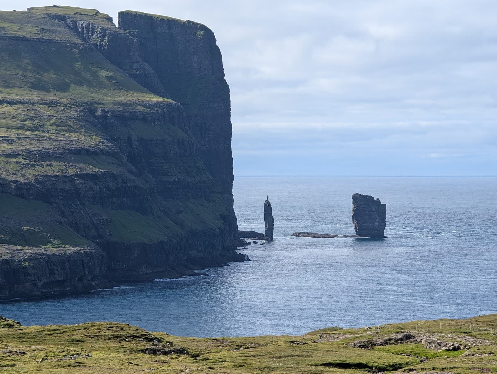
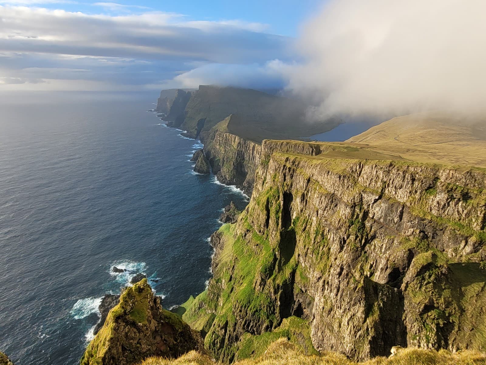
Summit Views
Slættaratindur Summit
Panoramic vistas of the Faroe Islands' dramatic coastline and rolling green hills on a clear day. Absolutely breathtaking!

The Ascent Trail
Slættaratindur Hiking Trail
A challenging yet rewarding hike with steep sections and gravel paths leading to the highest point in the Faroes.

Sunset Spectacle
Slættaratindur Summit
Experience a magical sunset from the highest peak, but be mindful of descending in fading light.
Plans like a pro.
Thinks like you
Planning Your Visit
Weather is Key
Footwear & Fitness
Best Times
Insider Tips
from TikTok, Instagram & Reddit
🥾 Sturdy Boots Essential
Do NOT attempt in sneakers. Gravel sections are slippery, especially on descent. Hiking poles recommended!
🌦️ Check Weather Constantly
Faroese weather changes FAST. Clouds can obscure views instantly. Go on a clear day for the reward.
Slaettaratindur - question for any Faroe Islanders out there!
Hi, some friends and I are thinking about making a documentary on Faroe in the future, and I had an idea - ski touring down Slaettaratindur, the highest mountain in the islands. We are all experienced skiers looking to do something cool - think red bull type stuff! My question…
Hiking trip to Faroe Islands
I am a student interested in hiking and would like to make a weekend hiking trip to Faroe Islands. Do you have any recommendations for some good mountain to hike up to and/or some affordable hostel to stay in?
⚠️ Descend Before Dark
If hiking for sunset, start down 15-20 mins before it sets. It gets dark quickly and the trail is tricky.
💪 Fitness is Key
The first half is a steep, sustained climb. You need good physical fitness to enjoy the hike.
Sunset Hike to Slaettaratindur on Summer Solstice
Do Faroese people still hike Slattaratindur on Summer Solstice for sunset and stat until sunrise?
Tips
from all over the internet
🥾 Sturdy Boots Essential
Do NOT attempt in sneakers. Gravel sections are slippery, especially on descent. Hiking poles recommended!
🌦️ Check Weather Constantly
Faroese weather changes FAST. Clouds can obscure views instantly. Go on a clear day for the reward.
⚠️ Descend Before Dark
If hiking for sunset, start down 15-20 mins before it sets. It gets dark quickly and the trail is tricky.
💪 Fitness is Key
The first half is a steep, sustained climb. You need good physical fitness to enjoy the hike.
🧭 Trail Can Be Tricky
The path at the very top can be hard to find. Follow the short chains for guidance, but stay aware.
What Travellers Say
Reviews Summary
Slættaratindur offers a challenging but rewarding hike with potentially spectacular summit views. Visitors praise the incredible panoramas on clear days and the satisfying physical accomplishment. However, the unpredictable weather can often obscure the views, and the trail's steep, gravelly sections require caution and proper footwear, especially on the descent.
"Crazy view and wonderful hike! Use precaution regarding weather since the steep parts may be a lot more slippery when wet.
Good footwear is required! The last part is kind of climbing more than it’s hiking, however, worth it!!"
Victor Sørensen
"Satisfying hike! Not technically challenging, but you need some level of physical fitness to make it to the top. The path can get slightly muddy and the top cloudy, but if sunny the views are great! Clouds may come and go"
Winston C
"Beautiful trail but you can get tired a bit. From the beginning it’s quite intensive. In the higher part people who are not used to hiking can get scared a bit but it’s not a problem if you are hiking I the mountain. There are chains but not really needed. However it’s easier to find a path thanks to chains. In the top part path is hiding a bit. Unfortunately it’s not easy to get nice weather and view on the top cause it’s often cloudy"
Agata XYZ
What People Like
What People Dislike
Frequently Asked Questions
🚇 🗺️ Getting There
The trailhead is accessible by car and is located at a parking area off the main road between Eiði and Funningur. It's well-marked. Many visitors rent a car to explore the Faroe Islands, which offers the most flexibility.
Public bus services in the Faroe Islands are limited, especially to more remote hiking areas. Renting a car is highly recommended for easy access to the Slættaratindur parking lot. Check local bus schedules for routes that might pass nearby, but be prepared for potential long walks.
The primary way to reach the Faroe Islands is by flying into Vágar Airport (FAE) from various European cities. Alternatively, you can take a ferry from Denmark. Once on the islands, car rental is the most convenient way to explore.
Yes, there is a dedicated parking area at the base of the Slættaratindur trail. It can get busy during peak season, so arriving earlier in the day is advisable.
Hiking Slættaratindur in winter is possible but requires extreme caution. Snow and ice can make the trail very dangerous, and weather conditions are even more unpredictable. Experienced hikers with appropriate gear and knowledge of winter conditions should only attempt this.
🎫 🎫 Tickets & Entry
No, there are no entrance fees or tickets required to hike Slættaratindur. It's a natural attraction accessible to everyone.
Slættaratindur is open 24/7 as it's an outdoor natural landmark. However, the best time to visit is during daylight hours, and especially when the weather is clear for optimal views.
The best season to hike Slættaratindur is during the summer months (June to August) when the weather is generally milder and there's a higher chance of clear skies. However, even in summer, weather can be unpredictable.
No permits are required for hiking Slættaratindur. It's a public hiking trail.
While technically possible, visiting Slættaratindur at night is strongly discouraged due to safety concerns. The trail is steep and can be treacherous, especially in the dark. If you plan for sunset, ensure you descend well before it gets completely dark.
🎫 🧭 Onsite Experience
The hike typically takes about 1-2 hours round trip, depending on your fitness level and how long you spend at the summit. Some reviewers mention 50 minutes up and over an hour down in perfect weather.
The hike is considered moderately difficult. The first half is very steep and strenuous, while the upper sections are less steep but can be gravelly and slippery. Good physical fitness is recommended.
There are no specific facilities like restrooms or visitor centers at the Slættaratindur trailhead. It's a natural hiking path.
The trail is generally visible, but the path can become less distinct near the summit. There are some chains in steeper sections that can help with navigation, but they are not always continuous or necessary.
Bring plenty of water, snacks, a waterproof jacket, and wear sturdy hiking boots. A map and compass or GPS device are advisable, especially if visibility is poor.
📸 📸 Photography
The summit offers incredible panoramic views of the surrounding islands and coastline. Sunsets and sunrises, if the weather permits, are particularly stunning. The dramatic landscape on the ascent also provides great photo ops.
Early morning or late afternoon (golden hour) often provides the best light for photography, especially if the skies are clear. However, be prepared for rapidly changing conditions.
A wide-angle lens is great for capturing the expansive landscapes. A sturdy tripod can be useful for low-light conditions or long exposures. Ensure your gear is protected from wind and potential rain.
Yes, the terrain can be slippery and precarious, especially on the descent. Be mindful of your footing and secure your equipment. Losing a lens down the mountain is a real possibility if not careful!
Drone regulations can vary. It's essential to check the latest rules and regulations for drone usage in the Faroe Islands before flying. Be mindful of other hikers and potential wildlife.


Social
from TikTok, Instagram & Reddit