
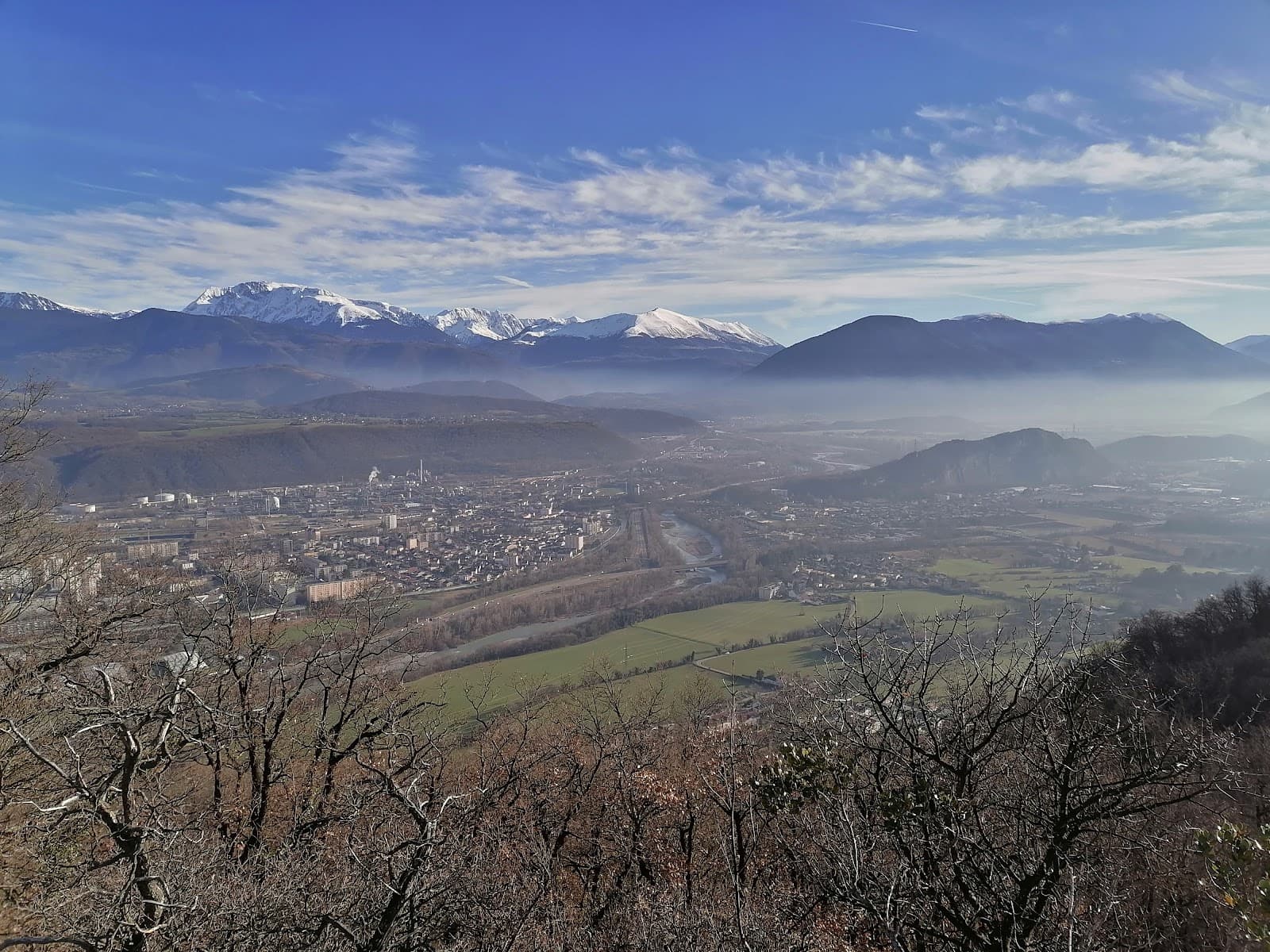
Chartreuse Regional Natural Park
A mountainous nature preserve offering breathtaking hikes, unique geological wonders, and stunning alpine scenery.

Highlights
Must-see attractions

Social
From TikTok & Reddit
Best Time
Snow melts, ideal for hiking
Chartreuse Regional Natural Park
Best Time
Snow melts, ideal for hiking
Highlights
Must-see attractions
A mountainous nature preserve offering breathtaking hikes, unique geological wonders, and stunning alpine scenery.
"Amazing hikes in this beautiful park and easily accessible by the bus too."

Pack for all weather
Mountain weather changes fast! Bring layers, rain gear, and sun protection. ☁️ ☂️ :sunwithface:
Download offline maps
Trail signage is good, but an app or map is handy for longer hikes. :iphone: :world_map:

Quick Facts
Hours
Rating
4.7 · 8,472 reviews
Type
Park
Highlights
Discover the most iconic attractions and experiences

Cirque de Saint-Même
Saint-Pierre-d'Entremont
Enchanting natural site with imposing cliffs, spectacular waterfalls, and a beautiful loop trail.

Geyser de la Combe
Saint-Cassin
An unusual natural water jet, a subterranean resurgence that surprises hikers in a clearing.

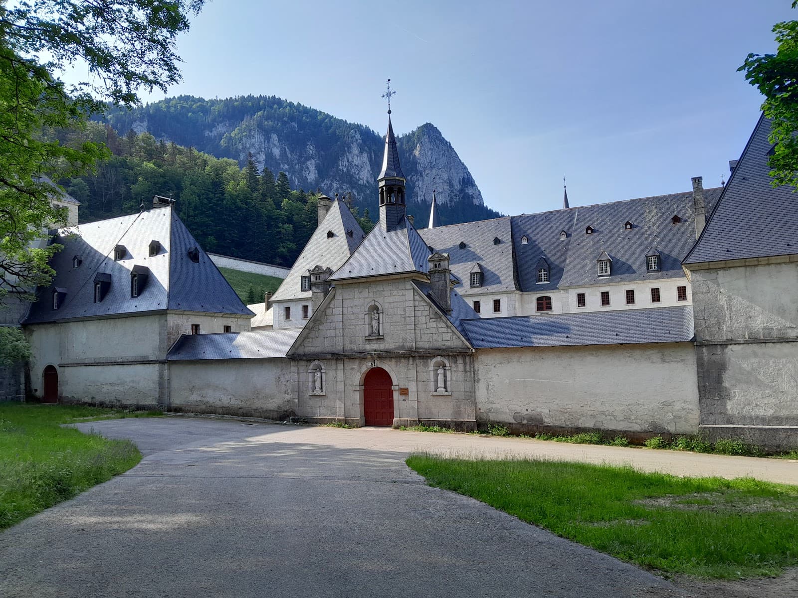
Dent de Crolles Caves
Near Saint-Hilaire-du-Touvet
Explore fascinating caves, some accessible with local guidance and equipment for an adventurous experience.
Plans like a pro.
Thinks like you
Planning Your Visit
Best Time for Hiking
Navigating the Trails
Best Times
Insider Tips
from TikTok, Instagram & Reddit
Pack for all weather
Mountain weather changes fast! Bring layers, rain gear, and sun protection. ☁️ ☂️ :sunwithface:
Download offline maps
Trail signage is good, but an app or map is handy for longer hikes. :iphone: :world_map:
Stay hydrated & fueled
Bring plenty of water and snacks, especially for hikes with elevation gain. :water_wave: :apple:
Respect nature
Follow Leave No Trace principles and be mindful of the environment. :evergreen_tree: ✨
Tips
from all over the internet
Pack for all weather
Mountain weather changes fast! Bring layers, rain gear, and sun protection. ☁️ ☂️ :sunwithface:
Download offline maps
Trail signage is good, but an app or map is handy for longer hikes. :iphone: :world_map:
Stay hydrated & fueled
Bring plenty of water and snacks, especially for hikes with elevation gain. :water_wave: :apple:
Respect nature
Follow Leave No Trace principles and be mindful of the environment. :evergreen_tree: ✨
Check bus schedules
Public transport is convenient for accessing trailheads. 🚌 🎟️
What Travellers Say
Reviews Summary
Visitors rave about the stunning natural beauty and incredible hiking opportunities in Chartreuse Regional Natural Park. The accessibility, even in winter, and well-marked trails are frequently praised. Some note that certain paths can be steep, requiring effort, and recommend bringing ample supplies.
"Amazing hikes in this beautiful park and easily accessible by the bus too."
RV
"A beautiful place for hiking. We walked a route of 12KM with a height difference of 700m and came a cross some beautiful spots. Pretty good signs to guide you the right way but an extra map or app on your phone will come in handy. Nothing crazy, no real climbing but there were some steep parts where it takes some effort to keep on moving up. Bring something to drink and some food for on the way."
Jorrian Piek
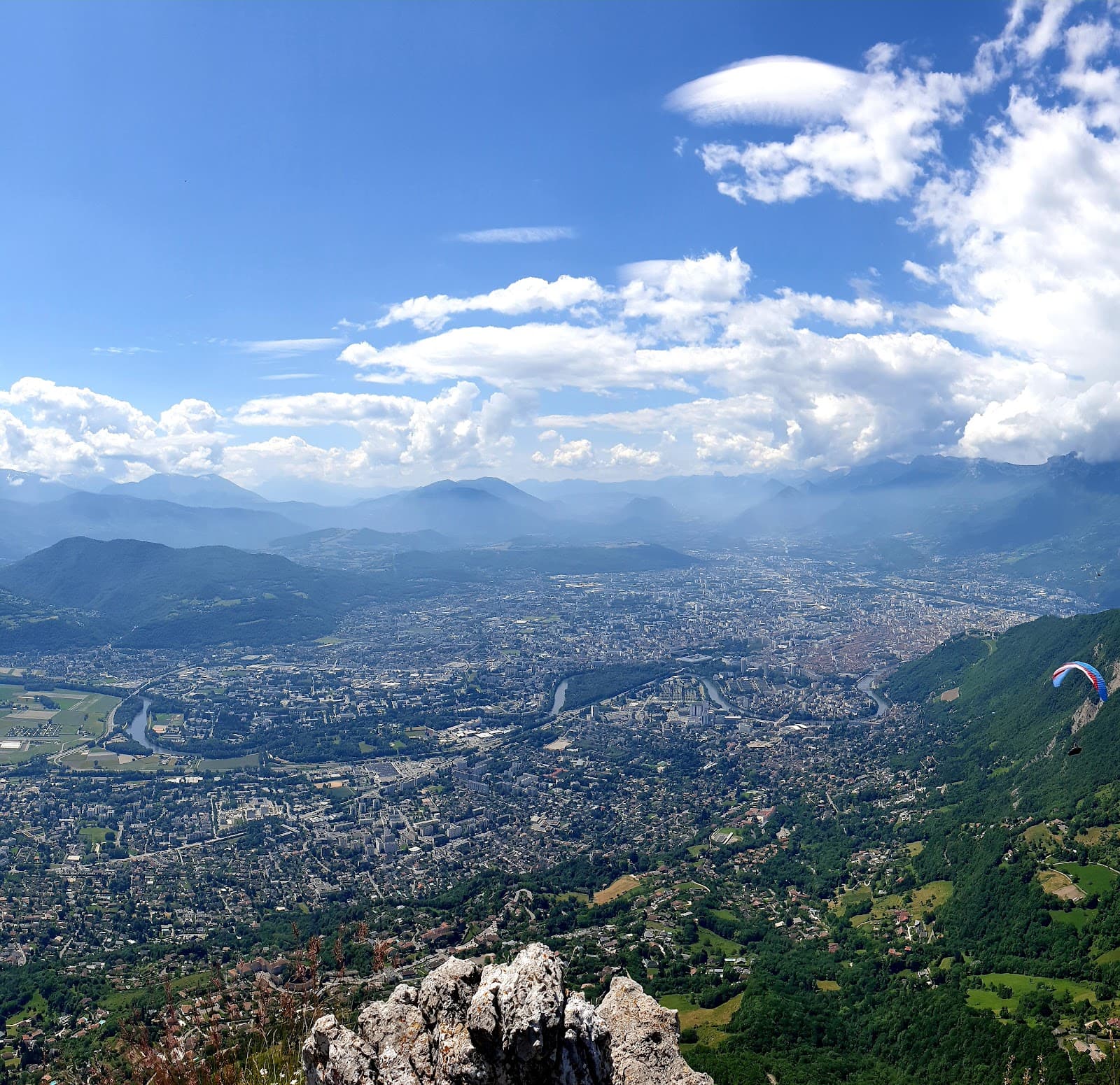
"Came here during the beginning of February and I was amazed at how easy access to the park was. The buses run regularly and the roads are all clean even with lots of snow. I walked in the GR 9 from Le Sappey de Chartreuse to the center of Grenoble and found the views to be stunning. Well worth a visit all year round."
Laurence Brown
What People Like
What People Dislike
Frequently Asked Questions
🚇 🗺️ Getting There
The park is accessible by car and public transport. Buses run regularly from Grenoble and other nearby towns, making it easy to reach trailheads like Le Sappey de Chartreuse. Driving is also an option, with parking available at various points of interest.
Yes, the park is known for its easy accessibility, even in winter. Roads are well-maintained, and public transport options are reliable.
Absolutely! Buses are a great way to access many trailheads, including those for popular hikes like the GR 9.
For reaching trailheads, buses are convenient. Once on the trails, hiking is the primary mode of exploration.
While not always designated 'hiker routes,' many regular bus lines connect towns to popular starting points for hikes within the park. Check local transport schedules.
🎫 🎫 Tickets & Entry
No, Chartreuse Regional Natural Park is a natural preserve and does not have an entrance fee. You can explore its trails and natural beauty freely.
For general park access and most hiking trails, no advance booking is required. However, if you plan to visit specific attractions or guided tours, checking their individual requirements is advised.
As a natural park, it's open 24/7. However, access to certain areas or facilities might be restricted during specific hours or seasons.
For standard hiking, no permits are generally needed. However, for activities like caving or more specialized expeditions, local regulations and permits may apply.
While there isn't one central visitor center for the entire park, various towns within and around the Chartreuse massif offer local tourist information points.
🎫 🥾 Onsite Experience
Popular trails include the loop around Cirque de Saint-Même, hikes to the Geyser de la Combe,
and routes like the GR 9 from Le Sappey to Grenoble.
Many offer stunning views and varied terrain.
Generally, yes. Paths are often well-marked, but having a map or navigation app on your phone is highly recommended for longer or more complex routes.
Hikes range from easy to moderate, with some steep sections. Trails like the one at Cirque de Saint-Même are suitable for beginners, while others offer more challenge.
Yes, Dent de Crolles is known for its caves. Some locals suggest exploring them, but it's recommended to go with proper equipment and a knowledgeable guide.
Expect breathtaking mountain scenery, including imposing cliffs, waterfalls, and panoramic vistas, especially on routes like the GR 9.
🍽️ 🍎 Food & Dining
You'll find restaurants and cafes in the towns surrounding and within the park, such as Saint-Pierre-d'Entremont and Grenoble.
It's essential to pack plenty of water and snacks, especially for longer hikes with elevation gain.
Yes, many scenic spots along the trails are perfect for a picnic lunch amidst nature.
Exploring the local towns will offer opportunities to try regional Savoyard cuisine. Look for restaurants serving traditional dishes.
Generally, food options are limited to the towns. It's best to carry your own provisions for your hikes.
📸 📸 Photography
The Cirque de Saint-Même with its cliffs and waterfalls, the unique Geyser de la Combe,
and panoramic viewpoints along trails like the GR 9 offer incredible photo opportunities.
A wide-angle lens is great for landscapes, while a telephoto can capture distant peaks. A sturdy tripod is useful for waterfalls and low-light conditions. Don't forget extra batteries!
Golden hours (early morning and late afternoon) offer beautiful light for landscapes. Midday can be harsh, but good for capturing details.
Generally, no. However, always be respectful of the natural environment and any private property. Drone usage may be restricted in natural parks, so check local regulations.
Yes, but always maintain a safe distance and avoid disturbing the animals. Patience is key for capturing wildlife shots.


Social
from TikTok, Instagram & Reddit