
Hochstaufen Bavaria
A rugged 1771m Bavarian peak offering challenging hikes, via ferrata, and breathtaking 360° alpine panoramas.
Highlights
Must-see attractions

Social
From TikTok & Reddit
Best Time
Clear views, good weather
Hochstaufen Bavaria
Best Time
Clear views, good weather
Highlights
Must-see attractions
A rugged 1771m Bavarian peak offering challenging hikes, via ferrata, and breathtaking 360° alpine panoramas.
"The view is fantastic. Bad Reichenhall, Salzburg, the Berchtesgaden Alps, simply beautiful."
🥾 Sturdy Footwear is Key
Good trekking shoes are essential to avoid slipping on steep, rocky paths.
💧 Pack Plenty of Water & Snacks
No amenities on the trail until the summit hut. Stay hydrated and fueled!
Quick Facts
Rating
4.8 · 73 reviews
Type
Natural Feature
Highlights
Discover the most iconic attractions and experiences
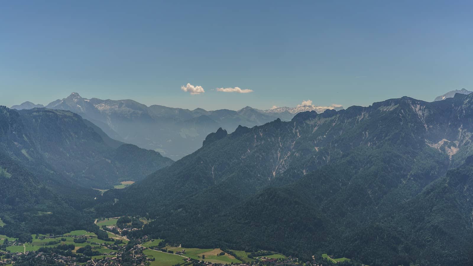
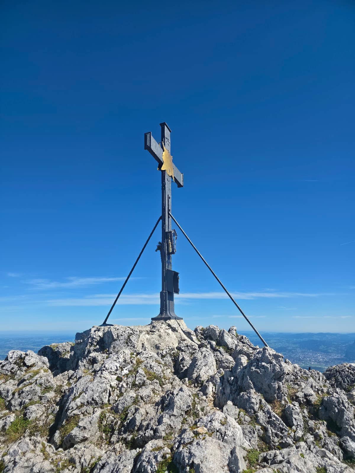
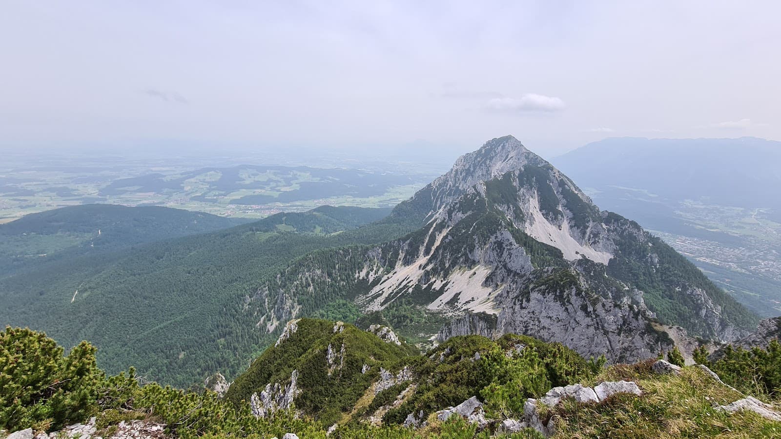
Summit Panorama
Hochstaufen Summit
Breathtaking 360° views of the Bavarian Alps, Salzburg, and beyond. A true reward!
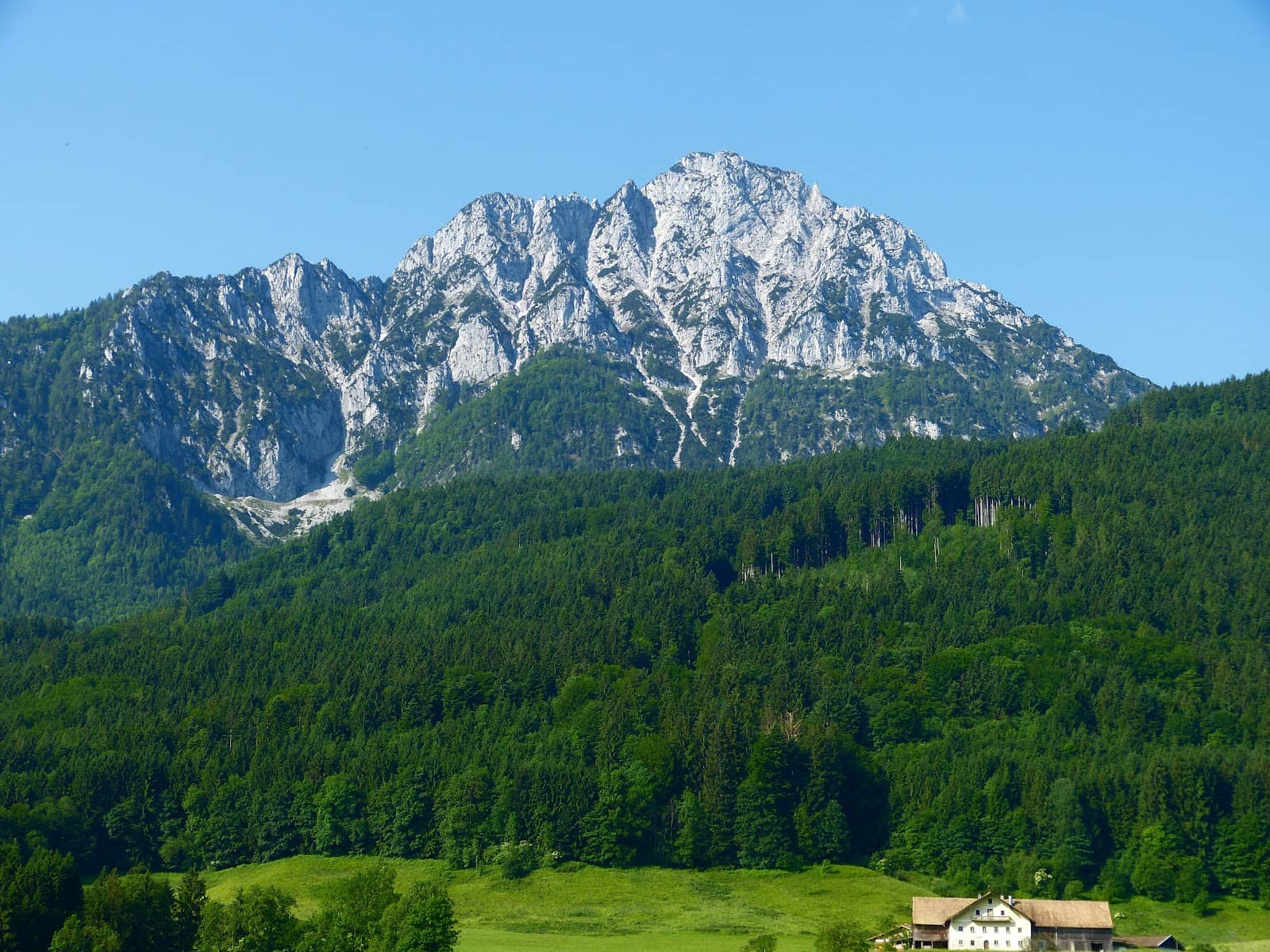
Steinerner Jager Trail
Ascent route
A challenging yet rewarding path with dramatic drops and stunning alpine scenery.
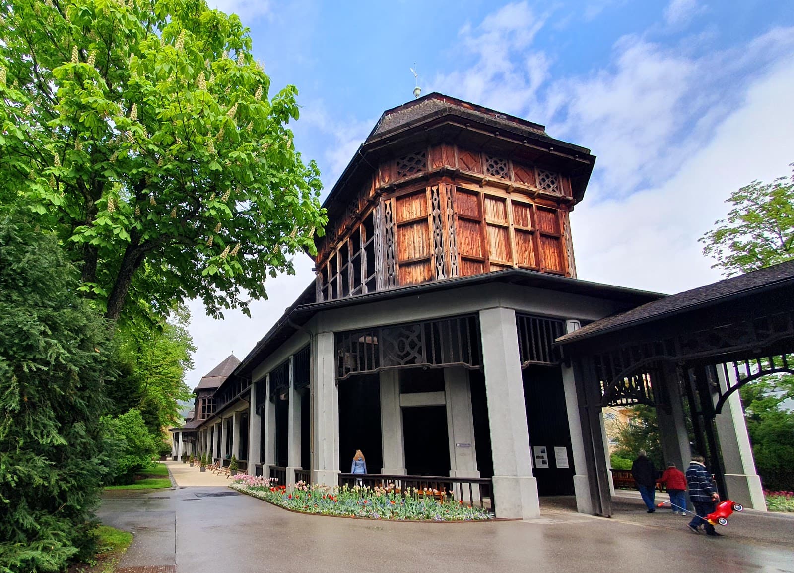
Summit Hut (Reinhardt-Schuster-Haus)
Summit
A welcome respite with refreshments and a place to soak in the incredible views.
Plans like a pro.
Thinks like you
Planning Your Visit
Tackle the Terrain: Gear Up for Hochstaufen
Timing is Everything: Beat the Crowds
Best Times
Insider Tips
from TikTok, Instagram & Reddit
🥾 Sturdy Footwear is Key
Good trekking shoes are essential to avoid slipping on steep, rocky paths.
💧 Pack Plenty of Water & Snacks
No amenities on the trail until the summit hut. Stay hydrated and fueled!
⬆️ Allow Ample Time
Plan for 7-8 hours round trip, including breaks. It's a strenuous hike.
☁️ Check Weather Forecast
Avoid hiking in rain or fog; conditions can be treacherous.
Tips
from all over the internet
🥾 Sturdy Footwear is Key
Good trekking shoes are essential to avoid slipping on steep, rocky paths.
💧 Pack Plenty of Water & Snacks
No amenities on the trail until the summit hut. Stay hydrated and fueled!
⬆️ Allow Ample Time
Plan for 7-8 hours round trip, including breaks. It's a strenuous hike.
☁️ Check Weather Forecast
Avoid hiking in rain or fog; conditions can be treacherous.
📸 Capture the Views
The 360° panorama from the summit is unforgettable. +1
What Travellers Say
Reviews Summary
Hochstaufen is lauded for its spectacular 360° summit views and challenging, rewarding hiking trails like the Steinerner Jager. While the climb is strenuous and requires good fitness and a head for heights, the panoramic vistas and sense of accomplishment are consistently praised. Some visitors note the summit hut's basic amenities and the demanding nature of the trek.
"Great mountain peak with gorgeous view both from below it and on the peak."
William Wang
"One of my memorable hiking trips. The tracks are well defined and the path is marked everywhere. Make sure to carry enough food and water along, there's nothing on the way. Mostly people come by car, park their car at the start of the trek and walk from there. It is quite tiring. The path is quite steep. Make sure you have good trekking shoes so you dont slip. Avoid doing this trek on a rainy day."
Manish Saraswat
"This mountain is not for the faint of heart. A head for heights and surefootedness are essential! I'm proud that I made it, but I wouldn't attempt it again. We started from the Listsee hiking car park and it took us about 3.5 hours to get up, and a bit longer to get down, so you should plan on about 8 hours.
At the hut, you can cool off or enjoy a light meal. The restrooms there are not recommended.
The view is fantastic. Bad Reichenhall, Salzburg, the Berchtesgaden Alps, simply beautiful."
Felix M5
What People Like
What People Dislike
Frequently Asked Questions
🚇 🗺️ Getting There
From Salzburg, you can drive to Bad Reichenhall and then to the Listsee hiking car park, which is a common starting point. Public transport options might involve trains to Bad Reichenhall followed by a bus or taxi to the trailhead.
The Listsee hiking car park is a popular and convenient starting point for many hikers tackling Hochstaufen.
While driving is common, you can reach Bad Reichenhall by train from Salzburg. From there, local buses or taxis can take you closer to the trailhead, though direct public transport to the very start of the hike might be limited.
From Salzburg, head towards Bad Reichenhall. Follow signs for the Listsee or Hochstaufen trailhead. The exact route may vary, so using a GPS is recommended.
Yes, it's possible to start hiking from Bad Reichenhall, but it adds significant distance and elevation. Most hikers opt to drive to a closer trailhead like Listsee.
🎫 🎫 Tickets & Entry
No, there are no entrance tickets required to hike Hochstaufen. It's a natural mountain accessible to the public.
Hochstaufen is accessible year-round, but hiking is best during daylight hours and in favorable weather conditions. The summit hut has its own operating hours.
There is no admission fee for hiking Hochstaufen. Parking at trailheads may incur a fee.
You don't need to book in advance for the hike itself. However, if you plan to stay at the summit hut, it's advisable to book accommodation well in advance, especially during peak season.
No permits are required for general hiking on Hochstaufen.
🎫 ⛰️ Onsite Experience
The hike is considered strenuous and challenging, requiring good fitness, a head for heights, and surefootedness. It's not for the faint of heart.
The ascent typically takes around 3.5 hours, with the descent taking a bit longer. Plan for a total of 7-8 hours for the round trip, including breaks.
The Steinerner Jager trail is a popular, albeit challenging, route. Other well-defined and marked paths are available, offering varying degrees of difficulty.
Yes, Hochstaufen offers climbing opportunities, including a via ferrata, making it appealing for experienced climbers.
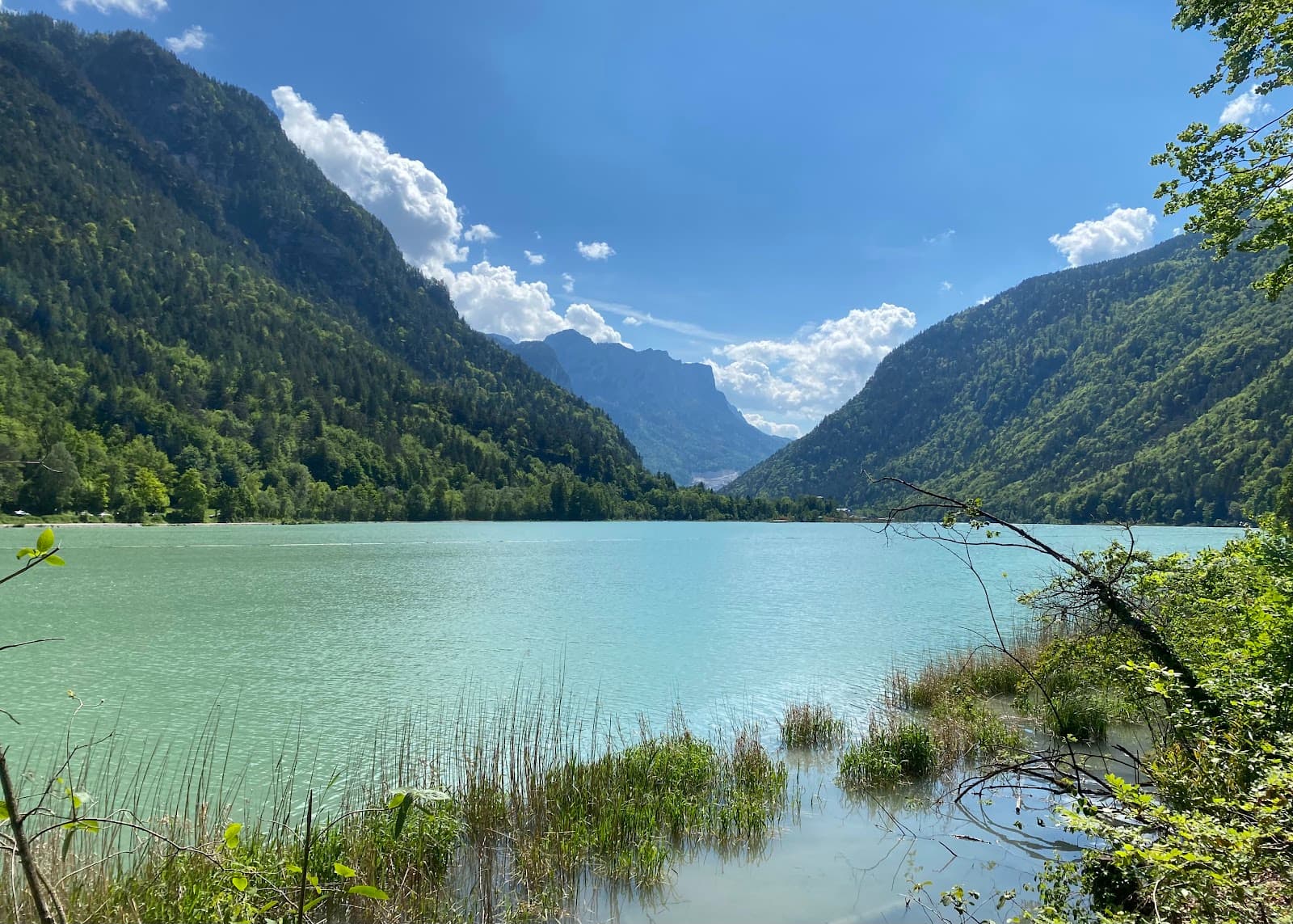
Expect spectacular 360° panoramic views of the Bavarian Alps, including Bad Reichenhall, Salzburg, and the Berchtesgaden Alps.
🍽️ 🍽️ Food & Dining
Yes, there is a hut at the summit, the Reinhardt-Schuster-Haus, where you can get refreshments and light meals.
The hut typically offers traditional Bavarian fare and drinks. It's a good place to rest and refuel after the climb.
While there might be options in Bad Reichenhall, there are no restaurants directly at the trailhead. It's best to pack your own food or plan to eat at the summit hut.
Absolutely! It's highly recommended to bring your own water and snacks, as options are limited until you reach the summit hut.
Reviews suggest the restrooms at the summit hut are not highly recommended, so be prepared.
📸 📸 Photography
Early mornings and late afternoons offer the best light for photography, with golden hour casting a beautiful glow on the landscape.
The summit offers incredible 360° panoramic views. The Steinerner Jager trail also provides dramatic backdrops with steep drops and alpine vistas.
Drone regulations can vary by region and park. It's advisable to check local rules and regulations before flying a drone in the area.
A wide-angle lens is great for capturing the expansive panoramas. A sturdy tripod can be useful for low-light conditions or long exposures.
Keep an eye out for wildlife like chamois, which can make for unique photo subjects. The changing weather can also create dramatic skies.


Social
from TikTok, Instagram & Reddit