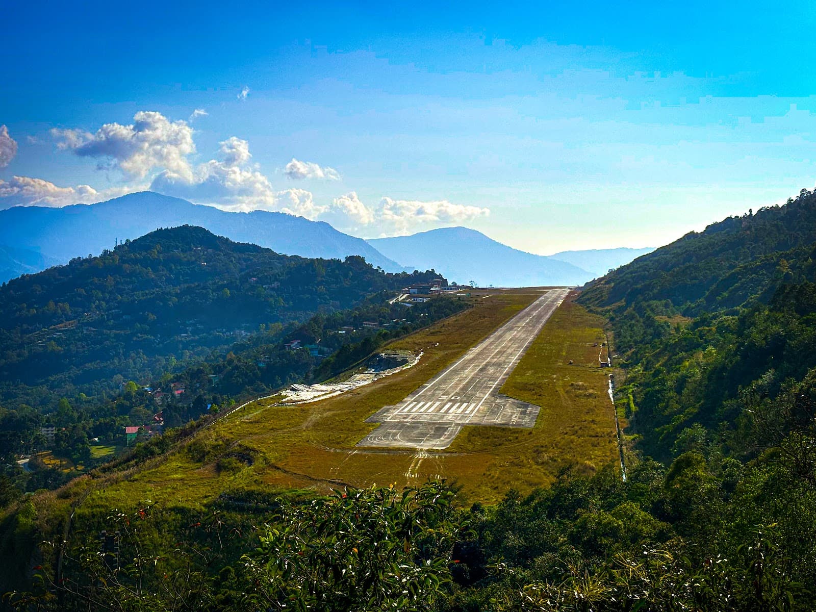
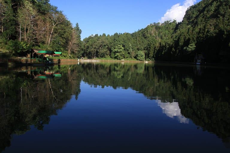
Pakyong Airport Viewpoint
Sikkim's first airport, offering breathtaking views of the runway against majestic Himalayan peaks. A unique aviation and landscape experience.

Highlights
Must-see attractions

Social
From TikTok & Reddit
Best Time
Best visibility for flights & mountains
Pakyong Airport Viewpoint
Best Time
Best visibility for flights & mountains
Highlights
Must-see attractions
Sikkim's first airport, offering breathtaking views of the runway against majestic Himalayan peaks. A unique aviation and landscape experience.
"A baby cute airport/runway in the lap of mountains with fantastic landscape!"
Check Flight Status First
Weather impacts flights heavily. Confirm schedules before you go to avoid disappointment! :airplane_departure:
Pack for All Weather
Sikkim's weather is unpredictable. Layers are your friend for comfort at this high-altitude viewpoint. ☁️ :mountain_snow:
Quick Facts
Rating
4.5 · 32 reviews
Type
Tourist Attraction
Highlights
Discover the most iconic attractions and experiences
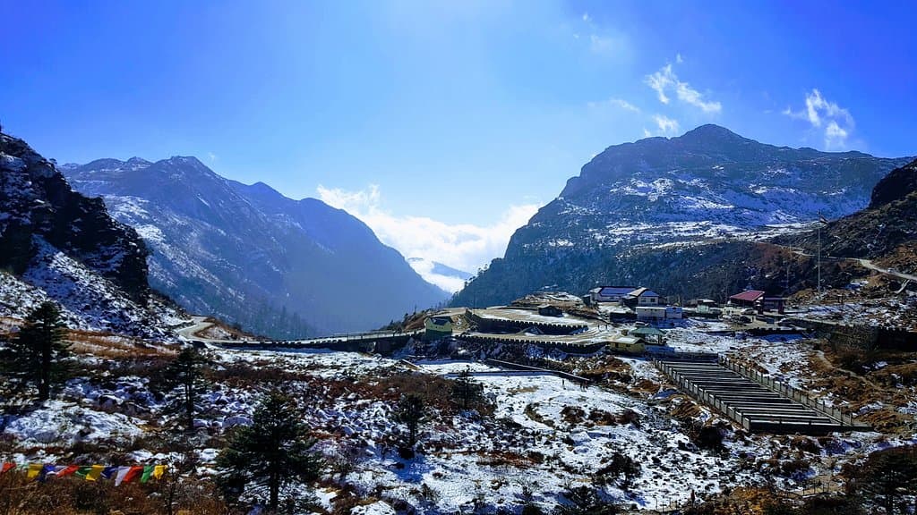
Pakyong Airport Runway
The main runway
Witness planes navigate the dramatic mountain terrain on Sikkim's first operational airport. A truly unique aviation experience.
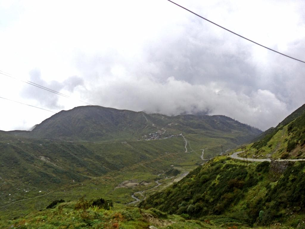
Panoramic Mountain Views
Surrounding hillsides
Marvel at the majestic Himalayas framing the 'baby cute' airport. The landscape is as breathtaking as the aviation activity.

Flight Take-off and Landing
Airport vicinity viewpoints
Experience the thrill of watching aircraft ascend and descend against a backdrop of unparalleled natural beauty.
Plans like a pro.
Thinks like you
Planning Your Visit
Timing is Everything
Best Vantage Points
Best Times
Insider Tips
from TikTok, Instagram & Reddit
Check Flight Status First
Weather impacts flights heavily. Confirm schedules before you go to avoid disappointment! :airplane_departure:
Pack for All Weather
Sikkim's weather is unpredictable. Layers are your friend for comfort at this high-altitude viewpoint. ☁️ :mountain_snow:
Local Snacks Available
Enjoy local treats like cendol while you wait for flights. A perfect way to soak in the atmosphere. 🍦
Bring Binoculars
Enhance your viewing experience of the planes and distant Himalayan peaks. :binoculars:
Tips
from all over the internet
Check Flight Status First
Weather impacts flights heavily. Confirm schedules before you go to avoid disappointment! :airplane_departure:
Pack for All Weather
Sikkim's weather is unpredictable. Layers are your friend for comfort at this high-altitude viewpoint. ☁️ :mountain_snow:
Local Snacks Available
Enjoy local treats like cendol while you wait for flights. A perfect way to soak in the atmosphere. 🍦
Bring Binoculars
Enhance your viewing experience of the planes and distant Himalayan peaks. :binoculars:
What Travellers Say
Reviews Summary
Visitors are captivated by the unique setting of Pakyong Airport, often described as a 'baby cute' airport nestled amidst stunning Himalayan landscapes. The chance to see flights against this dramatic backdrop is a major draw, though the unpredictable weather significantly impacts flight operations, leading to potential disappointment. The scenic beauty, however, remains a consistent highlight.
"Pakyong Airport, located near Gangtok, Sikkim, is the first operational airport in the northeastern Indian state of Sikkim. Situated at an altitude of 1,400 meters (4,593 feet), it serves as a gateway to the region, offering connectivity to cities like Kolkata and Delhi. The airport’s construction faced numerous challenges due to its remote location and difficult terrain, but it was eventually inaugurated in 2018. Its single runway is designed to handle small to medium-sized aircraft, and the airport is seen as a key driver for tourism and economic growth in the region. Despite its strategic importance, the airport’s operations are often affected by weather conditions, including heavy rainfall and fog, which can limit flight schedules."
Himanshu shekhar Palei
"A nice view of Pakyong Airport can be seen from here. Flights are irregular here due to climatic conditions. To see Flight's take off from runway can be very much enjoyable moment from this view point."
Suman Porijayee
"Pakyong airport is clearly visible from this view point. Amazing."
Santosh Yadav
What People Like
What People Dislike
Frequently Asked Questions
🚇 🗺️ Getting There
The Pakyong Airport Viewpoint is approximately 30-35 km from Gangtok. You can hire a taxi or a private car for a comfortable journey. The drive takes about 1-1.5 hours, offering scenic views along the way. Some travelers opt for shared taxis for a more budget-friendly option.
While direct public buses to the viewpoint are scarce, you can take a bus from Gangtok towards Pakyong town and then arrange for local transport or a short taxi ride to the viewpoint. It's advisable to check local bus schedules in advance.
The road conditions can vary, especially during monsoon season. While the main route is generally well-maintained, some stretches might be bumpy. It's best to travel in a sturdy vehicle.
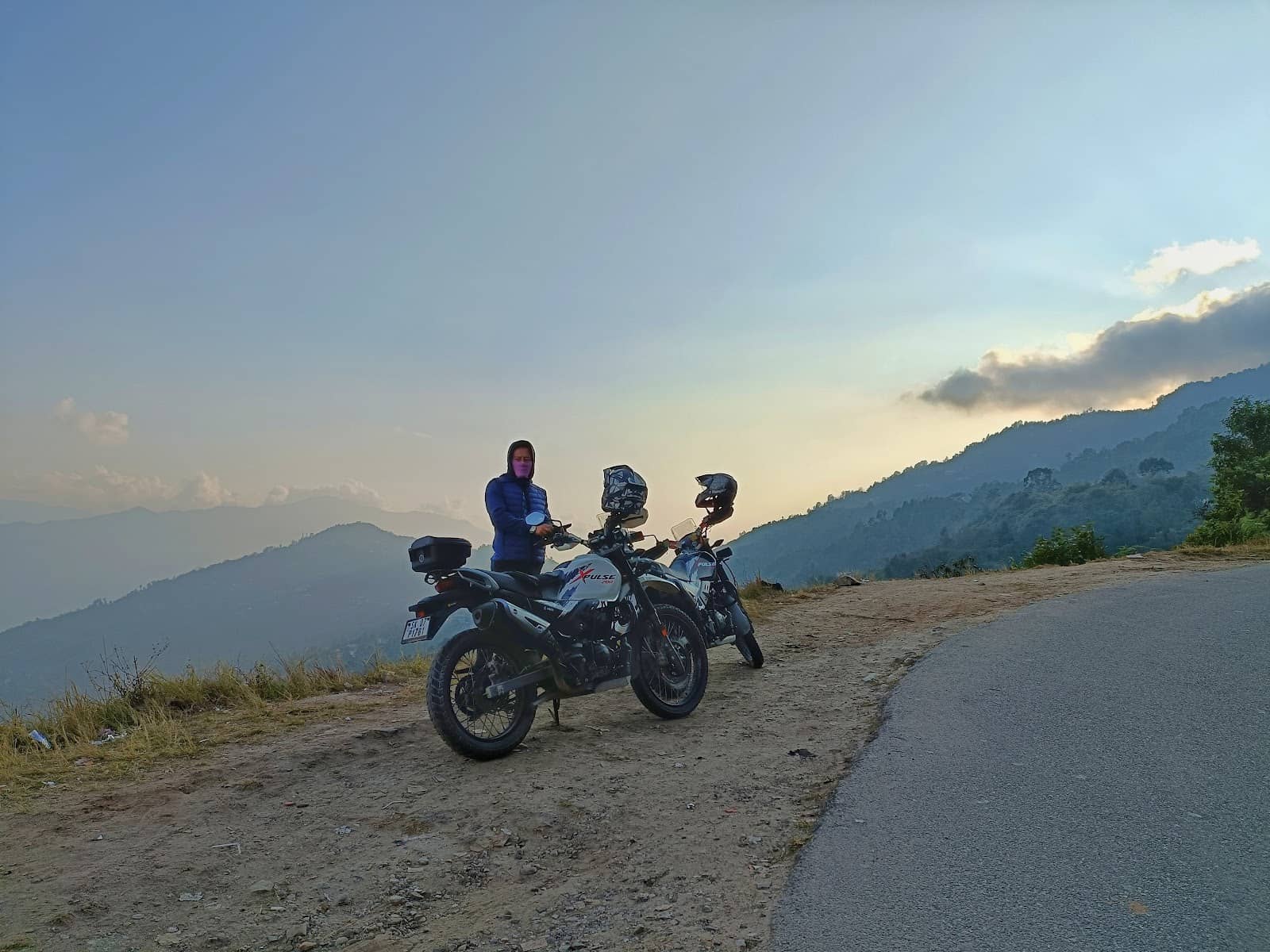
Yes, biking to Pakyong Airport Viewpoint is possible and can be a scenic adventure. However, be prepared for winding mountain roads and potential weather changes. Ensure your bike is in good condition.
As you approach Pakyong, you'll start seeing signs for the airport. The landscape gradually opens up, offering glimpses of the valley and the airport nestled within. Keep an eye out for local villages and monasteries.
🎫 🎫 Tickets & Entry
No, typically there is no entry fee to access the general viewpoints around Pakyong Airport. These are usually accessible from public roads or designated spots.
The viewpoint is generally accessible during daylight hours. However, flight operations dictate the best times to visit for viewing take-offs and landings. It's advisable to visit when there's good visibility.
General photography for personal use is usually permitted. However, avoid photographing sensitive airport infrastructure or security areas. Always be mindful of airport regulations.
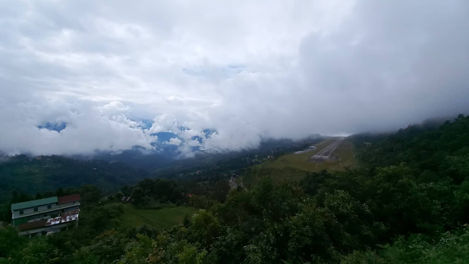
Flights are highly dependent on weather. Mornings often offer better visibility, but cancellations due to fog or rain are common. It's best to check the airport's official flight schedule or airline updates.
Viewpoints are located at a safe distance from the runway for operational and safety reasons. You can see the runway clearly, but you won't be able to access it directly.
🎫 ✈️ Flights & Operations
Flight operations at Pakyong Airport are infrequent and highly susceptible to weather conditions. Flights can be cancelled or delayed due to fog, rain, or strong winds, making them unpredictable.
Currently, SpiceJet is the primary airline operating flights to and from Pakyong Airport, connecting it to cities like Kolkata and Delhi. However, schedules can change.
The airport's location in a hilly terrain and its high altitude (1,400 meters) present significant challenges. Adverse weather, including heavy fog and rainfall, frequently disrupts flight schedules.
It's best to check directly with the operating airline (e.g., SpiceJet) or airport authorities for the most up-to-date flight status. Many travel apps also provide real-time flight information.
Pakyong Airport's single runway is designed to handle small to medium-sized aircraft. It is not equipped for large commercial jets.
📸 📸 Photography
Look for elevated spots that offer a clear, unobstructed view of the entire runway and the surrounding Himalayan peaks. The curves of the runway against the mountains make for dramatic shots.
A telephoto lens is great for capturing planes in detail. A wide-angle lens is useful for the expansive mountain landscapes. Consider a tripod for stable shots, especially in lower light. 📷
Early mornings often provide soft, golden light and clearer skies for capturing both the airport and the Himalayas. Late afternoons can also offer beautiful lighting.
Capture the unique engineering of the runway carved into the mountainside. The contrast between the man-made structure and the natural beauty is striking. Don't miss shots of planes taking off or landing.
While general photography is usually allowed, avoid capturing sensitive airport operational areas or security personnel. Always respect airport rules and regulations.


Social
from TikTok, Instagram & Reddit