
Nevado de Toluca National Park
Explore the breathtaking crater and serene lagoons of Nevado de Toluca, a majestic volcano offering stunning high-altitude hikes and panoramic views.
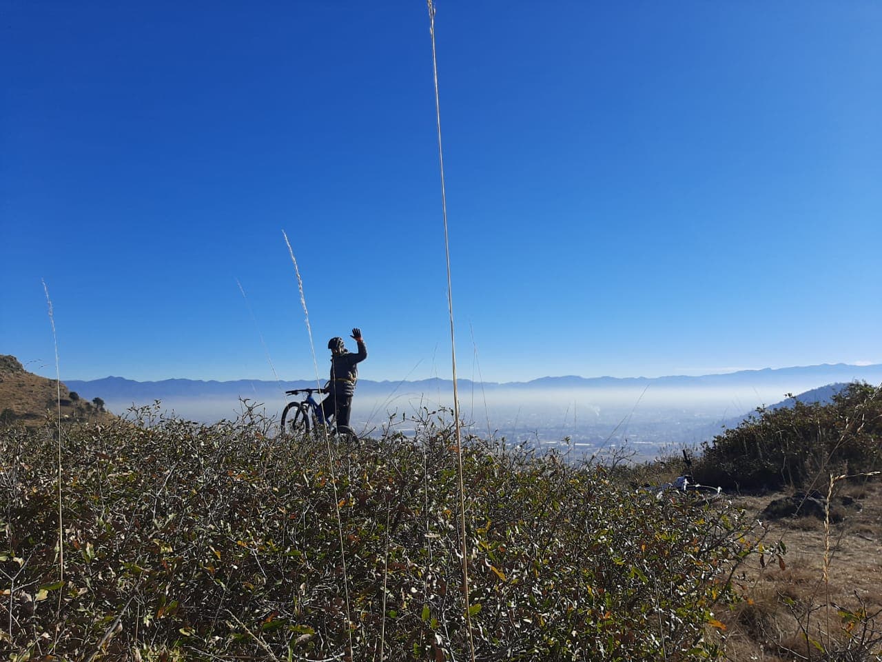
Highlights
Must-see attractions

Social
From TikTok & Reddit
Best Time
Clear skies, best views
Nevado de Toluca National Park
Best Time
Clear skies, best views
Highlights
Must-see attractions
Explore the breathtaking crater and serene lagoons of Nevado de Toluca, a majestic volcano offering stunning high-altitude hikes and panoramic views.
"Amazing place with many beautiful views to the crater and area around."
🚶♀️ Hike Smart, Not Hard
Experienced hikers can navigate with offline maps. The trail to the peaks is steep; take your time.
💰 Bring Cash for Fees
Entrance and shuttle fees often require cash. ATMs are scarce, so come prepared.
Quick Facts
Hours
Rating
4.8 · 176 reviews
Type
Hiking Area
Highlights
Discover the most iconic attractions and experiences
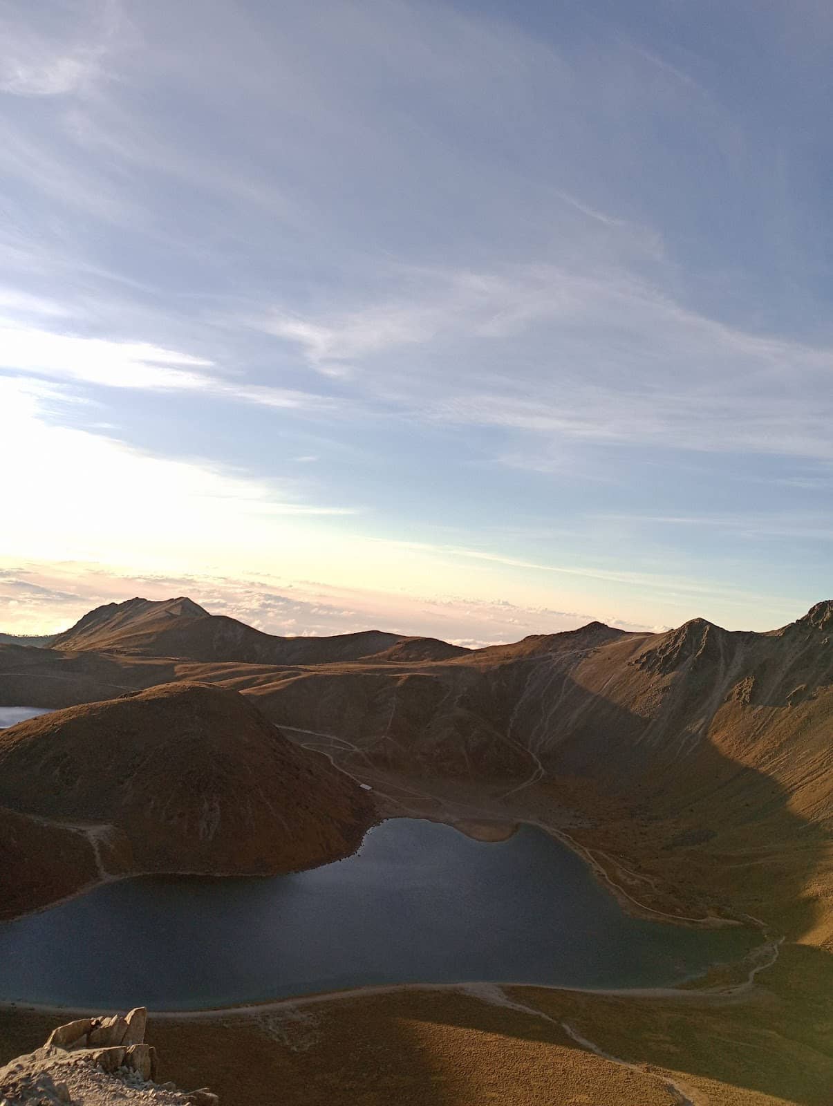
The Majestic Crater
Summit
Stand in awe of the vast volcanic crater, a breathtaking testament to nature's power.
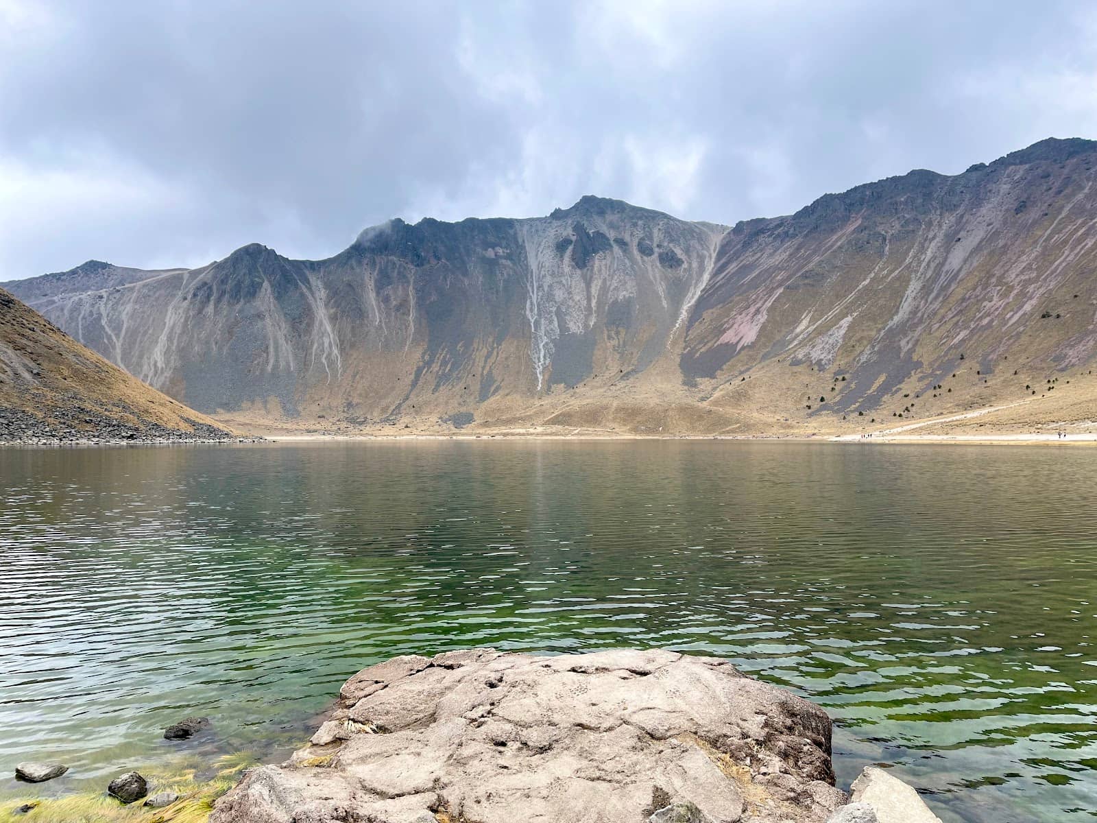
Laguna del Sol & Luna
Crater floor
Discover the serene beauty of these twin lagoons nestled within the crater.
Panoramic Summit Views
Highest peaks
Experience unparalleled 360-degree vistas of the surrounding landscape from the highest points.
Plans like a pro.
Thinks like you
Planning Your Visit
Altitude Awareness is Key
Plan Your Transport & Fees
Best Times
Insider Tips
from TikTok, Instagram & Reddit
Nevado de Toluca
Hi all! I have some questions about going to Nevado de Toluca. I am an experienced hiker and am not very into buying a guide unless absolutely necessary. From what I’ve read online the Nevado de Toluca hike is not very very and tough to navigate apart from having a mapped out…
🚶♀️ Hike Smart, Not Hard
Experienced hikers can navigate with offline maps. The trail to the peaks is steep; take your time.
💰 Bring Cash for Fees
Entrance and shuttle fees often require cash. ATMs are scarce, so come prepared.
Nevado de Toluca vs Iztaccihuatl
Heading to Mexico City at the end of the month and looking to do a hiking excursion one day near the end of my trip. Looks like the two best bets are either Nevado de Toluca or Iztaccihuatl. Any arguments to be made for one vs. the other? Other than booking a tour guide (which…
Best way to hike Nevado de Toluca as a day trip from Mexico City?
I realize that this is a very specific question but /r/mexico seems to be spanish-language only. We're staying in Mexico City and want to hike at least part of Nevado de Toluca, what is the best way to get there and back from Mexico City? The other option would be to stay a…
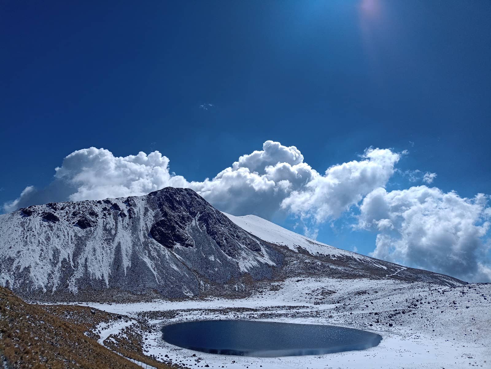
❄️ Snow? Pack Crampons!
During snowy periods, crampons are essential for safe ascent on steep, potentially slushy trails.
💧 Stay Hydrated
The high altitude demands extra water. Carry more than you think you'll need to combat dehydration.
Camping at 17 120 feet on Mexico's third largest volcano
So wife and I decided to amp things up, we had already done some snow camping in Europe and are no strangers to dangerous adventures but this took the cake Iztaccihuatl volcano is 5230 meter above sea level or 17 343 feet, we decided to climb them , since this was high…
Tips
from all over the internet
🚶♀️ Hike Smart, Not Hard
Experienced hikers can navigate with offline maps. The trail to the peaks is steep; take your time.
💰 Bring Cash for Fees
Entrance and shuttle fees often require cash. ATMs are scarce, so come prepared.
❄️ Snow? Pack Crampons!
During snowy periods, crampons are essential for safe ascent on steep, potentially slushy trails.
💧 Stay Hydrated
The high altitude demands extra water. Carry more than you think you'll need to combat dehydration.
🧥 Dress in Layers
Weather changes rapidly. Pack for sun, wind, and potential cold, even on a clear day.
What Travellers Say
Reviews Summary
Visitors rave about the stunning, otherworldly beauty of Nevado de Toluca's crater and lagoons, offering breathtaking panoramic views. The challenging hikes are rewarding for adventurers, though the high altitude and steep trails require preparation. Some find the shuttle services and fee collection a bit disorganized, but the natural splendor is consistently praised.
"Amazing place with many beautiful views to the crater and area around. You can begin to hike from entrance or from last parking lot. To the top better go from main lookout to the crater by right hand way. Be careful! Elevation is more then 4000 meters."
Андрей Демидов
"When it snows on Nevado, ensure to carry crampons. The trail towards the peaks don't have any switchbacks and is quite steep. Melting snow can be slushy and can easily slip. Once you reach the peaks, you are treated to brilliant views of the crater and the lagoons."
arjun c
"I.credible for hiking and climbing, shuttles to the base camp are not the best, be prepared with cash for access and shuttle fees"
Jorge Rodriguez
What People Like
What People Dislike
Frequently Asked Questions
🚇 🗺️ Getting There
Most visitors drive or hire a taxi/private driver from Toluca or Mexico City. Shuttles are available from the park entrance to the base camp, but can be unreliable.
While challenging, you can take a bus to Toluca and then a local taxi or arrange transport to the park. It requires more planning and flexibility.
The roads are generally paved up to the main entrance and then to the last parking lot. The final stretch to the base camp can be rougher.
Yes, downloading an offline map on your phone is highly recommended as cell service can be spotty within the park.
Guided tours are available and can be helpful for navigation and safety, especially if you're not an experienced hiker. However, many find it navigable with a good map.
🎫 🎫 Tickets & Entry
There is an entrance fee per person. It's advisable to carry cash as card machines are not always available.
Yes, you may need to pay for parking at certain lots and there's a separate fee for the shuttle service that takes you closer to the hiking trails.
The park is generally open daily, but it's best to check recent information as hours can vary. It's recommended to start your visit early.
Currently, tickets are typically purchased on-site. It's wise to confirm this closer to your visit date.
Camping is generally not permitted within the national park itself. Visitors usually make day trips.
🎫 🥾 Onsite Experience
The most popular route leads to the crater rim and then to the highest peaks, offering stunning views of the lagoons.
The hike is considered moderately difficult due to the steepness and high altitude. Proper footwear and acclimatization are crucial.
Wear sturdy hiking boots, layers of clothing (including a waterproof jacket), a hat, and gloves. The weather can change quickly.
Basic facilities like restrooms are available at the base camp. Food options are limited, so bringing your own snacks and water is recommended.
While many experienced hikers go independently with maps, it's always safer to hike with a companion or join a guided group, especially if you're unfamiliar with the terrain.
📸 📸 Photography
The crater rim, the twin lagoons (Laguna del Sol and Luna), and panoramic views from the peaks offer incredible photographic opportunities.
Early morning or late afternoon often provide the best light for dramatic landscape photography, with fewer crowds.
A good quality camera or smartphone with decent low-light capabilities is recommended. A wide-angle lens can capture the vastness of the crater.
Generally, personal photography is allowed. Professional or commercial shoots might require permits, so check park regulations.
Be prepared for changing weather. Fog can add a mystical atmosphere, while clear days offer sharp, expansive views.


Social
from TikTok, Instagram & Reddit