
Gasterntal Gastern Valley
A breathtaking, steep-sided valley accessible only in summer, offering scenic drives, glacier hikes, and charming alpine restaurants.

Highlights
Must-see attractions

Social
From TikTok & Reddit
Best Time
Perfect weather for hiking
Gasterntal Gastern Valley
Best Time
Perfect weather for hiking
Highlights
Must-see attractions
A breathtaking, steep-sided valley accessible only in summer, offering scenic drives, glacier hikes, and charming alpine restaurants.
"This place is never disappointing. I was there yesterday and the weather was just perfect."

🚗 Access Road GPS
Use these coordinates for the access road entrance: N 46°28'28.55470", E 7°39'36.64550"
🥾 Trail Markings
Follow white-red signs for standard hikes and white-blue for adventure trails. Easy to navigate!

Quick Facts
Highlights
Discover the most iconic attractions and experiences
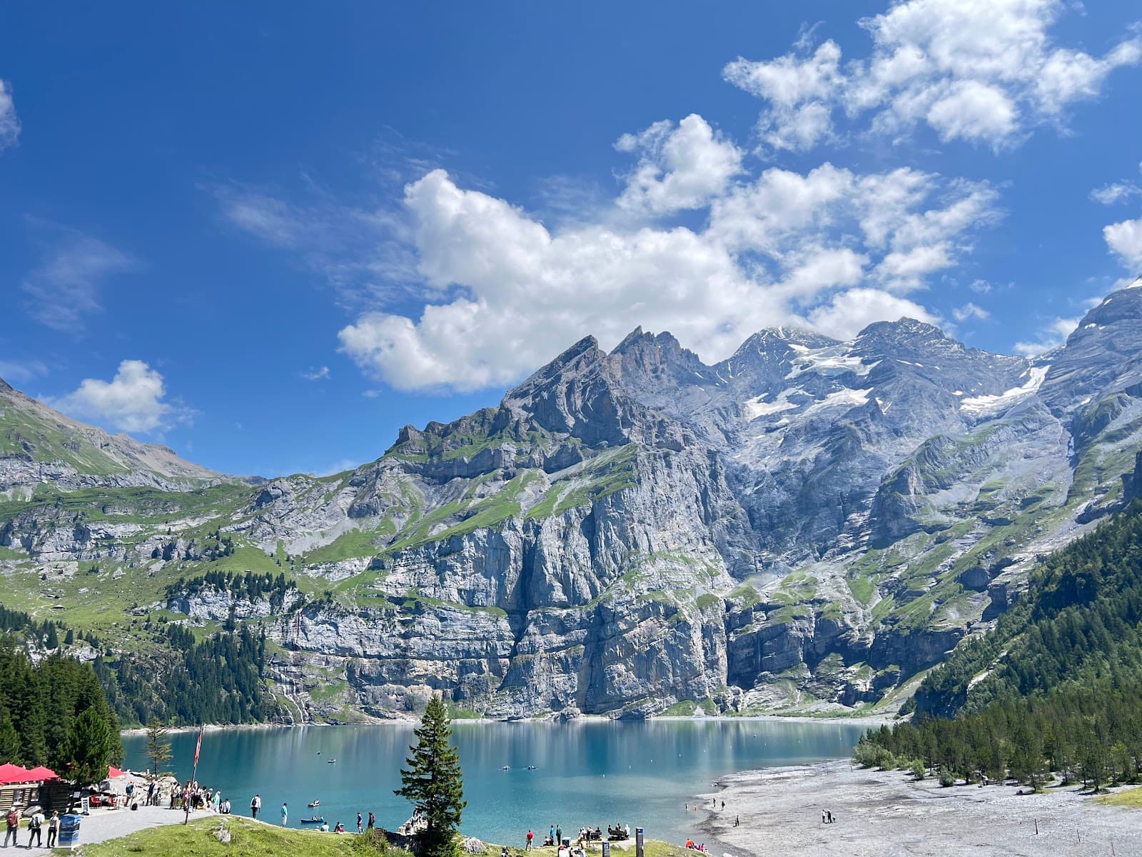
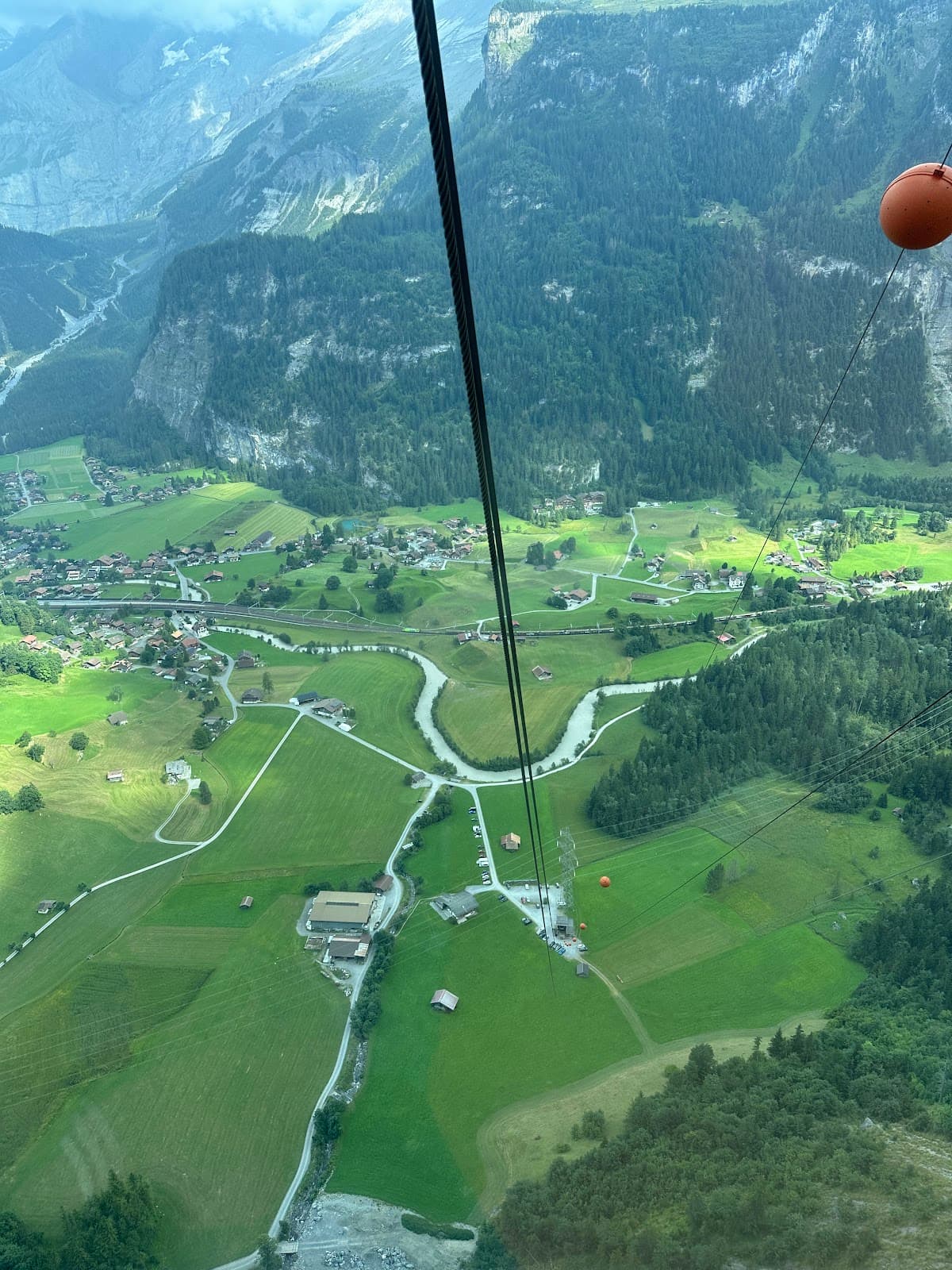
Scenic Gasterntal Drive
Valley floor
A breathtaking drive through a steep-sided valley, offering stunning views of glaciers and alpine landscapes.

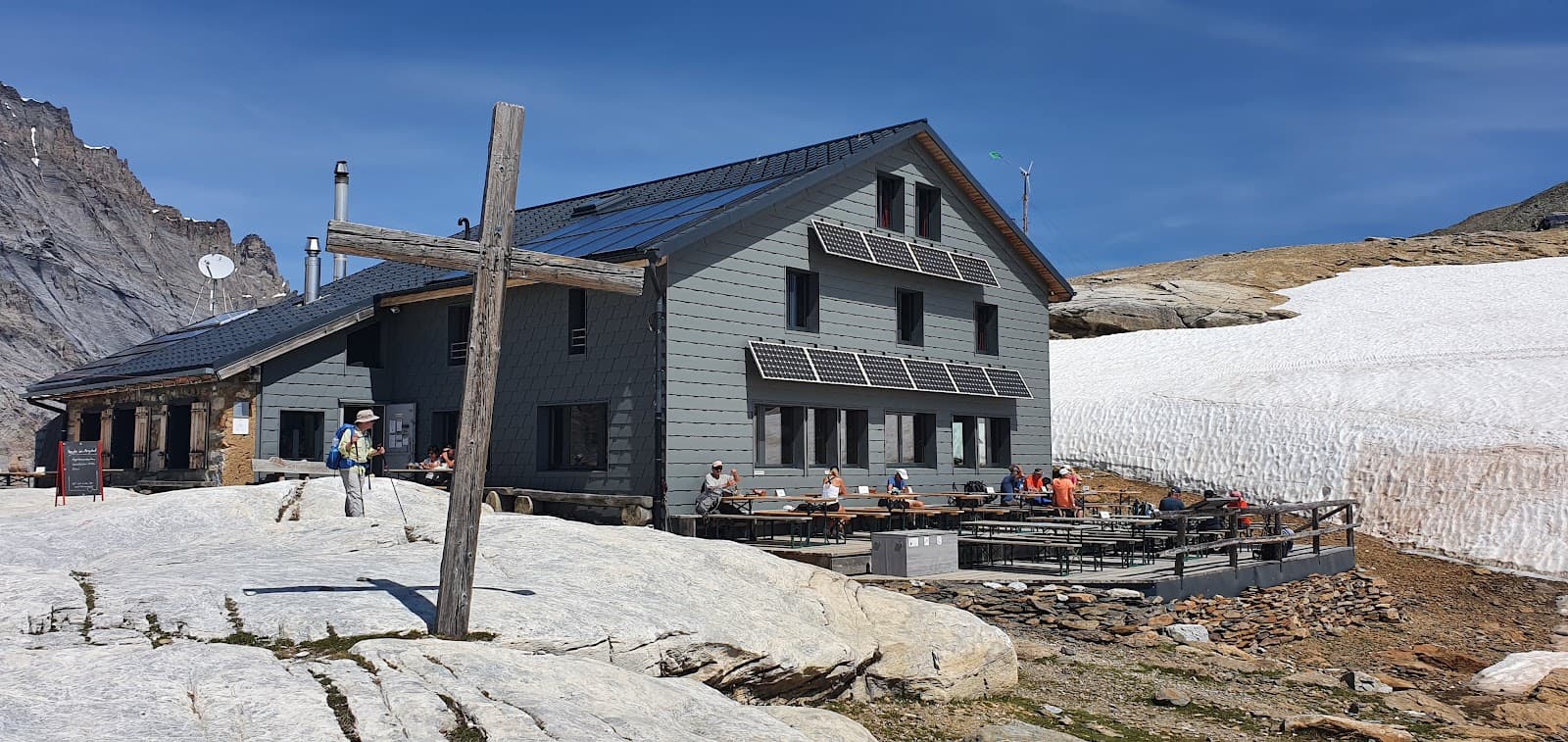
Glacier Hikes
Upper valley trails
Embark on hikes leading towards impressive glaciers, a truly unforgettable alpine adventure.

Alpine Restaurants
Various locations in the valley
Enjoy delicious local cuisine with a view at charming restaurants offering overnight stays.
Plans like a pro.
Thinks like you
Planning Your Visit
Summer Access Only
Hiking Trail Clarity
Best Times
Insider Tips
from TikTok, Instagram & Reddit
A weekend hiking the Gemmi pass via Sion and Kandersteg (August 2015).
(Photo: Entering Gasterntal with Kandersteg in the background) A bit of a nostalgic look back (helped by rainy weather). The trips I did in my first 6 months probably had the biggest impact on me, those I do now are still great – but it is never the same once you have gotten…
🚗 Access Road GPS
Use these coordinates for the access road entrance: N 46°28'28.55470", E 7°39'36.64550"
🥾 Trail Markings
Follow white-red signs for standard hikes and white-blue for adventure trails. Easy to navigate!
Is Kandersteg a good idea to use as a base for 3 days of hiking around there?
Thank you in advance. It's my first time in this part of Switzerland. 1. **Is it still crowded in this time of the year?** 2. **Is there a part of Kandersteg where it makes most sense to stay for connectivity to main train station, public transport and the cable cars?** 3.…
What are the most beautiful and mostly unknown places to visit in Switzerland?
I will be traveling soon for two months and I want to visit unpopular beautiful places in switzerland. What are your recommendations?
☀️ Check Weather
Weather can change quickly in the mountains. Always check forecasts before heading out.
🧺 Picnic Spots
Plenty of gorgeous spots by rivers and in meadows for a scenic picnic lunch.
Alps hiking suggestions?
Hi I’m looking for hiking suggestions. I’ve been to the Alps a couple of times and done a fair amount of hiking already but am looking for new and interesting areas for my next trip. I’ve been to the obvious places you hear mentioned again and again (Chamonix, Bernese Oberland,…
Tips
from all over the internet
🚗 Access Road GPS
Use these coordinates for the access road entrance: N 46°28'28.55470", E 7°39'36.64550"
🥾 Trail Markings
Follow white-red signs for standard hikes and white-blue for adventure trails. Easy to navigate!
☀️ Check Weather
Weather can change quickly in the mountains. Always check forecasts before heading out.
🧺 Picnic Spots
Plenty of gorgeous spots by rivers and in meadows for a scenic picnic lunch.
What Travellers Say
Reviews Summary
Gasterntal is consistently praised as a fantastic hidden gem and a must-visit in the Bernese Oberland. Visitors rave about the perfect weather, well-marked hiking trails, and the stunning natural beauty of the steep-sided valley and its glaciers. The scenic drive and the option for overnight stays at local restaurants add to its charm.
"This place is never disappointing. I was there yesterday and the weather was just perfect.
I hiked all the way unto from the Kandersteg. I just need to utilize the perfect weather.
All the hiking places are perfectly written down with the sign and symbols. There is no way you will miss the trail. White and Red sign are for hiking with the yellow mark and the white and blue sign are for adventure trail.
If you are in Berner overland this is a must for to place."
Nima Shrestha
"This is the most fantastic hidden valley. Only accessible in summer. It’s a Kander flood plain and very docile. The mountains each side are vertiginous and dangerous. Try the Balmhorn if you dare!"
Nicolas Kailides
"Gasterntal is also close to Kandersteg in the Bernese Oberland. If you don't want to go there, you'll also have to take a bus to get there. The Gasterntal natural and tourist paradise also has several restaurants with overnight stays. This area is located at a distance of 1352 m at an altitude of 1635 m. Thank you for nice experiences. With regards Josef
IG: josefonthe_road 👣🌍🤙🏽"
josef_on_the_road
What People Like
What People Dislike
Frequently Asked Questions
🚇 🗺️ Getting There
Gasterntal is accessible by a scenic drive or bus from Kandersteg, but the road is only open in summer. The GPS coordinates for the entrance are N 46°28'28.55470", E 7°39'36.64550". It's a fantastic hidden valley, perfect for exploring if you're in the Bernese Oberland region.
No, the road is only open during the summer months due to snow. Plan your visit between June and October to access the valley by car or bus.
Yes, you can hike all the way from Kandersteg to Gasterntal. It's a rewarding hike that allows you to fully appreciate the stunning alpine scenery.
Gasterntal is located at an altitude of approximately 1352 meters, with some areas reaching up to 1635 meters.
Yes, a bus service operates to Gasterntal from Kandersteg during the summer season, making it accessible for those without a car.
🎫 🎫 Tickets & Entry
There are no specific entry tickets required to access Gasterntal Valley itself. However, there might be parking fees or bus fares to consider.
Gasterntal is a natural valley and is generally accessible during daylight hours when the road is open in summer. There are no set opening or closing times.
The hiking trails within Gasterntal are free to use. Enjoy the well-marked paths without any additional charges.
Yes, several restaurants in Gasterntal offer overnight stays, providing a unique opportunity to experience the valley's tranquility.
While the drive itself is free, there may be a toll or fee for using the access road, especially if it's a private road. It's best to check locally for current charges.
🎫 🏞️ Onsite Experience
The valley offers various trails, from gentle walks along the flood plain to more adventurous routes leading towards glaciers. Trails are clearly marked with white-red and white-blue signs.
Yes, Gasterntal has several restaurants that serve local cuisine and also offer accommodation. They are perfect spots to refuel after a hike.
Many barbecue places are already set up within the valley, making it an ideal spot for a picnic or a leisurely outdoor meal.
Expect steep, vertiginous mountains on either side of a docile flood plain, with gorgeous rivers and views of glaciers. It's a fantastic natural paradise.
The valley offers a mix of gentle walks and more challenging hikes, with beautiful natural scenery and picnic spots, making it enjoyable for families.
📸 📸 Photography
Capture the dramatic steep-sided valley, the serene flood plain, glacial landscapes, and charming alpine restaurants. The drive itself offers numerous scenic viewpoints.
Early mornings and late afternoons often provide the best light for photography, with golden hour casting a beautiful glow over the mountains and valley.
Every turn on the scenic drive and along the hiking trails offers a postcard-worthy view. Keep an eye out for panoramic vistas of the valley and surrounding peaks.
A wide-angle lens is great for capturing the expansive valley, while a telephoto lens can be useful for zooming in on glaciers and mountain details.
Drone regulations can vary. It's advisable to check local rules and regulations regarding drone usage in protected natural areas before flying.


Social
from TikTok, Instagram & Reddit