Oro City Site California Gulch
A legendary, high-altitude off-road trail in Colorado's San Juan Mountains, offering extreme challenges and unparalleled alpine vistas.
Highlights
Must-see attractions

Social
From TikTok & Reddit
Best Time
Clearer skies, less chance of storms
Oro City Site California Gulch
Best Time
Clearer skies, less chance of storms
Highlights
Must-see attractions
A legendary, high-altitude off-road trail in Colorado's San Juan Mountains, offering extreme challenges and unparalleled alpine vistas.
🚗 Tire Pressure Management
Learn to air down for traction and air up for road travel. Essential for tackling rough terrain! :tire_flat:
⚙️ Master 4-Low
Understanding and utilizing 4-wheel low is critical for navigating steep inclines and descents. ⚙️
Quick Facts
Type
Natural Feature
Highlights
Discover the most iconic attractions and experiences
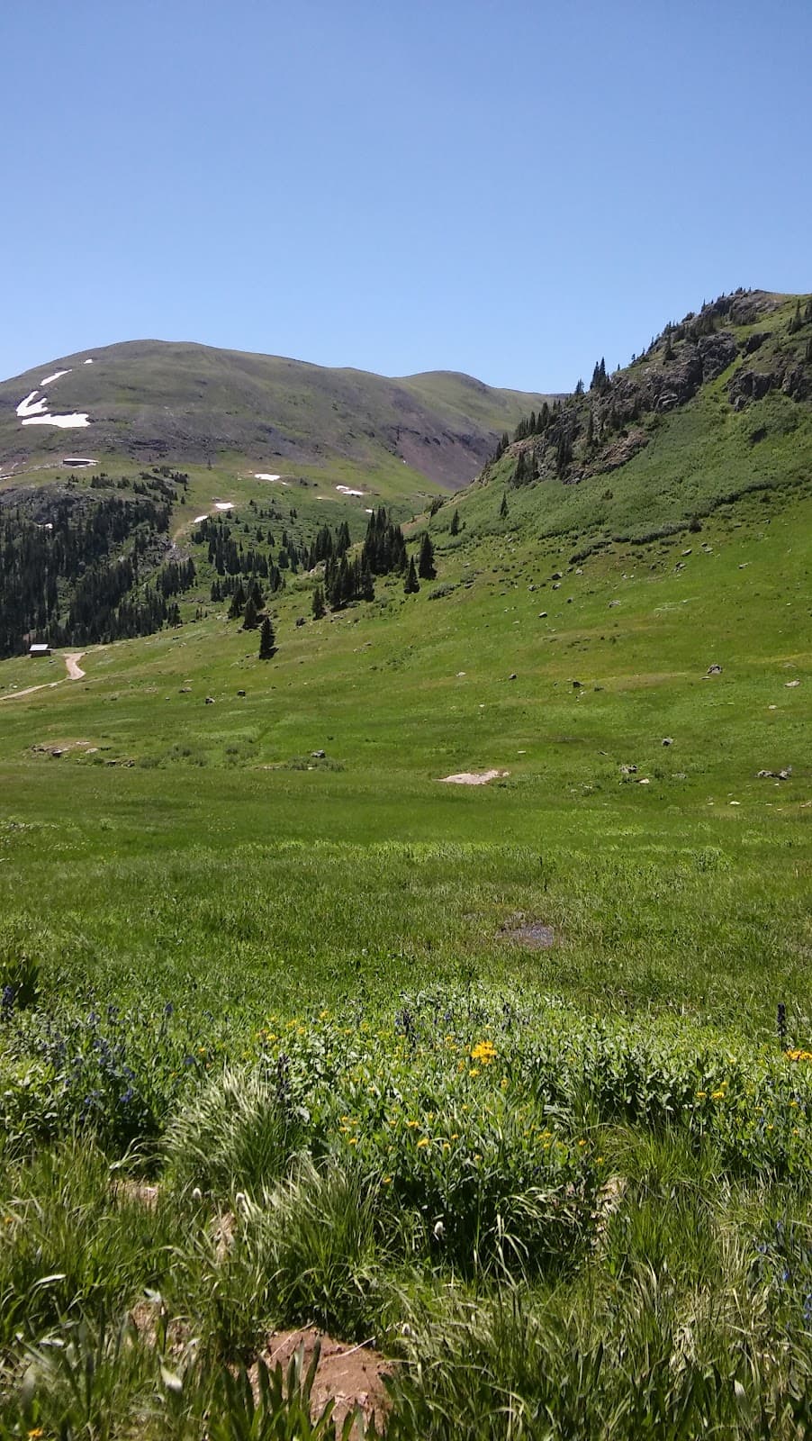
California Gulch Trail
San Juan Mountains, Colorado
A challenging off-road adventure with stunning mountain vistas and rugged terrain.
Alpine Loop Scenic Byway
San Juan Mountains, Colorado
Connects multiple historic mining areas and offers breathtaking high-altitude scenery.

Historic Mining Sites
Along California Gulch and Alpine Loop
Explore remnants of Colorado's rich mining past amidst dramatic mountain landscapes.
Plans like a pro.
Thinks like you
Planning Your Visit
Trail Difficulty & Vehicle Prep
Navigation & Trail Conditions
Best Times
Insider Tips
from TikTok, Instagram & Reddit
Flatland Noob tries Colorado, these trails are intense! Stock JKU on 33”
Spent a week in Colorado, I did Mosquito pass and the Alpine loop ( Cinnamon pass, California Gulch, Engineer pass, Placer Gulch) What I learned; How to use 4wheel low, how to air down and up my tires, that OnX off road can be deceiving at times. I only got 9 scraps which was…
🚗 Tire Pressure Management
Learn to air down for traction and air up for road travel. Essential for tackling rough terrain! :tire_flat:
⚙️ Master 4-Low
Understanding and utilizing 4-wheel low is critical for navigating steep inclines and descents. ⚙️
Who else has done Mosquito Pass?
Pics from 9/2/24. Such a fun road, incredible views and lots of rock. I tried to send this pass a few years ago in 2Hi as the 4x4 in my Explorer wasn’t engaging but she overheated on the switchbacks and had to bail. Finally able to redeem myself in the Ranger and made it across.
🛡️ Protect Your Undercarriage
Skid plates are a must-have to prevent serious damage from rocks and obstacles. 🛡️
🗺️ Reliable Navigation
Don't solely rely on apps; carry physical maps or have offline GPS. :world_map:
Tips
from all over the internet
🚗 Tire Pressure Management
Learn to air down for traction and air up for road travel. Essential for tackling rough terrain! :tire_flat:
⚙️ Master 4-Low
Understanding and utilizing 4-wheel low is critical for navigating steep inclines and descents. ⚙️
🛡️ Protect Your Undercarriage
Skid plates are a must-have to prevent serious damage from rocks and obstacles. 🛡️
🗺️ Reliable Navigation
Don't solely rely on apps; carry physical maps or have offline GPS. :world_map:
🛠️ Carry Recovery Gear
Be prepared for potential stuck situations with tow straps and recovery points. 🔧
What Travellers Say
Reviews Summary
Visitors praise the breathtaking scenery and the thrill of tackling the challenging California Gulch trail as part of the Alpine Loop. The historic mining remnants add a unique dimension to the adventure. However, many caution that the trail is extremely difficult and requires a highly capable vehicle and experienced driver, with potential for damage if not properly prepared.
What People Like
What People Dislike
Frequently Asked Questions
🚇 🗺️ Getting There
Oro City Site California Gulch is typically accessed via the Alpine Loop Scenic Byway, a challenging off-road trail. It's best reached with a high-clearance 4x4 vehicle. The closest towns for staging are Lake City and Silverton, Colorado.
A stock Jeep Wrangler on 33" tires can struggle. A high-clearance 4x4 with good articulation, low-range gearing, and preferably skid plates is highly recommended.
Services are extremely limited to non-existent along the trail itself. Ensure you have a full tank of gas, plenty of water, and all necessary supplies before starting.
California Gulch is part of the Alpine Loop, which is a two-way trail. Be prepared for oncoming traffic, especially during peak season.
The nearest major airports are Montrose Regional Airport (MTJ) and Durango-La Plata County Airport (DRO), both requiring a significant drive to reach the trailheads.
🎫 🎫 Tickets & Entry
Generally, no specific permit is required for driving the California Gulch trail itself, as it's part of the public Alpine Loop Scenic Byway. However, always check local regulations for any temporary closures or restrictions.
There are no direct entrance fees for accessing the Oro City Site or driving the California Gulch trail. However, you will incur costs for fuel, vehicle preparation, and potentially camping or lodging.
The California Gulch trail, as part of the Alpine Loop, is typically accessible during the warmer months, generally from late May or June through October, depending on snow conditions. It is not maintained in winter.
No, the trail is impassable and dangerous during winter months due to heavy snow. It's best visited from late spring through early fall.
Mornings are often best for clearer weather and fewer crowds. Be aware of afternoon thunderstorms common in the Colorado mountains.
🎫 🧭 Onsite Experience
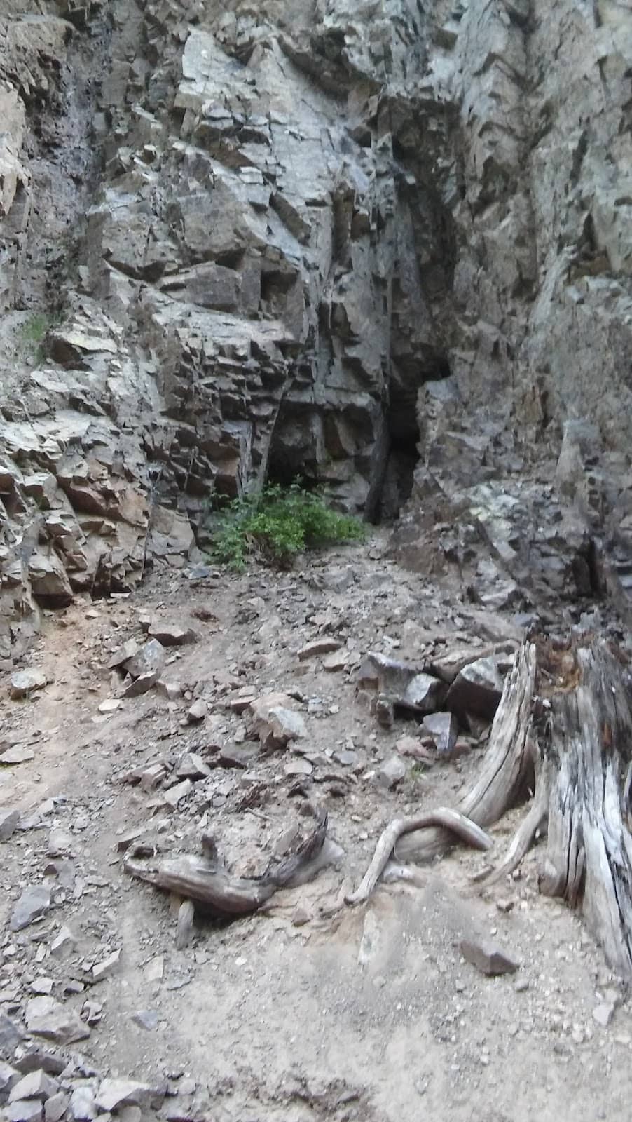
Oro City was a historic mining town. While little remains of the town itself, the site offers a glimpse into Colorado's mining past, with remnants and the dramatic mountain scenery that attracted miners. The surrounding California Gulch trail is the main attraction.
Driving the entire California Gulch trail, especially as part of the Alpine Loop, can take anywhere from 4 to 8 hours or more, depending on your pace, stops for photos, and any trail challenges.
While the primary activity is off-roading, there are opportunities for short hikes to explore historical remnants or enjoy the alpine scenery. Be prepared for rugged terrain.
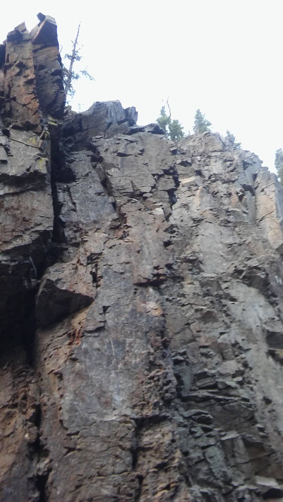
The trail is known for its steep ascents and descents, rocky sections, narrow passages, and potential water crossings. It requires careful driving and good vehicle control.
Cell service is extremely unreliable to non-existent for most of the California Gulch trail. It's crucial to download offline maps and inform someone of your travel plans.
🍽️ 🍽️ Food & Dining
No, there are no restaurants, cafes, or food services available at the Oro City Site or along the California Gulch trail. You must bring all your own food and drinks.
Pack plenty of water, high-energy snacks (trail mix, energy bars), and a packed lunch. Consider items that don't require refrigeration and are easy to eat while on the go.
Dining options are available in the nearby towns of Lake City and Silverton. These towns offer various restaurants, from casual diners to more established eateries.
Dispersed camping is allowed in designated areas along the Alpine Loop, but be sure to follow Leave No Trace principles. Campfires may be restricted due to fire danger.
There are numerous scenic pull-offs and small clearings along the Alpine Loop that make for excellent picnic spots. Choose a safe location away from the main trail.
📸 📸 Photography
The dramatic mountain landscapes, historic mining remnants, rugged trail conditions, and potential wildlife sightings offer fantastic photography opportunities. Capture the scale of the San Juan Mountains.
Early morning and late afternoon offer the best light for landscape photography, with softer shadows and warmer tones. Midday sun can be harsh.
A wide-angle lens is great for landscapes. A telephoto lens can be useful for wildlife. Ensure your gear is protected from dust and moisture. A sturdy tripod is helpful for low-light conditions.
Drone usage is subject to federal and local regulations. Check with the US Forest Service for specific rules regarding drone operation in the San Juan National Forest.
Focus on shots that show the vehicle navigating obstacles, the steepness of the terrain, and the scale of the surrounding mountains to convey the difficulty.


Social
from TikTok, Instagram & Reddit