
Path of the Flood Trail
A 14-mile historical trail tracing the 1889 Johnstown Flood, offering poignant history and scenic beauty. Pennsylvania's 2025 Trail of the Year.

Highlights
Must-see attractions

Social
From TikTok & Reddit
Best Time
Fresh air, blooming nature
Path of the Flood Trail
Best Time
Fresh air, blooming nature
Highlights
Must-see attractions
A 14-mile historical trail tracing the 1889 Johnstown Flood, offering poignant history and scenic beauty. Pennsylvania's 2025 Trail of the Year.

👟 Wear sturdy footwear
Some sections are rugged and can be muddy after rain. Good hiking boots are a must!
🗺️ Download trail map
Cell service can be unreliable. A downloaded map is essential for navigation.

Quick Facts
Highlights
Discover the most iconic attractions and experiences
South Fork Dam Breach Site
Trailhead
Stand where the catastrophic 1889 flood began. A somber reminder of nature's power.

Historical Markers
Along the trail
Discover the story of the 1889 flood through informative signage and markers.

Scenic Overlooks
Various points
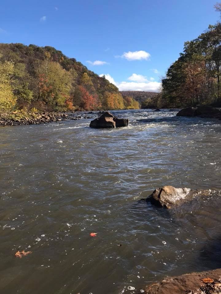
Enjoy breathtaking views of the surrounding Pennsylvania landscape, especially after rain.
Plans like a pro.
Thinks like you
Planning Your Visit
Plan Your Hike

Historical Significance
Best Times
Insider Tips
from TikTok, Instagram & Reddit
👟 Wear sturdy footwear
Some sections are rugged and can be muddy after rain. Good hiking boots are a must!
🗺️ Download trail map
Cell service can be unreliable. A downloaded map is essential for navigation.
💧 Check weather forecast
Heavy rains can cause localized flooding and landslides on the trail.
📚 Learn the history
The trail is rich with historical context about the 1889 flood. Read the markers!
Tips
from all over the internet
👟 Wear sturdy footwear
Some sections are rugged and can be muddy after rain. Good hiking boots are a must!
🗺️ Download trail map
Cell service can be unreliable. A downloaded map is essential for navigation.
💧 Check weather forecast
Heavy rains can cause localized flooding and landslides on the trail.
📚 Learn the history
The trail is rich with historical context about the 1889 flood. Read the markers!
What Travellers Say
Reviews Summary
Visitors praise the Path of the Flood Trail for its profound historical significance and scenic beauty, particularly after rainfall. While the trail offers a unique educational experience, some find certain sections rugged and challenging, emphasizing the need for proper footwear and preparation. The trail's designation as Pennsylvania's Trail of the Year highlights its importance.
What People Like
What People Dislike
Frequently Asked Questions
🚇 🗺️ Getting There
The trail has multiple access points. The main trailhead is often considered near the South Fork Dam area. It's recommended to research specific entry points based on the section you wish to hike. Driving is the primary way to access the trailheads.
Public transportation options are very limited for accessing trailheads. It's best to plan for private vehicle transportation. Consider carpooling if you're meeting others.
Parking availability varies by trailhead. Some popular access points may have designated parking areas, but these can fill up, especially on weekends. Research your specific entry point for parking details.
While parts of the trail may be suitable for cycling, it's primarily a hiking trail. Some sections are rugged and may not be ideal for all types of bikes. Check trail conditions before you go.
The Path of the Flood Trail is 14 miles long. While ambitious hikers might complete it in a day, it's often best enjoyed over multiple shorter hikes to fully appreciate the historical markers and scenery.
🎫 🎫 Tickets & Entry
No, the Path of the Flood Trail is generally free to access. It's a public trail maintained for historical and recreational purposes.
As an outdoor trail, it's typically accessible from dawn to dusk. There are no set operating hours, but it's advisable to hike during daylight for safety and visibility.
There is no entrance fee to hike the Path of the Flood Trail. Enjoy this historical journey at no cost.
Dogs are generally allowed on the Path of the Flood Trail, but they must be kept on a leash. Always clean up after your pet.
While official guided tours might be infrequent, local historical societies or outdoor groups sometimes organize walks. Keep an eye on local event listings or consider joining a group hike.
🎫 🏞️ Onsite Experience
The terrain varies significantly. You'll encounter wooded paths, rocky climbs, and some areas that can be muddy or show signs of past landslides. Sturdy hiking boots are highly recommended.
Bring plenty of water, snacks, a first-aid kit, insect repellent, and sun protection. A downloaded trail map is crucial as cell service is unreliable.
Restroom facilities are limited and may only be available at certain access points or trailheads. Plan accordingly and use facilities before you start your hike.
Some sections are suitable for families, but the rugged terrain and length might be challenging for very young children. Consider shorter, more accessible segments if hiking with kids.
You might encounter common woodland creatures such as deer, squirrels, and various bird species. Always observe wildlife from a distance and do not feed them.
📸 📸 Photography
Look for scenic overlooks, the historical markers, and any waterfalls that appear after rain.
It depends on the section. While some areas are flat, others involve rocky climbs. It's best to pause at safe spots to take photos to avoid accidents.
Early morning or late afternoon often provide the best light for landscape photography. However, the trail's historical nature can be compelling at any time.
Drone usage regulations can vary. It's essential to check local rules and regulations regarding drone operation in state parks or natural areas before flying.
A versatile camera with a good zoom lens is useful for capturing both landscapes and details. A wide-angle lens can be great for expansive views. Ensure your gear is protected from the elements.




Social
from TikTok, Instagram & Reddit