Icy Lake and Upper Reid Falls Trail
Hike through Alaskan wilderness to three stunning mountain lakes and the powerful Upper Reid Falls. A challenging but rewarding adventure.
Highlights
Must-see attractions

Social
From TikTok & Reddit
Best Time
Best light, fewer crowds
Icy Lake and Upper Reid Falls Trail
Best Time
Best light, fewer crowds
Highlights
Must-see attractions
Hike through Alaskan wilderness to three stunning mountain lakes and the powerful Upper Reid Falls. A challenging but rewarding adventure.
"The falls are totally worth it! I think going down was more difficult than going up."
👟 Sturdy Footwear is Key
The initial climb is steep and trails can be muddy. Good hiking boots are essential for this trek.
⚠️ Use Caution at Falls
The path to the 'real' Upper Reid Falls is steep and slippery. Rope access is at your own risk.
Quick Facts
Highlights
Discover the most iconic attractions and experiences
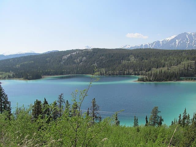
Lower Dewey Lake
Start of the trail
A beautiful mountain lake offering a serene start to your hike.
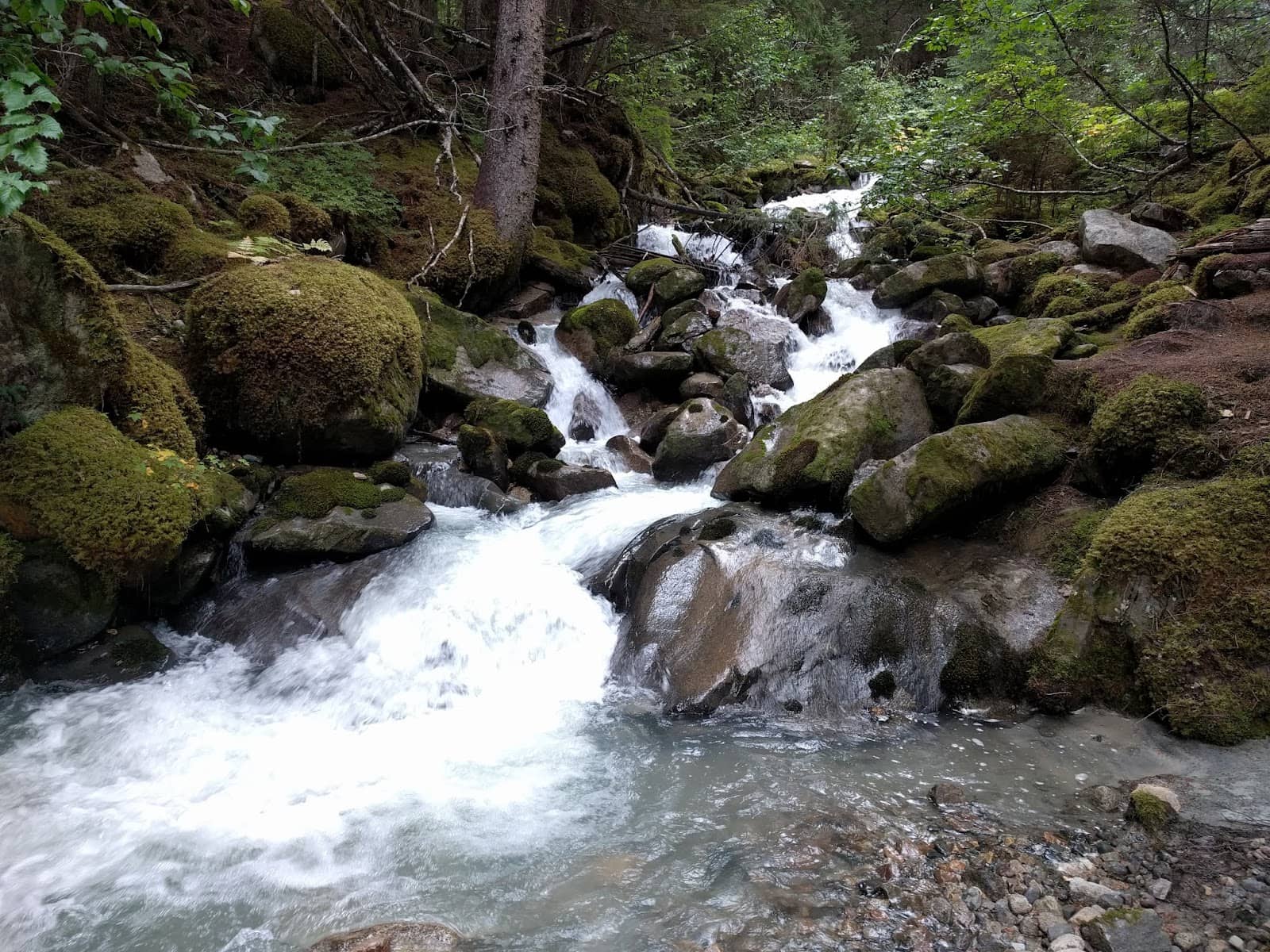
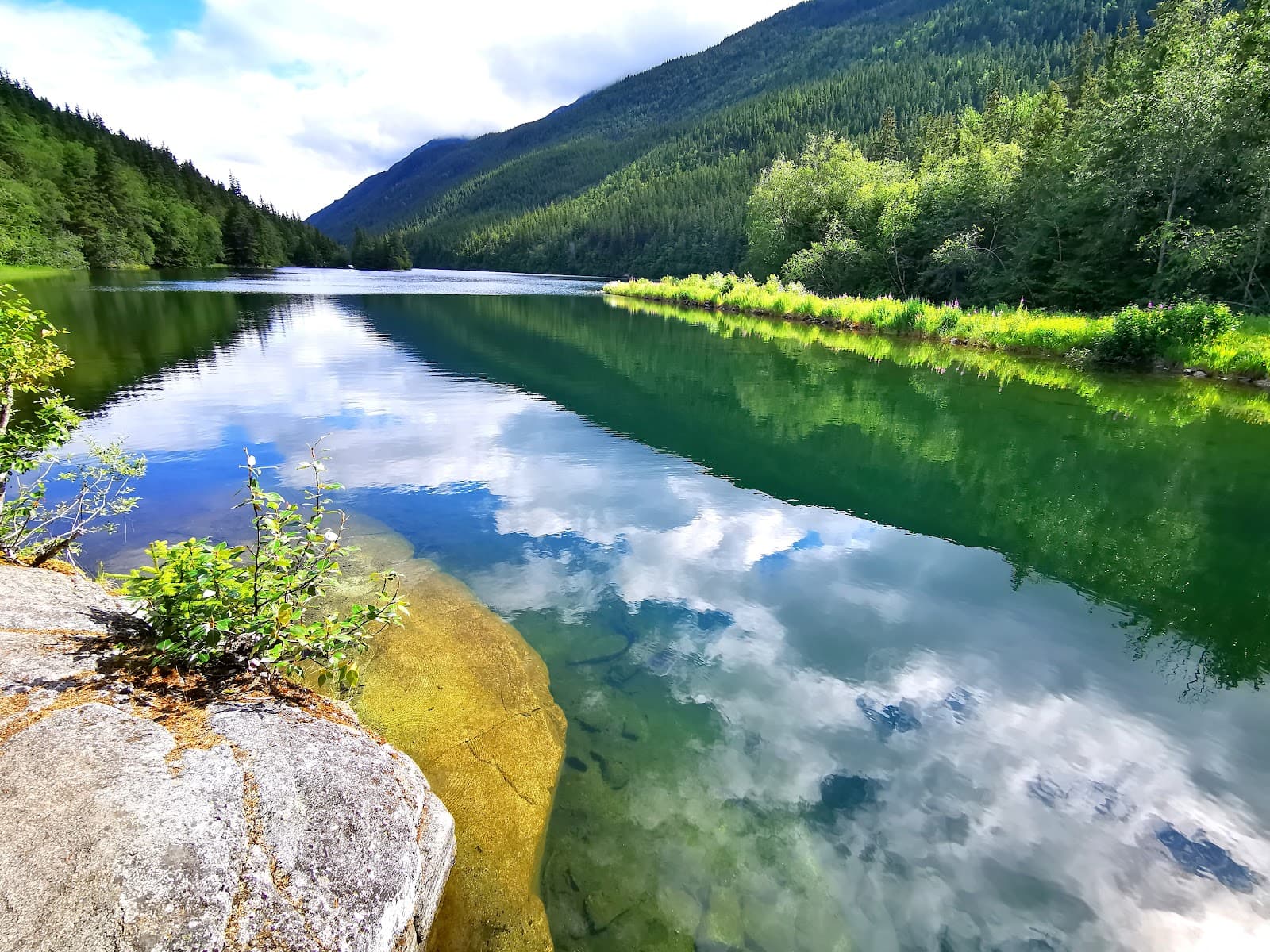
Icy Lake
Along the trail
Experience the unique sight of a lake filling with glacial silt.

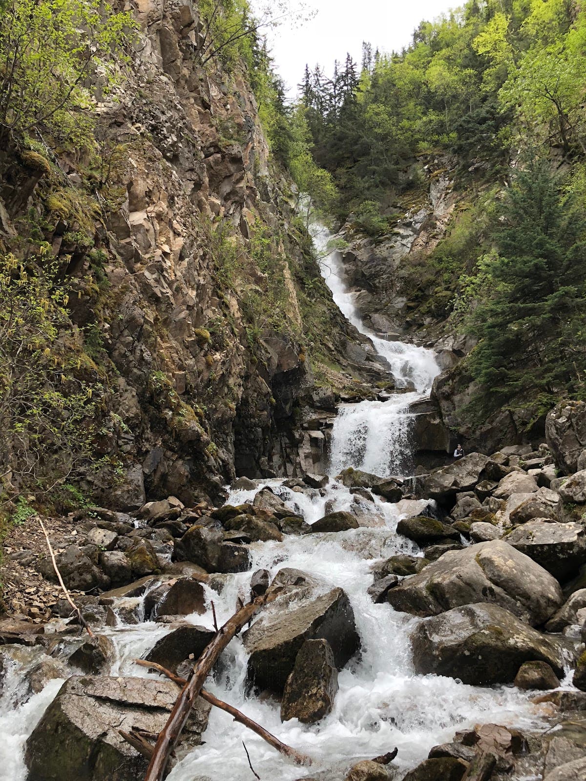
Upper Reid Falls
End of the trail
A powerful cascade, though access to the most impressive view requires caution.
Plans like a pro.
Thinks like you
Planning Your Visit
Trail Difficulty & Timing
Accessing Upper Reid Falls
Best Times
Insider Tips
from TikTok, Instagram & Reddit
👟 Sturdy Footwear is Key
The initial climb is steep and trails can be muddy. Good hiking boots are essential for this trek.
⚠️ Use Caution at Falls
The path to the 'real' Upper Reid Falls is steep and slippery. Rope access is at your own risk.
💧 Be Prepared for Mud
Icy Lake can be particularly muddy due to glacial silt. Waterproof gear is recommended.
🗺️ Follow Trail Signs Carefully
Signs may direct you to a 'safer' but less impressive waterfall. Know your route.
Tips
from all over the internet
👟 Sturdy Footwear is Key
The initial climb is steep and trails can be muddy. Good hiking boots are essential for this trek.
⚠️ Use Caution at Falls
The path to the 'real' Upper Reid Falls is steep and slippery. Rope access is at your own risk.
💧 Be Prepared for Mud
Icy Lake can be particularly muddy due to glacial silt. Waterproof gear is recommended.
🗺️ Follow Trail Signs Carefully
Signs may direct you to a 'safer' but less impressive waterfall. Know your route.
⏰ Allow Ample Time
The full ~7-mile hike can take 3-4 hours, depending on your pace and stops.
What Travellers Say
Reviews Summary
This hike offers stunning natural beauty with three mountain lakes and impressive falls, but be prepared for a challenging, steep initial climb and potentially muddy conditions. Accessing the 'real' Upper Reid Falls requires navigating a steep, slippery path with a rope, which is at your own risk.
"It's a nice hike with 3 beautiful mountain lakes plus the falls but the initial part of the hike is straight up for about 3/4 of a mile"
michael wiland
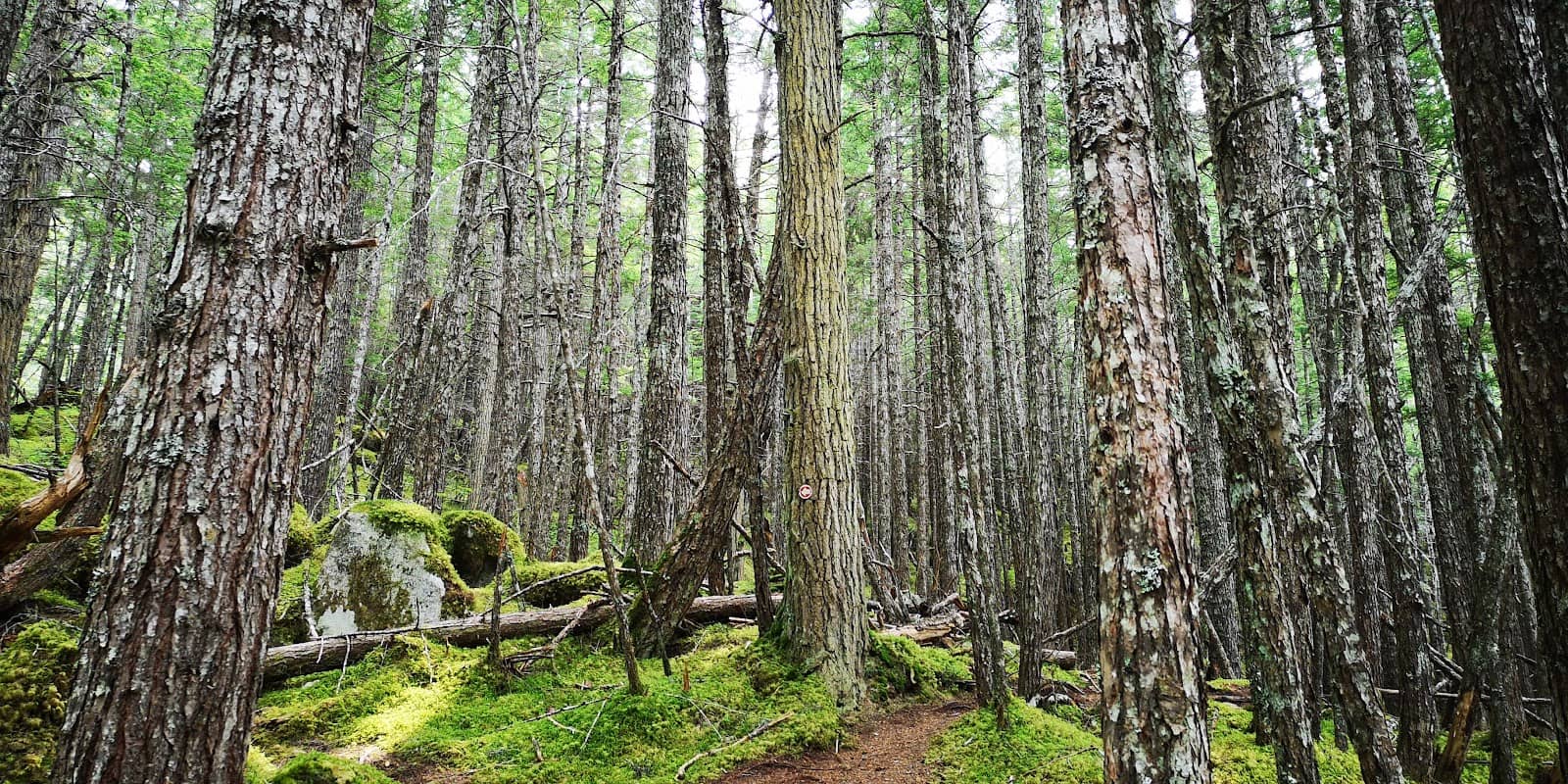
"At Lower Dewey Lake, turn left at the junction sign and follow the trail north. Cross several wooden footbridges, continuing north through spruce and hemlock forest, past the intersection with the trail to Upper Dewey Lake. Expect muddy places along the shore of Icy Lake, because the north end of the lake is filling with glacial silt.
When you see the sign showing 'Upper Reid Falls' going left and 'Service Road' going right, take the right 'Service Road' option. For some reason (most likely due to safety concerns) they want people to go to the smaller less impressive but safer 'fake' Upper Reid Falls, as opposed to the much higher and impressive 'real' Upper Reid Falls.
The trail will take you down to the creek bed which you walk along before finding the somewhat overgrown service trail. Note: the creek bed may or may not have water in it, depending on season and whether water is coming from the pipe further up. After a short time you will find a large metal pipe, which for the last 1/4 mile the trail you walk parallel with, that diverts water into Icy Lake from Reid Falls.
At the falls, use caution around the power company equipment shack, service catwalk and cliff edge. There is no 'safe' way to descend from this point to Lower Reid Falls, however there is a rope down (when I was there last on 7th September 2018) a very muddy and steep slope, with a very slippery, small and treacherous standing spot at the bottom, with only space for one at a time. The rope is too short, and I literally had to dig foot-holes in the mud bank to climb back up to the rope to climb back up.
A great ~7 mile (11km) round trip hike that takes 3-4 hours depending on your fitness and walking speeds."
Alan Mc
"Upper is kinda very blocked but if you use a hidden foot path behind the lower falls. There is a rope. Use at your own risk but it’s how I got the video I shared."
Brandon Gallegos
What People Like
What People Dislike
Frequently Asked Questions
🚇 🗺️ Getting There
From the Skagway cruise port, you can walk to the trailhead. It's about a 4.6-mile round trip hike starting from near the Gold Rush Cemetery. Some parts are on main tourist streets before heading into nature.
While walking is common, you might find local shuttle services or taxis available in Skagway, especially during cruise season, though walking is often recommended for the experience.
Limited parking may be available near the Gold Rush Cemetery, which is a common starting point for the hike. It's best to check local conditions upon arrival.
Many cruisers opt to walk from the port, combining the hike with exploring Skagway. It's a popular self-guided excursion. +1
The initial part of the trail is a steep climb, and the path to the 'real' Upper Reid Falls is challenging. It's best suited for those with moderate to good fitness.
🎫 🎫 Tickets & Entry
No, the trail itself is generally free to access. It's a public hiking trail in Skagway.
Access to the Gold Rush Cemetery, often a starting point, is typically free.
As an outdoor trail, it's accessible during daylight hours. However, hiking in the dark is not recommended due to trail conditions.
Many visitors complete this hike independently. Guided tours are available but not mandatory. +1
The trail is generally open year-round, but conditions can be challenging in winter due to snow and ice. Summer and early fall are ideal.
🎫 🏞️ Onsite Experience
The full round trip hike is approximately 7 miles (11 km), taking about 3-4 hours depending on your fitness level.
The hike starts with a steep 3/4-mile climb. The path to the 'real' Upper Reid Falls is steep, muddy, and requires caution.
You'll encounter three beautiful mountain lakes: Lower Dewey Lake, Icy Lake, and the destination, Upper Reid Falls.
It's not recommended to drink directly from Icy Lake. Always carry sufficient water or use a water filter.
Wear sturdy hiking boots, moisture-wicking clothing, and consider rain gear as weather can change quickly. Layers are recommended.
📸 📸 Photography Tips
The shores of Lower Dewey Lake and Icy Lake offer beautiful reflections. The area around Upper Reid Falls provides dramatic waterfall shots, but be mindful of safety.
Yes, but accessing the best vantage points for the 'real' Upper Reid Falls can be challenging and requires careful navigation.
Morning light can be soft and beautiful on the lakes. Late afternoon offers golden hour light, but be aware of the time needed to descend safely.
Drone usage may be restricted in certain areas, especially near the power company equipment at the falls. Always check local regulations before flying.
The Gold Rush Cemetery near the trailhead offers historical photo opportunities.


Social
from TikTok, Instagram & Reddit