
Guacamole Trail
Technical mountain biking and hiking trails with stunning Zion views, but navigation is key.
Highlights
Must-see attractions

Social
From TikTok & Reddit
Best Time
Ideal temps, avoid midday heat
Guacamole Trail
Best Time
Ideal temps, avoid midday heat
Highlights
Must-see attractions
Technical mountain biking and hiking trails with stunning Zion views, but navigation is key.
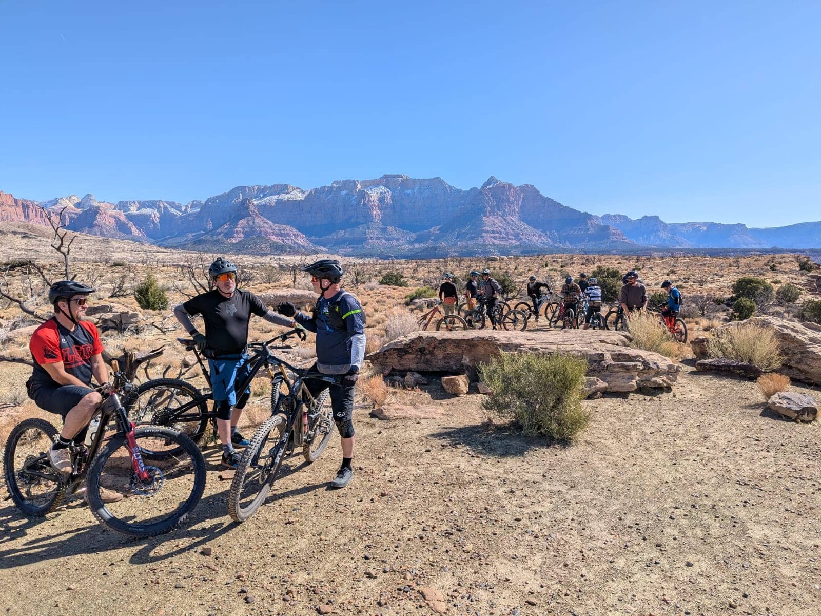
"Amazing group of intermediate to advanced mountain biking trails near Hurricane Utah."
GPS is Your Best Friend
No official signs! Use MTBProject or HikingProject apps to stay on track. :iphone:
All-Wheel Drive Recommended
The last 1.5 miles of the access road can be rough. AWD helps. 🚗
Quick Facts
Rating
4.7 · 39 reviews
Type
Hiking Area
Address
Website
nps.gov/zion/index.htmHighlights
Discover the most iconic attractions and experiences
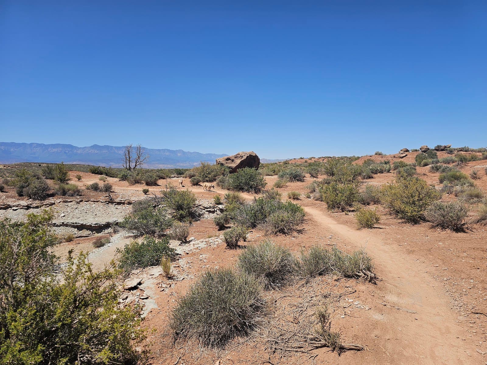
Slickrock and Rim Trails
Mesa Rim
Experience thrilling technical riding with stunning canyon views. A true test of skill!
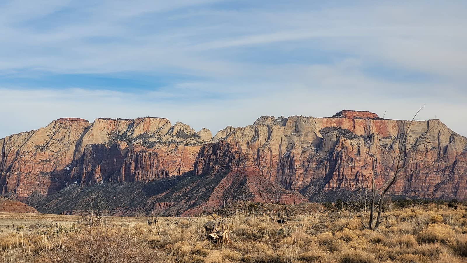
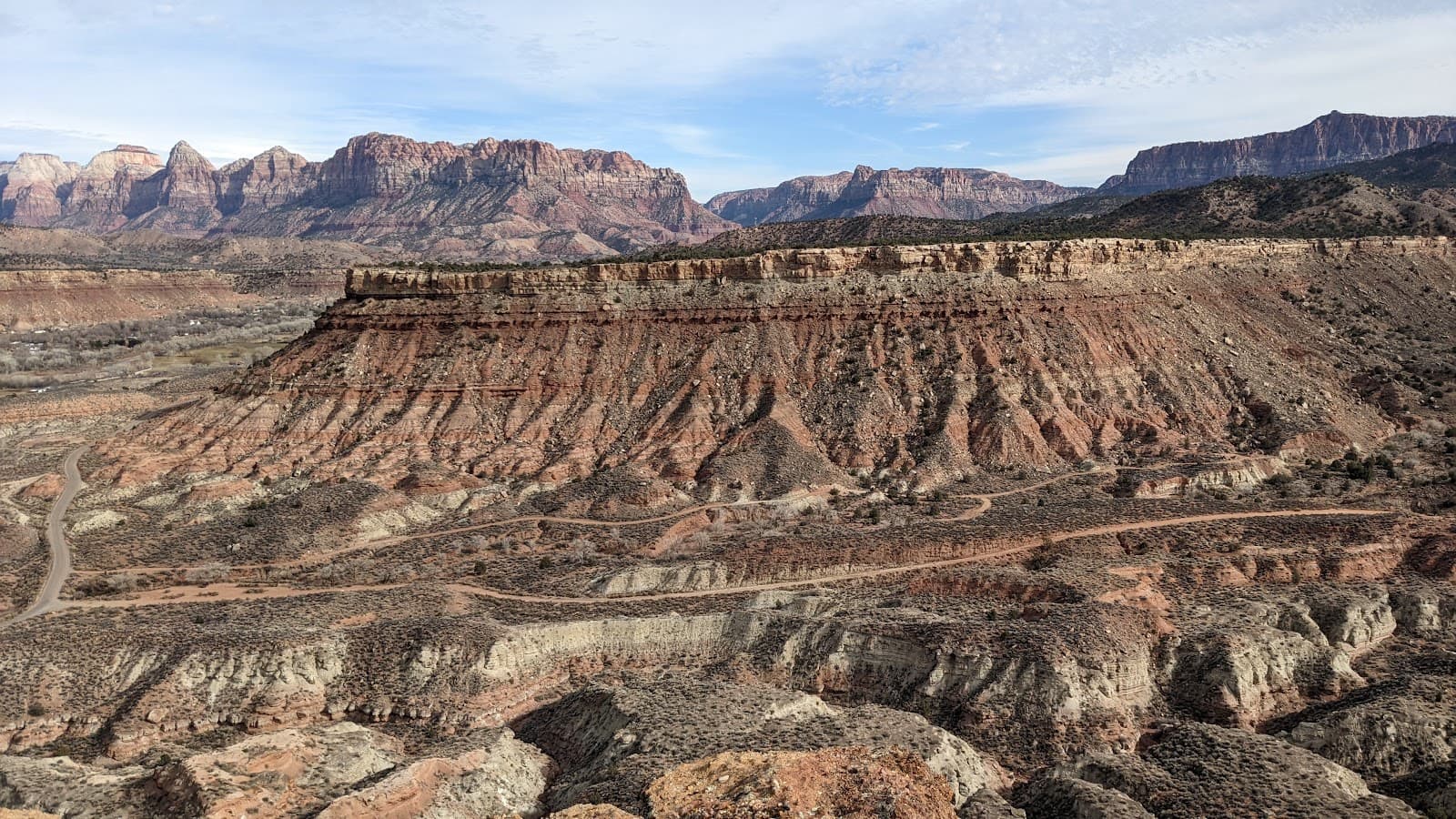
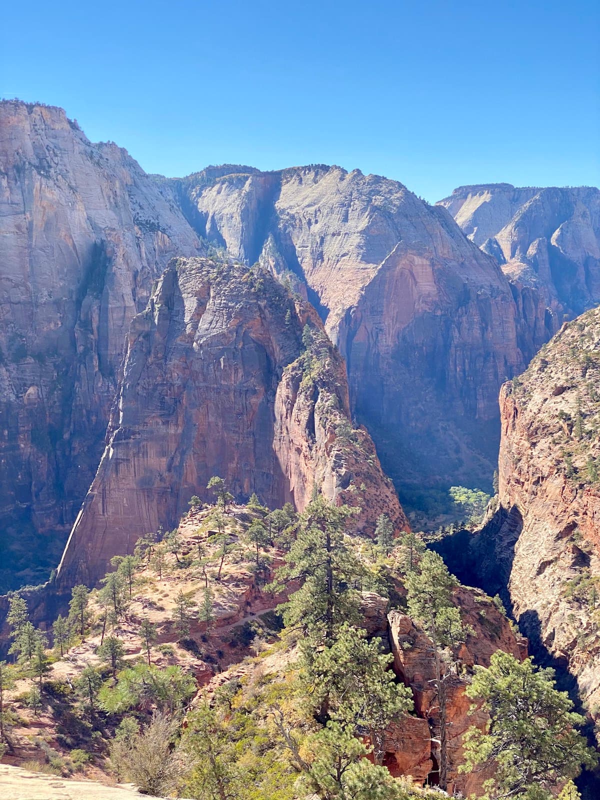
Zion Peak Vistas
Various points along the trails
Enjoy breathtaking panoramic views of Zion National Park's majestic peaks.
Technical Riding Challenges
Throughout the trail system
Master challenging moves on a mix of slickrock and rocky terrain. Fun for intermediate to advanced riders.
Plans like a pro.
Thinks like you
Planning Your Visit
Navigate the Guacamole Trail Maze
Best Time for Optimal Riding
Best Times
Insider Tips
from TikTok, Instagram & Reddit
St. George UT favorite trail
I'm going to St. George with the in laws. I'll only have time to do one ride while I'm in the area so I need some help picking. (longer ride on the hard side)
GPS is Your Best Friend
No official signs! Use MTBProject or HikingProject apps to stay on track. :iphone:
All-Wheel Drive Recommended
The last 1.5 miles of the access road can be rough. AWD helps. 🚗
Hydration is Key
Bring plenty of water, especially for pets. No water sources on the mesa. :water_wave:
Start on Slickrock
When you park, begin on the slickrock sections for the best experience. :rock:
Tips
from all over the internet
GPS is Your Best Friend
No official signs! Use MTBProject or HikingProject apps to stay on track. :iphone:
All-Wheel Drive Recommended
The last 1.5 miles of the access road can be rough. AWD helps. 🚗
Hydration is Key
Bring plenty of water, especially for pets. No water sources on the mesa. :water_wave:
Start on Slickrock
When you park, begin on the slickrock sections for the best experience. :rock:
Plan for 3-4 Hours
Allow ample time for navigation and enjoying the views. 🕐
What Travellers Say
Reviews Summary
Visitors rave about the Guacamole Trail's challenging technical riding and stunning canyon views, particularly the vistas of Zion National Park. However, the lack of signage is a significant drawback, making navigation difficult and requiring careful planning with GPS. The access road can also be a concern for some vehicles.
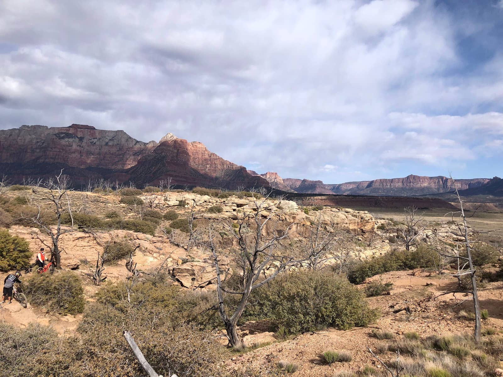
"Great technical mountain biking trails! These were tough but a lot of fun. The area is very scenic and is tucked up into a canyon that millions of people drive past every year.
It has some pretty amazing views of the peaks of Zion.
The dirt road to get up there was pretty good all the way up with a little wash board through out and bit towards the top."
Joey Winzenried
"Amazing group of intermediate to advanced mountain 🏔 biking 🚴🏿♂️ trails near Hurricane Utah. Mixture of slickrock and rocky trails many of which are along the Mesa rim providing excellent views and technical riding exposure. Lots of fun technical moves required and takes between 2-2.5 hours to ride most of the trails."
paterjo
"Cool area. All wheel drive vehicle preferable to get up the last mile and a half. Cool area and shout out to those who added the cairns, however even with those it's super easy to get lost on this trail. This wouldn't be the funnest ride in summer spring n fall is ideal. Once you park start riding on the slick rock as opposed to the other 2 jeep trails. I'd say plan 3-4 hrs to do the whole thing just because you have to stop so often to make sure your still on the right path. Dogs allowed but bring water and there paws can get roughed up on rock"
Matthew
What People Like
What People Dislike
Frequently Asked Questions
🚇 🗺️ Getting There
The Guacamole Trail is located near Hurricane, Utah. Access is via a dirt road that is generally in decent condition, though it can become challenging after rain. An all-wheel-drive vehicle is preferable for the last mile and a half. Many visitors recommend using a GPS app for navigation as there is no official signage.
While the road is usually passable, it's best to avoid it after rainfall due to potential mud and slick conditions. Spring and fall are generally the safest times to access the trail by vehicle.
Due to the lack of official signage, it's highly recommended to use a GPS navigation app like MTBProject or HikingProject. Following cairns is possible but requires constant attention to avoid missing turns.
No, there are no restrooms available at the Guacamole Trail parking area. Visitors should plan accordingly before heading out.
Yes, the Guacamole Trail is part of a larger network that includes trails like Holy Guacamole, Salt on the Rim, and Margarita. Some riders also suggest exploring Zen if staying in St. George or venturing to Gooseberry for a longer ride.
🎫 🎫 Tickets & Entry
No, the Guacamole Trail is a public access area and does not require any tickets or admission fees. It's a free-to-access mountain biking and hiking destination.
The Guacamole Trail is open from sunrise to sunset, as it is an outdoor recreational area. However, it's best to visit during cooler parts of the day, especially in warmer months.
There is no mention of a parking fee for the Guacamole Trail. The parking area is described as large and accessible.
Yes, dogs are allowed on the Guacamole Trail. However, be mindful of the rocky terrain, which can be tough on their paws, and ensure you bring plenty of water for them.
The Guacamole Trail is generally considered intermediate to advanced due to its technical nature, including slickrock and rocky sections. Beginners might find it challenging.
🎫 🏞️ Onsite Experience
The Guacamole Trail features a mix of slickrock and rocky trails, often situated along the mesa rim. It offers technical riding with significant exposure and challenging moves.
Riding most of the trails in the Guacamole system typically takes between 2 to 2.5 hours. However, some visitors recommend planning for 3-4 hours to account for navigation and photo stops.
You can expect amazing views of the peaks of Zion National Park. The trails are set in a scenic canyon, offering beautiful vistas of the surrounding landscape.
Yes, it's very easy to get lost on the Guacamole Trail due to the lack of official signage. Even with cairns, it's crucial to use a GPS app and pay close attention to your route.
For mountain biking, wear appropriate biking gear, including a helmet and padded shorts. For hiking, sturdy hiking shoes are recommended due to the rocky terrain.
🍽️ 🍽️ Food & Dining
There are no food or dining facilities directly at the Guacamole Trail. You'll need to bring your own snacks and water. The nearest town with dining options is Hurricane, Utah.
While there are no designated picnic areas, you can certainly bring your own food and enjoy a picnic amidst the scenic surroundings. Just be sure to pack out everything you pack in.
The town of Hurricane, Utah, offers various dining options. Many riders suggest having lunch in Hurricane before or after exploring the trails.
📸 📸 Photography
The mesa rim sections offer incredible panoramic views of Zion's peaks, making them prime photography locations. The unique slickrock formations also provide excellent photographic opportunities.
It can be challenging. While the views are stunning, the lack of clear trails means you might spend more time navigating than photographing. Using a GPS app will help you stay on track and find those scenic overlooks.
Early morning or late afternoon, during the golden hours, will provide the best light for photography, enhancing the colors of the landscape and the dramatic shadows on the rock formations.


Social
from TikTok, Instagram & Reddit