
Big Bald Mountain
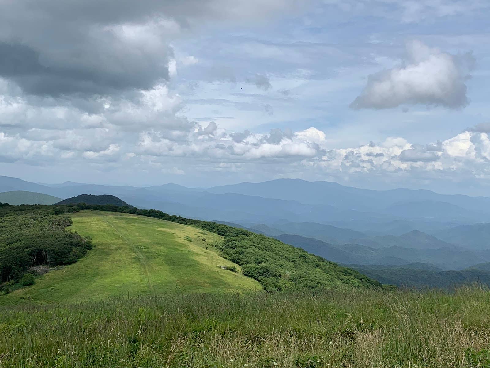
Experience breathtaking 360° panoramic views from the vast, treeless summit of Big Bald Mountain, a jewel of the Appalachian Trail.
Highlights
Must-see attractions

Social
From TikTok & Reddit
Best Time
Clearer skies, fewer storms
Big Bald Mountain
Best Time
Clearer skies, fewer storms
Highlights
Must-see attractions
Experience breathtaking 360° panoramic views from the vast, treeless summit of Big Bald Mountain, a jewel of the Appalachian Trail.
"Absolutely the most beautiful view in the area. Not easy to get to."
Check Access Before You Go
Some areas are privately owned. Verify public access routes to avoid disappointment! ⚠️
Pack for All Weather
The bald is exposed! High winds & lightning are common. Layers are essential. :cloudwithlightning:

Quick Facts
Rating
4.9 · 68 reviews
Type
Natural Feature
Highlights
Discover the most iconic attractions and experiences
The Great Bald Summit
Summit
Vast, treeless peak offering unparalleled 360° panoramic mountain views. A photographer's dream!
Appalachian Trail Section
Various access points
Hike a segment of the iconic AT, experiencing diverse forest and mountain landscapes leading to the bald.
Bird Watching Haven
Summit bald
The open expanse serves as a crucial resting spot for migratory birds, making it a prime location for birdwatchers.
Plans like a pro.
Thinks like you
Planning Your Visit
Access & Private Property Concerns
Weather Preparedness is Key
Best Times
Insider Tips
from TikTok, Instagram & Reddit
The Appalachian Trail in 31 Days (4/30): Davenport Gap to Erwin, TN
Post your tips, experiences, stories, really ANYTHING based on this part of the trail. For day three, we have from Davenport Gap to Erwin, Tennessee. [Today's map](http://i.imgur.com/96KdFVW.png). *On this part of the trail:* * Standing Bear Hostel * Max Patch * Hot Springs,…
Check Access Before You Go
Some areas are privately owned. Verify public access routes to avoid disappointment! ⚠️
Pack for All Weather
The bald is exposed! High winds & lightning are common. Layers are essential. :cloudwithlightning:
The Appalachian Trail in 30 Days (4/30): Davenport Gap to Erwin, TN
Greetings everyone. One of the great ideas that sprung out of the thread a few weeks ago was to do the whole trail in 30 days. Post your tips, experiences, stories, really ANYTHING based on this part of the trail. For day three, we have from Davenport Gap to Erwin, Tennessee.…
Appalachian trail to Beauty Spot, Erwin TN
I have family here. A beautiful place. Sunsets are breathtaking here.
Hike from Spivey Gap
A challenging but rewarding ~7-mile hike over two mountains to the summit. :hiking_boot:
Water Treatment is Crucial
All water sources on or near the AT must be filtered or treated. :droplet:
Best Section Recommendation?!
Active Duty Military Member here from Pennsylvania; with three years left until retirement eligibility!! Like many before me, upon retirement I am planning to thru-hike the entire AT! But until then, I’m still actively hiking when my career and family allow. This past…
Tips
from all over the internet
Check Access Before You Go
Some areas are privately owned. Verify public access routes to avoid disappointment! ⚠️
Pack for All Weather
The bald is exposed! High winds & lightning are common. Layers are essential. :cloudwithlightning:
Hike from Spivey Gap
A challenging but rewarding ~7-mile hike over two mountains to the summit. :hiking_boot:
Water Treatment is Crucial
All water sources on or near the AT must be filtered or treated. :droplet:
Summit Camping is Illegal
Enjoy the views, but don't camp or make fires on the bald itself. Use designated shelters/campsites. :noentrysign:
What Travellers Say
Reviews Summary
Big Bald Mountain is celebrated for its breathtaking 360-degree panoramic views from its vast, treeless summit. Visitors rave about the stunning scenery and its appeal to photographers and birdwatchers. However, access can be complicated by private property, and the exposed summit requires careful weather preparedness.
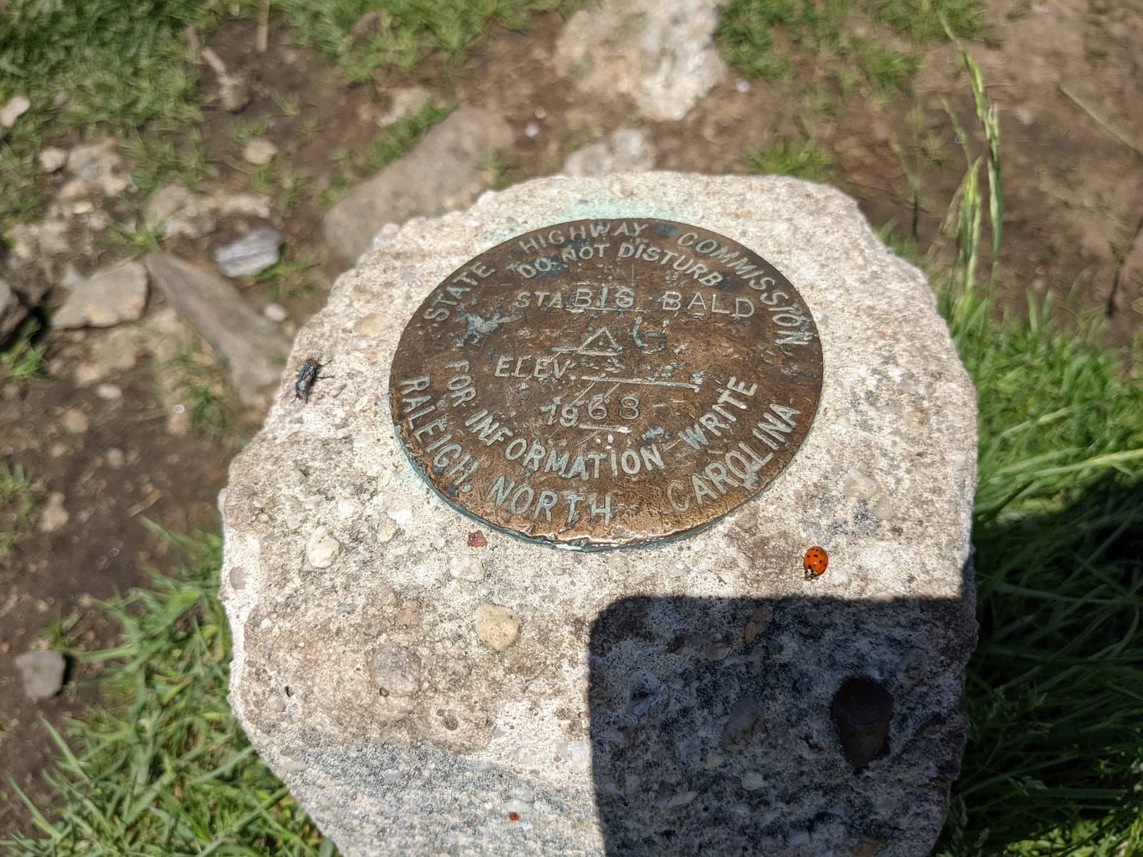
"It's big, it's bald and beautiful. It's a 5,516 feet tall mountain with sizable bald spaning across the peak offering 360 degree veiws. The bald makes a great area for bird watching as many species use it as a resting point during migration. It was originally called Greery bald after a hermit named David "Hog" Greery who lived on the mountain from 1802 to 1834. It was later renamed to Big Bald as it is the tallest peak in the Bald Mountains of Tennessee.
Access:
The quickest way to get to the summit is to drive up through the resort and park at Big Bald road, then walk a little over a half mile to the summit. If you want to hike from the bottom of the mountain you can take the Appalachian Trail from Street Gap road(dirt) 4 miles north to the summit. Going south you would park at US 19 West at Spivey Gap and hike a little under 7 miles to the summit going over two other mountains. Take caution during bad weather as the bald is exposed and is prone to high winds and lightning strikes. Conditions can be much more extreme on the bald than below the tree canopy.
Camping: While there is a wild camp and fire circle at the summit it is illegal to camp or light fires any where on the bald. For the closest (legal) campsite to the summit follow the Appalachian Trail for 0.2 miles then walk west on a dirt road for 0.3 miles, there is a spring here but the water must be filtered or treated. For better shelter you can walk 1.2 miles north of the Summit on the Appalachian Trail then 0.1 down a side trail to Bald Mountain shelter. The shelter sleeps 10, first come first serve with a privey and bear cables. 0.4 miles north there is a campsite. There are water sources at both sites but all water must be treated or filtered."
A Heinz
"NO PUBLIC ACCESS. I don’t know if this is my fault or not but after driving four hours to try and get to big bald, I was at a gate where I was told there was no public access to this spot. Safe to say, I was very disappointed. The area is privately owned and only if your I guess renting a cabin within the area, can you get to big bald?"
Anthony Volpe
"I think you can see California from there. Lol. Absolutely the most beautiful view in the area. Not easy to get to. 5ish mile hike in from Sam's gap. There is road access but I don't think it is public accessible. Someone else will have to comment on that."
Jared Hale
What People Like
What People Dislike
Frequently Asked Questions
🚇 🗺️ Getting There
Access to Big Bald Mountain can be complex. The quickest way to the summit is often via a short walk from Big Bald Road, accessible through a resort area. For a hiking experience, the Appalachian Trail offers routes from Street Gap Road (north, ~4 miles) or Spivey Gap (south, ~7 miles). Be aware that some reviews mention private property restrictions, so confirm current public access points before your visit.
While there is road access, it's often through private property or resort areas. Some visitors have reported encountering gates and being denied access. It's crucial to research current public road access or opt for the Appalachian Trail hike.
The Appalachian Trail provides excellent hiking options. The hike from Spivey Gap is approximately 7 miles one-way and involves traversing two other mountains, offering a challenging but scenic route. The hike from Street Gap Road is about 4 miles.
Direct driving to the summit is generally not possible for the public. While there might be service roads, public access is often restricted. The most common access involves a short walk from a designated parking area or hiking the Appalachian Trail.
Yes, Big Bald Mountain is situated along the Appalachian Trail. Hikers can access the summit by following sections of the AT, making it a popular stop for thru-hikers and day-trippers alike.
🎫 🎫 Tickets & Entry
No, typically there are no tickets or entrance fees required to visit Big Bald Mountain, as it's a natural mountain peak. However, access might be restricted in certain areas due to private ownership, so always confirm public access.
Big Bald Mountain is an outdoor natural area and is generally accessible at all times. However, any associated roads or resort access points may have their own operating hours. It's best to plan your visit during daylight hours for safety and enjoyment.
Parts of the land surrounding and potentially including areas near the summit of Big Bald Mountain are privately owned. This can affect public access, so it's essential to research current access policies before your visit.
Generally, no specific permits are required for hiking the Appalachian Trail sections leading to Big Bald Mountain. However, always check with local ranger districts for any potential area-specific regulations or advisories.
Access from Wolf Laurel is possible, often involving driving up through the resort area and then walking a short distance to the summit. This route is frequently mentioned as a quicker way to reach the peak.
🎫 🏞️ Onsite Experience
The main attraction is the breathtaking 360° panoramic view from the bald summit. It's an ideal spot for photography, bird watching, and enjoying the expansive mountain scenery. Hiking sections of the Appalachian Trail is also a popular activity.
The views are spectacular! The large, treeless bald offers unobstructed, sweeping vistas of endless mountain ranges in every direction. It's described as one of the most scenic spots in the area.
Absolutely! The expansive bald summit with its panoramic views is a photographer's paradise. Sunrise and sunset can be particularly stunning, but be mindful of weather conditions.
Camping and making fires directly on the bald summit are illegal. However, there are designated campsites and shelters along the Appalachian Trail nearby, such as the Bald Mountain shelter, which sleeps 10 people.
Wear sturdy hiking boots and dress in layers. The summit is exposed and can be windy and much colder than the surrounding areas. Bring rain gear, even if the forecast is clear.
🍽️ 💧 Food & Dining
No, there are no food services or restaurants directly at Big Bald Mountain. It's a natural mountain area. You'll need to pack all your own food and drinks for your visit.
The nearest dining options would be in towns like Erwin, TN, or other communities accessible from the various trail access points. Plan to eat before or after your excursion.
You can certainly have a picnic on the bald summit, but remember to pack out everything you pack in to keep the area pristine. Be aware of wind conditions, which can make eating outdoors challenging.
📸 📸 Photography
Golden hours, sunrise and sunset, offer magical light for photography. However, the expansive daytime views are also stunning. Be prepared for rapidly changing weather, which can add dramatic elements to your shots.
A wide-angle lens is ideal for capturing the vast panoramic views. A telephoto lens can be useful for distant mountain details or wildlife. Don't forget a sturdy tripod for low-light conditions or long exposures.
The entire bald summit is a prime photo location. Look for interesting rock formations or lone trees on the bald to frame your shots. The Appalachian Trail leading up to the summit also offers scenic photo opportunities.
Weather is a major factor. Be prepared for wind, rain, or fog, which can impact visibility and your ability to shoot. Also, be mindful of other visitors and respect the natural environment.


Social
from TikTok, Instagram & Reddit