Laurel River Trail 4
Hike an old railroad bed through historic logging town ruins alongside Big Laurel Creek, with lake access.
Highlights
Must-see attractions

Social
From TikTok & Reddit
Best Time
Pleasant temps, fewer crowds
Laurel River Trail 4
Best Time
Pleasant temps, fewer crowds
Highlights
Must-see attractions
Hike an old railroad bed through historic logging town ruins alongside Big Laurel Creek, with lake access.
"A nice little area that provides back water access and is very close to Corbin and I75."

🐾 Dog-Friendly Trail
Leashed dogs are welcome on the Laurel River Trail, making it a great spot for furry friends!
👟 Sturdy Footwear Recommended
The trail has varied terrain; wear good hiking shoes for comfort and safety.

Quick Facts
Rating
4.6 · 22 reviews
Type
Hiking Area
Address
Highlights
Discover the most iconic attractions and experiences
Ruins of Runion
Along the trail
Explore remnants of a historic logging town, adding a touch of history to your hike.
Big Laurel Creek Views
Trailside
Enjoy the scenic beauty of the creek, perfect for a refreshing nature escape.

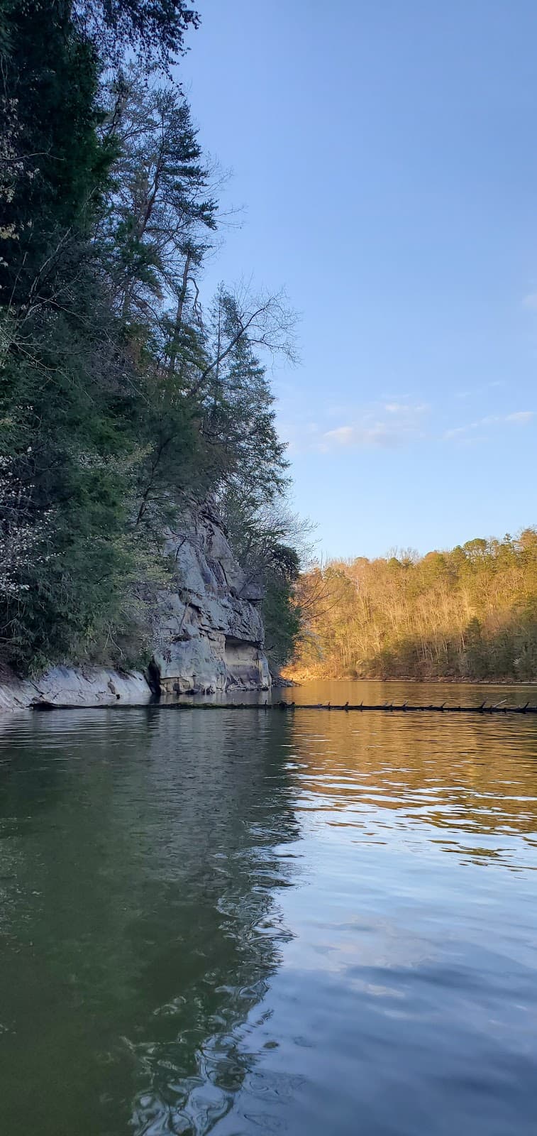
Three Sisters Rocks
Overlooking the water
Marvel at these distinctive rock formations jutting out over the water.
Plans like a pro.
Thinks like you
Planning Your Visit
Trail Etiquette & Preparation
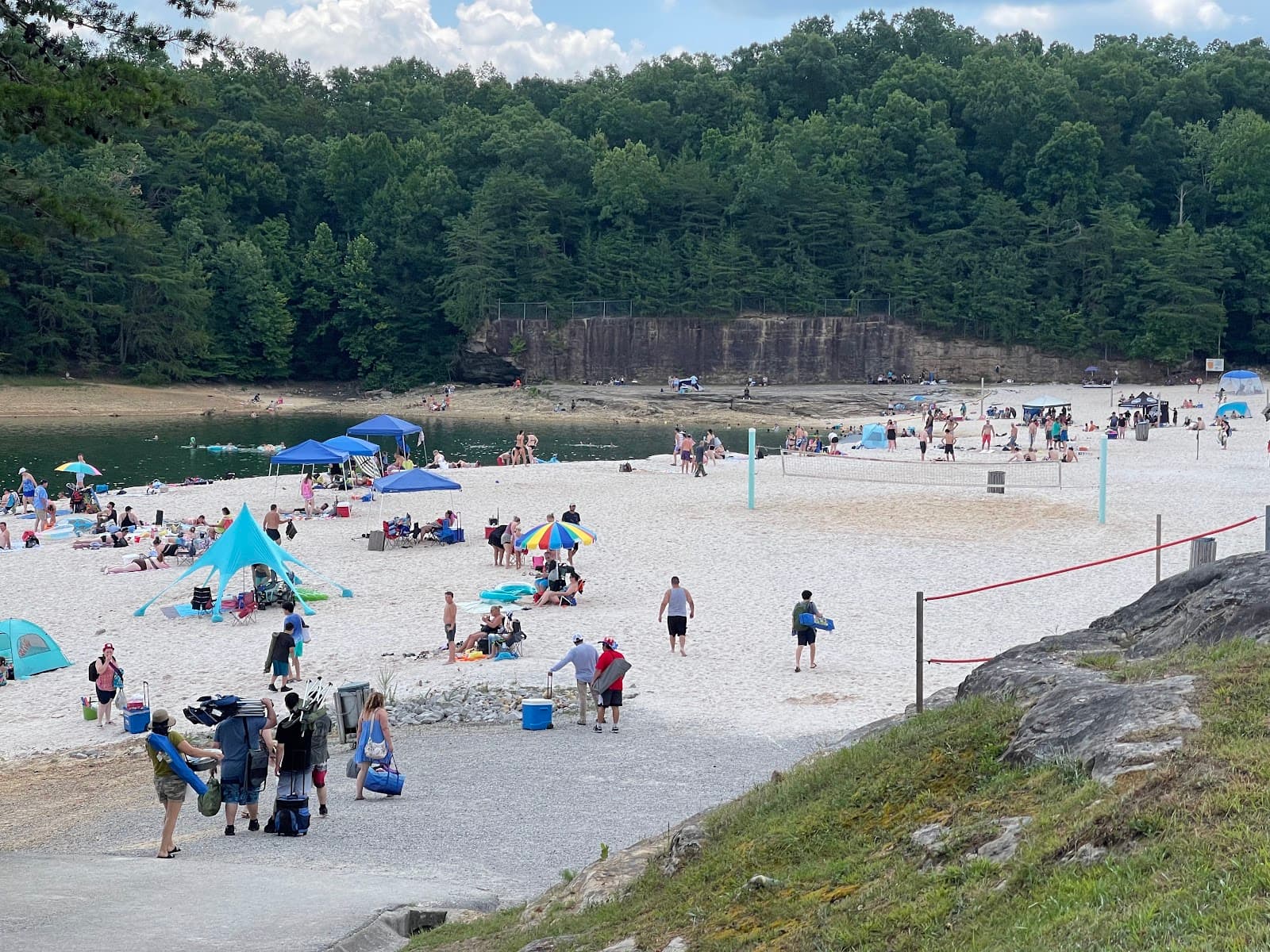
Accessing the Water
Best Times
Insider Tips
from TikTok, Instagram & Reddit
🐾 Dog-Friendly Trail
Leashed dogs are welcome on the Laurel River Trail, making it a great spot for furry friends!
👟 Sturdy Footwear Recommended
The trail has varied terrain; wear good hiking shoes for comfort and safety.
Cumberland Falls the RDR2 location, is inspired off of my home town. Cumberland Falls KY.
Lived not too far from there when I was a kid. Still remember how cool the "moonbow" looked during the full moon.
💧 Pack Plenty of Water
Stay hydrated, especially on warmer days, as there are no water sources on the trail.
📸 Capture the Views
Bring your camera to photograph the historic ruins and scenic creek.
Tips
from all over the internet
🐾 Dog-Friendly Trail
Leashed dogs are welcome on the Laurel River Trail, making it a great spot for furry friends!
👟 Sturdy Footwear Recommended
The trail has varied terrain; wear good hiking shoes for comfort and safety.
💧 Pack Plenty of Water
Stay hydrated, especially on warmer days, as there are no water sources on the trail.
📸 Capture the Views
Bring your camera to photograph the historic ruins and scenic creek.
🏷️ Boat Ramp Tag Needed
If using the boat ramp, ensure you have the required Daniel Boone National Forest parking tag.
What Travellers Say
Reviews Summary
Visitors praise the Laurel River Trail for its scenic beauty, historical remnants of Runion, and accessible water access points like the rocky beach and boat ramp. It's considered a great spot for families and dog owners, offering a diverse and enjoyable outdoor experience. Some signage could be improved, and seasonal bathroom availability should be checked.
"Most of this review is about the area and trail, not the boat ramp. Look at the very bottom for boat ramp info.
This is a nice little area that provides back water access and is very close to Corbin and I75.
Among the recreation area is a hiking trail that has decent incline/decline, a look out point that views the nearby bridge and 3 sisters rock. It also has a rocky small "beach"/lake side swimming spot for easy pedestrian water access. There are different paths to take to avoid some of the stairs. There is a small path that connects the two looped parking areas. There appears to be a volleyball court/net (useable but needs repair) and a baseball back stop and makeshift diamond. There is a nice shelter, with multiple tables, trash cans and a grill. There are (seasonal) bathrooms. For reference 11/8/24 they were closed for "winter". The shelter is available for reservation via the London ranger district contacts that have their phone number posted at the shelter.
This was overall a great short, diverse elevation trail. Leaf covered paved/asphalt that is mostly stable. The stairs can be slick but have metal edges for grip. The staircase rails are wood, slightly loose in some spots but overall great for what it is. Ideal for a quick hike or access to the lake. The trail is not great for mobility issues but the parking lot, shelter and path between the parking lots could be great for those with mobility issues.
To the far left is access for 2 vehicles to access a paved boat ramp with dock. It is kayak friendly. There is also a path, or step staircase that links the boat ramp to the boat parking area. The boat parking does require Daniel Boone National Forest boat ramp parking tags."
Nathan Dillon
"If you walk this path, you will see the three sisters is what it called?Its three big cliffs, rocks that stick out, and they are called the three sisters over the water and it's beautiful.Take a trip and walk up through there.You can take your dogs.It's free park in restrooms, picnic tables.Whatever you need it's nice"
Denise Knuckles
"Nice park but could use a little better with signage on path. Great views."
Ben Woods
What People Like
What People Dislike
Frequently Asked Questions
🚇 🗺️ Getting There
The Laurel River Trail is located in Western North Carolina, about 35 minutes from Asheville. It's accessible via an old railroad bed, making for a relatively flat hike. Specific driving directions can be found using GPS coordinates for the trailhead.
Yes, the Laurel River Trail is conveniently located about 35 minutes from Asheville, making it a great day trip destination for those visiting the city.
Downtown Marshall is a nearby town where you can grab a meal before or after your hike on the Laurel River Trail.
Yes, there are parking areas available. The boat ramp area has specific boat parking that requires a Daniel Boone National Forest boat ramp parking tag.
The trail ends along the railroad tracks beside the French Broad River, offering a connection to this waterway.
🎫 🎫 Tickets & Entry
The Laurel River Trail itself is generally free to access. However, the boat parking area requires a Daniel Boone National Forest boat ramp parking tag.
As an outdoor trail, Laurel River Trail is typically accessible from dawn to dusk. There are no set operating hours for the hiking path itself.
No, tickets are not required for hiking the Laurel River Trail. It's a public access trail.
Yes, there are seasonal bathrooms available. They are typically closed for winter, so check availability if visiting during colder months.
Yes, the picnic shelter is available for reservation. You can contact the London Ranger District for details and booking information.
🎫 🏞️ Onsite Experience
The Laurel River Trail is an out-and-back hike that is approximately 4 miles each way, totaling about 8 miles round trip.
The trail is primarily an old railroad bed, offering a relatively flat path with some varied inclines and declines. Parts of the trail are paved or asphalt, but can be leaf-covered and stairs can be slick.
Yes, it's a great short, diverse trail suitable for families. The rocky beach area is good for pedestrian water access.
There is a small, rocky 'beach' or lakeside swimming spot that offers easy pedestrian water access.
The 'Three Sisters' are three large cliffs or rocks that stick out over the water, offering beautiful views.
📸 📸 Photography
Great photo ops include the historic ruins of Runion, the scenic Big Laurel Creek, the Three Sisters rocks, and the lake views from the boat ramp area.
Absolutely! The trail offers diverse landscapes, from creek views to rock formations and the lake, providing excellent opportunities for landscape photographers.
Yes, the boat ramp and dock area offer scenic views of the lake and are popular spots for photography, especially at sunrise or sunset.
Early morning or late afternoon often provide the best light for photography, minimizing harsh shadows and enhancing the natural beauty of the area.
The overlook point offers views of the nearby bridge and the Three Sisters rocks, making it a prime spot for capturing memorable shots.


Social
from TikTok, Instagram & Reddit