
Cactus to Clouds Trail
An extreme day hike ascending over 10,000 ft from desert floor to San Jacinto Peak. One of the most strenuous in the US.

Highlights
Must-see attractions

Social
From TikTok & Reddit
Best Time
Ideal conditions, less heat
Cactus to Clouds Trail
Best Time
Ideal conditions, less heat
Highlights
Must-see attractions
An extreme day hike ascending over 10,000 ft from desert floor to San Jacinto Peak. One of the most strenuous in the US.
"This is one of the most strenuous day hikes in the US, climbing over 10,000 feet in 100° heat."

💧 Bring More Water Than You Think
Crucial for the desert heat. No water sources until the ranger station.
👟 Sturdy Hiking Boots Essential
The trail is rocky and gravelly, rough on the knees.

Quick Facts
Hours
Rating
4.7 · 287 reviews
Type
Hiking Area
Highlights
Discover the most iconic attractions and experiences
The Relentless Skyline Trail
Palm Springs Desert Floor to Tramway Station
The iconic, exposed ascent from the desert floor, gaining thousands of feet with breathtaking views.

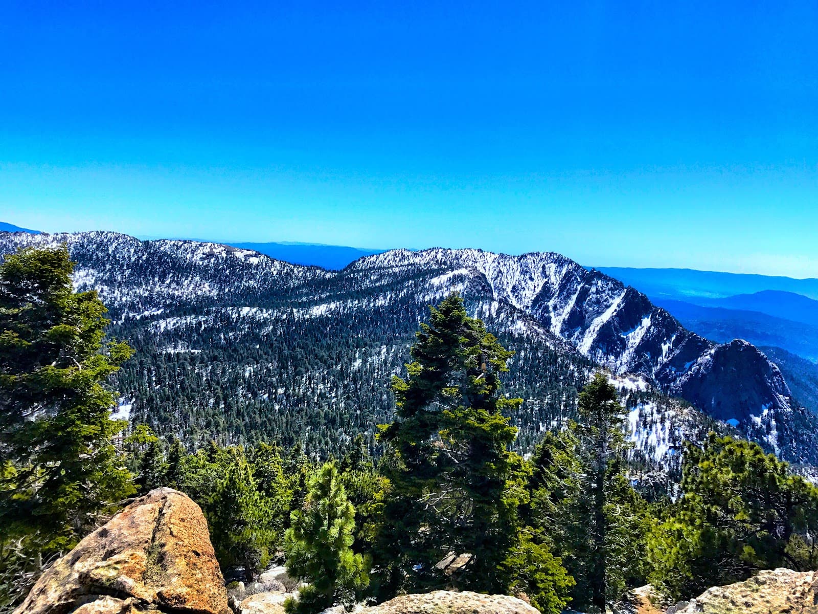
San Jacinto Peak Summit
Mount San Jacinto State Park
Reach the highest point of the San Jacinto Mountains for panoramic vistas after a demanding climb.
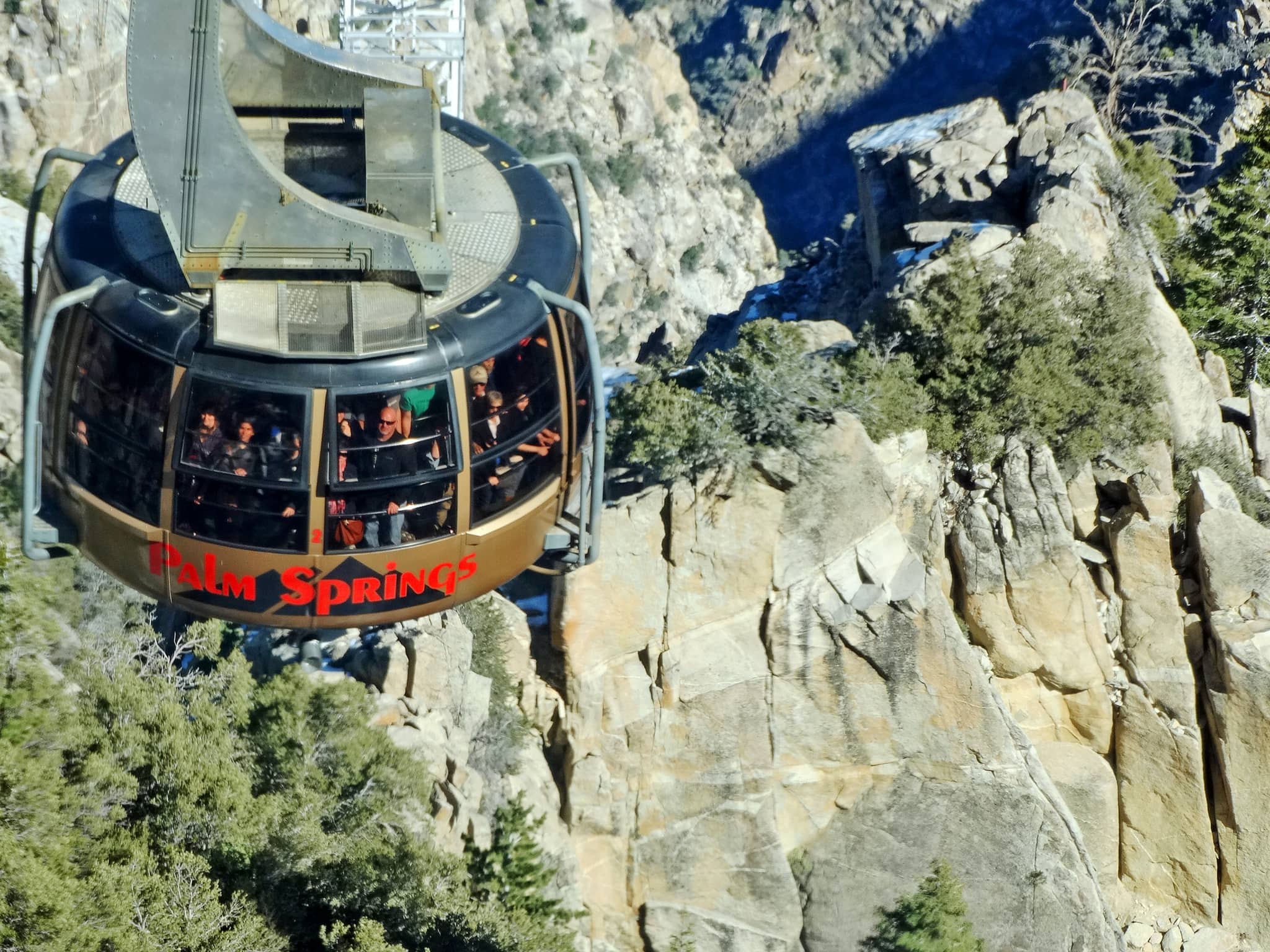
Palm Springs Aerial Tramway Descent
Mount San Jacinto State Park to Palm Springs
A comfortable and scenic way to descend, saving your knees after an epic trek.
Plans like a pro.
Thinks like you
Planning Your Visit
Start Early to Beat the Heat
Prepare for a Strenuous Ascent
Best Times
Insider Tips
from TikTok, Instagram & Reddit
💧 Bring More Water Than You Think
Crucial for the desert heat. No water sources until the ranger station.
👟 Sturdy Hiking Boots Essential
The trail is rocky and gravelly, rough on the knees.
📱 Download Offline Maps
Trail blazes disappear past picnic tables; navigation is key.
🤝 Hike with a Buddy
Safety first on this challenging and remote trail.
Tips
from all over the internet
💧 Bring More Water Than You Think
Crucial for the desert heat. No water sources until the ranger station.
👟 Sturdy Hiking Boots Essential
The trail is rocky and gravelly, rough on the knees.
📱 Download Offline Maps
Trail blazes disappear past picnic tables; navigation is key.
🤝 Hike with a Buddy
Safety first on this challenging and remote trail.
☀️ Start Before Sunrise
Beat the intense desert heat and gain elevation in cooler temps. +1
What Travellers Say
Reviews Summary
The Cactus to Clouds trail is an incredibly challenging but rewarding hike, lauded for its stunning desert-to-alpine scenery and the immense sense of accomplishment upon completion. Hikers consistently praise the breathtaking views and the unique experience of ascending from the desert floor. However, the extreme heat, relentless elevation gain, and sometimes poor trail marking are significant drawbacks that require thorough preparation and respect for the mountain's demands.
"Parking at the trailhead was easy, not many people attempting this every day. Trail was tough especially miles 8-10. After that the trail to the peak was not difficult. Absolutely beautiful"
Jeremy Russell
"Fantastic! This is a great trail with plenty of fantastic views whether you plan on a hike for a short while or an entire trek. Lots of rocks and gravel, and it’s rough on the knees, so be careful and come prepared. Bring water, and lots of it, because you’ll dry out quick!"
Andrew
"The trail is a difficult trail to attempt. There is over 10,000 ft of gain in the 15+ miles to San Jacinto. The most difficult part is from the trail head to the Tram area. And you will want to start early in the morning because of the desert heat and there is no water along the trail until you get to the Rangers station."
Ryan Hartwig
What People Like
What People Dislike
Frequently Asked Questions
🚇 🗺️ Getting There
The main trailhead for the Cactus to Clouds trail is the Skyline Trailhead, located near the Palm Springs Art Museum in downtown Palm Springs. Parking can be tough, but arriving early helps.
The trailhead is easily accessible by car in downtown Palm Springs. Public transportation options might be limited, so driving or ride-sharing is recommended.
Parking is available near the museum and trailhead, but it can fill up quickly, especially on weekends. Arriving early in the morning is your best bet for securing a spot.
While possible, it's challenging. You'd need to arrange transportation to the trailhead in Palm Springs. Many hikers use the tramway for descent, which adds another logistical element.
From Highway 111 in Palm Springs, head towards downtown and follow signs for the Palm Springs Art Museum. The trailhead is located nearby.
🎫 🎫 Tickets & Entry
No specific permit is required for the Cactus to Clouds trail itself. However, if you plan to camp in the San Jacinto Wilderness, a wilderness permit is necessary.
The trail is open year-round, 24 hours a day. However, due to extreme heat and safety concerns, hiking during the hottest parts of the day is strongly discouraged. +1
The hike itself is free. The primary cost associated with the hike is if you choose to ride the Palm Springs Aerial Tramway down, which has a fee.
No, tramway tickets must be purchased separately, typically at the Palm Springs Aerial Tramway Valley Station. It's advisable to check their operating hours and purchase in advance.
While the trail is free, there might be day-use fees or parking fees associated with accessing certain areas of Mount San Jacinto State Park, especially if you were to start from a different access point.
🎫 🧭 Onsite Experience
This is a very strenuous hike. Most people take 10-14 hours to complete the Cactus to Clouds (C2C) route to the tram. The full Cactus to Clouds to Cactus (C2C2C) can take 16-24 hours or more. +1
The trail involves an extreme elevation gain of over 10,000 feet, with the initial 10 miles climbing around 8,000-8,500 feet. +2
The trail is not consistently well-marked. White blazes are present early on, but they disappear past the picnic tables. Downloading a GPX track and using a GPS device or app is highly recommended.
Expect a mix of rocky, gravelly, and sandy terrain. The lower sections are exposed desert, while higher elevations can be forested. It's rough on the knees.
There are no water sources or restrooms on the trail until you reach the ranger station near the tramway. You must carry all your water and supplies.
📸 📸 Photography
The entire hike offers stunning views, from the desert floor to the mountain peaks. Sunrise and sunset from higher elevations are particularly spectacular. Look for unique desert flora and expansive desert vistas.
Early morning light for the desert landscapes and golden hour light on the peaks are ideal. Midday sun can be harsh. Consider the dramatic contrast between the desert and the alpine environment.
A wide-angle lens is great for capturing the vast landscapes. A sturdy tripod can be useful for low-light conditions or long exposures. Ensure your gear is protected from dust and potential moisture.
The entire Skyline Trail offers incredible panoramic views. The summit of San Jacinto Peak provides 360-degree vistas. Keep an eye out for unique rock formations and desert plants.
Use foreground elements like cacti or rocks to emphasize the steepness and scale of the climb. Wide shots showing the vast desert stretching out below can also convey the immense elevation gain.


Social
from TikTok, Instagram & Reddit